Camaret → A Coruña
approx. 350 nm
- 7 kn
- 50 h
- 8 kn
- 44 h
- 9 kn
- 39 h
Brittany or La Rochelle → Northern Spain
Departure options, distances, sailing times and arrival harbours on the other side of Biscay.
01 · From Brittany to Galicia
The coast falls behind, and the passage continues through the night. Life aboard finds a simple rhythm: sail, eat, sleep and change watch. Morning light arrives while the boat is still underway.
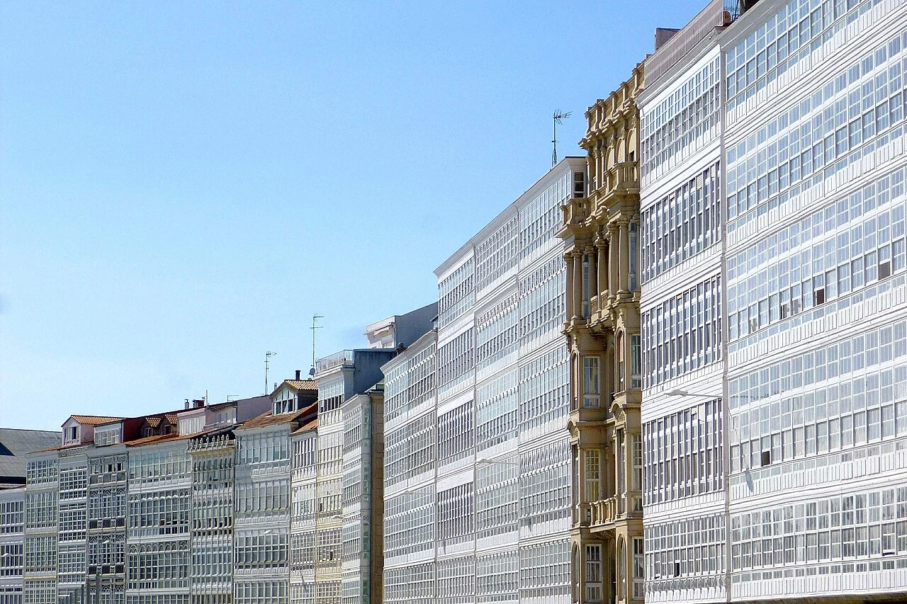
One possible passage runs from Camaret in Brittany to A Coruña in Galicia. Arrival can have its own small celebration: a shower, a meal ashore and a whole night at rest. The stay can continue in Galicia, or the voyage can carry on towards Portugal.
Biscay is an offshore leg lasting several days. Departure depends on a weather window, wind and swell, with room for waiting. A summer passage can also bring demanding conditions.
The days before departure in Brittany ↗Biscay is an established connection for cruising sailors. Recurring events and personal logs show that both French and British departure harbours are used en route to Spain. This shows that the crossing forms part of ordinary long-distance cruising, without predicting how any particular trip will turn out.
The crossing can also serve as a delivery leg.
Two different starting points
French Finistère is the western end of Brittany. It is a different place from Cabo Fisterra in Galicia. Camaret is the main departure point in the western example, with visitor facilities and documented crossings to both A Coruña and Gijón. Starting inside Brest adds the passage out of the roadstead.
From Les Minimes in La Rochelle, the examples leave through the Pertuis d’Antioche, south of Ré and north of Oléron. First between the islands, then across the sea. Current depths, tides and harbour notices form part of the actual departure.
Camaret is the starting point. Sainte-Évette lies farther south; moving there is a separate leg.
A shorter crossing to Santander or Getxo gives a different start to the holiday from an arrival in Galicia.
Solid blue: French Finistère. Dashed ochre: La Rochelle. Coastline: Natural Earth 5.1.1 · public domain. Reference points Brest and Cabo Fisterra: © OpenStreetMap contributors. Map and calculation: Sophie, 18 September 2026.
To the same A Coruña, the examples give about 350 nm from Camaret and 370 nm from La Rochelle. La Rochelle is closer to the eastern arrivals. If the voyage continues to Galicia after Santander or Getxo, the coastal passage west is additional. Moving from Brittany to La Rochelle is not included either.
Sainte-Évette near Audierne is already south of the Raz de Sein. It is an outer roadstead with moorings, distinct from Audierne’s river harbour. The mooring, depth and weather conditions must suit the boat. The river harbour’s bar and changing depths need assessment if using that harbour. Moving from Camaret is a separate leg additional to the crossing.
At an average of 8 knots, Camaret–A Coruña takes around 44 hours, a little under two days. La Rochelle–Getxo takes around 25 hours, about one day.
Wind, current and course choices affect the time taken.
Times are calculated using average speed over the ground and rounded to whole hours. nm means nautical miles.
approx. 350 nm
approx. 305 nm
approx. 330 nm
approx. 370 nm
approx. 255 nm
approx. 210 nm
approx. 200 nm
The starting point is geodesic distances on the WGS84 ellipsoid. The comparison uses coarse geometry around islands and headlands: west of the Sein area from Camaret, through the Pertuis d’Antioche from La Rochelle and around the headlands before A Coruña. The shortest geographic line can cross land and is therefore kept separate from these estimates.
Local additions from an unspecified visitor berth to the offshore point are 1.5 nm in Camaret, 1 nm in Les Minimes and 0 nm from Sainte-Évette’s roadstead. From the offshore arrival point to the visitor harbour/manoeuvring, 3 nm is added in A Coruña, 4 nm in Gijón and 6 nm in Santander/Getxo. These additions are estimates, not measured harbour tracks. Distances are rounded to the nearest 5 nm. Hours = the displayed distance / knots, rounded to whole hours.
No extra weather allowance, tacking into headwinds or onward coastal sailing is hidden in the figures. Starting inside Brest, choosing the Raz de Sein, a different exit between the islands or a different visitor berth will change the comparison. Coordinates, assumptions and the reproducible calculation are retained in the project’s research note.
From shelf to deep ocean
Off France, the relatively shallow continental shelf extends far out before the seabed drops down the continental slope. Farther west lies a basin several thousand metres deep. Along northern Spain, the shelf is generally narrower, but varies and is cut by submarine canyons.
The three muted connections show how the crossings pass over different parts of the seabed.
Depths are measured from LAT – Lowest Astronomical Tide. The scale at the bottom shows nautical miles.
From Camaret, the passage crosses the shelf southwest of Brittany and continues over deep water. From La Rochelle, it spends longer over the broad French shelf before the sea deepens.
Seabed: EMODnet Bathymetry Consortium · DTM 2024, published March 2025. Coastline: Natural Earth 5.1.1. Map: Sophie.
EMODnet DTM 2024 has an original grid spacing of 1/16 arc-minute. Here, every fourth cell was retrieved at 1/4 arc-minute intervals on 18 September 2026. Elevations are relative to LAT, not mean sea level. Grid spacing is not the same as measurement accuracy; sources and the degree of interpolation vary.
Depth bands and contours are calculated from the values. The background raster is projected with bilinear interpolation; missing data has not been converted to zero depth. Natural Earth land overlays the depth colours. The map shows no wave forecast.
EMODnet’s service metadata permits free use and redistribution, subject to possible errors and without warranty. Product DOI · Metadata and terms of use.
A meal ashore and time to look around
Galicia
Marina Coruña beside the old town offers a walk and dinner after resting, with Galicia as the next cruising ground. Beam, allocated depth and visitor space need confirmation. Sea conditions at the entrance and off the headlands are assessed separately. The yard at Oza is a different site.
Asturias
Puerto Deportivo de Gijón is beside the city and offers visitor berths, showers and laundry facilities. A quiet day ashore can precede the choice between Asturias farther west or the coast to the east.
Approaches differ according to the weather. The fuel pontoon is shallower than the entrance, so the boat’s draught affects access to fuel.
Cantabria
Marina del Cantábrico is in the south of the bay, so visiting the city requires a separate trip from the marina. This is a starting point for Cantabria, with Galicia farther west.
The harbour’s pilotage notes describe tidal currents and channel entry. Arrange a visitor berth with the marina for the boat’s dimensions.
Basque Country
El Abra-Getxo offers an arrival at Getxo and the possibility of a later trip into Bilbao. It is particularly suitable if the Basque Country is the desired start to the holiday.
The marina accepts visitor berth enquiries and is within Bilbao’s larger port area. Sea conditions at the entrance, traffic and allocated depth must be assessed, not inferred from the size of the commercial harbour.
A shorter crossing can be worthwhile in itself; if Galicia is the holiday destination, a longer crossing may provide the right starting point.
Sources checked on 18 September 2026.
World Cruising Club documents recurring Biscay crossings from Britain. Frenesi, August 2024 describes Camaret–A Coruña, and Kath McNulty in Flying Fish 2015/2, pp. 187–188 describes Camaret–Gijón. Logs show actual use, not popularity or safety statistics.
Money Penny, October 2017 describes La Rochelle–Santander around the northern end of Oléron. bx4, August 2016 sailed via Île d’Aix to Bilbao/Las Arenas. La Rochelle–Gijón is retained as a geographic option with a verified visitor harbour; direct practice from Les Minimes has not been established here through a complete first-hand log. La Rochelle–A Coruña is a comparison to the same western destination.
Camaret municipality, Audierne’s harbour overview and Les Minimes are operator/authority sources. Bloc Marine / Figaro Nautisme is a secondary pilotage source for Audierne’s bar and silting. Kannjawou’s log, July 2021 concerns the river harbour, not a particular Sainte-Évette mooring. La Rochelle’s 2021 map guide supports the island geography; old tide tables have not been used.
EMODnet DTM 2024 is used for the seabed. The University of Hawaiʻi, Stewart’s textbook and Segar / American Meteorological Society explain how waves form and move.
Charles et al. (2012) examine the regional wave climate in 1958–2001. IPMA explains the Azores High. Rijo et al., pp. 150–156, conference 2016 / book publication 2017, examine the nortada along western Iberia using the model period 1989–2007. NOAA distinguishes the trade winds as a tropical wind belt. Météo-France describes products for total sea, wind sea and swell.
The four operator links appear beside the harbours above. Additional sources are Gijón’s visitor services, Santander’s 2022 pilotage notes and Port of Bilbao’s 2024 annual report. The latter lists depths of 2.5–5.0 metres for El Abra-Getxo, distinct from the depths at the large quays. The currently allocated berth, length, beam, draught and entrance conditions need confirmation for each arrival.