Brevik
On Sydkoster’s western side, Brevik has colourful boathouses beside a small harbour and access to the shore paths toward Långegärde and Kyrkosund. The harbour places a visit closer to the western landscape and its views toward Ursholmen.
Northern Bohuslän · Kosterhavet
Wooded island channels open onto Kosterfjorden, with Strömstad on one shore and Koster’s beaches, heath and village lanes on the other. Beneath the crossing lies one of Scandinavia’s richest marine landscapes.
Explore the coastSwedish west coast & Southern NorwayBaltic & Skagerrak
The geography · Inner islands and Kosterfjorden
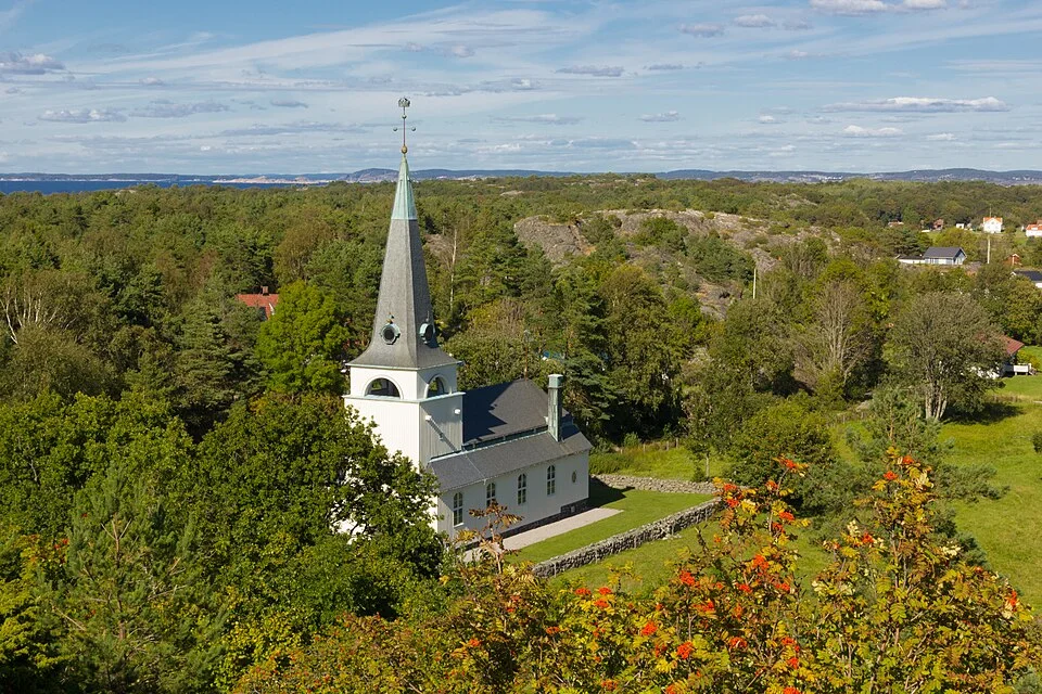
North of Havstenssund, Bohuslän changes character. The islands around Resö, Rossö and Tjärnö carry more trees and green interiors, with bays tucked behind wooded shores. Bare rock remains part of the coast, but the view is less consistently a maze of low granite skerries. Enclosed channels and places to lie at anchor become a larger part of the experience.
West of these islands, Kosterfjorden opens a broad stretch of water. Strömstad lies on the mainland side, a busy town with shops, restaurants and ferries. Across the fjord, Nordkoster and Sydkoster have small settlements, footpaths, beaches and an almost car-free network of lanes. The two islands are close neighbours with noticeably different landscapes: open heath and stony shores on Nordkoster, more woodland, pasture and cultivated ground on Sydkoster.
The change from the inner channels to Kosterfjorden is also a change in sea exposure. Swell can remain outside after the wind has eased among the islands. Beyond Koster’s western shores lies a further scatter of low rocks and small natural harbours, facing the Skagerrak directly. The protected mainland channels, the fjord and the outer skerries each offer a different setting for a visit.
The southern connection · Havstenssund
White houses, red boathouses and marine businesses follow the narrow sound at Havstenssund. The passing boats are part of village life: from the quay or the rock-side walkway, the channel is close enough to watch without leaving the settlement. Spången continues beside the water toward the bathing place; the climb to Sunneberget looks out over the roofs and the islands beyond.
The village sits naturally between two coastal landscapes. To the south is the exposed opening at Tjurpannan and the archipelago around Grebbestad and Fjällbacka. To the north, the islands gather around the channels toward Resö. The Sotekanalen–Havstenssund guide develops the village and the coast to the south.
The working island harbour · Resö
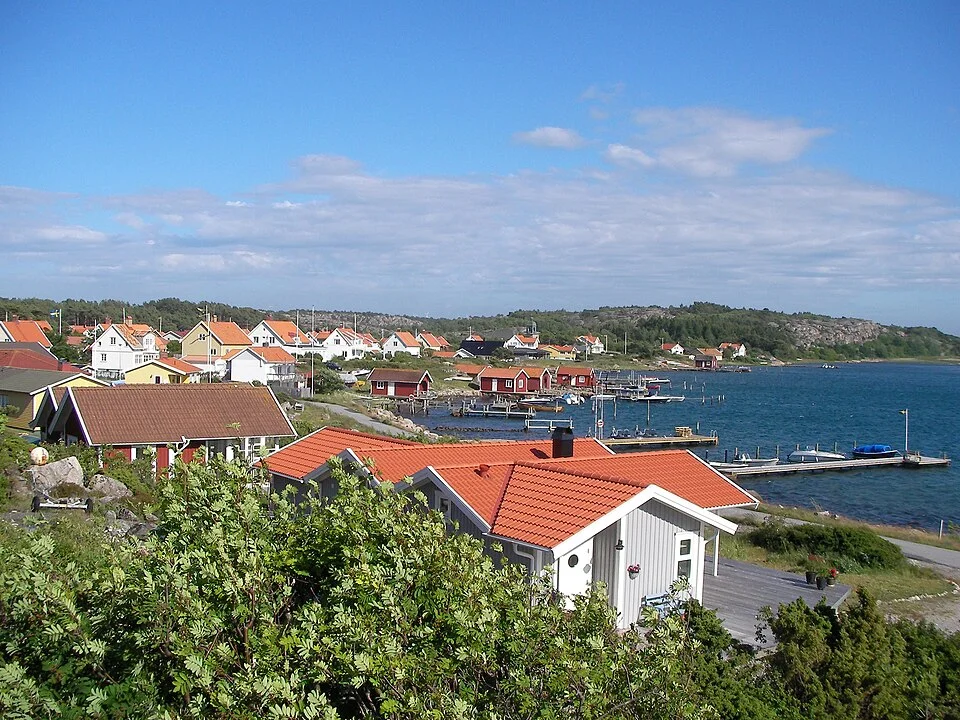
Resö keeps the scale of a small fishing community. The harbour is on the island’s western side, with Hamnholmen enclosing one edge and working boats alongside the visitor activity. Shellfish, a summer bakery and a bathing place give the stop its own rhythm; paths lead away from the waterfront into the island.
The harbour association publishes walking maps, including routes through the island’s cultural landscape. Kosterhavet’s southern entrance exhibition is another way into the area’s story: the fishing harbour belongs to the same marine environment protected farther out around Koster. Resö is a place to linger ashore as well as a useful harbour among the inner islands.
The inner island landscape · Rossö, Tjärnö and Saltö
Rossö’s waterfront looks across an enclosed sound, with jetties and boathouses close to the settlement. The old harbour warehouse houses Entré Rossö, a café and exhibition about Kosterhavet and the island’s former importance in the lobster trade. This maritime history gives the small harbour more substance than its quiet appearance suggests.
On the western side of Rossö, Kockholmen brings together twisted pine trees, rocky shore paths and views toward Koster. Sand and rock alternate around the water’s edge. Tjärnö and Saltö continue the wooded island landscape farther north, while Saltö’s exposed western shore faces the fjord. Small bays here feel different from the bare-rock landings around Fjällbacka: trees and enclosed shorelines often define the anchorage.
Tjärnö Aquarium, part of the University of Gothenburg’s marine laboratory, opens to the public in summer. Its tanks show local habitats, from eelgrass and mud-bottom animals to a small cold-water coral reef; marine biologists explain the life that is usually hidden beneath a boat. It is a shore attraction at a working research station, rather than a guest marina.
Saltö has another close view of that underwater world: the marked snorkel trail in Hasslebukten. The park’s two snorkel trails, here and at Rörvik on Sydkoster, are about 200 m long, with information boards on the seabed at roughly 1–1.5 m depth.
Beneath the surface · Kosterfjorden
Kosterfjorden’s drama is largely underwater. The shores are low, yet the Koster trench reaches 247 m. It follows an ancient fault, subsequently shaped by ice, with steep rock sides and deep sediment on its floor.
The trench connects to the deep Skagerrak and ultimately the North Atlantic. Cold, salty ocean water sustains animals that would otherwise be associated with much deeper offshore environments. Cold-water corals, sponges and sea fans are part of the reason this became Sweden’s first marine national park in 2009. A broad, ordinary-looking stretch of water separates the islands from the mainland; below it lies a very unusual habitat.
This open water also creates a choice in the cruising geography. Strömstad gathers town facilities on the eastern side. Koster offers a collection of island harbours on the western side, with walking and cycling connecting the settlements ashore. Neither needs to be treated simply as a stop on the way north.
The mainland town · Strömstad
Strömstad has a different scale from the fishing villages farther south. The harbour sits against a substantial town centre, with food shops, restaurants, cafés and streets that continue inland beyond the quays. Ferries and visiting boats share the waterfront, giving it an everyday transport role alongside its summer life.
The promenade gives long views over the approaches, while the town supplies the practical variety that small island settlements cannot. A harbour stay here can combine provisioning, a restaurant evening and a shore excursion without moving the yacht. Kosterbåtarna connects Strömstad with several island landings; Västtrafik also provides the rail and bus connections through the mainland region.
Across the fjord · Nordkoster and Sydkoster
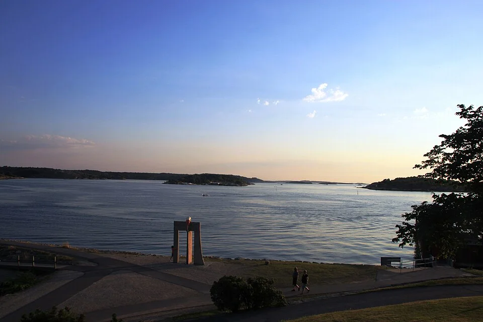
Kostersundet separates the main islands, but their settlements face one another across a narrow stretch of water. Bopallen on Nordkoster and Långegärde on Sydkoster are linked by the small Kosterlänken cable ferry when its visitor service is operating. The regular Koster ferries also serve both islands. A berth on one island need not limit time ashore to that side of the sound.
Walking suits both islands; Sydkoster’s gravel roads are particularly good for cycling between the scattered villages. Rental bicycles are available at Ekenäs and Långegärde. Beyond the lanes, the reserve paths pass through pasture, woodland, heath and rock, with a choice of short connections and longer shore walks. The Koster nature-reserve map shows how these paths connect the harbour settlements and beaches.
Kosterhavet is primarily a marine national park. Most of the land on Nordkoster and Sydkoster belongs to separate nature reserves, while a small part of southern Sydkoster falls within the park. That distinction explains why the shore landscape and the surrounding sea have different mapped protection areas.
The open island · Nordkoster
Nordkoster’s northern and western shores feel open to the sea. Heather, rock and broad fields of rounded stones replace the richer vegetation found in sheltered hollows. These klapperstensfält, old wave-worked shingle fields, are striking places to walk beside: the shoreline’s earlier positions remain visible above the present water.
Högen, crowned by two old lighthouse towers, gives a wide view over the islands and toward Norway. The island’s marked paths also reach the beaches at Basteviken and Norrvikarna. Some sections cross uneven rock and stones, so the harbour-to-beach walk and a circuit of the outer shore offer quite different terrain.
Near Kostersundet, houses, small businesses and the ferries bring the island back to a lived-in scale. The harbour is on the southern edge, while much of the walking landscape extends north and west from it. That short transition from settlement to open heath is one of Nordkoster’s particular pleasures.
The greener island · Sydkoster
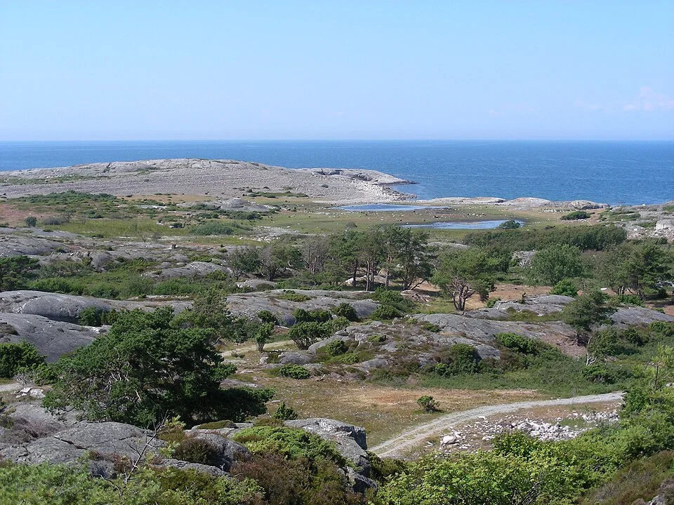
Sydkoster spreads its settlements through a greener interior. Gravel lanes run between fields, woodland and houses, with the sea repeatedly appearing beyond them. Near the church, steps climb Valfjäll for a view that gathers the island’s scattered places into a whole: roofs among trees, the sound to Nordkoster and water stretching toward the mainland.
Kilesand’s long sandy beach occupies the southeastern shore. Rörvik, north of Ekenäs, combines bathing with the underwater nature trail. The two places make very different shore excursions from the rocky western paths and the working quays, without requiring a move between harbours.
Food is distributed around the island rather than concentrated in one town centre. Ekenäs has a smokehouse and fish shop, while the grocery shop stands inland. Kosters Trädgårdar now welcomes prebooked groups for garden visits and courses; it is no longer a general drop-in restaurant stop. Its cultivated setting belongs to the same island landscape as the meadows and small farms.
Sydkoster’s eastern harbour · Ekenäs
Ekenäs, also called Korshamn, brings together guest boats, the passenger ferry and naturum Kosterhavet. The visitor centre explains the sea immediately outside, with exhibitions and activities that make the marine park tangible from shore. Rörvik lies a short walk north; bicycle hire beside the harbour opens the roads across Sydkoster.
The quay is also a place to eat, with the smokehouse, fish shop and hotel restaurant close by. The main grocery shop is about 1.8 km inland. Ekenäs therefore combines several island attractions within a compact arrival area, while the rest of Sydkoster remains within reach on foot or by bicycle.
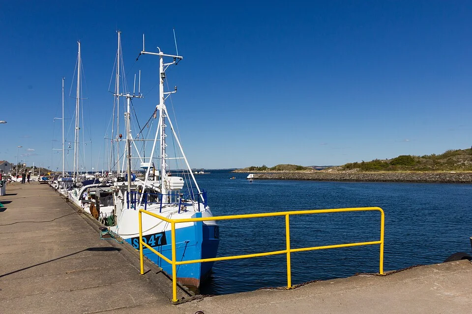
On Sydkoster’s western side, Brevik has colourful boathouses beside a small harbour and access to the shore paths toward Långegärde and Kyrkosund. The harbour places a visit closer to the western landscape and its views toward Ursholmen.
Kyrkosund sits at the southern end of the island, beside village lanes and the coastal walking route.
Beyond the main islands · Kosterhavet
West and southwest of Koster, inhabited shores give way to an intricate scatter of rocks, islets and narrow gaps. Ursholmen’s twin lighthouses mark one of the most recognizable outer landmarks. The view across this island field is part of Koster’s appeal from both sea and shore.
The outer skerries have small natural harbours, but they are a different proposition from the broad water of Kosterfjorden. Shallow connections and locally enclosed basins make individual harbour detail useful here. Svenska Kryssarklubben’s Västkustens Naturhamnar provides the annotated local descriptions that a broad island map cannot supply.
Within the national park, mooring or anchoring in one place is limited to two consecutive days. Anchoring is prohibited in bottom-protection zones, and boats may not be anchored, moored or hauled up within 50 m of sandy beaches. Some areas have a five-knot limit from 15 May to 31 August. The park rules and linked protection maps identify the zones, including seasonal bird and seal protection. These boundaries matter when choosing an island landing or an anchorage.
Neighbouring cruising grounds
Sotekanalen–Havstenssund follows the coast toward Grebbestad, Fjällbacka and the canal. Across the border, Hvaler and outer Oslofjord continues the island landscape through Skjærhalden, Herføl and the approaches to Fredrikstad. The Baltic & Skagerrak map places both within the wider cruising region.
Coastline extract from GSHHG 2.3.7 by Paul Wessel and Walter H. F. Smith: regional GeoJSON, dataset notice, LGPL and GPL. Map composition: sol.blue.