Sweden’s west coast · Bohuslän
Sotekanalen–Havstenssund
A canal through granite, fishing villages beneath the hills and islands with room to step straight ashore. Around Fjällbacka, the small natural harbours become as compelling as the famous town waterfronts.
Explore the coastSwedish west coast & Southern NorwayBaltic & Skagerrak
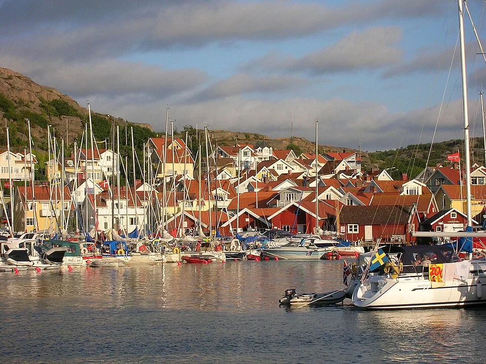
Photo: Kimblad
The geography · Canal, archipelago and open headland
Granite islands with many ways ashore
North of Smögen, the coast becomes an intricate arrangement of granite islands, narrow sounds and small basins. Green hollows and wooded shores remain, but bare rock increasingly defines the view. Hunnebostrand, Hamburgsund, Fjällbacka and Grebbestad give this island world its village centres; between them lie many of the natural harbours that make Bohuslän such a distinctive cruising ground.
Sotekanalen cuts across the neck of Ramsvikslandet, separating it from the mainland and opening an inside connection toward Hunnebostrand. Farther north, Fjällbacka looks out across an extensive archipelago. Beyond Grebbestad, the protective island screen breaks at Tjurpannan before returning around Havstenssund’s enclosed channel. These changes in geography matter more than the modest distances between towns.
Sotekanalen and Hunnebostrand
Map: sol.blue · Coastline: GSHHG 2.3.7, LGPL 3 or later.
Inside Ramsvikslandet · Sotekanalen
A canal worth passing through
Sotekanalen brings the shore very close. Rock faces, stretches of greenery and a low swing bridge replace the wider island views, with boats moving through a narrow cut between Ramsvikslandet and the mainland. The whole connection is about 4.8 km long. It is a memorable piece of the coast in its own right, not simply a way to shorten time in open water.
The canal was built to give shipping a protected alternative to the waters around Soteskär. Construction began in 1931, employing unemployed stonemasons, and the opening followed in 1935. That history connects it directly with the granite industry whose traces appear all along this shore. The works turned Ramsvikslandet into an island; the bridge preserves its road connection.
The outside passage remains an ordinary option in suitable weather, with a more open view of Ramsvik and the sea. Inside, the attraction is the closeness of the land and the transition between coastal waters at each end. Summer boat traffic can collect around the bridge opening, but away from it the canal has a quieter visual rhythm of rock, trees and water.
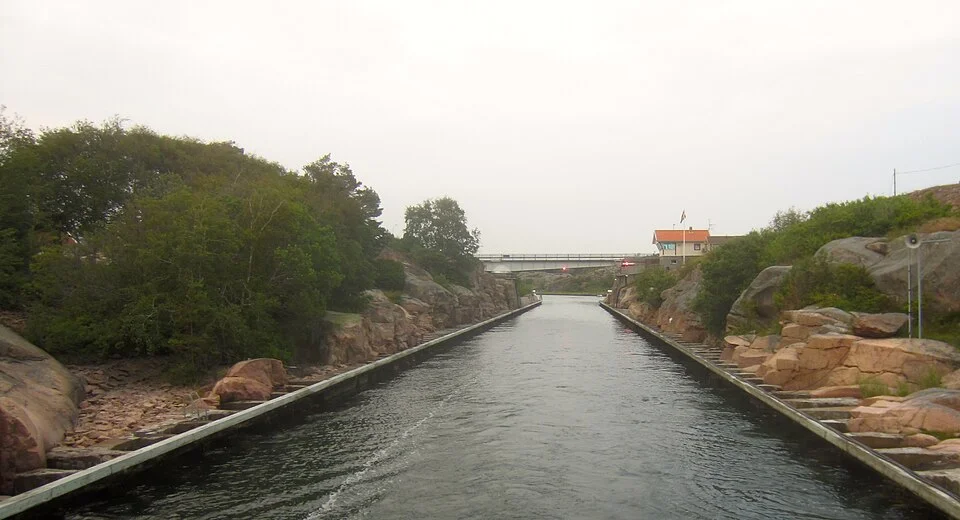
Photo: Eskil Malmberg
The stone-working coast · Hunnebostrand and Ramsvik
A harbour beneath the granite hills
Hunnebostrand gathers around a harbour backed by granite heights. Visiting yachts, red boathouses and white houses make a concentrated waterfront, with shops and places to eat close by. A walk along the shore soon brings the town’s other defining subject into view: the stone itself, worked on an industrial scale rather than simply admired.
At Udden, the old quarry on the northern quay has become an outdoor sculpture park. Cut faces form a striking backdrop to the works, and the sea remains in view. The park lies on the waterfront promenade toward the bathing area, so it fits naturally into a walk from the harbour. The Stenhuggerimuseet develops the working history more fully.
Stone extraction became a major industry in northern Bohuslän from the nineteenth century. Quarry faces, discarded blocks and old loading places are part of the landscape’s human history, alongside fishing and boatbuilding. Around Ramsvikslandet, the canal’s island setting leads into a more open world of rock, pasture and shore paths. The granite had already appeared around Lysekil; here it becomes increasingly dominant.
The sheltered village · Hamburgsund and Hamburgö
A sound with a settlement on each side
Hamburgsund has a strongly enclosed geography. The mainland village faces Hamburgö across a narrow sound, with a vehicle ferry moving between the two. Boats, houses and waterfront businesses remain close together, while the island beyond the shore offers a less built-up landscape.
The mainland side holds the concentration of food shops, other shops and restaurants. Swimming places lie on both sides of the sound. Hamburgsund gives the outer-island cruising ground a useful village centre without the scale of a larger town: the practical stop and the pleasure of being ashore are closely connected.
The harbour town · Fjällbacka
A cliff above the roofs, an archipelago beyond
Fjällbacka has one of the coast’s most recognizable settings. Vetteberget rises directly behind the village, with houses and lanes pressed between the hill and the harbour. From the boats, the rock forms a dramatic backdrop; from above, the town becomes a foreground to an extraordinary spread of islands.
Kungsklyftan, the cleft through the rock, and the ascent toward the viewpoint give a shore visit a very different perspective from the waterfront. Down below, restaurants, cafés and shops surround the harbour streets. Ingrid Bergman’s association with the area is remembered at the waterfront square bearing her name, but the town’s strongest impression comes from the relationship between cliff, village and sea.
The harbour deserves its reputation, yet Fjällbacka town is only part of this cruising ground. Islands overlap to the west and southwest; some carry houses or patches of trees, others are little more than smooth granite rising from the water. Looking out from Vetteberget makes that geography legible: a mainland town on one side, a dispersed world of small landings and enclosed water on the other.
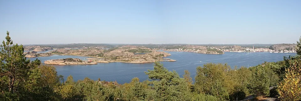
Photo: Bjoertvedt
Among the islands · Naturhamnar
The small places between the named ports
A naturhamn is a natural harbour or anchorage, often without a quay, harbour office or village. Around Fjällbacka, these places are central to the way the coast is enjoyed. A low island can enclose a basin that is invisible from the next channel; a strip of smooth rock can become the shore for a swim, a walk or an evening beside the boat.
The familiar local arrangement is a stern anchor with bow lines ashore, allowing people to step onto suitable rock from the bow. Bow steps and platforms on many Scandinavian boats make sense in this setting. Other places work as swinging anchorages. The relevant distinction is the individual shore, its underwater shape and exposure, rather than whether the island has a name on a tourist map.
These are social places as well as apparently secluded ones. A well-known basin may hold several boats in summer, while a nearby rock landing takes only a few. The geography produces very different scales of company and space, often within the same island group. A night among the rocks and an evening in Fjällbacka belong to the same cruising area.
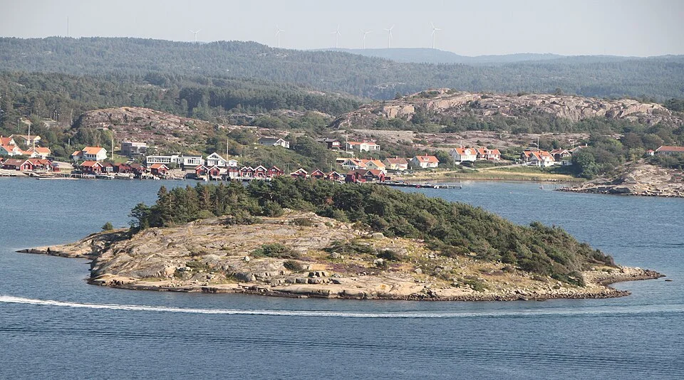
Photo: Bjoertvedt
The northern town waterfront · Grebbestad
Seafood, shops and the busy brygga
Grebbestad brings the shore back into a town-sized concentration. Fishing and shellfish give the waterfront its identity, alongside restaurants, shops and the summer crowd along Grebbestadsbryggan. It is a lively place to come ashore after the small island landings, with a wider choice of food and services close to the boat.
The long waterfront makes the harbour feel more expansive than Fjällbacka’s compact centre beneath the cliff. It is also a substantial stopping place south of Tjurpannan, with restaurants and town walks to occupy a pause while the exposed coast is unsettled.
The exposed opening · Tjurpannan
Where the outer islands fall away
Tjurpannan interrupts the sheltered pattern. Along much of the coast, islands stand between the boat and the open Skagerrak; here that screen falls away. The passage can feel markedly rougher than the enclosed water on either side, even though the exposed stretch is relatively short.
That contrast is the important local fact. Conditions among the islands south of the headland do not describe the sea off it. An onshore sea reaches the rock coast directly, and the decision to round belongs with the conditions outside. Grebbestad and Havstenssund provide substantial places to be on opposite sides of the opening, rather than making the headland a deadline in a fixed progression.
Ashore, the Tjurpannan nature reserve shows the same exposure in its low vegetation, bare rock and heath. Paths reach broad sea views, with smaller bays cut into the cliff shore. It is a landscape that makes the absence of shelter visible.
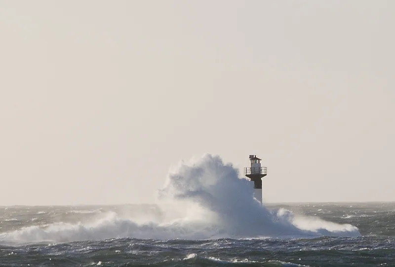
Photo: ingth
The sheltered channel · Havstenssund
A working village beside the passing boats
Havstenssund returns to a more enclosed scale. The channel runs close to houses, jetties and rock, with boats passing through a village whose fishing and marine businesses remain active. Red roofs and boathouses soften the granite, while the narrow waterway gives the place a distinct sense of movement.
Shore walks follow that geography. Spången, the walkway fixed to the rock beside the narrowest part of the sound, brings pedestrians close to the passing boats and continues toward the bathing place. Målarklöva cuts through the rock; the climb toward Sunneberget opens a wider view across the roofs and island channels.
This is a compact place to combine a berth, supplies and time ashore, with a sandy bathing place and village paths within walking reach. To the north, islands gather again around Resö and the approaches toward Koster. Havstenssund belongs naturally to both sides of that continuing coast.
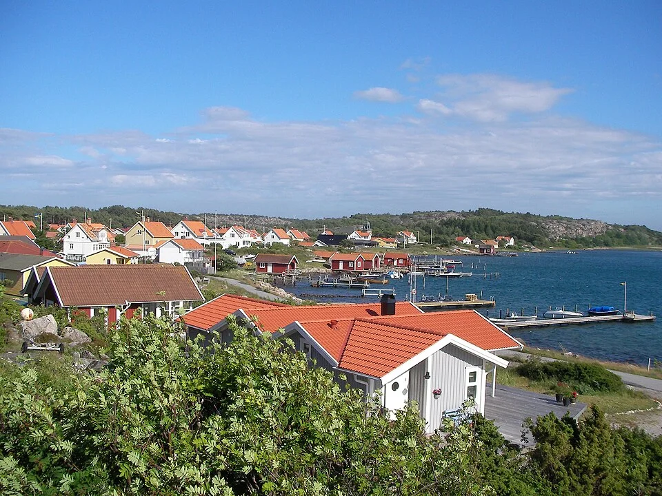
Photo: M.M.S.
Neighbouring cruising grounds
Along the coast and across the sea
Gothenburg–Smögen follows the coast south through Lysekil, Gullholmen, Käringön and Marstrand. Northward, Havstenssund–Koster explores Resö, Strömstad and the Koster islands. The Baltic & Skagerrak map places this shore alongside Denmark and the approaches to Norway; Western Norway explores the coast across Skagerrak.
Map data and licence notices
Coastline extract from GSHHG 2.3.7 by Paul Wessel and Walter H. F. Smith: regional GeoJSON, dataset notice, LGPL and GPL. Map composition: sol.blue.