Sweden’s west coast · Bohuslän
Gothenburg–Smögen
Island villages, swimming rocks and harbours at the heart of summer life. From Gothenburg’s ferry-linked communities to Marstrand’s fortress and the outer villages of Orust, this coast draws its character from places only a few miles apart.
Explore the coastSwedish west coast & Southern NorwayBaltic & Skagerrak
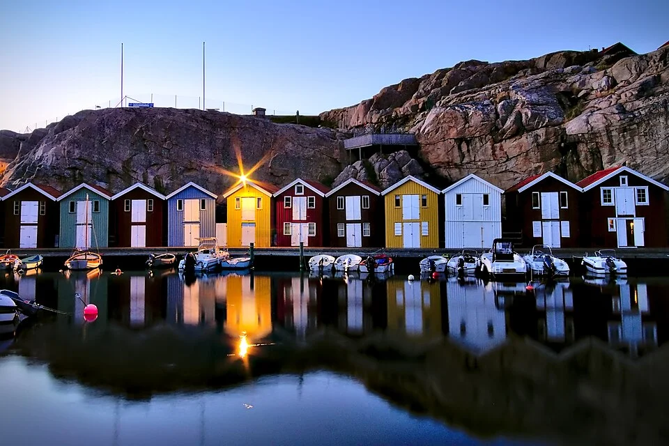
Photo: Thomas Fabian
The geography · Islands, sounds and village harbours
A coast made for stopping
Between Gothenburg and Smögen, fishing villages sit close to the water, and the water divides into channels, bays and small enclosed seas. A few nautical miles can separate a busy summer harbour from bare rock and a swimming cove. Marstrand, Käringön and Gullholmen each have enough character to become the centre of a visit, rather than a name passed on the way north.
The southern archipelago lies off Gothenburg’s river entrance. Beyond the northern islands, Marstrand sits at the southwest corner of the much larger Tjörn–Orust island group. Around Orust’s western shore, outer fishing villages face the sea while inner channels lead past wooded slopes, boatyards and mainland settlements. Lysekil stands at the mouth of Gullmarsfjord; Smögen and Kungshamn sit farther northwest, on opposite sides of their bridge.
Gothenburg’s islands and Marstrand
Map: sol.blue · Coastline: GSHHG 2.3.7, LGPL 3 or later.
The granite gives this coast depth as well as intricacy: steep-sided channels alternate with reefs and shallow pockets. The islands often interrupt the sea long before they interrupt the wind. July brings a concentrated boating season, and the best-known village harbours can fill; the density of other settlements and natural harbours is part of the area’s appeal.
Gothenburg’s southern archipelago · Vrångö, Donsö and Styrsö
Island life within reach of the city
Approaching from Kattegat, the change is tangible. Low islands begin to overlap, ferries cross between villages, and the open horizon breaks into smaller stretches of water. The southern islands are car-free, with passenger ferries linking them to Gothenburg. They are year-round communities: a harbour shop and a school belong to the same landscape as summer cafés and swimming rocks.
Vrångö marks the southern end of this inhabited chain. Paths lead away from the village into a nature reserve, with sandy bays, low rock and a former pilot lookout above the roofs. It is an especially good island for combining a harbour visit with walking and a beach, without needing transport ashore.
Donsö has a stronger working-waterfront character. Fishing and shipping remain conspicuous, alongside the bakery, food shop and guest harbour. A bridge joins Donsö to Styrsö, opening up another island’s lanes and bathing places on foot. Styrsö’s villages and wooded interior give a softer contrast to the outer skerries. Brännö, farther north, adds another settled island with footpaths and familiar summer dance traditions.
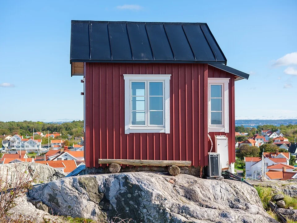
Photo: ArildV
Gothenburg’s northern archipelago · Hönö to Rörö
Working harbours and the outer shore
Hönö and Öckerö belong to a different island network, with bridges, roads and the large yellow vehicle ferries that connect these communities with the mainland. Hönö Klåva concentrates fishing boats, seafood, cafés and shops around a lively harbour. Öckerö has its own fishing port and boating businesses; Källö-Knippla offers the smaller scale of a tightly gathered village beside a sound.
Rörö lies at the northern end of the group. The harbour village occupies only part of the island; beyond it, paths lead into a much more open landscape of heath, rock and stony shore. The contrast between an active fishing community and the exposed western reserve is the reason to come ashore. These outer islands already look toward Marstrand, while the ferries and everyday harbour activity keep Gothenburg’s presence close.
The sailing town · Marstrand
Carlsten above, boats all around
Marstrand is one of the great meeting places of Swedish west-coast sailing. In summer, masts crowd the water below Carlsten Fortress, and the quays carry a steady movement of arriving crews, ferry passengers and people simply watching the boats. The town and harbour face each other at close quarters. Sailing is woven into the place, from visiting cruising yachts to the regattas that periodically intensify the activity.
Ashore, narrow pedestrian streets climb between wooden houses. Old hotels and waterfront restaurants belong to a resort tradition that long predates modern marinas. The town has a particular combination of elegance and saltwater informality: a substantial fortress, decorated façades, bathing rocks and people walking back from a swim. Beyond the compact centre, the island’s coastal paths open onto rock, coves and views toward the outer sea.
Carlsten gives the visit its physical centre. The climb from the waterfront brings the harbour, Koön opposite and the surrounding islands into view; the fortress itself adds a fuller historical visit. Its construction followed the Treaty of Roskilde in 1658, when Bohuslän passed from Norway to Sweden. The great walls were a statement of that new frontier. Today the town is unmistakably Swedish, with a regional identity shaped as much by the sea as by the line on a national map.
The sheltered harbour scene and the seaward side of the island feel remarkably different. A walk beyond the last houses soon trades restaurant terraces for exposed granite. Both belong to Marstrand: the social concentration around the boats and the open coast just behind the town.
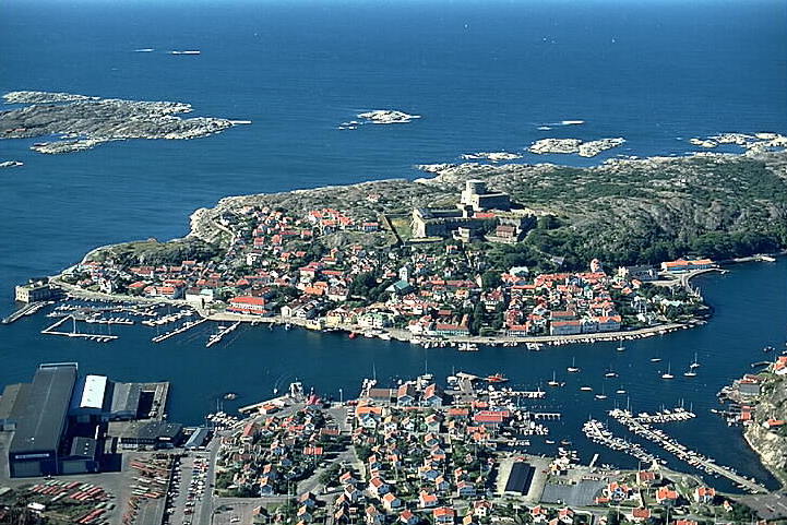
Photo: Jan Norrman / Riksantikvarieämbetet (1990)
Tjörn and Orust · Channels and small settlements
Villages tucked into the passages
North of Marstrand, the coast divides around Tjörn and Orust. The inside passages carry a succession of villages, islands and small harbours, with wooded land often close behind the rock. The outer edge has more sky and open water. These are neighbouring versions of the same cruising ground, and the villages make the geography worth exploring in detail.
Mollösund occupies a narrow sound on Orust’s southwest corner, with houses rising behind waterfront buildings and boats close to the village. It is a concentrated fishing-settlement scene, smaller and more intimate than Marstrand. Farther north, Ellös has shops and boatyard activity; Grundsund gathers around another narrow waterway, with tightly spaced houses and boathouses along the shore.
Across from Lysekil, Fiskebäckskil climbs the southern shore of Gullmarsfjord. Its old houses and lanes offer a different scale from the larger town opposite. The fjord entrance opens the view after the enclosed passages around Orust, before islands and granite return around the next headland.
Outer Orust · Käringön
A whole island gathered around its harbour
Käringön sits toward the western edge of the archipelago, with a dense fishing village pressed into a small island. Wooden houses, narrow lanes and harbour buildings form a compact settlement; beyond them, the land soon becomes rock and sea. The island is car-free, and the change of scale is immediate on stepping ashore.
The fishing community developed from the late sixteenth century. Its harbour remains the island’s gathering place, now shared with a substantial summer fleet of visiting yachts. Restaurants and swimming places are close enough to belong to the same shore visit, while a walk through the houses leads out toward the more exposed edges of the island.
Käringön’s popularity is part of its character. On busy summer days, arriving boats, people on the quays and restaurant terraces give the harbour an unusually lively atmosphere for somewhere so far out among the rocks. Away from that small centre, the island still has open shore and long views. The appeal is the combination of village intimacy and an outer-coast position.
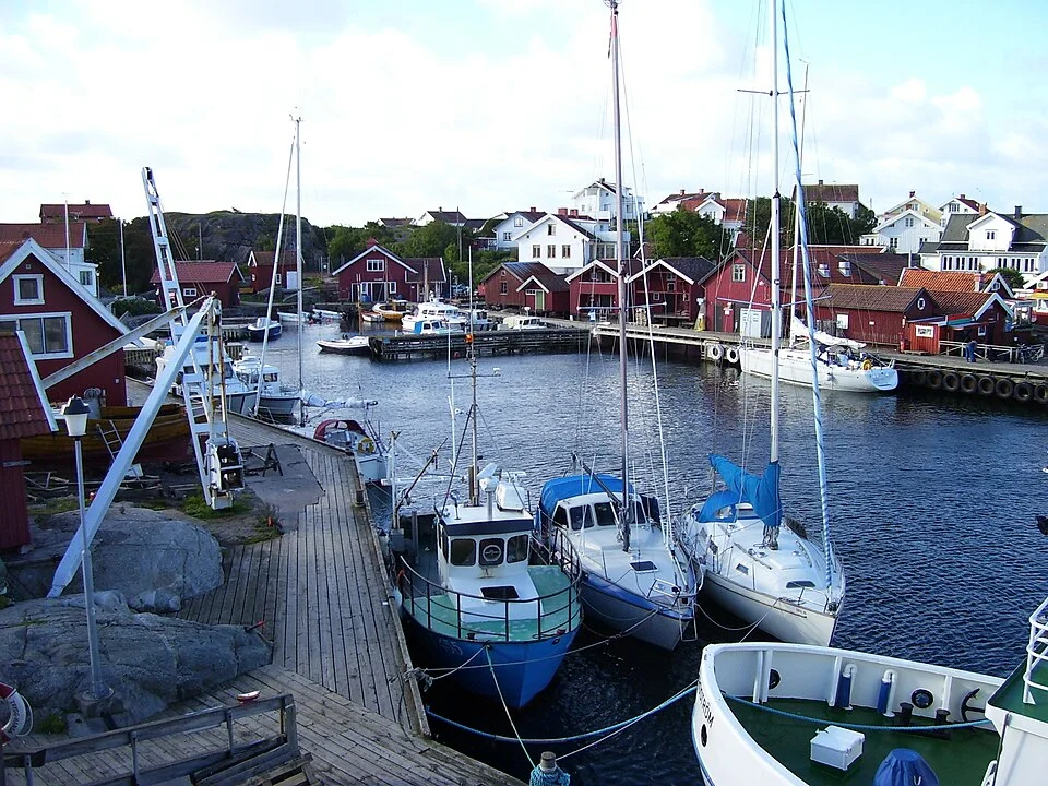
Photo: User Greverod on sv.wikipedia
Gullholmen and Härmanö · Village and walking country
Houses, jetties and paths at the water’s edge
Gullholmen is a particularly close-knit piece of Bohuslän. Houses, boathouses and jetties occupy almost every useful edge around the old fishing settlement. Paths pass between buildings, open onto the water and disappear into the next small cluster. The village itself is the attraction, best appreciated at walking pace.
The connection with neighbouring Härmanö gives the visit another dimension. Beyond the dense settlement, the landscape opens into walking country, with pasture, rock and sea views. A harbour berth therefore brings both an intimate village and a much larger island ashore. The transition happens on foot, without arranging a mainland excursion.
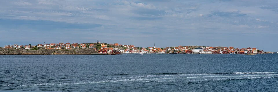
Photo: Bengt Nyman from Vaxholm, Sweden
Gullmarsfjord’s northern shore · Lysekil
A town beside the red granite
Lysekil is a more substantial town stop among the small fishing villages. Shops, restaurants and several visitor-harbour areas give it practical weight, but its appeal extends well beyond replenishing the boat. The old town of Gamlestan, the bathing waterfront and the red granite headland each offer a different shore walk.
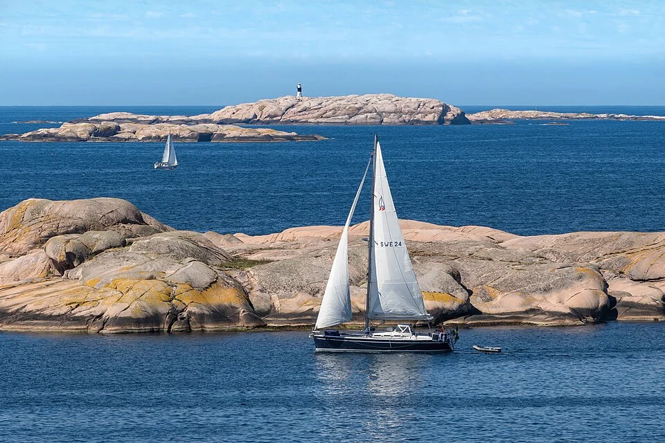
Stångehuvud lies close to the town’s western edge. Rounded red rock rises and dips beside deep blue water, with narrow passages and wider views toward the outer islands. The colours and smooth forms make this one of the coast’s most distinctive landscapes. The short distance from town to exposed rock is a large part of Lysekil’s appeal.
Those rocks also tell a human story. Quarrying transformed much of Bohuslän into building stone and paving; Calla Curman’s campaign and land purchases helped preserve Stångehuvud from further extraction. The headland’s beauty owes something to that deliberate act of protection.
Smögen and Kungshamn · Two sides of the bridge
Colourful quays and long summer evenings
Between Lysekil and Smögen, the water sometimes opens into a broader view, with low island groups and more room between the shorelines. At Smögen the scale contracts again: colourful boathouses line the water, the wooden brygga fills with people, and fishing, seafood and visiting yachts share a famously animated waterfront.
Smögen is a place to enjoy that concentration. Fish shops and restaurants give the fishing harbour a direct connection with what reaches the table. The old buildings and lanes sit immediately behind the busy waterside walk, while bathing rocks offer another reason to leave the boat. In high summer, bars and nightlife are part of the scene; a berth beside the brygga belongs to an evening destination as much as a picturesque fishing village.
Kungshamn, across the bridge, has a more substantial everyday town around its harbour, with groceries and a broad range of services. It is a separate place with its own restaurants and summer activity, rather than simply Smögen’s overflow. Staying on this side also makes a visit to Smögen possible by land. The two harbours let the same small area support quite different shore visits.
Neighbouring cruising grounds
Along the coast and across the sea
Sotekanalen–Havstenssund continues through the canal toward Hunnebostrand, Fjällbacka’s natural harbours and the northern granite coast. Kattegat opens south and west toward Anholt, Læsø and Denmark. The Baltic & Skagerrak map brings the wider region together.
Map data and licence notices
Coastline extract from GSHHG 2.3.7 by Paul Wessel and Walter H. F. Smith: regional GeoJSON, dataset notice, LGPL and GPL. Map composition: sol.blue.