Norway’s southeastern islands · Outer Oslofjord
Hvaler and outer Oslofjord
Smooth rock, wooded islands and village harbours continue north from Koster. Outside Hvaler lies the open Skagerrak; inside, sheltered channels lead to Fredrikstad’s old town and working maritime waterfront.
Explore the coastSwedish west coast & Southern NorwayBaltic & Skagerrak
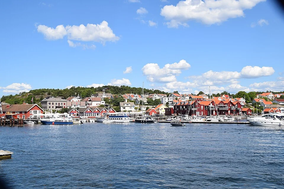
Photo: Bo Randstedt
The geography · Island sounds and open Skagerrak
An archipelago with an inside and an outside
The island landscape continues across the Swedish–Norwegian border with little visual interruption. Around Hvaler, wooded interiors stand behind smooth rock shores, while small settlements gather beside sounds and sheltered landings. Skjærhalden is the main harbour village; Herføl and the Sandøy islands form a distinct eastern group, and the outer skerries stretch west toward the mouth of Oslofjord.
Two different water landscapes connect these places. Outside the main islands, there is room to sail across open water, with the Skagerrak in view. Inside, Løperen leads north between Kirkøy and Asmaløy toward the Glomma and Fredrikstad. Channels also connect westward around Kjøkøy and Kråkerøy, with a fixed bridge controlling one of those links.
The inside waters give greater enclosure and access to the river city, with more channel-following and often more motoring. The outside offers a broader sailing horizon and more exposure to wind and swell. Both are normal ways to enjoy this coast; the choice changes which villages, shores and approaches lie naturally nearby.
Hvaler and the Fredrikstad approaches
The harbour village · Skjærhalden
A lively waterfront with beaches beyond it
Skjærhalden gathers the eastern archipelago’s busiest shore life around a compact waterfront. Boats lie immediately below the square, with restaurants, cafés and shops close together. The ferries to the smaller islands make the harbour a place of departures and returns as well as somewhere to sit beside the water.
The village is on Kirkøy, Hvaler’s largest island. Its immediate harbour beach, Krokstrand, gives a quick alternative to the quays; the paths toward Storesand and Ørekroken lead into a broader landscape of sand, pine woods and exposed shore. A visit can easily move between a café table and the quieter coast without changing harbours.
Ytre Hvaler’s visitor centre occupies Kornmagasinet beside the harbour. Its marine exhibits connect the visible island landscape with the coral, kelp and seabed habitats outside. Storesand has a second visitor-centre setting beside its long beach, with a café and outdoor activities when open.
The eastern islands · Herføl
From a small marina to a shore carved by ice
Herføl puts a remarkable variety of coast within a small island. The harbour side has summer shops, a café and marina activity; paths lead away through low vegetation toward rounded rock, shingle shores and open sea. The contrast is immediate: a sociable landing on one side, a much more exposed landscape on the other.
The island’s most memorable formations are its jettegryter, potholes cut into the rock by glacial meltwater. Some are deep rounded cavities; Hvalgapet, also called Katedralen, opens horizontally into the shore. These are substantial pieces of landscape, with the sea visible through and beyond the stone.
Bronze Age burial cairns add a human history to the walks. Near the southwestern side, Linnekleppen’s black-and-white seamark stands above the low island. The local island guide connects these landmarks with the paths, bathing places and harbour settlement. The western part of Herføl lies within Ytre Hvaler National Park.
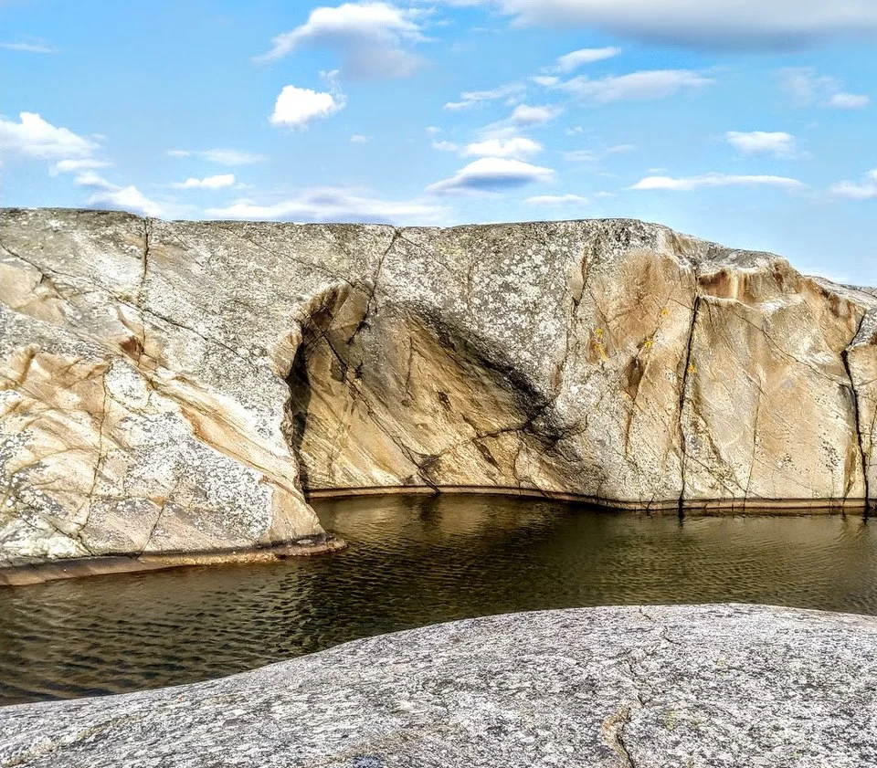
Photo: Ole-Erik Yrvin
The greener eastern islands · Søndre Sandøy
Woodland lanes and old herring shores
Søndre Sandøy is greener and more wooded than Herføl’s outer shore. A gravel road connects Nedgården with Gravningsund, with paths branching through meadows and woodland toward beaches. Nedgården has a small settlement and Café Oline; at Gravningsund, large red waterfront buildings recall the herring trade that once animated the narrow sound between Søndre and Nordre Sandøy.
The island’s walking routes offer different terrain. Hjertestien crosses more uneven woodland toward Gjøkvika, while Kløverstien follows easier ground through the southern cultural landscape. Stuevika’s sandy shore faces the eastern water of Sekken; Gjølertangen has a small reserve with yew woodland.
Regular island ferries call at Nedgården and Gravningsund, so Sandøy is also accessible as a shore excursion from Skjærhalden. The ferry landing itself is a transport quay, separate from any arrangement for a visiting yacht. This is a useful island to explore on foot without needing to relocate the boat.
The outer archipelago · Akerøya and Ytre Hvaler
Low islands, open horizons and a fort by the sea
Akerøya lies outside the larger inhabited islands, with broad grass and rock landscapes facing the Skagerrak. Across the narrow water, Akerøy fort occupies Festningsholmen. Its low walls seem closely fitted to the skerry, part of the chain of coastal defences associated with Fredrikstad.
The sheltered water by Festningsholmen and the shore near Akerøya’s main house form a familiar focus for boat visitors. Beyond that pocket, the island opens into bird country and sea-facing shores. The fort, open ground and low horizon make a very different shore visit from the woodland lanes of Sandøy or the village quays.
Much of Akerøya lies within seasonal bird-protection areas. In Ytre Hvaler’s mapped bird and seal zones, access restrictions apply from 15 April to 15 July, including a 50 m separation for boats. The national park’s access page links the protection map and the local outdoor-recreation map, which identifies landings, mooring facilities and shore amenities. The protected area’s boundary, rather than the island name alone, determines which shore is accessible.
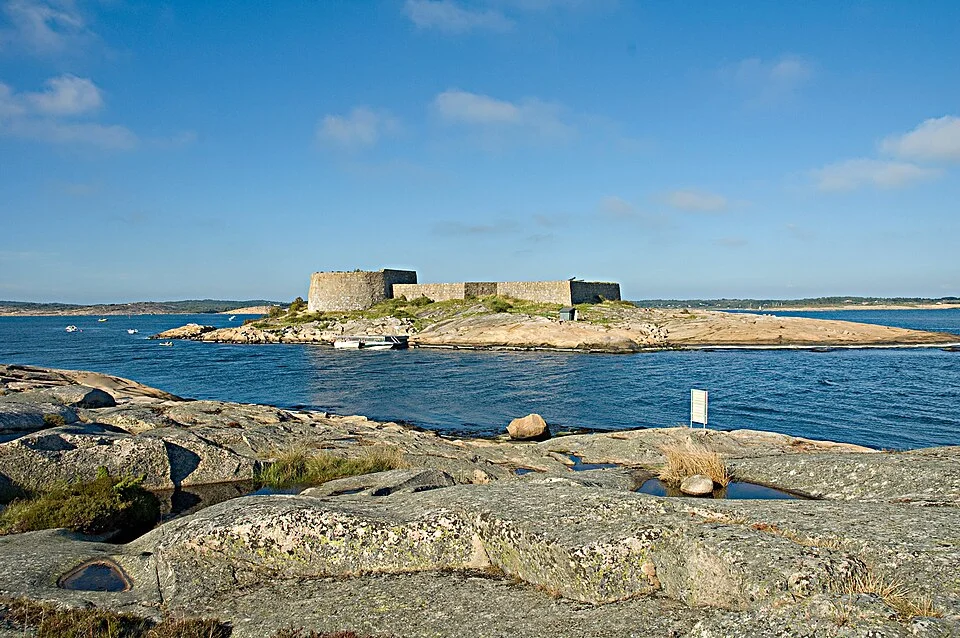
Photo: Kyrre
Ytre Hvaler National Park continues the marine landscape protected at Kosterhavet. Most of its area is underwater: kelp forests, eelgrass meadows, deep rock faces and cold-water corals occupy a far more varied world than the surface suggests. The large coral reef near Tisler belongs to that submerged geography. Skjærhalden’s exhibits provide a close view of habitats that cannot be seen simply by sailing past their islands.
The western shore · Fishing harbours and small communities
Utgårdskilen, Vikerhavn and Papperhavn
Hvaler’s western side has a more working-harbour character than the holiday waterfront at Skjærhalden. Utgårdskilen’s fishing boats and marine businesses sit within a substantial enclosed harbour on Vesterøy. Vikerhavn is a smaller settlement on Asmaløy, near the island’s open southern coast.
Papperhavn is another of the coast’s small maritime communities, with houses and boathouses around enclosed water. The authority lists its quays for commercial use rather than as a regular guest harbour. It belongs in the picture of Hvaler’s coastal life, but is not an equivalent visitor-berth option to Skjærhalden.
The open-water choice · Outer Hvaler and Strømtangen
Room to sail beyond the island screen
Outside Hvaler, the coast becomes a line of low islands against a broad sea. There is space for longer sailing legs, with the outer rocks, occasional lights and distant wooded land giving the water its scale. In settled weather, this can be the most direct way to enjoy the archipelago as a sailing landscape.
The exposure is real, especially around Strømtangen and the waters toward the Søstrene islands. Here the protecting skerries thin out and sea from the southwest reaches the coast more directly. A short, steep or mixed sea can feel quite different from the water behind the main Hvaler islands; swell may remain after local wind has eased.
That distinction helps explain the appeal of both sides of the archipelago. The outside gives room and a sea horizon. The inside connects sheltered shorelines, small settlements and the river approach to Fredrikstad. Skjærhalden, the eastern islands and the western harbours provide places to enjoy whichever water landscape suits the visit.
Strømtangen is also a useful geographic hinge. Eastward lie the channels around Kråkerøy and Kjøkøy; northward, Oslofjord opens beyond the coastal islands. The lighthouse coast belongs to the meeting of these different waters, rather than marking the end of Hvaler’s interest.
The inside waters · Løperen and Kjøkøysund
Sheltered channels with a river at their head
Løperen is the broad north–south opening between Kirkøy and Asmaløy. It leads toward the eastern Glomma approach, which also carries commercial traffic to Fredrikstad and Sarpsborg. Wooded shores and islands enclose much of the view, with the river city farther inland.
The northern part of this connection is influenced by freshwater flowing out of the Glomma. In its Østerelva sailing directions, Kartverket describes about 2 knots in mid-river, with speeds approaching 4 knots measured during major floods. Those figures describe the river reach, not a uniform current throughout Løperen. They explain why an upstream visit can involve appreciably slower progress than the protected water alone suggests.
A smaller-vessel connection passes through Kjøkøysund between Kråkerøy and Kjøkøy, joining the eastern approach with the channels toward Strømtangen. The fixed Kjøkøysund bridge has a stated sailing clearance of 25 m. This is the material air-draught constraint on that cross-connection; it does not sit across the main Løperen–Østerelva approach.
Borg Havn’s approach description distinguishes these waters from the western river entrance. It gives about 6 nm from Strømtangen to Fredrikstad by the western approach, and 12 nm from Vidgrunn by the eastern approach. These are different harbour approaches with different bridge implications.
The river destination · Fredrikstad
A fortified town, a working boatyard and a living waterfront
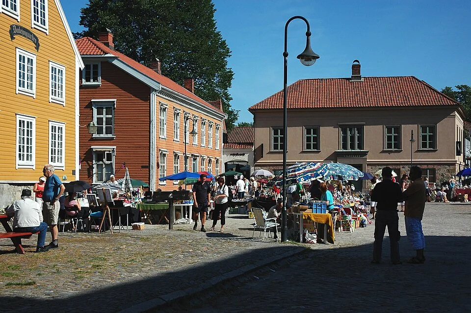
Fredrikstad changes the scale again. The Glomma divides an urban waterfront, a fortified old town and the green island of Isegran. Restaurants line Brygga on the modern centre’s side; across the river, Gamlebyen’s cobbled streets sit within earthworks, bastions and a moat.
The old town is compact enough to discover on foot, with shops, galleries and cafés among former military and commercial buildings. Walking the ramparts gives a different view from the streets: the defensive geometry becomes clear, with water and open ground surrounding the settlement. The square’s market activity and everyday businesses keep it from feeling like an isolated monument.
The city ferries connect the river’s districts and are part of the pleasure of a visit. The short crossings give views of boats, quays and the old town’s river-facing walls. They also make it possible to enjoy several parts of Fredrikstad while leaving a yacht at its chosen berth.
Fredrikstad’s maritime island · Isegran
Traditional boats still have work to do here
Isegran lies where the river branches meet. Wooden boats and historic vessels gather around its quays, with restoration and traditional boatbuilding continuing in the workshops. This is a living maritime environment, where the work on a hull is as much part of the visit as the older buildings.
Ashore, paths lead through green space, past the old house and its Renaissance-style garden. The fortified tower recalls the island’s military role, while the boatyard gives it a present-day purpose. The combination is particularly rewarding after time among Hvaler’s low outer islands: the sea’s working history is gathered here at the head of the approach.
The museum harbour accommodates historic vessels under its own arrangements. For a visiting cruising yacht, Isegran is chiefly a shore destination reached from a guest berth elsewhere in the city, on foot or using the river-ferry connections.
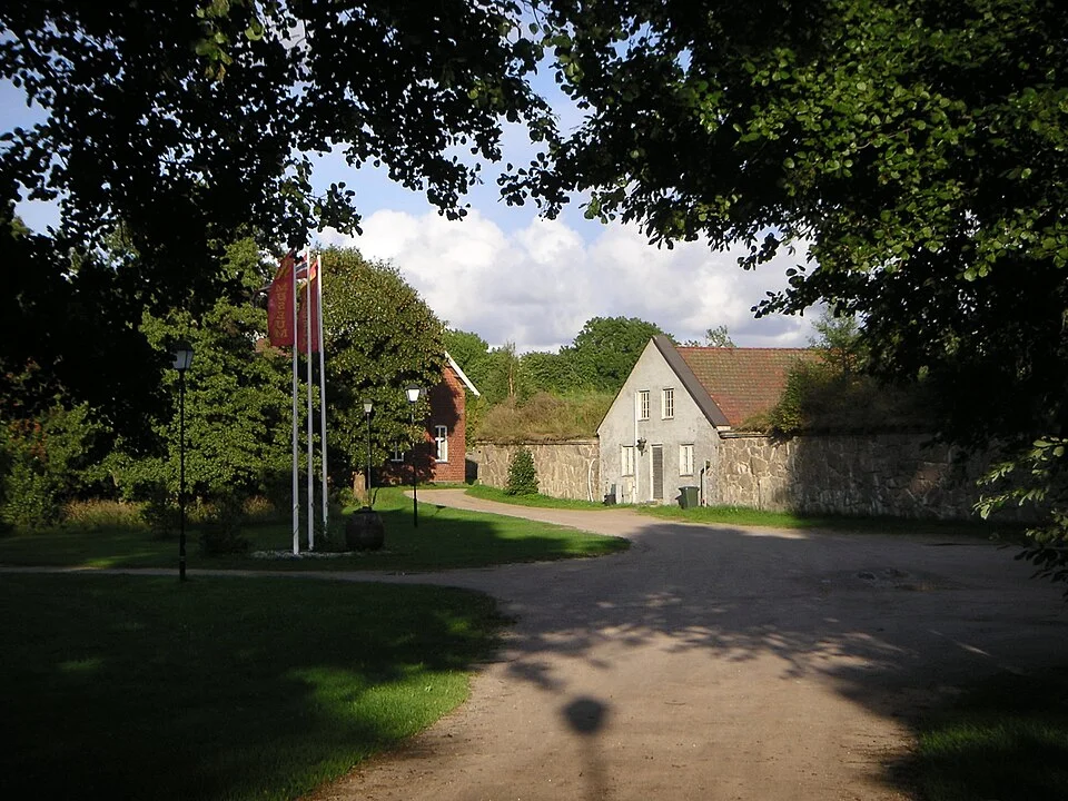
Photo: John Erlandsen
Neighbouring cruising grounds
Along the coast and across the sea
Southward, Havstenssund–Koster explores the Swedish islands, Kosterfjorden and Strömstad. The Baltic & Skagerrak map connects these waters with Bohuslän, Denmark and the Baltic approaches. Across the Skagerrak, Western Norway introduces the coast toward Stavanger and Bergen.
Map data and licence notices
Coastline extract from GSHHG 2.3.7 by Paul Wessel and Walter H. F. Smith: regional GeoJSON, dataset notice, LGPL and GPL. Map composition: sol.blue.