Lyø
Lyø lies off Faaborg, with a village of old farmsteads, ponds and small lanes behind the northern harbour. Its harbour is linked to the island by a causeway, leaving the village and shoreline walks just beyond the boats.
Denmark · The Belts and island waters
Wooded straits, broad shipping waters and an archipelago of small harbours, farm lanes and old seafaring towns.
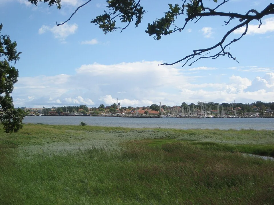
Fyn—also called Funen in English—sits between the two Danish Belts. Lillebælt curls between its western shore and Jutland; Storebælt opens broadly to the east. Samsø lies beyond the northern approaches, an island destination between the Belts and Kattegat.
South of Fyn, the scale changes. Faaborg and Svendborg look out over low islands, shallow banks and branching channels, with Ærø and Langeland along the outer edge. Town berths, village harbours, beaches and lanes through farmland sit close together here, while the larger straits retain the space and movement of through-waterways.
The cruising ground
Map: sol.blue · Coastline: GSHHG 2.3.7, LGPL 3 or later.
Lillebælt narrows sharply near Middelfart, where the two bridges cross between wooded banks. South of those narrows it widens toward Als and the western entrance to the South Funen islands. Storebælt, on the opposite side of Fyn, has much more of an open-sea horizon, with the bridge and commercial shipping prominent in the view.
Samsø reaches north toward Kattegat. The island’s harbours face different waters: Ballen on the east coast, Langør beside the northeastern shallows, and Mårup on the northwest. South Funen gathers the smaller-scale island water between the Fyn coast, Ærø and Langeland.
Western Fyn · Lillebælt
The narrow part of Lillebælt feels almost river-like, though it connects substantial bodies of sea. Around Middelfart, wooded slopes come close to the water and the bridges frame the view. The Hindsgavl peninsula offers paths through beech woods and along the shore; the old town brings smaller streets and cafés to the waterfront. Harbour porpoises are part of this strait’s character, with shore observation and local boat trips adding another reason to linger.
Fredericia stands across the water on the Jutland side. Its straight streets and substantial grassy ramparts tell a different story from Middelfart’s older waterfront: this was a planned fortress town. The marina lies south of the centre, beside a beach and the woods at Hannerup, so a berth there puts nature closer than the central shopping streets.
Current in the narrows reflects the exchange of water through the Belts, with wind and water-level differences often more significant than the small astronomical tide. DMI’s water-level observations and forecasts are useful here. The old Lillebælt bridge has a published clearance of 33 m.
Eastern Fyn · Storebælt
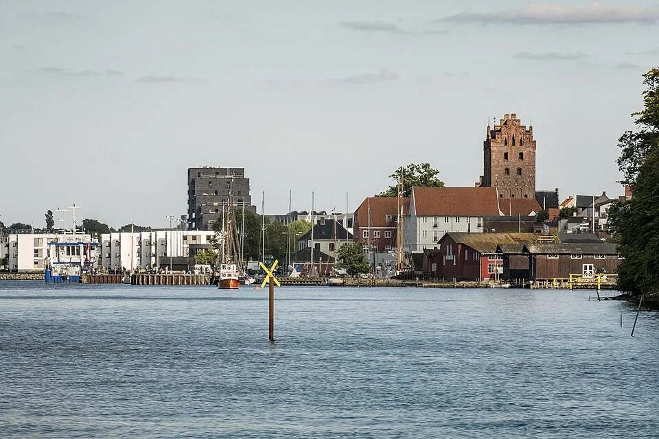
On Fyn’s eastern side, Storebælt opens into broad water between Fyn and Zealand. The suspension bridge is visible from far away, while ships following the main channel give the passage a very different rhythm from the island channels to the south. Nyborg sits inside a bay on the Fyn side, close to the western end of the crossing.
The town makes the eastern shore more than a view of bridge pylons. Its old centre, former royal castle precinct and harbour reflect centuries of movement between Denmark’s islands. The waterfront is close to shops and cafés, with beaches along the bay beyond the town.
The two bridge passages are materially different. The bridge operator gives 18 m clearance for the low western bridge between Fyn and Sprogø, and 65 m for the eastern suspension bridge toward Zealand. The taller eastern span is on the shipping side of the crossing; the western passage is not an interchangeable choice for every mast.
Northern approaches · Kattegat
Samsø sits between the northern Belts and Kattegat. Its appeal reaches well beyond a convenient harbour: farm shops and roadside produce, villages connected by lanes, beaches and a landscape that opens out as soon as the harbour is behind you. A bicycle makes the island’s inland places part of a sailing visit.
Ballen is the busiest harbour settlement, with restaurants, fish sellers, shops and a beach close to the boats. The quays can feel distinctly sociable in summer. Langør’s northeastern setting and Mårup’s northwestern shore offer other ways into the island; their positions matter as much as their different harbour atmospheres.
Southwestern approaches · Als
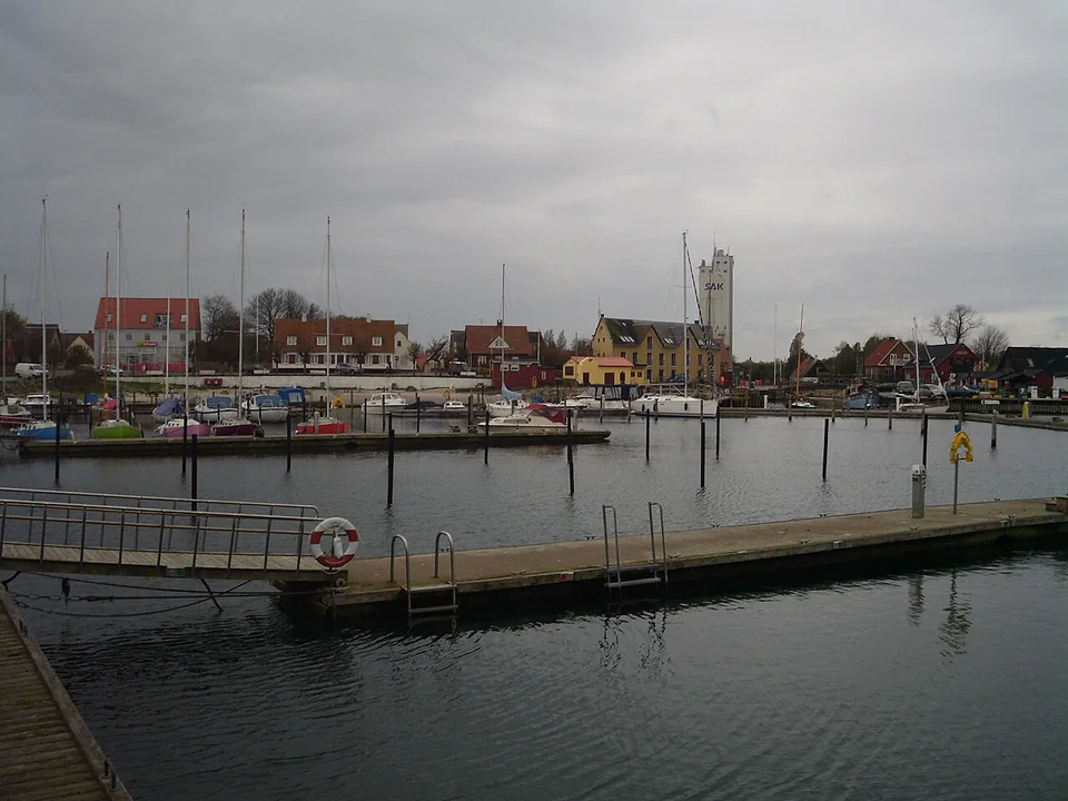
Sønderborg sits at the southern end of Alssund, with the castle and town waterfront beside the narrows. It connects naturally with the German Baltic coast, Flensburg Fjord and the waters leading toward South Funen. Continuing through Alssund gives a wooded, enclosed passage; the eastern side of Als faces broader Baltic water.
The waterfront promenade links beach, castle and town, while the nearby landscape carries the history of the Danish–German border and the fighting at Dybbøl. Those layers of history give a walk ashore more substance than a marina resupply stop.
South of Fyn · The archipelago
Map: sol.blue · Coastline: GSHHG 2.3.7, LGPL 3 or later.
The South Funen Archipelago has a close-grained geography: an island village across the water, a church tower behind fields, a ferry threading between low shores. Faaborg and Svendborg provide larger town harbours on Fyn. Ærø gives the southern edge a line of substantial seafaring towns; the smaller islands occupy the water between.
Shallow banks define the channels between these islands, and wind-driven changes in water level matter more than a conventional tide-table rhythm. Entrance and basin depths vary considerably, even between two harbours on the same island. Ærøskøbing and Marstal, for example, each have different draught allowances for their old or outer harbour and their yacht marina.
South Funen · Svendborgsund
Svendborg’s waterfront remains a place of ferries, traditional vessels and marine trades. The sound curves past the town, with Tåsinge close across the water. Behind the quays, streets climb into a centre of shops, cafés and ordinary town life. The connection between harbour and town is immediate.
Frederiksø, the old shipyard island, adds workshops and cultural life to the waterfront. This is a good place to see the archipelago’s maritime character in a more urban form: island ferries arriving, timber boats alongside and working yards close to places to eat. Current through Svendborgsund belongs to the experience of the place as much as the view from the quay.
South Funen · Faaborg
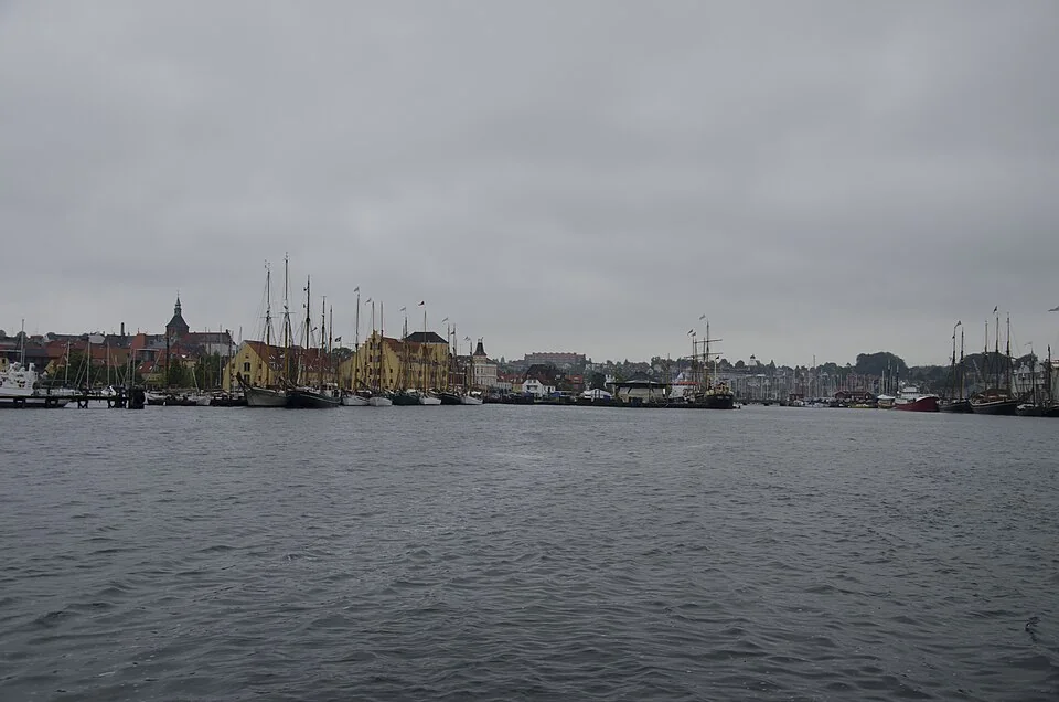
Faaborg’s harbour faces Bjørnø and the island water toward Lyø and Avernakø. The old centre is close behind the quay, with narrow streets, the freestanding bell tower and places to eat around the market square. The hills of Svanninge rise inland, adding a different landscape to the low islands offshore.
Faaborg Museum and Øhavsmuseet offer two ways into the area: the painters associated with Fyn, and the surrounding archipelago and its history. Both fit naturally into a town visit. Ferries toward Lyø and Avernakø also make the smaller islands accessible from a stay in Faaborg.
South Funen · Between Fyn and Ærø
These islands have a different scale from the main towns. The harbour often opens directly onto a lane, with the village a walk inland and fields continuing almost to the beach. A café, village shop or farm stall may be the main stop ashore. The individual harbours matter: a ferry landing, an older shallow basin and a newer yacht harbour can offer quite different access on the same small island.
Lyø lies off Faaborg, with a village of old farmsteads, ponds and small lanes behind the northern harbour. Its harbour is linked to the island by a causeway, leaving the village and shoreline walks just beyond the boats.
Avernakø stretches out as two former islands joined by a narrow causeway. A walk or cycle ride carries on from Avernak through the farmland toward Korshavn, with beaches on the outer shore.
Skarø sits near the western approach to Svendborgsund, with a small village, fields and low shoreline close to its harbour. Its locally made ice cream has become one of the island’s small pleasures.
Drejø reaches farther into the central archipelago, with lanes through the village and open views toward Ærø. It has two distinct harbours.
South Funen · Northern Ærø
Ærøskøbing has the compact streets, cobbles and brightly painted doors that make an old harbour town inviting on foot. The ferry quay and yacht basins lie just below the centre. Beyond the town, the beach huts along Vesterstrand add a different kind of colour, with low shore and open views across the archipelago.
Ærø is large enough for the countryside to become part of the visit. Lanes pass farms, villages and churches, with cycle routes linking the island’s towns. Søby, toward the northwestern end, is another harbour town and a useful point of connection with the western island water. Ærøskøbing, Søby and Marstal have distinct settings; the island is more than one picturesque waterfront.
South Funen · Eastern Ærø
Marstal, at Ærø’s eastern end, has a more overtly working maritime identity. Shipyards, the harbour’s long breakwater and streets of seafarers’ houses connect it with the era when local vessels traded far beyond Danish waters. The Marstal Maritime Museum develops that story through ships, crews and their voyages; its Eriksens Plads shipyard site brings the work of building and maintaining wooden vessels back to the harbour.
Eriks Hale, beyond the town, offers a narrow sandy shore and bathing huts facing the water. It is an easy change of scene from the museum and workshops, and helps explain why Marstal works as a shore destination as well as a harbour near the eastern entrance to the archipelago.
South Funen · Eastern islands
Langeland forms the long eastern edge of the South Funen island water. Rudkøbing faces west across the sound, with an old town of small streets above a waterfront that mixes ferries, fishing and leisure boats. Its position offers a different perspective on the archipelago from the Fyn shore: Ærø and the smaller islands lie across the water, while Langeland’s countryside extends north and south behind the town.
The nearby harbour bathing facility provides a place to swim ashore. Strynø, southwest of Rudkøbing, adds a smaller island village, old maritime connections and lanes across farmland; the ferry from Rudkøbing also makes it accessible without moving the boat.
Neighbouring cruising grounds
The waters around Als and southern Fyn connect with Kiel Bay and the German shore. The German Baltic coast guide follows the contrasting settings of the Schlei, Fehmarn, Lübeck, Wismar and the Mecklenburg beach towns.
North of Samsø, Kattegat opens between Jutland and Sweden, with Anholt and Læsø out in the basin. Farther east, Møn and southern Øresund lead toward Copenhagen.
Coastline extract from GSHHG 2.3.7 by Paul Wessel and Walter H. F. Smith: regional GeoJSON, dataset notice, LGPL and GPL. Map composition: sol.blue.