Germany · Baltic Sea
German Baltic coast
Brick church towers behind fishing quays, beaches beside the harbour entrance, and big ships passing close enough to feel part of the town.
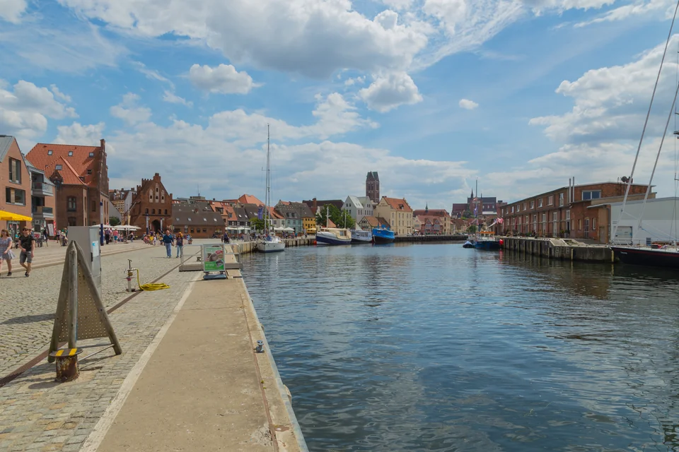
Photo: J.-H. Janßen
Between the Schlei and the Darß peninsula, Germany’s Baltic shore alternates between deep bays and long, open stretches of low coast. Kiel brings the bustle of a major sailing centre; Lübeck and Wismar put the Hanseatic trading towns within reach of a berth. At Kühlungsborn and Warnemünde, the sea-facing promenade and sandy beach are as much the attraction as the harbour.
The Schlei is a different world within the same coast: a narrow entrance opening into winding inland water, reed margins, villages and small shipyards. Fehmarn, farther east, stands at the meeting of Kiel Bay, Lübeck Bay and the passages toward Denmark.
The cruising ground
Bays, towns and the open coast
Kiel and the Schlei face east into Kiel Bay. Around Fehmarn, the coastline turns south into Lübeck Bay; farther east, Wismar lies well inside its own bay. Kühlungsborn and Warnemünde sit on the outer shore, while the rounded Darß peninsula leads toward Prerow. The distance into a bay matters as much as the spacing of towns along the coast: a visit to Wismar or Lübeck is a deliberate turn inland.
Kiel Bay to Lübeck Bay
Maps: sol.blue · Coastline: Natural Earth, public domain.
Western Baltic · The Schlei
Kappeln and the Schlei
From Schleimünde, the Schlei runs inland through a succession of narrows and broader reaches. Fields and wooded banks take the place of the open Baltic horizon. Kappeln sits astride the water, its bridge, quays and church tower forming a compact waterfront town. The old herring fence beside the bridge is a reminder that fishing shaped this place long before visiting yachts arrived.
The museum harbour adds traditional working boats to the scene; fish stalls and restaurants keep the quay lively. Shops are close enough for an ordinary town visit on foot. Continuing inland brings Arnis and the softer shores of the Schlei into the same picture, without the scale or traffic of Kiel Fjord.
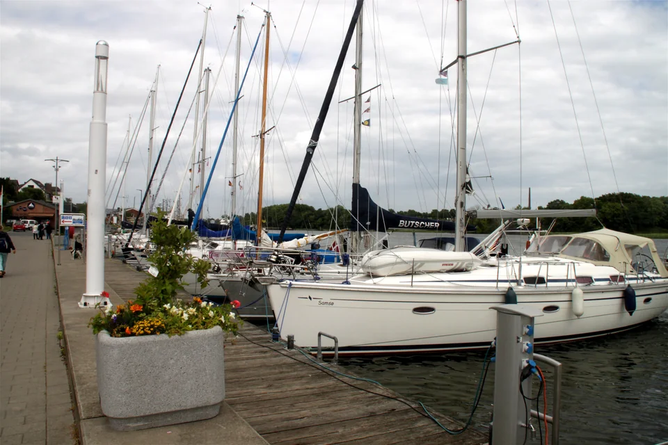
Photo: Eduard47
Kiel Bay · Kiel Fjord
Kiel Fjord: the Baltic gateway
At Holtenau, the Kiel Canal meets the Baltic and the scale of shipping changes the view: commercial traffic, ferries and sailing boats share the long inlet. The fjord extends well beyond the city waterfront. Toward its outer western shore, Schilksee has the concentrated life of a sailing harbour, with rigging, regattas, repair services and the beach immediately alongside.
Schilksee’s Olympic harbour was built for the 1972 sailing events. Its low modern buildings and extensive basins make a striking contrast with the old trading towns farther east. This is a useful place for boat services and a straightforward beach stop; central Kiel is a separate trip ashore rather than a town square just beyond the pontoon.
Between Kiel Bay and Lübeck Bay
Fehmarn: island shore or the sound
Fehmarn’s low farmland and long beaches sit between two quite different passages: the narrow Fehmarnsund beside the German mainland and the broad Fehmarnbelt toward Denmark. Going through the sound or around the island changes both the amount of open water and the harbours that fall naturally on the way.
On the southern shore, Burgtiefe lies inside the Burger Binnensee, behind the beach. Its circular pontoon and waterfront promenade give the marina a distinctive shape. Südstrand is close by; Burg, inland, offers a larger choice of shops and places to eat. Nearby Burgstaaken retains a fishing-harbour character, including fish sold from boats.
Lübeck Bay · The Trave
Travemünde and Lübeck
Travemünde combines a seaside resort with a busy river mouth. The beach and promenade face Lübeck Bay; ferries and freighters pass between the waterfront and Priwall. Across the water, the four-masted Passat gives the yacht harbour a very different skyline from the passenger terminals farther up the Trave.
A berth here leaves the beach, fish restaurants and waterfront within easy reach. The Priwall ferries connect the two banks. Lübeck can then be visited by public transport, or the boat can continue upriver for a different kind of stay.
Lübeck’s old town occupies an island threaded with narrow lanes and passages behind merchants’ houses. Brick churches, the Holstentor gate and the salt warehouses express the wealth of the medieval Baltic trade. The UNESCO-listed town rewards walking beyond the main shopping streets into those smaller courtyards and waterside edges.
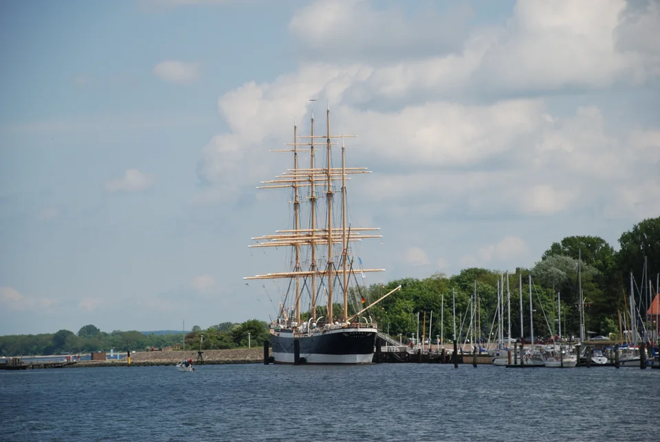
Photo: Erika39
Mecklenburg · Wismar Bay
Wismar: the harbour at the town’s feet
Wismar lies at the head of its bay, with the old harbour leading directly toward the brick-built town. Fishing boats selling their catch, restored vessels, warehouses and cafés share the waterfront. Beyond it, the Wassertor opens onto streets that still connect the harbour to the market square and the great brick churches.
The city’s trading history is visible in its shape as well as its buildings. Along with Stralsund, Wismar forms a UNESCO World Heritage site representing the Hanseatic towns of the southern Baltic. Later Swedish rule added another chapter to that maritime history. This is a town stop with a working waterfront, well suited to arriving on foot from the quay and wandering inland for food, museums and architecture.
Mecklenburg · The open coast
Kühlungsborn: a marina on the beach coast
Kühlungsborn faces the open sea rather than sheltering deep inside an inlet. Behind its breakwaters, the marina sits at the eastern end of a resort waterfront: a long sandy beach, promenade and streets of seaside villas. The change from Wismar is immediate. Here, the shore visit is about beach life and a walk along the water rather than medieval lanes.
Mecklenburg · The Warnow
Warnemünde and Rostock
At the mouth of the Warnow, Warnemünde brings fishing-harbour lanes, a broad beach and a lighthouse into the foreground of a major port. The Alter Strom is the intimate side of the place, with small boats, quayside food and houses close to the water. Just beyond, the scale changes to ferries and cruise ships entering the river.
Hohe Düne lies across the entrance, on the eastern side. Staying there gives the boat a modern marina setting, with the passenger ferry across the Warnow providing the connection to Warnemünde’s older waterfront. Rostock, farther inland, offers another town visit beyond the resort: brick churches, shopping streets and the riverfront.
Darß peninsula · Prerow
Prerow and the Darß coast
Beyond Warnemünde, the Darß changes the coastline again: a low peninsula of forest, dunes and long beaches projecting into the Baltic. Prerow’s new island harbour sits offshore at the end of a 721 m pier, giving a very different arrival from a basin tucked into a town. The walk ashore is part of the place, with the broad beach on either side.
Opened in 2024, it replaced the former emergency harbour at Darßer Ort. Its role remains a short stop on the exposed coast between Warnemünde and the approaches toward Barhöft and Rügen.
Neighbouring cruising grounds
Across to the Danish islands
North of Kiel Bay, the low Danish islands lead into the Belts and the more intricate water south of Fyn. Explore Fyn, the Danish Belts and South Funen for the contrasting harbours of Sønderborg, Svendborg, Faaborg and Ærø.
Northeast of Fehmarn, Møn and southern Øresund bring chalk cliffs, Klintholm’s harbour and the Danish coast toward Copenhagen.