From the Ebro Delta to the Pyrenees

Catalonia, Barcelona & Costa Brava

Rice fields at the water’s edge. Galley halls behind a city harbour. Fishing boats, ancient trading towns and the last rocks of the Pyrenees.

Catalonia’s coast changes from low, river-built land to wooded coves and exposed headlands. Barcelona sits between those worlds, a maritime city with beaches, shipyards and several very different yacht harbours. Farther north, the Costa Brava alternates rocky shores with broad bays and busy seaside towns; its fishing and trading past is still part of what there is to see, eat and visit.

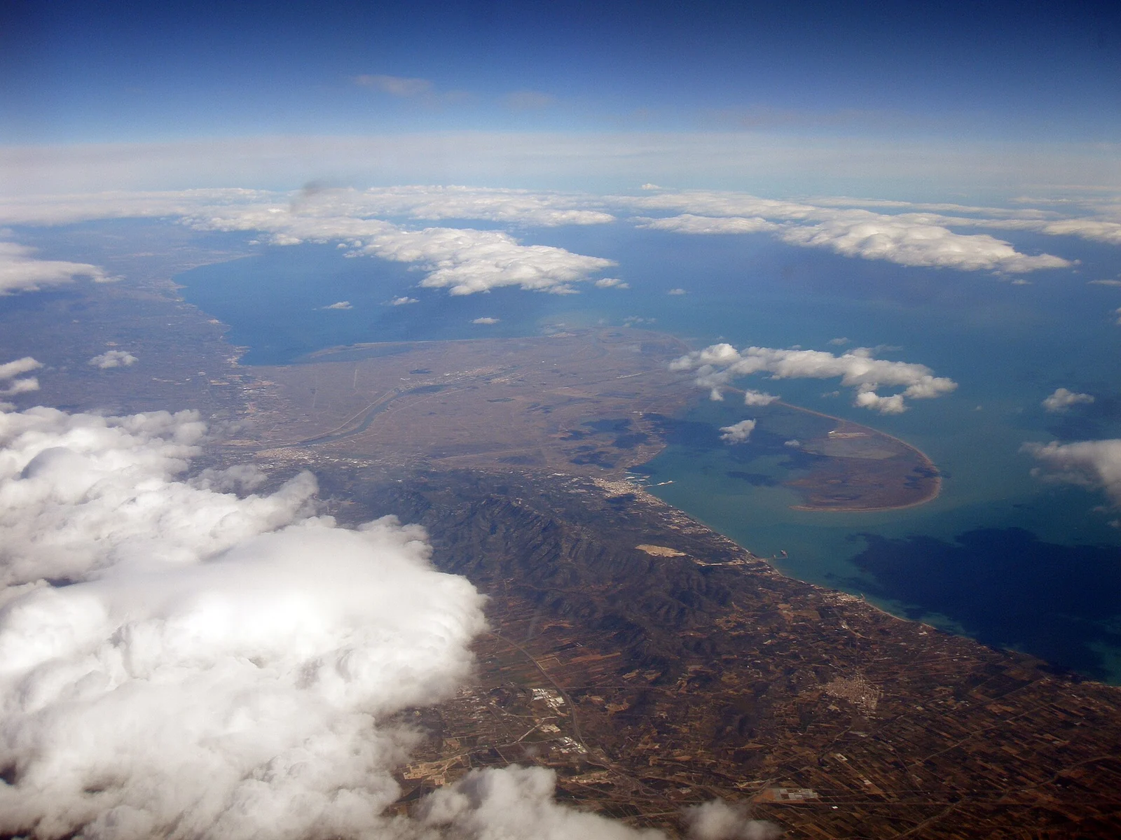
The Ebro Delta and surrounding coast seen from above
The Ebro reaches the Mediterranean through a landscape of sand and water.
Photo: Gons

Gons / Wikimedia Commons · CC BY-SA 4.0

Seven parts of a changing coast

Catalonia coastSeven linked areas from the Ebro Delta in the southwest, through Tarragona and Barcelona, to Cap de Creus in the northeast.CATALUNYAN40 nm1234567
Natural Earth · Public domain
  1. 1
    Ebro Delta & Els Alfacs

    Rice, mussel farms and a low horizon.

  2. 2
    Tarragona & the southern coast

    Roman shores and a living fishing quarter.

  3. 3
    Barcelona by yacht

    Shipyards, Barceloneta and city marinas.

  4. 4
    Blanes, Tossa & Sant Feliu

    The rocky coast begins.

  5. 5
    Palamós & the central Costa Brava

    Fishing culture and paths between coves.

  6. 6
    Medes, L’Escala & the Bay of Roses

    Island reserve, anchovies and ancient ports.

  7. 7
    Cadaqués & Cap de Creus

    Dalí’s shore and the Pyrenees at sea.

The Ebro mouth and Cap de Creus are about 145 nautical miles apart in a straight line; following the shore adds distance. Long, relatively open coastal stretches around Tarragona and Barcelona contrast with the indented northern coast. There, a short distance on the map may take a boat around a headland into quite different exposure.

The tramuntana gives the northern coast much of its character: clear air, wind-shaped vegetation and demanding conditions around exposed capes. Summer brings busy beaches, excursion boats and competition for visitor berths. A sheltered town harbour and a cala are different ways to experience this coast, with very different limits when the wind changes.

01

Ebro Delta & Els Alfacs

Here the coast is made of sediment, reeds and working water. The Ebro spreads into a flat delta, while the long sand arm of La Banya encloses Els Alfacs Bay beside La Ràpita.

Els Alfacs and La RàpitaLa Ràpita lies on the western shore of Els Alfacs, behind the sand spit of La Banya. The rice fields and lagoons lie inland to the north.Els AlfacsLa BanyaN2 nmAB
© OpenStreetMap contributors · Coastline data (ODbL)
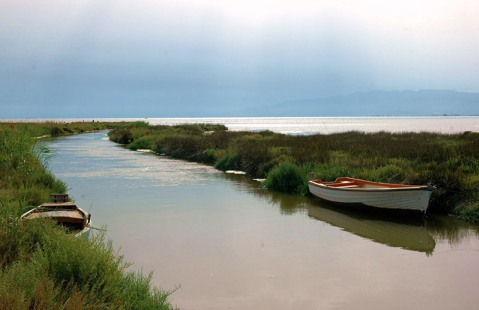
Small boats and reeds beside Els Alfacs Bay
A quieter waterline at Els Alfacs.
Photo: Lohen11 - Josep Renalias

Lohen11 - Josep Renalias / Wikimedia Commons · CC BY-SA 3.0

A landscape kept alive by water

Rice fields, irrigation channels, freshwater and salty lagoons form a landscape worked as well as protected. Its appearance changes with the rice cycle: flooded surfaces, green growth and harvest stubble. Birds gather across those habitats, but the delta is also a place of farming, fishing and seafood cultivation. Mussels and oysters grown in Els Alfacs, and rice cooked with local fish or shellfish, belong to the same water system.

The park’s Ecomuseu in Deltebre explains irrigation, traditional fishing and the delta’s different habitats. Around L’Encanyissada, Casa de Fusta and the birdwatching routes open another part of the landscape. These are outings ashore from a harbour: the shallow lagoons and field channels are not cruising-yacht waterways.
La Ràpita: fishing town and yacht base

La Ràpita faces the bay with an active fishing port and a town behind it.

02

Tarragona & the southern coast

North of the delta, the Costa Daurada becomes a coast of beaches, towns and harbours. Tarragona gives that shoreline unusual depth: Roman buildings above the sea and a fishing quarter beside a major modern port.

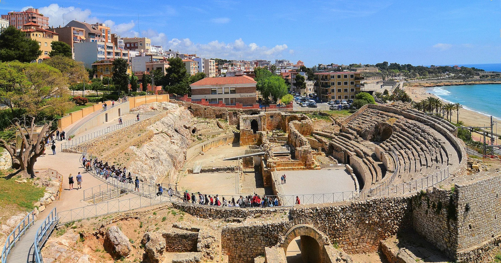
Tarragona’s Roman amphitheatre beside the Mediterranean
Tarragona’s amphitheatre, between the city and the sea. May 2017.
Photo: Mike McBey

Mike McBey / Wikimedia Commons · CC BY 2.0

Rome at the water’s edge

The amphitheatre sits below the old town, with the sea immediately beyond it. Its position was practical as well as dramatic: the nearby beach could receive animals brought by ship for the spectacles, and the Via Augusta passed close by. Higher up, the Roman circus and the streets of the old town connect the monument with the larger city of Tarraco. The city’s visitor guide explains those connections.

At El Serrallo, fishing boats, fish restaurants and the neighbourhood’s streets bring the story forward into working life. The Port Museum in Refugi 2 covers the harbour’s history; booked visits through the Observatori Blau introduce fishing and the auction. This is a different Tarragona from the Roman terraces, and both belong in a visit from the water.

Between Tarragona and Barcelona, the coast through Vilanova i la Geltrú and Sitges is more open and urban than the northern calas: these towns are distinct coastal stops, not part of a continuous sheltered archipelago.

03

Barcelona by yacht

Barcelona is a destination in its own right. The old harbour, the fishermen’s district of Barceloneta and the beaches lead into a city whose relationship with the sea runs from medieval galley building to modern waterfront renewal.

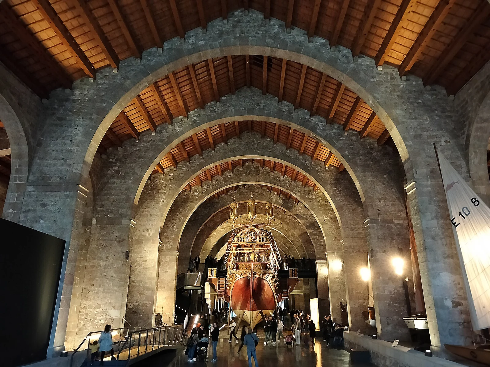
The Royal Galley replica under the stone arches of Barcelona’s Maritime Museum
A galley inside the former Royal Shipyards. March 2025.
Photo: Enric

Enric / Wikimedia Commons · CC BY-SA 4.0

A fleet built under stone roofs

The Royal Shipyards began beside the beach in the 13th century, serving the Crown of Aragon’s Mediterranean fleets. Their great arcades make the scale of that enterprise tangible. Much of the surviving fabric was rebuilt in the 16th century after changes to the waterfront; the building is a record of centuries of adaptation, not one untouched medieval hall. Today the Maritime Museum’s full-size Royal Galley replica brings the rows of oars and the labour of a galley fleet into view.

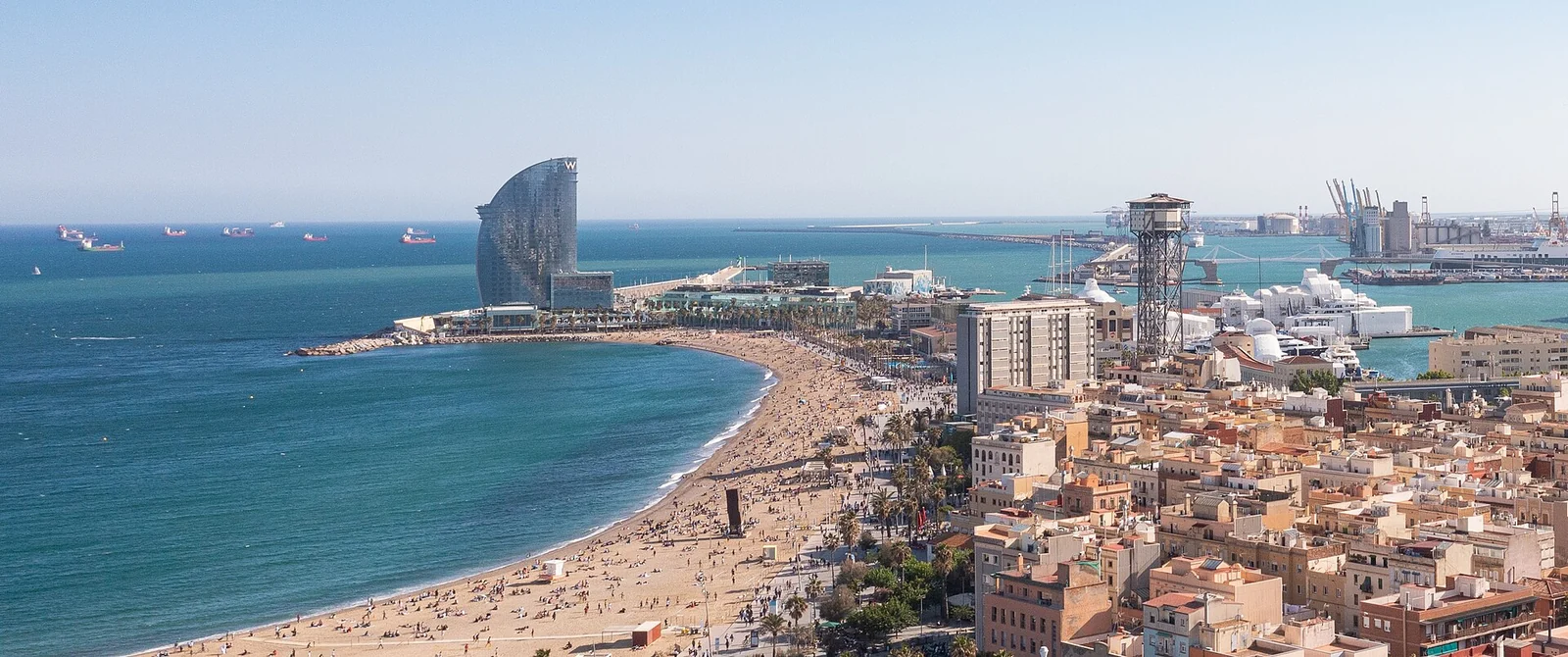
Barceloneta’s blocks and beach, with Port Vell beyond
Barceloneta between beach and harbour. May 2021.
Photo: Dronepicr

Dronepicr / Wikimedia Commons · CC BY 2.0

The city returns to its waterfront

Barceloneta’s narrow blocks sit between Port Vell and the beach. Its market, small streets and seafood tables give the city visit a neighbourhood scale, while the promenade opens onto a much busier public seafront. Barcelona’s Olympic-era transformation and later Port Vell projects have changed how the city meets the water. The 2024 harbour improvements are another layer in that long process.

Barcelona’s waterfrontPort Vell and the shipyards lie southwest of Port Olímpic. Port Fòrum lies farther northeast along the waterfront.BARCELONAN1 nmABC
© OpenStreetMap contributors · Coastline data (ODbL)

Choosing the city waterfront

04

Blanes, Tossa & Sant Feliu

At Blanes, the rock of Sa Palomera marks the conventional beginning of the Costa Brava. Beaches give way to a more broken shore: wooded slopes, defended towns and coves divided by headlands.

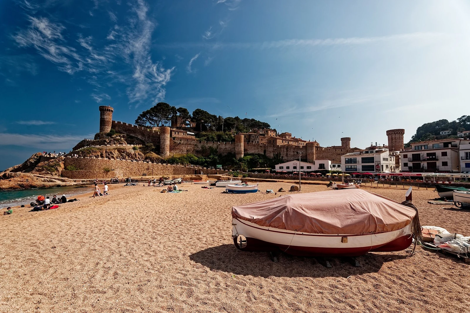
A covered boat on Tossa’s beach below the walls and towers of Vila Vella
Tossa: the beach lies directly below the defended old town. May 2011.
Photo: Txllxt TxllxT

Txllxt TxllxT / Wikimedia Commons · CC BY-SA 4.0

A fishing coast that needed walls

Tossa’s Vila Vella rises above the beach inside its surviving walls and towers. The fortified settlement defended a coast exposed to seaborne raiding; below it, the coves and fishermen’s quarter tell another story of the same sea. Tossa’s local guide connects the walls, Sa Roqueta and the little beach of Es Codolar. The fish-and-potato dish cim i tomba recalls food cooked aboard fishing boats: a local meal with a working history.

Tossa is a shore destination without a yacht marina. Blanes and Sant Feliu provide harbour alternatives for visiting the surrounding coast by land. The camins de ronda are coastal paths associated with watching the shore and controlling smuggling; today they reveal the folds of this coast at walking pace. Individual stretches include steps and rocky ground, so a beach-to-beach walk is not necessarily a level promenade.

Two harbours with different surroundings

Blanes gives access to its long urban beachfront; Sant Feliu sits around a curved town bay, with its monastery and streets inland from the water.

05

Palamós & the central Costa Brava

Palamós puts the fishing port at the centre of the visit. Beyond it, La Fosca, S’Alguer and Castell lead into the coves and coastal paths of the central Costa Brava.

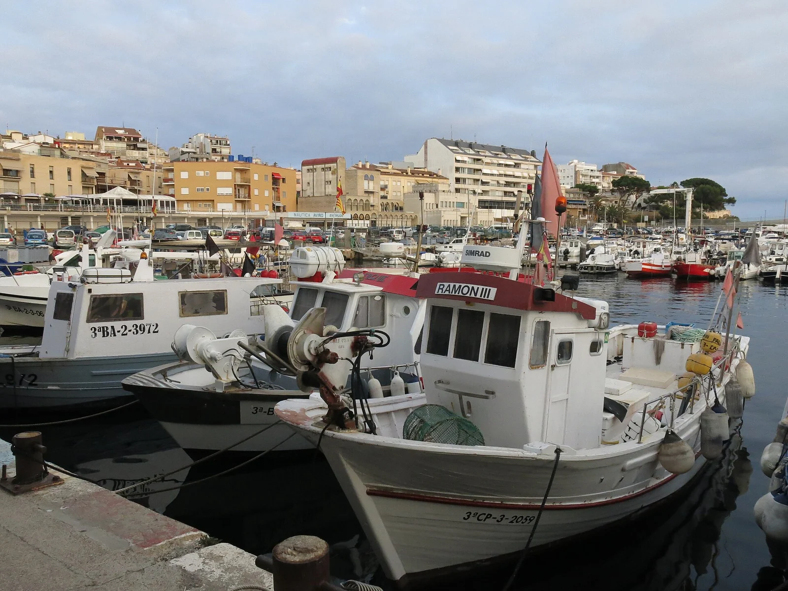
Fishing boats tied up at Palamós’s old quay, with town buildings behind
Fishing boats at Palamós’s old quay. August 2021.
Photo: Enric

Enric / Wikimedia Commons · CC BY-SA 4.0

From boat to auction to table

At the Museu de la Pesca, fishing becomes more than a picturesque row of boats. Gear, vessels and the lives of fishing households explain how the catch was earned. The museum’s programme can include guided auction visits and fish-cooking sessions at Espai del Peix. The auction’s moving boxes and buyers, followed by the kitchen’s treatment of the catch, connect the harbour economy with what appears on a restaurant plate; these are booked activities, not unrestricted access to a working auction.

The shore beyond the fishing port

The coastal path from Palamós passes La Fosca and the small former fishermen’s huts of S’Alguer toward Castell, where an Iberian settlement overlooks the sea. Calella de Palafrugell, farther north, brings white seafront houses and small beaches; the path to Llafranc follows a particularly intimate stretch of the shore. These walks let a marina stay reach the same rocky coast seen from the boat, without requiring a berth or overnight anchorage at every attractive beach.

06

Medes, L’Escala & the Bay of Roses

The Medes Islands stand offshore from L’Estartit. North of the Montgrí coast, the land opens into the Bay of Roses: beaches, wetlands and trading settlements replace the closely spaced calas.

Northern Costa BravaFrom the Medes Islands north through L’Escala and Roses to Cadaqués, Cap de Creus and El Port de la Selva. The large Bay of Roses separates Montgrí from the Cap de Creus peninsula.Golf de RosesIlles MedesN5 nmABCDEF
© OpenStreetMap contributors · Coastline data (ODbL)

The Bay of Roses is the broad pause in this rocky coastline. L’Escala and Empúries occupy its southern side, Roses the northern side. The Cap de Creus peninsula projects east beyond Roses; Cadaqués faces its eastern shore, while El Port de la Selva lies around the northern side.

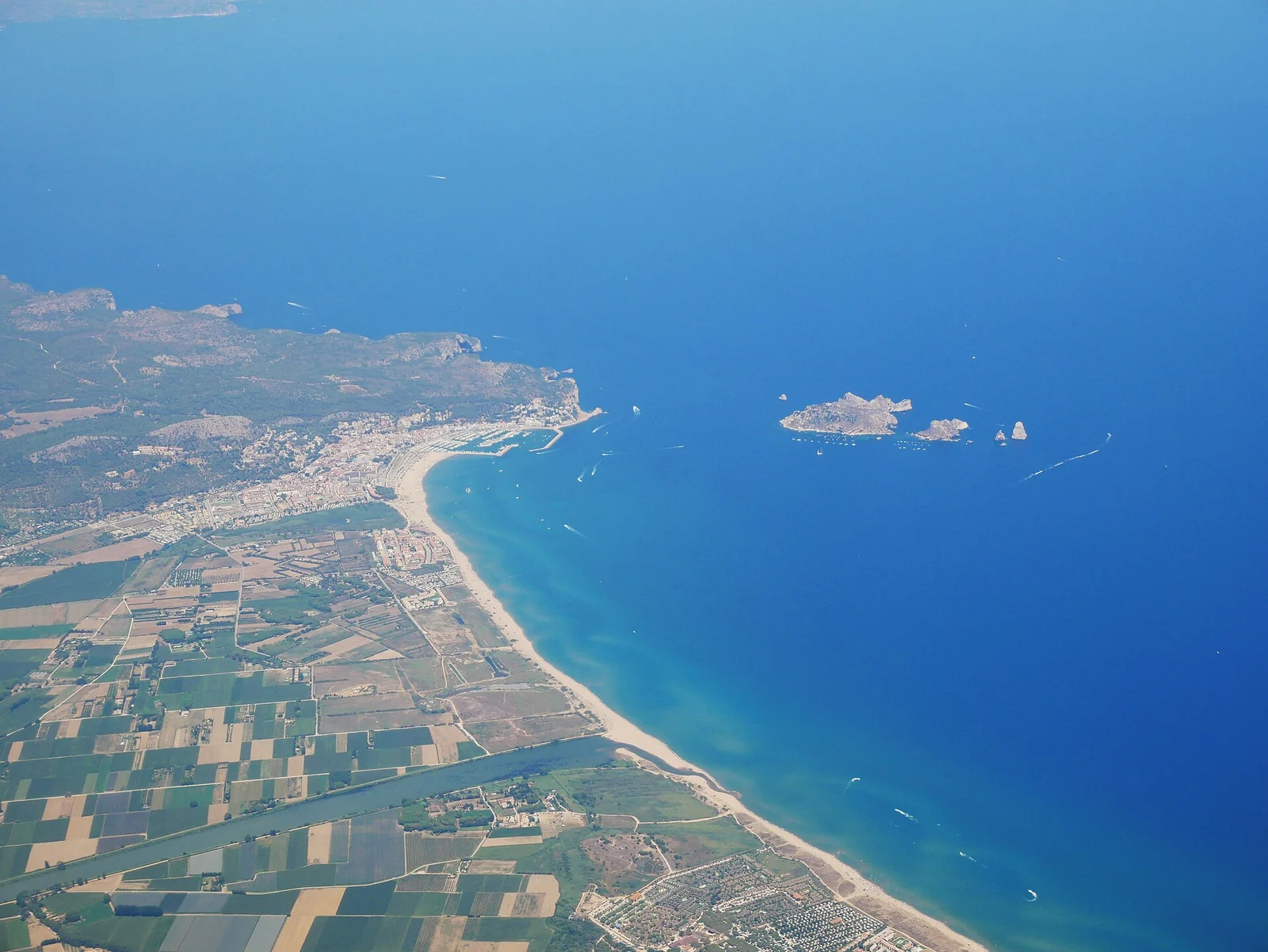
The Medes Islands offshore from L’Estartit and the Ter river mouth
L’Estartit, the Ter plain and the Medes Islands. August 2022.
Photo: Naioli

Naioli / Wikimedia Commons · CC BY-SA 4.0

A small archipelago with a rich underwater life

The Medes are a protected marine landscape, not simply another collection of anchorages. Dive and snorkelling operators in L’Estartit make the underwater reserve accessible without moving a yacht into it; boat excursions give another view of the islands. Espai Medes at the port adds interpretation ashore, while the old fishing streets explain the town before its growth as a holiday centre.

Visiting the islands in your own or chartered boat is a separate decision: the park’s boating guidance governs the zones, moorings and permitted activities. A mainland berth does not include permission to anchor in the reserve.

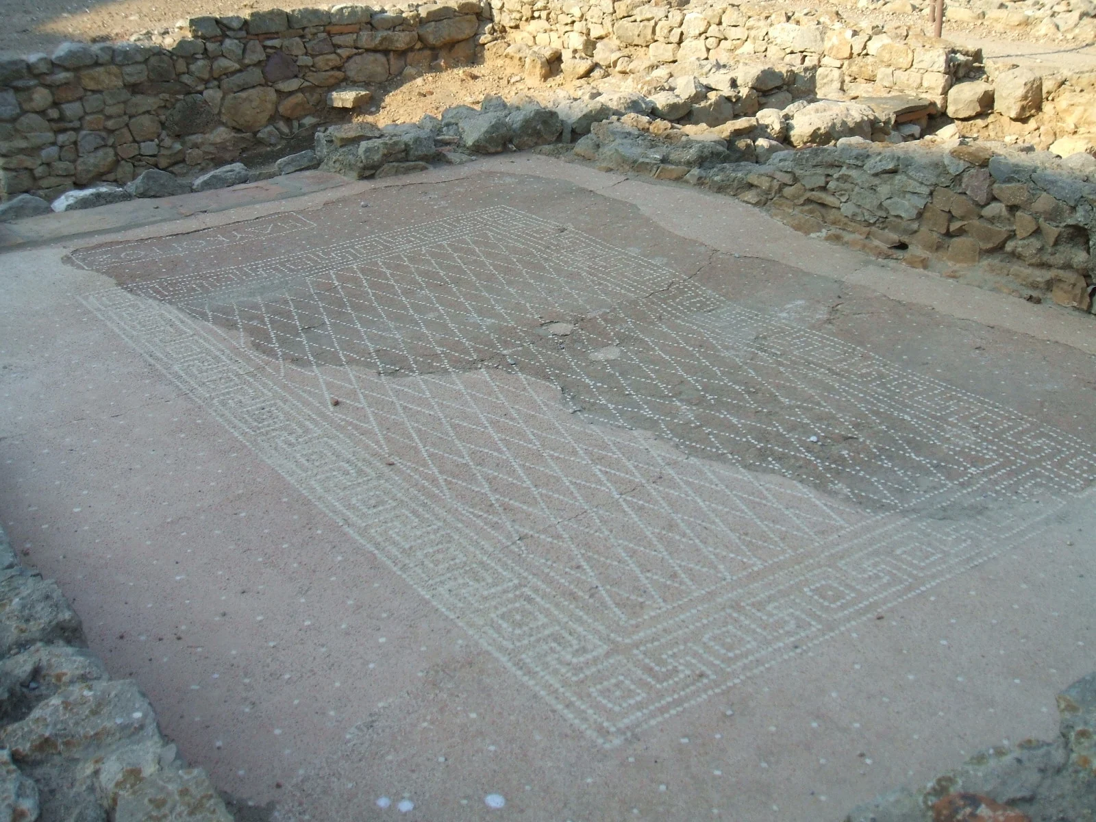
A mosaic floor with Greek lettering among the ruins at Empúries
A domestic detail in the ancient city of Empúries. 2007.
Photo: LeZibou

LeZibou / Wikimedia Commons · CC BY-SA 3.0

Anchovies, salt and a much older trading shore

L’Escala’s anchovies carry a history of preserving fish for trade. The Anchovy and Salt Museum connects fishing, salting and the town’s growth. Women’s work in the salting factories belongs at the centre of that history, alongside the men and boats at sea. A tasting or a visit to a producer makes the link between preserved food and the waterfront tangible.

Nearby Empúries takes the story back to Greek and Roman Mediterranean trade. Streets, mosaics and the remains of two cities lie beside the sea; the museum’s Port de cultures exhibition explores the movement of people and objects between distant shores. Sant Martí d’Empúries and the beach-side walk give the archaeological visit a living coastal setting.

The broad bay and its different waterfronts

Roses combines a fishing port, a long town seafront and the Ciutadella, whose Renaissance walls enclose traces of earlier Greek, Roman and medieval settlement. Across the bay, Empuriabrava’s residential canals show a very different, modern relationship between houses and boats. The local visitor programme includes canal outings: an excursion option without assuming a cruising yacht can use every residential waterway.

07

Cadaqués & Cap de Creus

The northern end is a harder landscape: bare rock, folded stone and the tramuntana. Cadaqués occupies a deep indentation on the eastern shore; beyond it, Cap de Creus carries the Pyrenees into the Mediterranean.

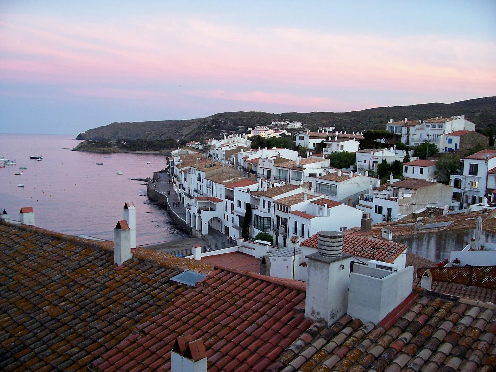
White houses and tiled roofs along the shore at Cadaqués
Cadaqués gathers around its bay.
Photo: Phil Tizzani from Atlanta, USA

Phil Tizzani from Atlanta, USA / Wikimedia Commons · CC BY-SA 2.0

A town facing the sea, and Dalí’s smaller bay

Cadaqués is best understood on foot as well as from the water: white façades, steep lanes and a waterfront following the curve of the bay. It retains the scale of a fishing settlement even when the shore is busy with visitors. Around the headland, Portlligat is a smaller, more enclosed setting. It was here that Salvador Dalí began with a fisherman’s hut in 1930 and gradually made the interconnected house and studio now open as the Dalí House-Museum.

The studio, domestic rooms and olive-grove setting connect the art with the light and rocks outside. Advance booking is required for the house. A visit to Portlligat does not depend on bringing the yacht into that small bay: Cadaqués and the museum can also be reached by land from a harbour base. Treat the town visit and any mooring arrangement as separate plans, especially in the crowded summer months.

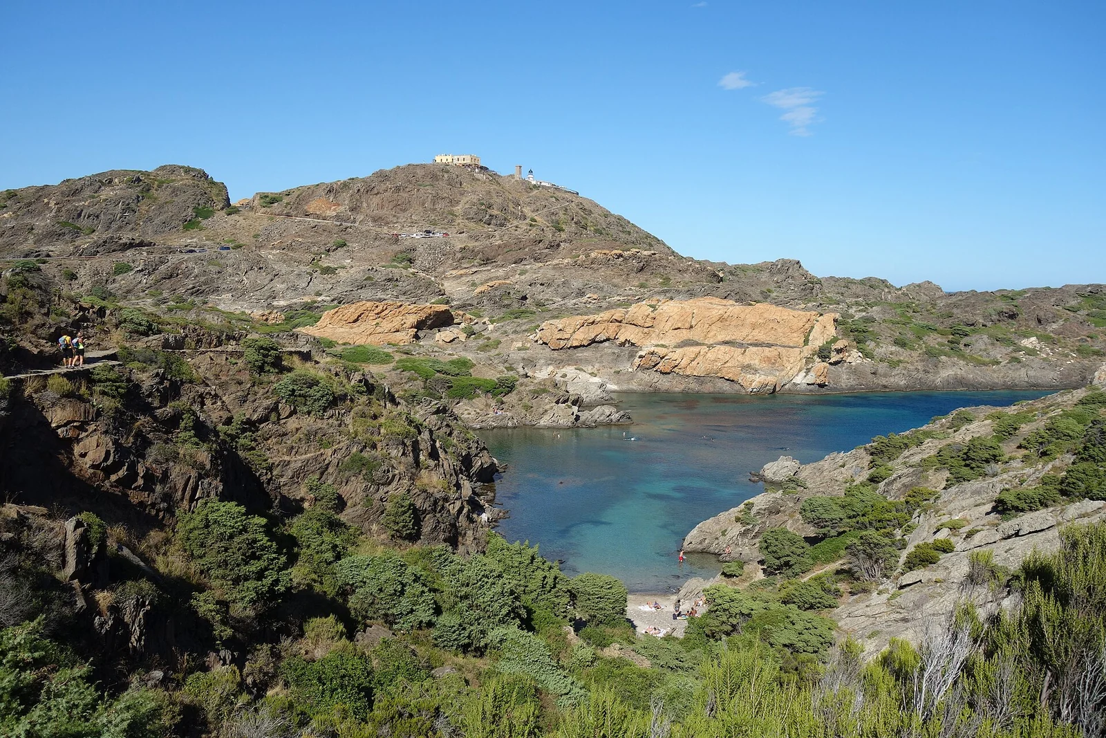
Rocky inlet and folded coastal hills at Cap de Creus
Rock and water at Cap de Creus. August 2020.
Photo: Pimlico27

Pimlico27 / Wikimedia Commons · CC BY-SA 4.0

The rock is part of the attraction

Cap de Creus is a place to look closely at the land: dark and pale bands of rock, wind-pruned vegetation and coves cut into an irregular shoreline. The lighthouse and the park’s land paths give views that a passage offshore cannot. Its exposure is also real. The tramuntana can transform the same clear-water coast into a hard place to round or linger; the headland separates different shores rather than offering one continuous line of equally sheltered bays.

The park’s current marine rules distinguish protection zones and buoy fields, restrict anchoring over seagrass and include night-navigation restrictions in partial reserves. Several cala arrangements depend on installed moorings. Those rules affect whether a particular inlet can be used for a stop or an overnight stay; the park’s current map and guidance belong beside any choice of bay.

El Port de la Selva and the monastery above

On the northern side of the peninsula, El Port de la Selva brings fishing boats, white houses and a yacht harbour back into the scene. High above, the Romanesque monastery of Sant Pere de Rodes, the remains of Santa Creu village and Verdera Castle reveal another organisation of the landscape: religious, farming and military power on the same mountainside. This is an uphill land excursion, distinct from the harbour-front walk.

Across the border, south along the mainland, or offshore

North of El Port de la Selva, Llançà and Portbou lead toward the French border and the Côte Vermeille and Golfe du Lion. Offshore, the Balearic Islands open a different set of cruising grounds. South of the Ebro, Castellón lies between this guide and our Cartagena–Valencia mainland guide; detailed coverage of that intervening coast is still to come.

Back to Mediterranean Spain