Rhône delta · working waterways · rocky coves
Camargue, Fos & Côte Bleue
A fishing bridge, a river delta, a steelworks horizon—and then a harbour tucked into limestone.
Between Le Grau-du-Roi and Marseille, the Mediterranean changes scale repeatedly. Salt ponds and rice fields spread behind the beach. At the Rhône mouth, yachts share the landscape with river traffic and boatyards; across Fos, cranes and industrial plants rise above the water. Farther east, Carro and the Côte Bleue draw the coast back into small ports and rocky coves. Fishing runs through the whole story, from Le Grau’s quays to Martigues’ lift-net and the marine park beyond Carry.
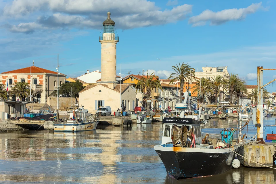
Photo: Benjamin Smith
From the delta to the Côte Bleue
A working channel beside a purpose-built yacht town.
Royal maritime ambition and a landscape made by salt workers.
Pilgrimage, grazing land and water managed across the delta.
The meeting of sea cruising, inland waterways and boat preparation.
Ships, raw materials and industry on a continental scale.
An inland sea, town canals and the fish behind poutargue.
Fishing villages, protected seabed and a railway above the coves.
The Petit Rhône and Grand Rhône frame the central delta. Aigues-Mortes lies on its western side; east of the Grand Rhône, the Golfe de Fos opens towards Caronte and Étang de Berre. The Côte Bleue runs along the southern side of the hills separating Berre from the sea. Carro’s harbour places Marseille’s Vieux-Port about 14 nautical miles away: the small coves and the city are close neighbours.
Le Grau-du-Roi & Port Camargue
The town opens its bridge for the boats
A grau is a passage between lagoon and sea. At Le Grau-du-Roi, that opening became the spine of a fishing town, with houses and quays facing one another across the channel. The swing bridge still makes room for boats. The return of the trawlers towards the end of the day gives the waterfront a rhythm quite different from the beach behind it: traffic pauses while the fleet moves through town.
The channel runs past the lighthouse and rows of fishing boats. Le Grau’s maritime life includes trawlers and smaller coastal craft, fish sales and the work of landing a catch. On the quays, the relationship between boat, town and dinner remains unusually visible. The town railway station also puts this waterfront within reach of crews arriving through Nîmes.
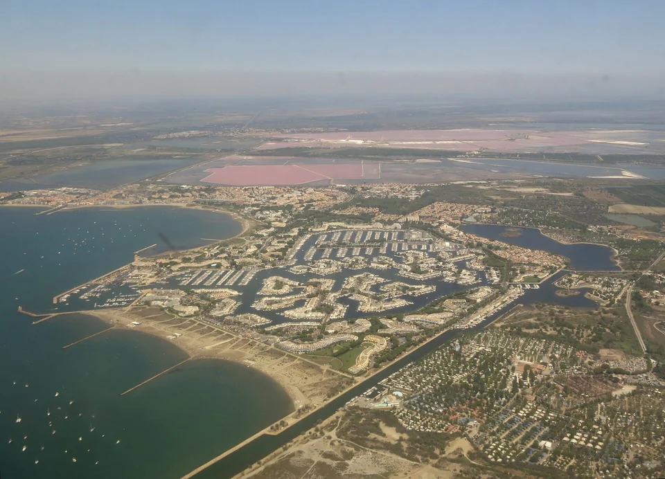
Photo: Olivier Cleynen
An entire town designed around yachts
Next door, Port Camargue tells a later chapter of the same coast. Its basins emerged in 1969 during the state-led development of the Languedoc shore associated with Mission Racine. Waterways, marina homes, quays and services were planned around leisure boating. From above, the branching basins make that ambition particularly clear. Port Camargue and the old fishing channel reveal two different ways of building a town around boats.
Aigues-Mortes & the salt landscape
A royal port behind the shore
Aigues-Mortes can look an unlikely maritime city from the modern coast. Louis IX founded it in 1240 to give his kingdom Mediterranean access, and sailed from its port system on the crusades of 1248 and 1270. The connection was always more intricate than ships arriving beneath the walls: lagoons, channels, shallow craft and offshore loading places linked the town to the sea. The history of its fortifications is also a history of engineering that connection.
Walk the ramparts and the geography becomes tangible. Nearly 1.6 km of walls enclose the town, while the view opens over the salins. The compact streets inside and the broad water landscape outside belong to quite different scales. This is an excursion ashore from Le Grau or Port Camargue; arriving through today’s inland waterways is a separate undertaking.
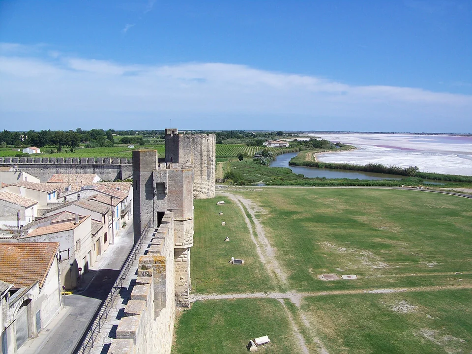
Photo: Einaz80
The colour belongs to a working landscape
The salt ponds are production basins. Seawater is moved through them as sun and wind concentrate the brine, with the salt workers managing water and harvests. Their striking colours sit within that working system. The salin’s visitor train gives access to the production landscape and a view from a salt mound; use the operator’s available visits rather than treating the ponds as open walking country.
Saintes-Maries & the living delta
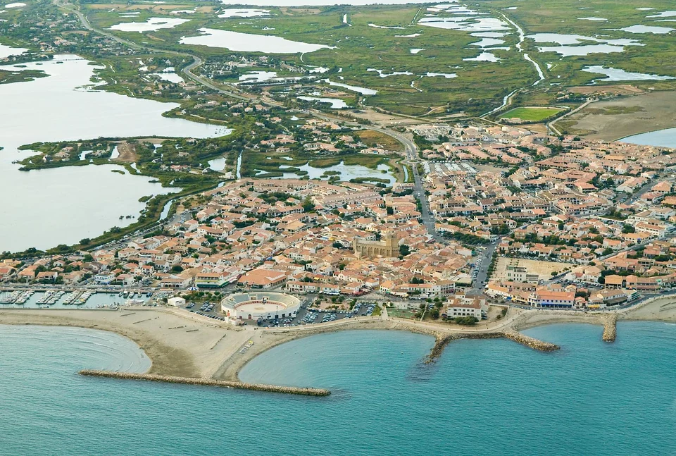
Photo: Jean-Louis Vandevivère
Land made by the Rhône, water moved by people
The Rhône laid down the sediment of Camargue; dykes, drains and irrigation now shape much of its water movement. Rice fields, grazing land, reed beds, salt ponds and brackish lagoons occupy different parts of the plain. From the sea, the low beach reveals only an edge of this landscape. The interior comes into view on foot, by bicycle or through a local wetland visit.
Fresh Rhône water has an unexpected role in this salty country. Flooded rice cultivation helps remove salt from agricultural soils, while irrigation and drainage influence the wider delta. The regional park’s account of farming makes the rice paddies part of the coast’s water history. They sit within a system where farming, fishing, salt production and conservation all depend on how water is shared.
The white horses and black bulls belong to working grazing land. Gardians, the mounted cattle herders, use horses to work with the herds; grazing itself helps shape the open landscape. Flamingos inhabit another part of the same mosaic, feeding in shallow waters whose salinity and levels vary. Camargue’s animals become more interesting when seen together with the people and water management sustaining their habitats.
A church facing the sea
At Saintes-Maries-de-la-Mer, the fortified church rises above a low village between lagoons and beach. Local religious tradition tells of the arrival by sea of Marie Jacobé and Marie Salomé, with Sara closely associated with their story. That connection is enacted in the May pilgrimages: Sara’s statue is taken towards the sea on 24 May, followed by the boat bearing the two Maries on 25 May. Roma pilgrims and mounted gardians take part in this living religious gathering.
The church is also a seamark. Port Gardian’s own introduction describes its centuries-long role for approaching sailors. Its compact, fortified silhouette connects the view from the water with the shrine and streets ashore. Saintes-Maries feels different from the royal enclosure at Aigues-Mortes: the village faces the open sea, with the wetland plain immediately behind it.
North of the village, the Pont de Gau ornithological park offers established paths and birdwatching in the marsh. Pets are not admitted there.
Across the mouth of the wind corridor
The Mistral accelerates down the Rhône valley before spreading over this coast. Bright skies can accompany a strong, dry and gusty northerly. The broad delta offers little terrain to interrupt it, so the wind belongs to the experience of cycling and walking as well as sailing. The long beach coast and the small rocky inlets farther east offer very different surroundings in the same weather.
Port-Saint-Louis-du-Rhône
Where sea cruising meets inland Europe
At the Grand Rhône, the coast opens onto another network of journeys. Port-Saint-Louis stands beside the river, while its central harbour connects to the Golfe de Fos through the Canal Saint-Louis. The lock links this maritime basin with the Rhône. A boat arriving from the sea therefore follows a different access arrangement from one coming downriver.
Beyond the lock lie river currents, bridges, further locks and the routes towards inland France. Mast clearance, draught and the intended waterway determine what is possible for a sailing yacht. VNF’s Saône–Mediterranean navigation information is the relevant starting point for that separate passage. Here, the important geographic fact is the junction: coastal and inland boating meet in the same town.
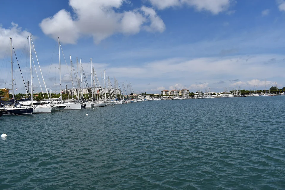
Photo: Tylwyth Eldar
Boats between journeys
The surrounding yards explain another reason for the concentration of yachts here: lifting, mast work, storage and refit. Port Camargue was built around leisure afloat; at Port-Saint-Louis, a substantial part of boating life happens ashore between passages. The separate Port Napoléon logistics guide covers preparation and storage. Its sea access is through Canal Saint Antoine, without requiring the Rhône lock.
A smaller boat for the marsh
For another view of this junction, the tourism office offers booked outings in a nègo-chin, a traditional shallow marsh boat, with a local heritage association. The low craft reaches a scale of water and reed beds quite different from the harbour basin. It makes the delta’s variety of boats understandable through an actual visit.
Golfe de Fos
The machinery behind the maritime horizon
At Fos, a crane or a ship can dominate the view in a way that a church tower did farther west. Tankers, bulk carriers, container terminals, tugs and industrial plants occupy the gulf’s working shore. The port’s western complex extends across about 10,000 hectares. Its scale comes from handling the raw materials, fuels and goods moving between sea routes and continental industry.
Steelmaking gives a particularly direct connection between ship and landscape: ore arrives in bulk, is moved through enormous handling equipment and feeds an industrial process ashore. Refineries and storage installations tell another part of the same story. The proximity of this coast to Camargue’s wetlands is striking; both landscapes depend on water, but use it in profoundly different ways.
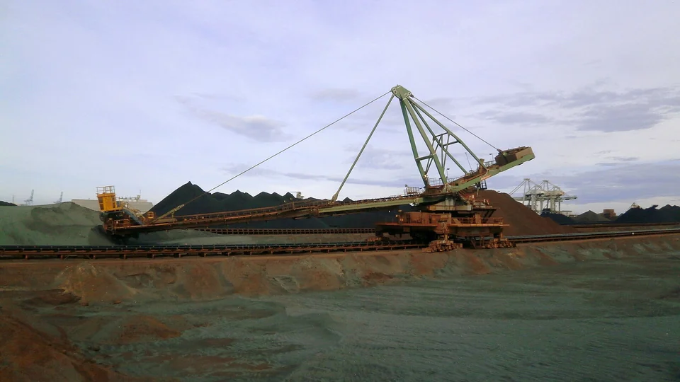
Photo: Borvan53
An industrial coast still changing
The port’s industrial development programme includes ambitions for lower-carbon production and new energy activities alongside its established economy. The Caban-Tonkin industrial platform brings businesses together around shared infrastructure and industrial innovation. These plans concern a working landscape of refineries, metal production and logistics, with new projects at different stages of development.
Martigues, Caronte & Étang de Berre
Another sea behind the channel
The Caronte channel connects the Golfe de Fos with Étang de Berre. Martigues stands at the eastern end of that connection, where canals divide the town into Ferrières, L’Île and Jonquières. Beyond it, Berre opens into a broad brackish water landscape bordered by towns, industry and shores used for sailing and fishing. It has a different character from the shallow lagoons of Camargue.
Around the Miroir aux Oiseaux, small boats sit beneath close-packed waterfront houses. Walk through L’Île to see how the town turns around its canals, then towards Ferrières and the waterside. The narrow passages make sense of Martigues’ long relationship with fishing: fish moving between the lagoon and the sea have to pass through this meeting of waters.
The net behind the poutargue
The calen is a large lift-net lowered into the channel and raised to catch passing fish. Martigues’ tourism office identifies Jordan Ortiz and the working calen fishery on Avenue de la Paix. Mullet—locally muges—leave Berre for the sea during their spawning migration. The roe of females is salted, pressed and dried to make poutargue, eaten in thin slices or grated over a dish.
The flavour has a precise geography behind it: an inland feeding ground, a narrow outlet and a fishing technique adapted to that passage. Direct sales depend on the catch and production; the tourism office advises that the new poutargue stock is usually available from mid-August. A visit to the fishery and a walk around the canals connect the food with the water it comes from.
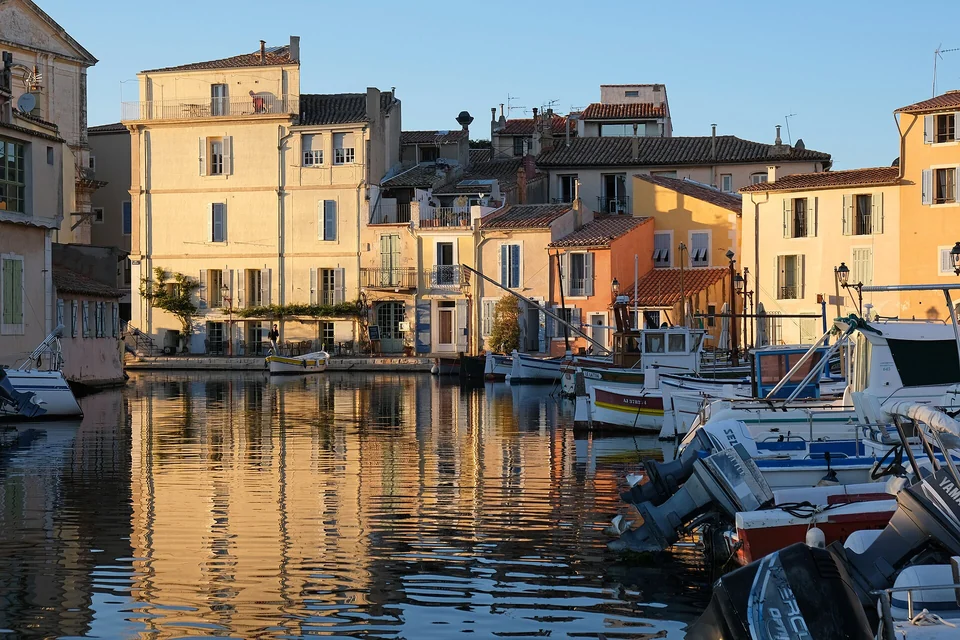
Photo: kallerna
Fort de Bouc guards the connection
At Caronte’s seaward entrance, Fort de Bouc combines a defensive position with a lighthouse. Its location explains why the channel mattered to trade and territorial control. The Martigues tourism office offers scheduled guided visits; access is organised, rather than an informal landing at the fort.
Côte Bleue: Carro to Niolon
Carro brings the harbour back to village size
At Carro, fishing boats gather directly beside the village and the morning fish market. The change from Fos is immediate: individual hulls, quays and the sale of a catch take the place of distant terminal structures. La Couronne’s headland introduces the more broken coast beyond, with beaches, rock and small harbours rather than the delta’s long level shore.
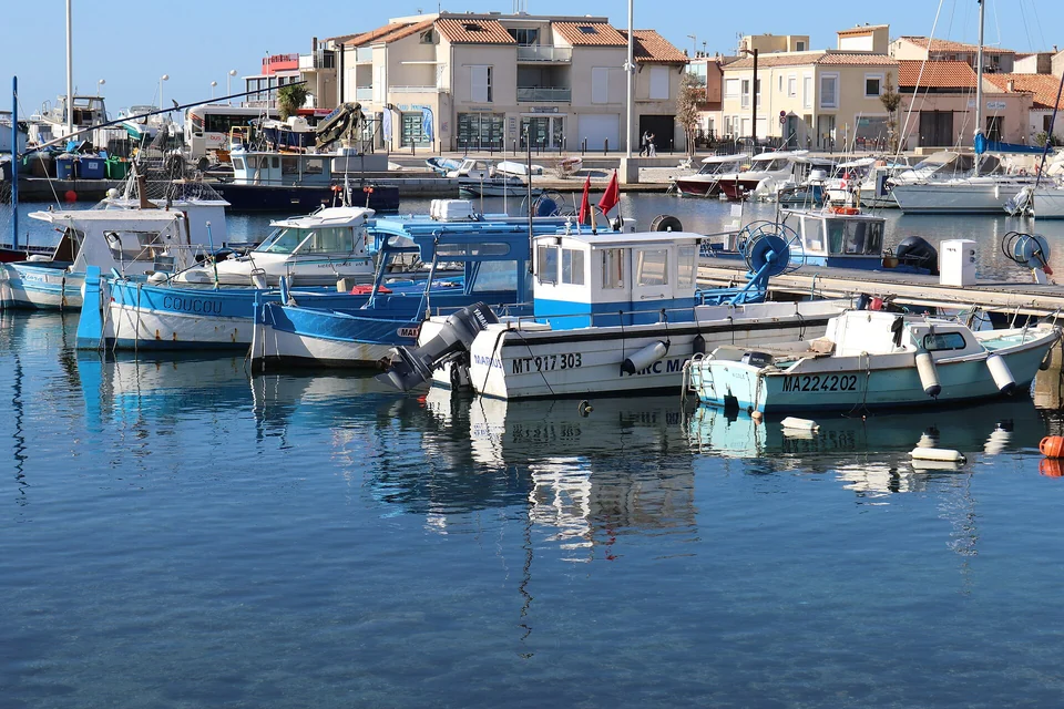
Photo: Thérèse Gaigé
Sausset-les-Pins
Sausset combines a fishing and leisure harbour with a town waterfront and railway station. The coast remains relatively open here, with beaches and low rocky stretches. It offers a town stay on the coast, with rail travel available for visits farther along it.
Carry-le-Rouet
At Carry, the waterfront gathers around a smaller enclosed basin with restaurants and paths continuing along the rocky shore. Fishing, swimming and marine protection are close neighbours here: the protected waters off Carry form part of the coast’s own marine park.
Protection built with the fishing community
The Parc Marin de la Côte Bleue began in 1983, bringing local authorities, scientists and professional fishers into a shared approach to the coast. Protected areas and artificial reefs sit alongside continuing fishing activity. Fishers also participate in scientific monitoring of the reserves. Conservation here has developed beside the industrial gulf and metropolitan Marseille, within an inhabited and working coastline.
Carry and Cap-Couronne have protected zones with specific restrictions; they are not interchangeable with the surrounding marine-park waters. The park’s current activity and anchoring information distinguishes the applicable areas, including additional anchoring provisions for vessels from 20 m. Posidonia seagrass is a central reason for managing where anchors fall. This is the Côte Bleue’s marine park, separate from the Calanques National Park east of Marseille.
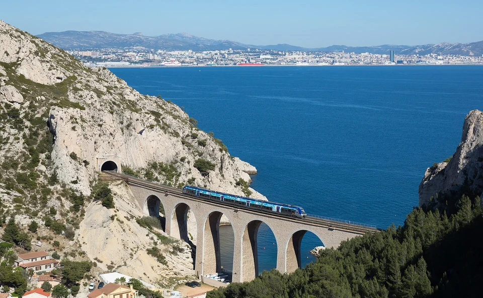
Photo: Kabelleger / David Gubler
La Redonne & Méjean: the coast above the water
East of Carry, the shore becomes more deeply cut. La Redonne and Méjean are small inhabited calanques, with houses and boats close to the rock. The Côte Bleue railway threads tunnels and viaducts above this coast, connecting Marseille and Miramas through stops including Niolon, La Redonne-Ensuès, Carry and Sausset. It lets a crew see the same shoreline from another height, or visit a cove without needing a berth there.
La Redonne, Méjean and Niolon’s intimate waterfronts are worth exploring on foot, but the presence of moored boats does not establish transient yacht space. The larger visitor harbours and the railway combine a confirmed berth with shore access along the coast. Coastal paths add another perspective where open; summer fire restrictions can close access to the hills.
Niolon, with Marseille across the water
Niolon gathers a small harbour, village and diving activity beneath the limestone slopes. The station is above the cove. Down at the water, the scale is close and contained; from the railway and surrounding slopes, the view opens across the rade towards Marseille. The local visitor guide gives access and shore options. Beyond Niolon and L’Estaque, the city and Frioul become the next geography.
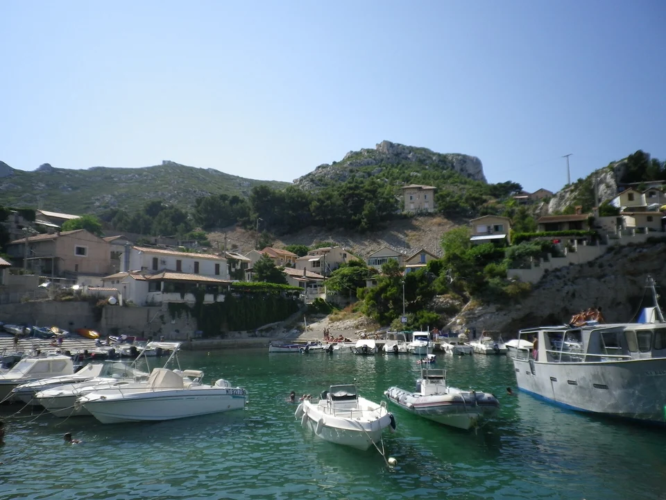
Photo: Matieu Castel
Along the coast
West of Le Grau-du-Roi, La Grande-Motte and the lagoon coast lead towards Sète and Thau. East of Niolon, Marseille brings a large city harbour and offshore islands into view; the Calanques and La Ciotat belong to the coast beyond it.
Sources & image credits
Local port operators, the Camargue regional park, the Côte Bleue marine park, monument custodians and local tourism offices supply the linked visiting information. Sources reviewed in September 2026. Individual photographs retain their creator and licence links in the credit beneath each image.
Map data: © OpenStreetMap contributors, ODbL 1.0. Download the geographic source extract.