Mediterranean France · Provence
Marseille to La Ciotat — Frioul and the Calanques
Marseille’s crowded waterfront gives way to pale offshore islands, then to limestone inlets with fishing settlements beneath the cliffs. Around Cassis, white rock meets the ochre heights of Cap Canaille; farther east, the Bec de l’Aigle announces La Ciotat’s harbour and shipyards.
The distances are modest, but the settings—and the possibilities for stopping—change sharply. Mistral exposure, protected waters and organised moorings shape how this remarkable coast is explored.
Explore the coast ↓ ← Mediterranean France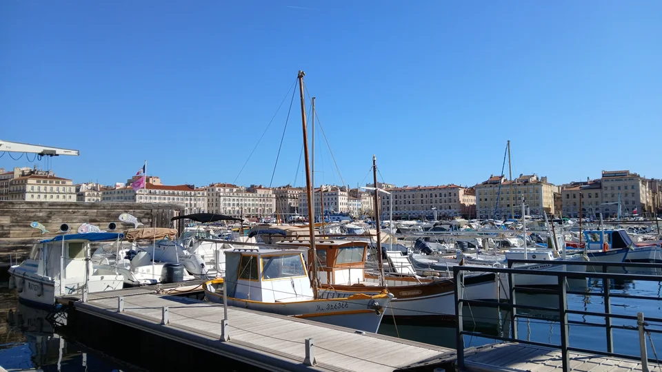
Photo: Gabriel from92
City · archipelago · mountain coast
One coast, several different worlds
Frioul lies about 2.3 nautical miles from the Vieux-Port. South of Marseille, the coast turns east through the Calanques towards Cassis. Beyond the town, Cap Canaille and the Bec de l’Aigle lead into La Ciotat’s bay.
- Marseille City quays, markets and the harbour that created the city.
- Frioul & If Island paths, a working village and Marseille’s offshore defences.
- The Calanques Fishing settlements give way to steep, closely protected inlets.
- Cassis & Port-Miou A town harbour and a long mooring inlet, with different ways ashore.
- Cap Canaille The change from white limestone to layered ochre cliffs.
- La Ciotat Île Verte, extraordinary rock formations and a living shipbuilding town.
Maps: sol.blue · © OpenStreetMap contributors · Geographic data
Marseille · Vieux-Port
The harbour came first
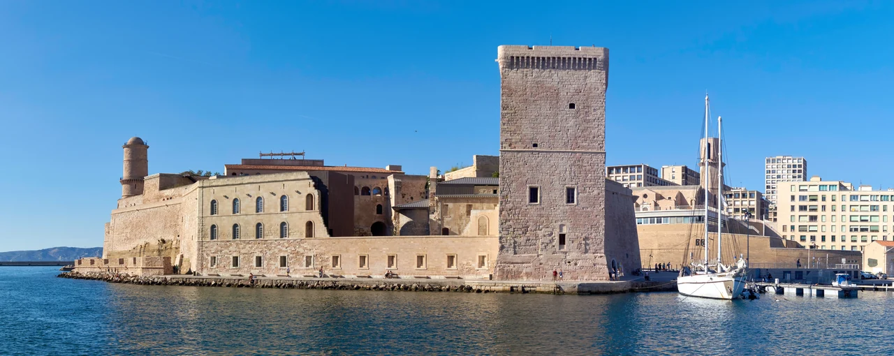
Photo: Celuici
The entrance between Fort Saint-Jean and Fort Saint-Nicolas brings a boat straight into Marseille’s history. Around 600 BC, Greeks from Phocaea founded Massalia in the sheltered inlet of Lacydon, now the Vieux-Port. The city grew around this water. Approaching from the sea, with Notre-Dame de la Garde above the roofs and the quays closing around the boat, that geography is still easy to understand.
The waterfront remains everyday urban space. Fishermen sell their morning catch on the quay; the little ferry crosses the harbour between its two sides. Le Panier rises behind the northern waterfront, while Fort Saint-Jean and the Mucem place gardens, walkways and exhibitions beside the harbour entrance. The view back across the basin is as much a part of the visit as the museums.
For provisions with a sense of the city, continue to the Capucins market in Noailles: fruit, vegetables and spices, with food shops in the surrounding streets. A berth in the Vieux-Port means stepping directly into this city life. Frioul, visibly close across the roadstead, offers a very different setting.
Off Marseille · Pomègues, Ratonneau & If
The islands that guarded the city
Marseille stays in sight, but the quays and traffic give way to bare limestone, low vegetation and paths above the water. The islands belong to the city, and their history explains how closely they remain connected to it.
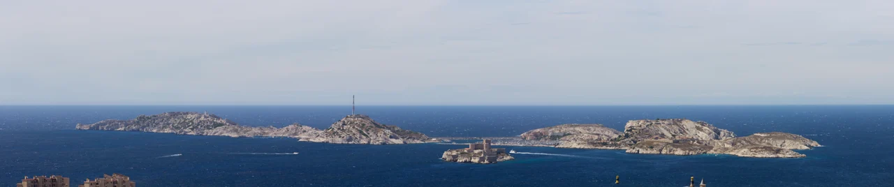
Photo: Spitfire06
Pomègues and Ratonneau form the main pair, joined by the breakwater beside the harbour village. If stands separately between them and Marseille; little Tiboulen lies to the west. Ferries, permanent residents and harbour cafés keep Frioul connected to city life, while the paths quickly reach an exposed island landscape.
A fortress, a prison, a story
On its isolated rock, Château d’If makes immediate geographical sense: it was built to command Marseille’s seaward approach. It later became a prison, made internationally famous by Alexandre Dumas’s The Count of Monte Cristo. The fictional escape is part of its appeal, but the real fortress and the city across the water are just as compelling.
A visit to Château d’If uses the monument’s passenger-boat connections; the crossing and admission are separate, and swell can prevent landing. A stay in Frioul harbour does not itself provide a landing arrangement at If.
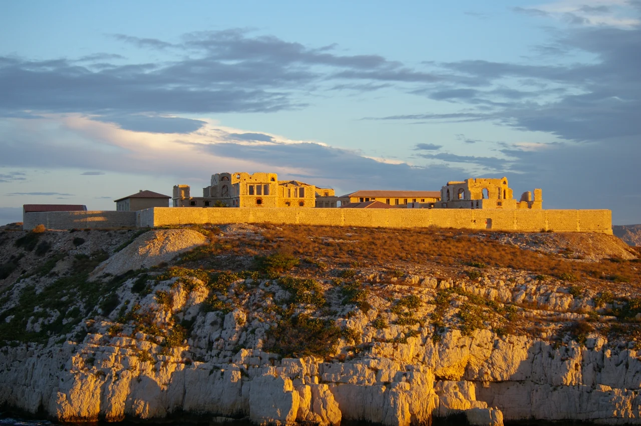
Photo: Yann Droneaud
Keeping disease outside Marseille
Maritime trade also brought the threat of disease. Pomègues served as a quarantine anchorage, and the nineteenth-century Hôpital Caroline on Ratonneau was designed around separation, observation and circulating air. Its position outside the city was the point: ships and their passengers could be isolated while Marseille remained across the water.
The island paths connect this military and quarantine landscape with coves and views back to Marseille. Saint-Estève, on Ratonneau, offers a beach and a summer underwater discovery trail. Hôpital Caroline is a historic site under restoration; interior visits depend on organised openings.
An island harbour, with the city across the water
Le Bateau Frioul–If connects the islands with the Vieux-Port, making a city visit possible from an island berth.
Southern Marseille · Sormiou & Morgiou
Small settlements beneath the mountain coast
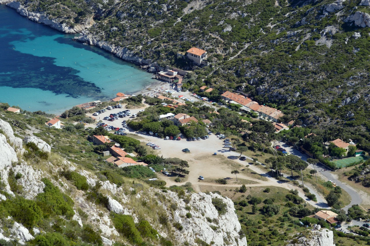
Photo: DimiTalen
Around Les Goudes and Callelongue, Marseille thins into small harbours at the foot of the hills. Riou’s islands lie offshore. Eastwards, roads retreat from view and the limestone slopes meet the sea: a calanque is a rocky inlet enclosed by steep sides, and here those sides can feel like whole mountains.
Sormiou’s beach, red roofs and modest houses interrupt the pale rock. These cabanons grew from fishing shelters into a distinctive Marseille seaside culture: small places for meals, summer living and time by the water. This is an inhabited landscape, with local attachments older than its fame as a national park.
Morgiou is narrower, with a little fishing harbour and a resident cabanon community. Traditional pointus—the local fishing boats with pointed ends—connect it with the working quays of Marseille, Cassis and La Ciotat. Looking closely at the houses and boats reveals a different coast from the apparently empty cliffs seen farther east.
Visiting Sormiou and Morgiou
Their small local harbours are distinct from the visitor facilities at Marseille or Frioul. Yacht stopping places and permitted water vary with the park’s marked zones; a waterfront settlement does not establish an available visitor berth. The park describes Morgiou as particularly exposed to northerly winds. For a shore visit, the park’s Sormiou and Morgiou pages explain their walking approaches.
Towards Cassis · En-Vau & Port-Pin
The great cliffs, and the ways to see them
En-Vau compresses the landscape into a deep cleft of pale rock and blue-green water. Nearby Port-Pin has lower, pine-covered sides. Their proximity on a map conceals how different the views—and the walks—can be.
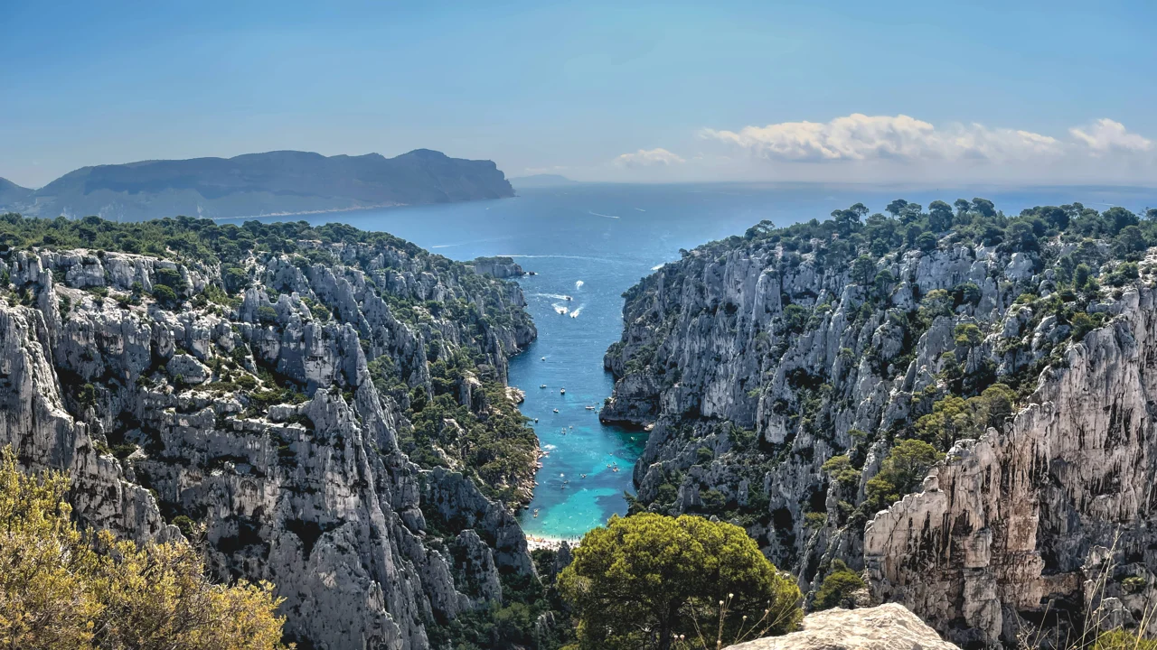
Photo: Mmullie (WMF)
En-Vau and Port-Pin are not yacht anchorages. The park’s rules prohibit anchoring, stopping and drifting in their designated protected zones. The inner waters also have navigation restrictions. A view from the permitted water and a beach visit on foot are different experiences; the official marine map shows the boundaries.
From the Cassis side, Port-Miou provides the landward connection to Port-Pin and En-Vau. Port-Pin makes the closer outing; continuing to En-Vau involves more substantial terrain. The En-Vau viewpoint and beach are separate destinations. The high view down the inlet offers a different understanding of its scale from reaching the shingle below.
Cassis · the western inlet
Port-Miou: a harbour cut by water and industry
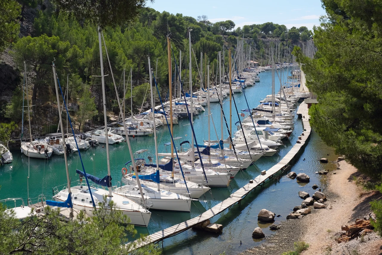
Photo: kallerna
Port-Miou reaches about 1.4 km inland. Its long, enclosed shape made it a historic refuge, but the rock walls are also the work of quarrymen. Cassis limestone was extracted around these shores for centuries; industrial quarrying by Solvay transformed the inlet on a much larger scale.
Rock was broken out of the hillside and loaded onto ships for soda production. The cut faces, loading structures and surviving quarry traces give the landscape a second history alongside its geology. The former company building now serves as the harbour office. Walking the shore makes this sequence visible: natural inlet, working quarry, then protected landscape and organised mooring harbour.
The Petit Prince path explores the peninsula; paths west continue towards Port-Pin. Cassis town is roughly half an hour’s walk from the Port-Miou area, with the actual distance from a boat depending on its berth and landing. Staying here puts the rock landscape close at hand, while a Cassis town berth puts the quays and restaurants immediately outside.
Pontoons and ecological moorings
Allocation and the connection ashore
The operator currently describes the outer buoy area as non-reservable and lists seasonal buoy use from April to October. Its page also retains older booking instructions, so current allocation and the landing arrangement are best resolved directly with the Port-Miou harbour office on VHF 9. The listed July–August road shuttle helps connect boat stays with town; its operating hours determine whether it suits an evening ashore.
Cassis · harbour, vines & two cliff landscapes
A town in the gap between the cliffs
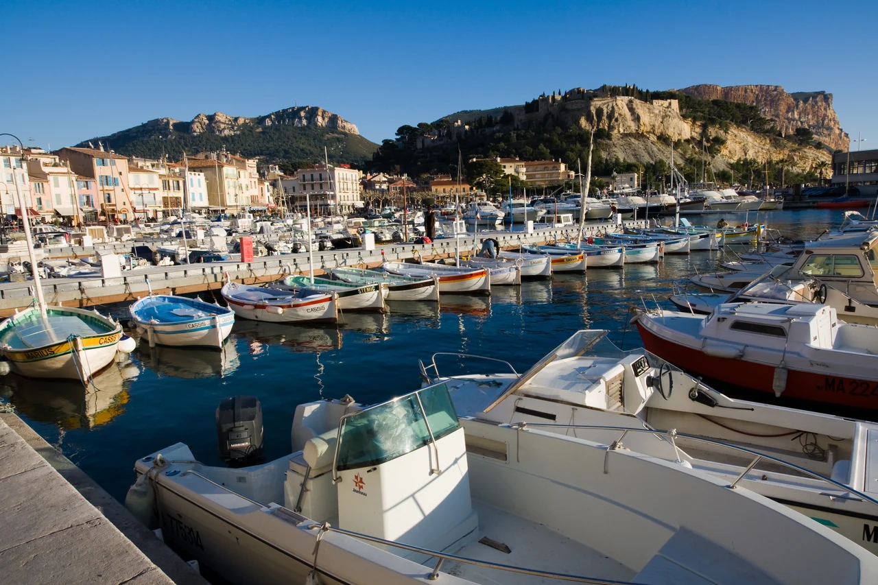
Photo: Jean-Christophe BENOIST
Cassis gathers around its harbour: colourful quays, fishing boats and restaurant tables, with streets rising just behind. After the mountain coast, the attraction is the return to a compact town where the waterfront is part of daily life. The local pointus and fishermen’s catch give the harbour a working identity beneath its postcard appearance.
Look beyond the basin and its setting becomes clearer. White limestone lies to the west; Cap Canaille rises to the east; vineyards occupy the slopes inland. Cassis wine received its appellation in 1936. A vineyard visit connects the town to that landscape, while the market and nearby food shops keep an outing closer to the quay.
The market is normally held on Wednesday and Friday mornings. The streets behind the harbour, the waterfront and the nearby Grande Mer beach make an easy shore visit without committing to a long Calanques walk. Vineyard visits have their own opening and booking arrangements; the Cassis tourist office brings those local options together.
East of Cassis · Cap Canaille & the Soubeyranes
The coast turns ochre
Beyond Cassis, the pale Calanques give way to a different wall of rock. Limestone, sandstone and conglomerate form the warmer, layered Soubeyranes cliffs; their highest point reaches about 394 m. From the water, the horizontal bands and immense faces explain the change more clearly than a distant view from town.
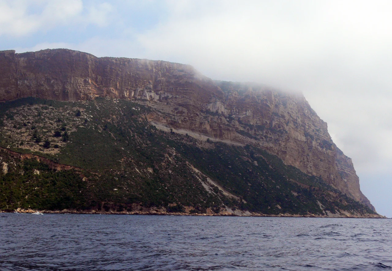
Photo: Remi Mathis
This is the reason to carry the story beyond Cassis. The coast rises in broad, coloured faces before breaking into the stranger shapes around La Ciotat. The Route des Crêtes offers views from above when open; a sea passage reveals the cliffs from their foot. They are two quite different ways of seeing the same landform.
La Ciotat · Bec de l’Aigle & Île Verte
Strange rock, small boats and great shipyards
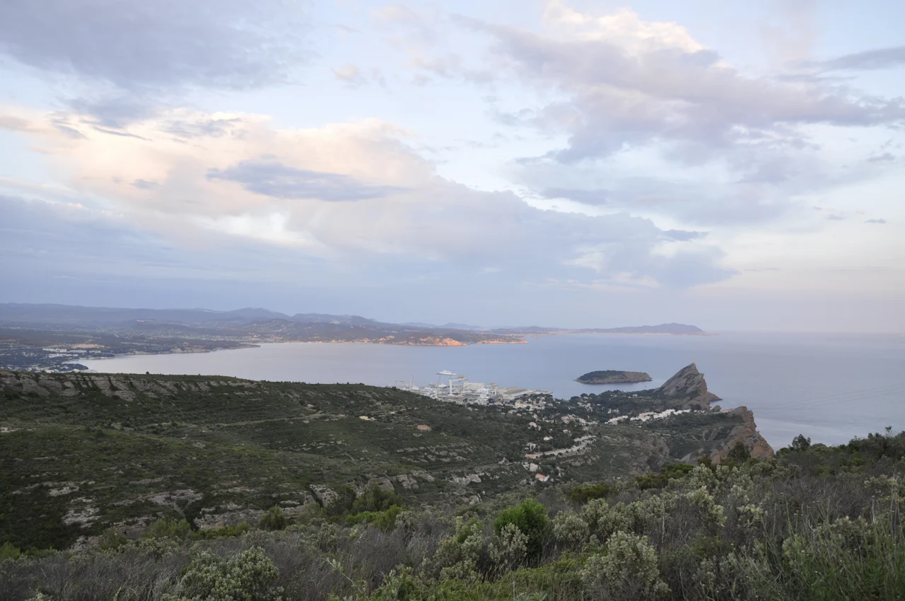
Photo: Cesar Sebouhian
The Bec de l’Aigle, the “eagle’s beak”, is a striking seaward landmark. Its brown rock is poudingue: rounded pebbles bound into conglomerate, deposited by ancient rivers. The tilted forms around Figuerolles and Le Mugel, and Île Verte just offshore, complete the change from the white Calanques west of Cassis.
Le Mugel combines small coves with a botanical park beneath the rock. Figuerolles opens on the other side of the headland, its beach framed by rounded, weathered formations. Wooded Île Verte offers another view back to the town and headland; passenger crossings from La Ciotat provide a way to visit without treating the island as an assumed yacht berth.
In the old port, traditional pointus and waterfront streets sit beside the enormous structures of the shipyards. Modern shipbuilding developed here in the nineteenth century. Following the industrial crisis of the 1980s, the yards found a new role in yacht and superyacht refit. The cranes and large vessels are part of La Ciotat’s identity, as much as its old houses and small fishing craft.
From the waterfront to the cinema
The Lumière family’s experiments and early films connect La Ciotat with the beginnings of cinema. The Eden Théâtre offers visits devoted to that history as well as a cinema programme. For another way into the town, the shipbuilding heritage explains the waterfront’s industrial scale. These are substantial reasons to go ashore, close to the landscape encountered under sail.
Eastwards, the coast continues towards Saint-Cyr, Bandol and Sanary, then Toulon and the Hyères islands. The next coastal area begins that different story. The park’s marine regulations still need to be read by their actual boundaries around La Ciotat and Île Verte.
Joining the coast
City connections and island crossings
Marseille is the principal air and rail gateway. The airport coach to Saint-Charles connects with the city’s metro and onward transport to the Vieux-Port. Joining a boat on Frioul adds the island ferry. Cassis station is about 3 km inland, so arriving by train requires a bus or taxi connection to the waterfront.
La Ciotat also has rail connections, with a separate onward journey from the station to the harbour. These town connections make shore visits and joining a crew possible at several points along the coast. For boat preparation or storage west of Marseille, see the separate Port Napoléon guide.
Local information
Harbours, landscapes and access
Harbour links sit beside the places they describe. For the protected coast, use the park’s marine regulation map and daily land-access map. The Conservatoire du littoral explains Cap Canaille, and the BRGM explains the rock of the Bec de l’Aigle. Photograph credits accompany each image.
Back to the coast map ↑