Toulon’s great naval roadstead opens towards Giens, a peninsula joined to Provence by two narrow ribbons of sand. Beyond its salt lagoons lie the Îles d’Or: Porquerolles, where bicycles connect the harbour village with beaches, vineyards and art; Port-Cros, where forest paths and protected waters shape the visit; and Le Levant, whose small naturist community occupies the accessible edge of a largely military island. West and east winds continually change which shores invite a stop.
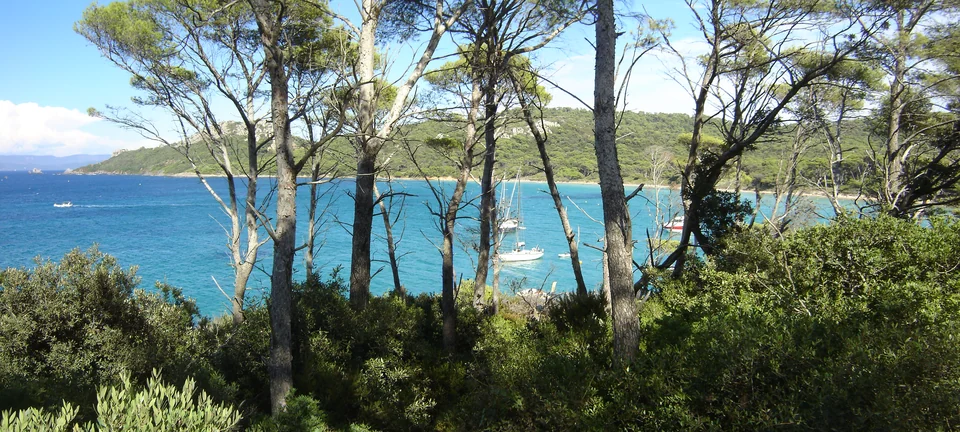
Porquerolles’ northern shore at Notre-Dame.Photo: A. Delesse (Prométhée)
Bandol and Sanary lie on the western approach to Toulon. East of the roadstead, Giens separates the Golfe de Giens from the Rade d’Hyères. Porquerolles lies just beyond its southern tip; Port-Cros and Le Levant continue the island chain eastwards, facing the Bormes–Le Lavandou coast. The islands are close neighbours, but the landfall, shore life and available services change markedly between them.
Along this coast the mistral can bend towards the west, while easterly weather exposes a different set of shores. Giens and the islands repeatedly offer opposing coastlines. Port-Man’s shelter from the mistral and Port-Cros harbour’s exposure to strong westerlies illustrate why an island’s name alone says little about the conditions at a particular stop.
Toulon · the western roadstead
A naval city built around an enclosed sea
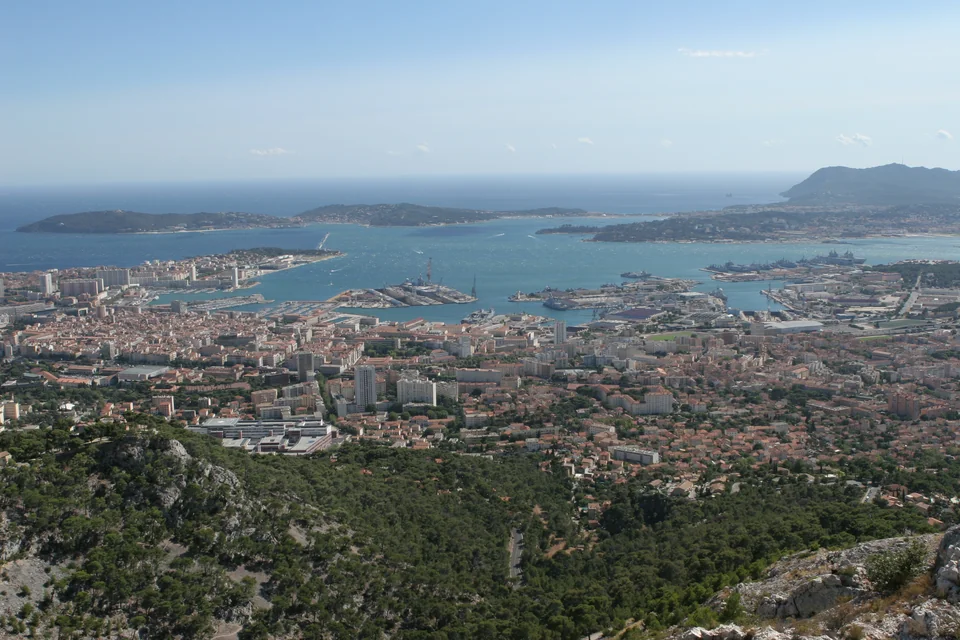
The roadstead from Mont Faron: city, arsenal and sheltered sea.Photo: Pierre Sénard
The scale of Toulon comes from the water. Saint-Mandrier and the surrounding hills enclose a roadstead large enough to sustain a naval city; breakwaters divide the inner Petite Rade from the more open Grande Rade. The arsenal developed under Richelieu, Colbert and Vauban, and the navy still dominates the waterfront. Naval ships, ferries and working basins belong to the view from a visiting yacht.
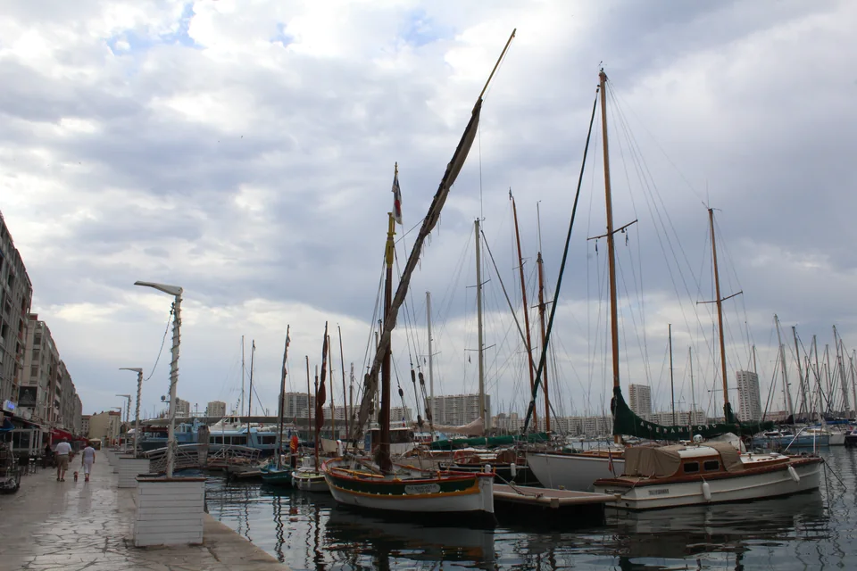
Vieille Darse brings the civilian city to the water’s edge.Photo: Chabe01
Vieille Darse puts the old centre immediately ashore. Cours Lafayette market, pedestrian streets and waterfront restaurants make the city an easy place to inhabit from a berth. Beside the arsenal entrance, the Musée national de la Marine explains how this natural harbour became a Mediterranean naval base.
The rade is also part of everyday urban life. Réseau Mistral’s boat-buses cross to La Seyne, Les Sablettes and Saint-Mandrier. A passenger crossing gives another view of the same working water, with the city and Mont Faron behind it.
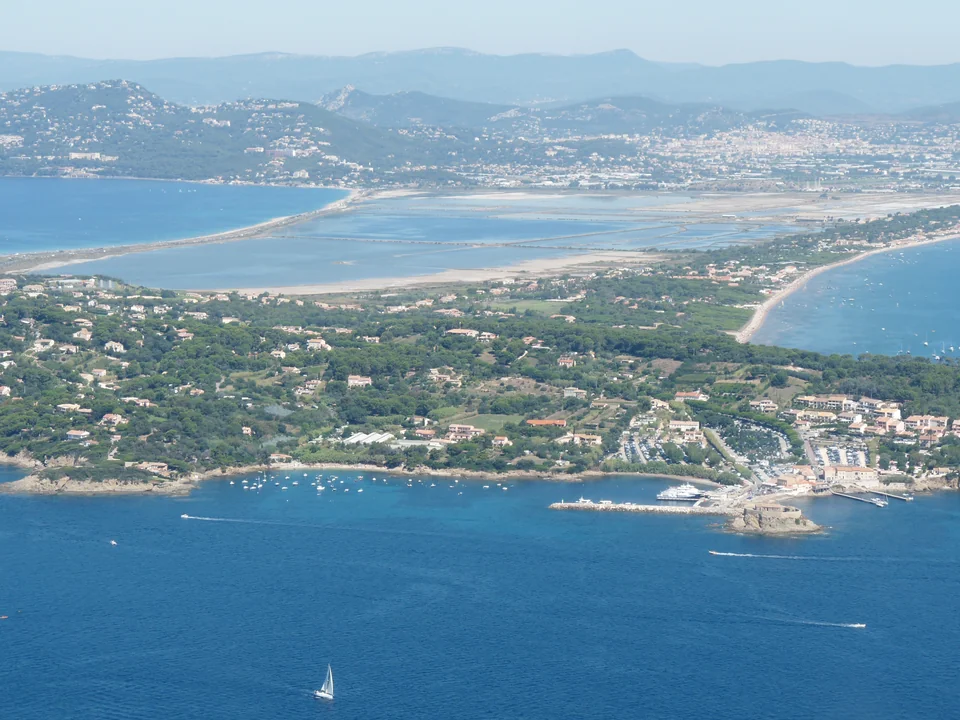
Giens was once an island. Two narrow sandbars, each about four kilometres long, now connect its rocky spine to the mainland. Together they form a double tombolo, enclosing the Pesquiers salt lagoon. Almanarre faces the Golfe de Giens on the western side; La Capte and La Bergerie face the Rade d’Hyères to the east. From the peninsula, the sea is never far away in either direction.
The lagoon made salt production possible. Pesquiers’ nineteenth-century saltworks left an ordered landscape of basins and banks; production ended in 1995, and conservation now gives those same waters another purpose. Flamingos, herons and other waterbirds use a landscape whose geometry still reveals the work that shaped it. Guided visits explain the saltworks and their wildlife; access inside the site follows the published programme.
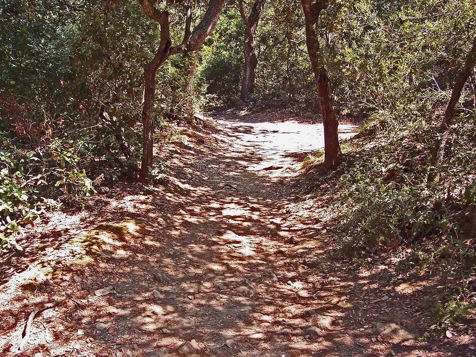
The two sides also explain Giens’ wind-sport culture. A westerly can make Almanarre a busy windsurfing shore while conditions differ across the sandbars; easterlies reverse the exposure. Around the rocky peninsula, the coast path climbs through pines and scrub, with steeper stretches towards its western headlands.
Port du Niel · below Giens village
Niel is a small fishing and leisure harbour tucked below the village. It brings the peninsula back to human scale after Toulon’s naval basins and Saint-Pierre’s pontoons. It is also a shore destination in its own right.
Tour Fondue · the island crossing
At Giens’ southern tip, the little Fort du Pradeau overlooks the passage towards Porquerolles. Built under Richelieu, it guarded an approach that now carries the daily passenger ferries. Tour Fondue is the mainland terminal for that crossing, separate from both Saint-Pierre marina and a visitor yacht berth.
Port Saint-Pierre faces the islands from the Rade d’Hyères. Its shops, marine trades and waterfront restaurants make it the practical mainland base for provisioning, repairs and crew changes.
A separate visit to the old town
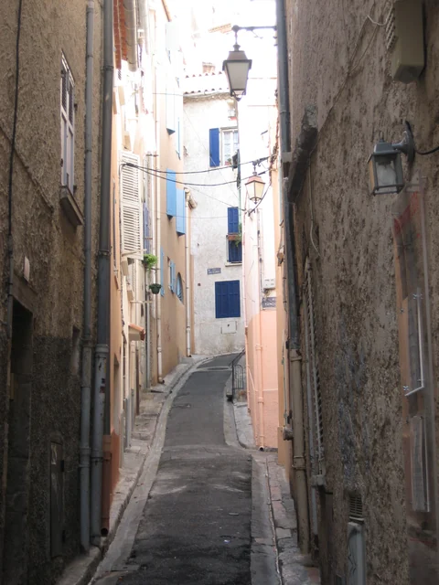
The old town rises inland, away from the marina. Its sloping lanes, small workshops and café squares offer a different setting from the coast. A transfer from the harbour is part of that visit; the city centre, Saint-Pierre and Tour Fondue should not be treated as interchangeable arrival points.
Porquerolles · village, vines and beaches
Arrive by boat, explore by bicycle
The harbour opens straight onto the village, where bicycles gather beside shops and restaurants. Beyond it, tracks spread through pine woods, vineyards and open cultivated ground. The change of pace is immediate: the yacht has brought you to an island whose interior is as rewarding as its shore.
Passenger boats from Tour Fondue bring a strong daily pulse, especially in July and August. The village serves residents, harbour visitors and beachgoers at once; fishing and deliveries share the waterfront with leisure boats. Staying afloat makes it possible to see the village before the busiest arrivals and after the excursion traffic eases, although summer evenings can remain lively.
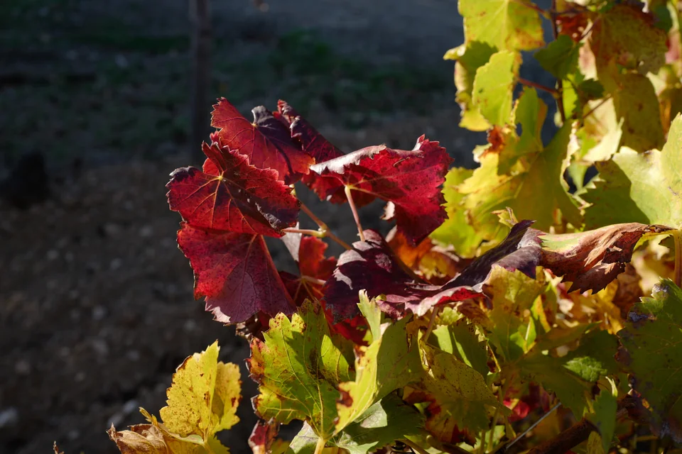
Vines are part of Porquerolles’ living agricultural landscape.Photo: Herve5
In 1912 François-Joseph Fournier bought Porquerolles as a wedding gift for his wife Sylvia. His agricultural enterprise expanded wine production, citrus growing, market gardens and livestock. That cultivated landscape is part of what makes a ride across the island interesting: vines and orchards interrupt the woodland, and the windmill gives another glimpse of an island shaped by work.
After the state acquired much of the island in 1971, protection also embraced its agricultural heritage. Conservatory orchards preserve varieties of figs, olives and mulberries. The COPAINS project combines their care with employment-integration work, and its signed discovery circuit gives the landscape a story beyond the beach.
Near La Courtade, Villa Carmignac brings contemporary exhibitions and a sculpture garden into the island landscape. Bicycles can bring visitors across the island, but the final change of mode happens indoors: shoes come off to visit the gallery barefoot. The foundation publishes its seasonal programme and ticket arrangements; the paths to it can close during high fire risk.
Courtade lies close to the village, while Notre-Dame draws visitors farther east along the softer northern coast. To the west, Plage d’Argent and Langoustier offer other shore settings. At Langoustier, beaches lie on opposite sides of a narrow isthmus: the northern beach is pale, while the darker southern shore retains traces of nineteenth-century soda-factory waste. The island’s southern coast is generally rockier and steeper.
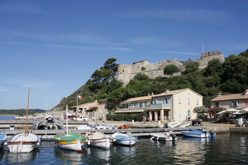
Port-Cros gathers around a small harbour beneath Fort du Moulin. Restaurants and village houses occupy a narrow edge between the water and wooded slopes; the paths soon climb away into the island. Here exploration is on foot. Bicycles are prohibited, so a ridge, a headland or a distant bay takes on a different scale from the same distance on Porquerolles.
The national park was created in 1963 after a long campaign involving island residents and naturalists. Marceline Henry’s gift of land to the state helped secure that future. The village, its hospitality businesses and its history of writers remain part of the island: protection grew from people’s attachment to a lived-in place.
La Palud connects a woodland walk with a different kind of nature trail. From its beach, a marked, self-guided snorkelling circuit introduces the shallow seabed using mask, snorkel and fins. The park does not lead these visits. Wind and sea conditions matter here: strong mistral can make the bay unsuitable for the trail.
Above the village, Fort de l’Estissac looks across the Rade d’Hyères. Fort du Moulin watches the harbour, while Fort de Port-Man occupies the eastern promontory towards Le Levant. Their positions explain the island’s strategic importance from the water; access inside the forts varies, and Port-Man is normally closed to visitors. The park’s writers’ trail adds another way to connect the paths with the island’s past.
On Port-Cros’ eastern side, Port-Man is known for shelter from the mistral. The fort above it once guarded both the bay and the passage towards Le Levant. That exposure differs from the village harbour’s, but shelter alone does not establish where anchoring is permitted: the park’s current marine map applies to this bay too.
Beyond the village, there are no drinking-water points, and dogs are prohibited. Fire restrictions may close the paths. Tender access at La Palud and Plage du Sud uses the designated pontoons for craft under 5 m; boats may not be pulled onto the beaches.
Le Levant changes the story again. Héliopolis occupies a small civilian part of an island largely used by a defence missile-testing centre. Founded by the doctors André and Gaston Durville in the early 1930s, the naturist community grew from ideas about health, outdoor life and a different relationship with the body. It remains a living village with accommodation, restaurants and its own customs.
The accessible island is therefore much smaller than the coastline suggests. Paths and steps connect the port, the hillside settlement and swimming places. Naturism is part of the local way of life; the visitor association explains where nudity is expected and where a covering is required, including the port. The military territory is closed to ordinary visitors.
Across the water, La Favière is Bormes’ marina beside the mainland beach; Bormes’ hill village is a separate inland visit. Le Lavandou and Cap Bénat belong to this mainland shore, which continues towards Cavalaire and the Gulf of Saint-Tropez. Westwards, the coast through Sanary and Bandol leads back towards La Ciotat and the Calanques.
Toulon’s railway station connects with the city harbour through the centre. Toulon–Hyères airport is close to the island-facing coast, but the final transfer depends on the actual port. Saint-Pierre marina, Hyères old town and Tour Fondue are separate destinations. Passenger services to Porquerolles leave Tour Fondue; routes to Port-Cros and Le Levant use other mainland departure points, including Hyères and Le Lavandou, according to the service.
The ferries are also the islands’ everyday connection for residents and supplies. Seasonal timetables, peak-season reservations and weather interruptions affect those connections; the operators publish the current departure points and sailing information.
Harbour and park information was checked on 22 September 2026. The linked operators and park pages publish current local arrangements. Photographs are credited and dated individually.