An open mouth, Monte Louro, stone arcades and the shellfish grounds around Noia.
Rías Baixas · Galicia · Spain
Rías Baixas.
The sea reaches into Galicia.
Four long rías carry the Atlantic inland between wooded hills, granite towns and vineyards. Near their mouths are ocean swell and rocky islands; farther inside, mussel farms spread across the water, fishing boats supply town markets and ferries connect opposite shores.
Muros e Noia, Arousa, Pontevedra and Vigo each open into a different Galician world. A turn inland can lead to a fishing quay, a woodland island, waterfront granaries or a city whose working harbour is part of the view.
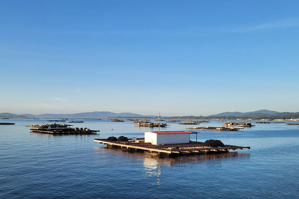
Photo: Urs Schönholzer
Four rías · from north to south
Four different ways into Galicia.
A ría is a coastal valley flooded by the sea. Here the inlets run broadly northeast into the land, with peninsulas between them. Sálvora stands at Arousa’s entrance, Ons off Pontevedra and Cíes across Vigo’s mouth. Muros e Noia has no comparable island screen; Cortegada lies at the other extreme, deep inside Arousa.
The broadest ría: island communities, mussel rafts, markets and the vineyards of O Salnés.
Ons outside; Bueu and the summer harbours along the shores; Combarro and the historic city farther in.
Cíes at the ocean entrance, ferries across the busy central ría, and Rande and San Simón beyond.
The Atlantic and the inner water
The choice changes at each mouth.
Inside a ría, the hills and islands can reduce the ocean swell and bring opposite shores within an appealing local sail. The mouths and the water between rías remain Atlantic passages. Cabo Corrubedo, between Muros e Noia and Arousa, and the headlands around the island entrances give that change a physical shape.
The outer islands shelter some directions while remaining exposed to others. Wind can run along an inlet, and swell can reach an apparently protected shore. The useful choice is local: an outer island, a move across the ría, or a berth farther inland beside a town.
Ría de Muros e Noia
The ocean still feels close.
Monte Louro rises beside the northern side of the entrance. There is no Sálvora, Ons or Cíes across this mouth: the first of the four rías retains a direct relationship with the Atlantic. Inland, the view changes to wooded slopes, fishing towns and the tidal ground around Noia.
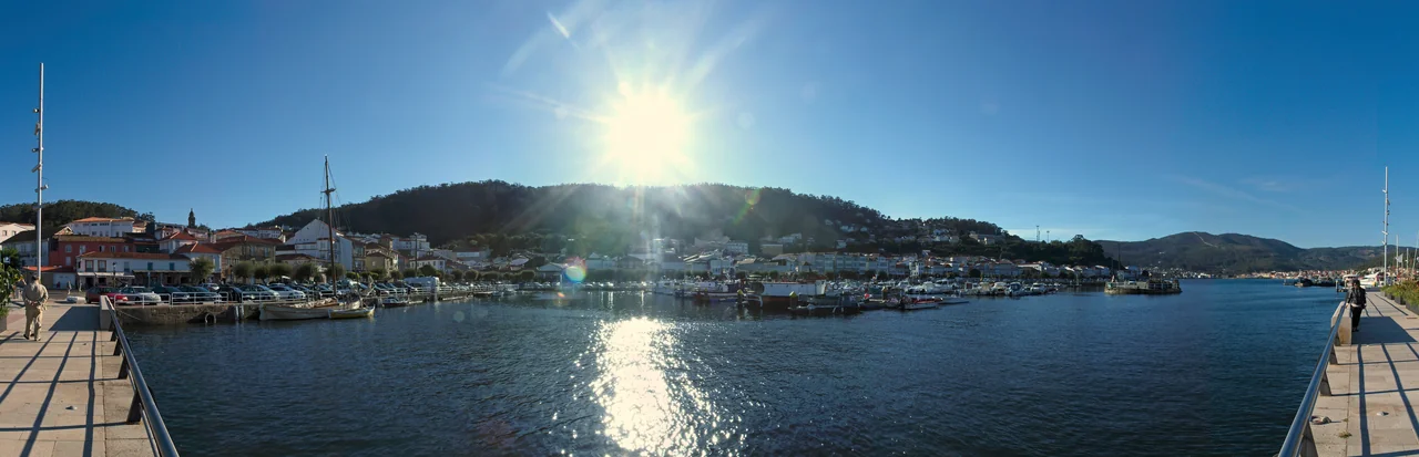
Photo: Xosema
Muros e Noia · Northern shore
Muros: granite arcades and the fishing quay
Muros rewards a walk beyond the pontoons. Stone arcades shelter the lower floors of old fishermen’s houses; lanes climb behind them into a town whose frontage still faces the water. Fishing, salting and canning shaped this waterfront long before visiting yachts arrived.
At Serres, the Pozo do Cachón tidal mill gives the same water another role. Its pond stored the rising tide, releasing it to power the mill. The restored site makes a good shore excursion from Muros, with visits arranged through the town’s tourism office.
Mar de Velas’s “Marina de Muros” is a separate traditional-boat heritage project.
Muros e Noia · Inner and southern shores
Noia, Portosín and the shellfish grounds
Towards Noia, the water spreads over shallow tidal ground. Cockles and clams connect this landscape to the town’s food culture; shellfish are gathered both on foot and from boats. Noia’s medieval centre, the church of San Martiño and its market make a rewarding visit inland from a yacht berth.
Portosín offers a useful southern-shore harbour for that visit. Its yacht club sits beside a working fishing port and can arrange taxis or hire cars. Leave the yacht there for Noia or the outer-coast sights rather than treating the shallow head of the ría as a town-marina approach.
Muros e Noia · A shore excursion
Baroña: a settlement on the Atlantic edge
South of Porto do Son, the stone foundations of Castro de Baroña occupy a rocky peninsula beside the ocean. Circular houses sit within defensive walls, with granite and surf just beyond them. This Iron Age settlement extends the coast’s human story far beyond its medieval towns. Reach it by road, then the footpath through the pines; the archaeological site is the destination, not a yacht landing.
Ría de Arousa
A sea that people cultivate.
Arousa opens on a larger scale. Islands interrupt the water, towns occupy both shores and rows of rectangular platforms extend across the ría. These are bateas: floating frames supporting ropes on which mussels grow. The boats moving among them belong to a farming landscape whose crop is underwater.
The interest lies in following those connections ashore. A Pobra brings the yacht close to a food market; Carril faces clam grounds; A Illa de Arousa lives among fishing harbours and mussel farms; Cambados joins the tidal flats to Albariño country. These are different encounters with the same working sea.
From the outer island to the inner shores
Sálvora lies near the ocean entrance, with Ribeira on the northern side of the outer ría. A Pobra is farther up the western shore. Across the water, A Illa de Arousa sits between the central ría and its eastern shore; Cambados lies to its south. Vilagarcía, Carril and Cortegada draw the story towards the head.
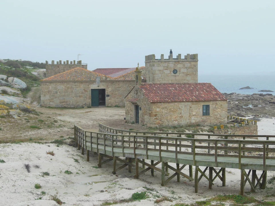
Photo: Estevoaei
Arousa · The Atlantic entrance
Sálvora: a village and a rescue in the dark
Granite islets surround Sálvora at the entrance to Arousa, across the outer water from the mainland fishing port of Ribeira. Its old village and salting buildings belong to a history of cultivation, fishing and island ownership. The abandoned houses give this protected landscape a human scale: people once raised crops and livestock here and went fishing in small wooden dornas.
In the early hours of 2 January 1921, the passenger steamer Santa Isabel wrecked beside the island. Many residents were away for New Year. Those who remained, mostly women, launched their boats and helped rescue 48 people; 213 died. The rescue is remembered as part of the island’s history.
The old-village path is visited with an authorised guide. Organised boat visits offer a way to reach Sálvora from the mainland; a private-yacht visit follows the park’s separate navigation, anchoring and landing rules.
Arousa · The island within the ría
A Illa: boats, beaches and a bridge
A Illa de Arousa belongs to the inner working water. Around O Xufre, fishing boats and mussel boats make the island’s economy visible. On the southern peninsula, O Carreirón offers a different shore: pinewoods, small beaches and paths among granite outcrops.
The bridge, opened in 1985, ended the island’s dependence on boats for everyday mainland travel. It also makes A Illa an easy shore excursion from the surrounding towns. Its position among the farms is as interesting as its beaches: from here the bateas become part of the neighbourhood.
O Xufre is a working harbour. Arrange yacht accommodation with a local operator before making it your destination; a shore visit via the bridge gives access to the island without moving the yacht.
Arousa · Western shore
A Pobra: from the harbour to the market
A Pobra do Caramiñal makes the link between a berth and a town particularly direct. Its visitor marina sits beside the waterfront; the municipal food market faces the Valle-Inclán Museum in the stone Torre de Bermúdez. Fishmongers, fruit and vegetables bring the surrounding sea and countryside into the same shopping trip.
The museum adds another reason to linger ashore: the writer Ramón del Valle-Inclán lived in the area, and the tower connects his story to the town. Along the waterfront, Areos beach offers an easy change of pace after the streets and market.
Wednesday is the municipality’s listed weekly outdoor market day; the food market and museum have their own opening hours.
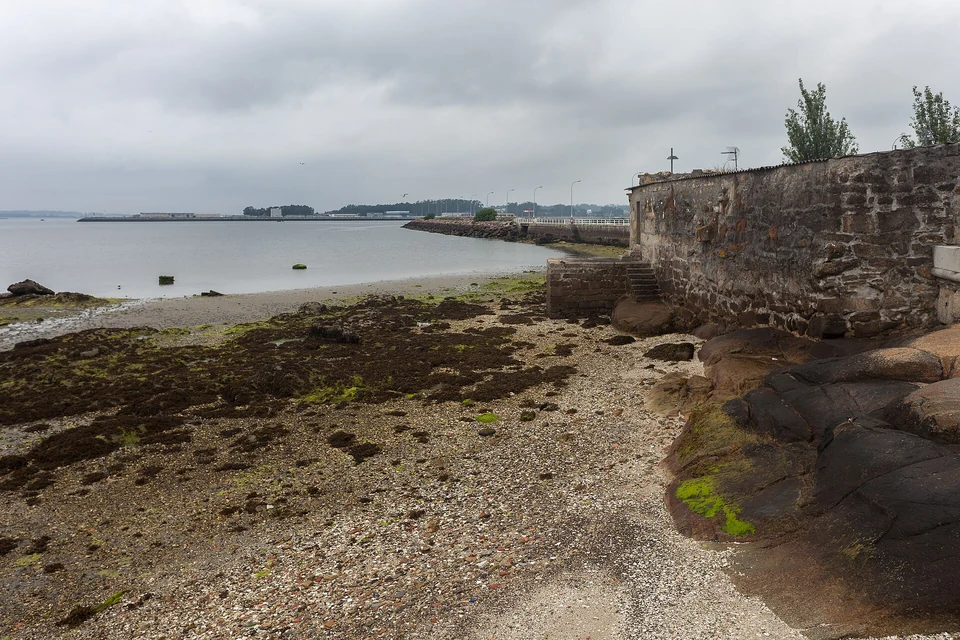
Photo: Luis Miguel Bugallo Sánchez (Lmbuga)
Arousa · Eastern shore and O Salnés
Cambados: shellfish below, vineyards behind
Cambados brings two Galician landscapes together. In Santo Tomé, small fishing boats and the waterfront face the shellfish flats. Inland, the town’s stone squares, manor houses and wineries lead into the Albariño vineyards of O Salnés. A walk through Fefiñáns and a winery visit belong naturally alongside the maritime shore.
The mariscadoras and mariscadores who work the intertidal beds are cultivating and harvesting a managed resource. Their work follows tides, seasons and authorised openings. A guided visit with local shellfish workers can reveal that knowledge; seeing people on the flats is not a daily spectacle guaranteed by low water.
Treat Cambados and its vineyards as a shore excursion from an arranged berth on Arousa. The shallow eastern shoreline does not turn every waterfront into a yacht stop. Local excursions and road connections let the boat stay where it is while the crew explores inland.
Arousa · The inner shore
Vilagarcía and Carril: a town walk beside clam grounds
Vilagarcía provides a larger town on the eastern shore. Its seafront promenade continues towards Carril, where the tidal clam grounds lie close to the houses and Cortegada sits just offshore. The changing tide reveals how closely everyday life follows the working edge of the ría.
Carril’s waterfront and Cortegada’s excursion departures are separate destinations from that berth.
Arousa · The woodland island
Cortegada: the opposite of an Atlantic outpost
Cortegada lies deep inside the ría, close to Carril and the mouth of the Ulla. Woodland surrounds the remains of its village; shaded paths replace the exposed cliffs of the outer islands. It belongs to the same national park as Sálvora, Ons and Cíes, but shows a very different relationship with the sea.
Organised guided visits leave chiefly from Carril and Vilagarcía; there is no regular daily ferry. Private boats need park permissions, and access is confined to permitted paths. The abandoned buildings and the surrounding reserve islets are not open for independent exploration.
Ría de Pontevedra
An island outside. A city at the head.
Pontevedra brings its contrasts into a more compact landscape. Ons faces the Atlantic at the mouth. Bueu occupies the southern shore; Sanxenxo and Portonovo bring beaches and summer sailing to the north. Farther inland are Combarro’s granaries and, where the ría meets the Lérez, the historic city of Pontevedra.
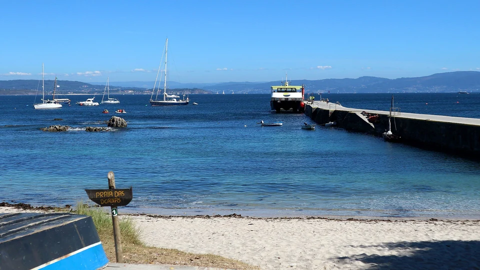
Photo: Miguel Branco
Pontevedra · The outer island
Ons has two shores—and an island community
On the eastern side, beaches and the settlement around O Curro face the ría. Across the island, paths reach the Atlantic cliffs, sea caves and open horizon. Fishermen’s houses and hórreos add another layer: Ons retains an island community, with a history closely tied to fishing, especially octopus.
At Buraco do Inferno, a collapsed sea-cave roof opens a deep shaft in the granite. Tradition heard the voices of suffering souls there; the national park connects the cries to seabirds that once nested in the cave. It is a memorable place to encounter the island’s geology and one of its legends together.
The park’s marked walking circuits lead from the information point towards beaches, viewpoints and the island’s exposed side. Passenger boats provide an alternative to bringing the yacht, with departures varying by season and mainland port.
Pontevedra · Southern shore
Bueu: the fishing town and the cannery
Bueu offers a mainland continuation of the working-sea story. The port, market and Museo Massó connect fishing to the industries that preserved and exported its catch. The museum occupies part of the old cannery and brings together maritime collections, fish salting and canning history.
Bueu is also a departure point for passenger visits to Ons. It works well as a town and museum excursion from a confirmed berth elsewhere in the ría, or as the mainland start of an island visit.
Pontevedra · Northern shore
Sanxenxo and Portonovo: the summer waterfront
Sanxenxo’s marina and Silgar beach make the leisure side of the ría especially visible. Nearby Portonovo combines a fishing harbour with beaches, places to eat and island excursions. These busier summer waterfronts offer a different setting from Bueu or the narrow stone lanes of Combarro.
For a yacht berth, the named options are Nauta Sanxenxo and Club Náutico de Portonovo. Their harbours are separate from the passenger-boat departure arrangements. Summer demand makes an advance berth enquiry useful here.
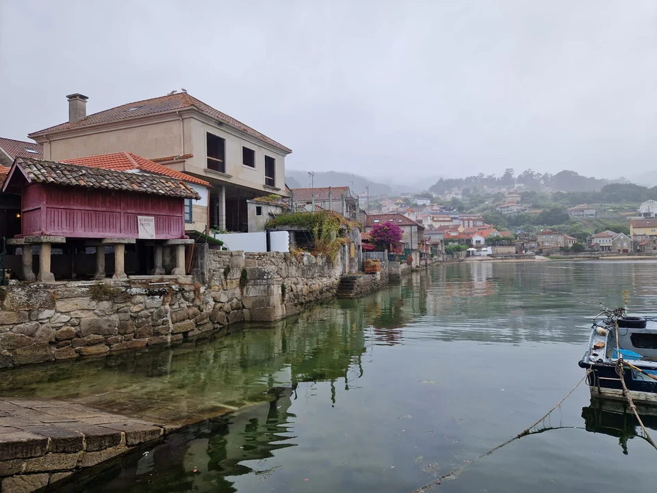
Photo: José Alejandro Salamanca Pérez
Pontevedra · Inner northern shore
Combarro: fields, fishing houses and the water
The waterfront hórreos look maritime because of where they stand. They are agricultural buildings: raised granaries designed to keep food dry and ventilated. Beside them are fishermen’s houses, small boats, nets and granite lanes. Combarro compresses the relationship between fields and fishing into a short stretch of shore.
Walk through Rúa do Mar and towards the old Peirao. At low water the foreshore changes the view of the houses and granaries; from O Padrón beach their position beside the ría is especially clear. The village has a busy visitor life as well as its older fabric.
Anchoring within Marín–Pontevedra port-service waters is subject to local port regulation. Obtain the applicable authorised area or permission from the authority; the marina’s proximity does not establish permission to anchor off Combarro.
Pontevedra · A city visit from the ría
Continue ashore into Pontevedra
The city at the head gives the inlet a destination beyond its waterside villages. Walk through the old centre’s stone squares and arcades, visit the Museo de Pontevedra and follow the Lérez waterfront. Praza da Leña and the streets around the museum make a good starting point for a city walk.
Combarro provides a nearby yacht berth for a road visit to Pontevedra. Arrange a taxi or use the regional bus journey planner for Combarro–Pontevedra; the city visit need not depend on bringing the yacht up the river.
Ría de Vigo
Atlantic islands at the door of a working city.
Cíes stands across the ocean entrance. Inside, the ría carries ferries, fishing boats, mussel boats, yachts and large commercial ships. Vigo spreads along the southern shore, opposite Cangas and Moaña. Farther east, the water narrows at Rande before opening again into the inner bay of San Simón.
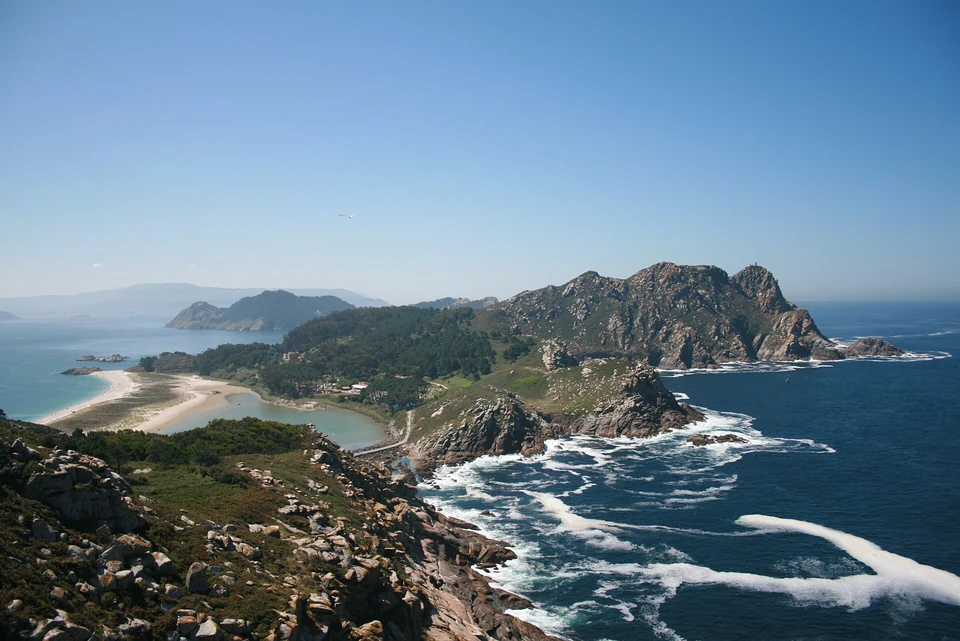
Photo: Óscar (xindilo/fotosderianxo)
Vigo · The Atlantic entrance
Cíes: cliffs outside, sand towards the ría
The western faces of Cíes rise in Atlantic cliffs; the eastern shores open into beaches and bays towards Vigo. Rodas links the two northern islands beside a lagoon. Seen from a path above the beach, the shape of the islands explains how they stand between the ocean and the ría.
A walk towards the lighthouse viewpoints brings the exposed side into view. Down at Rodas, sand, pinewoods and boats belong to the gentler eastern landscape. The contrast is the attraction, but a sheltered shore in one wind is not shelter in every direction.
A yacht visit needs park navigation permission and dated anchoring permission, with landing rules for the chosen place. Passenger boats from mainland ports offer another way to visit; the park has separate authorisation arrangements for those passengers.
Across the ría, then farther inland
Cangas and Moaña face Vigo across the central ría. Passenger ferries make these shores part of the same daily journey. Beyond the city, Rande forms a narrow gateway to San Simón; Baiona lies in a separate bay near the southern side of the outer entrance.
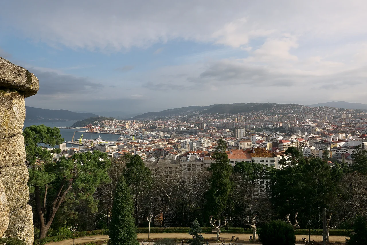
Photo: José Luis Filpo Cabana
Vigo · Southern shore
A city that still works at sea
Vigo’s fishing and commercial waterfront is part of its character. Large vessels, shipyards and freight activity share the ría with ferries and leisure boats. Above the quays, the old quarter and O Berbés preserve a more intimate maritime scale, with streets climbing away from the water.
O Castro gives that geography a broader frame. The uphill walk leads into parkland and viewpoints over the city, the port and the opposite shore. Back below, markets and places to eat connect the visit to a fishing economy that extends far beyond the local ría.
Vigo · Across the water
Cangas and Moaña: the ría as a road
Passenger boats connect Vigo with Cangas and Moaña. For people living here, the water is part of the transport network: the opposite shore is a crossing away, rather than a drive around the head of the ría. A yacht crew can use the same connection for a different town, a meal or a beach walk while leaving the boat at its berth.
Cangas’s old streets sit close to its waterfront. Rodeira’s broad beach and promenade extend along the bay to the east. Moaña gives another view of the northern shore and the city opposite. Use the operator’s dated timetable for the return crossing; passenger access is separate from yacht berthing.
Vigo · The inner ría
Rande: a naval battle becomes a story
At Rande, the ría narrows beneath the bridge before spreading into San Simón. Here, in 1702, Anglo-Dutch and Franco-Spanish fleets fought during the War of the Spanish Succession. The fate of the treasure aboard the Spanish ships became a lasting legend; Jules Verne drew on it in Twenty Thousand Leagues Under the Seas.
The Meirande interpretation centre on the shore explores the battle and local industrial history. San Simón adds a more sombre past, including its use as a quarantine station and later as a prison. Organised island excursions provide a practical way to visit without assuming a private-yacht landing.
Exploration by yacht beyond Rande involves bridge clearance, the shallower inner bay and local port-water rules. For the history ashore, the road to Meirande or an organised San Simón boat trip is the straightforward starting point.
Outer Vigo · Baiona
A harbour looking back towards the Atlantic.
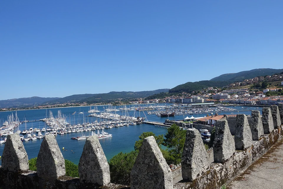
Baiona gathers its harbour, old town and the fortified peninsula of Monterreal around a bay near Vigo’s outer entrance. The fortress gives a walk ashore a long view over the water; below it, visiting yachts lie close to the town.
On 1 March 1493, the Pinta arrived here on its return from Columbus’s first Atlantic voyage. Its replica caravel is a shore visit beside the modern harbour, with the old town immediately behind the waterfront.
The exterior coastal circuit around Monterreal is approximately two kilometres; access to the upper fortress is a separate visit.
Beyond Cabo Silleiro, the coast towards A Guarda and the Miño becomes more linear. The succession of long inlets falls behind; Portugal introduces a different pattern of coastal passages and river-mouth harbours.
Sálvora · Cortegada · Ons · Cíes
Visiting the Atlantic Islands National Park
The four archipelagos share a national park, but their visits differ. A private boat needs navigation permission and a separate anchoring permission for the chosen date and area. Passenger visits follow another process. Arrange the visit through the park or an authorised operator for the island and season concerned.
Island visits · Private boats
Navigation, anchoring and landing
Obtain the navigation permit before requesting dated anchoring permission. Permission to anchor does not grant general use of a quay: Carracido on Cíes, Dornas on Ons and the Sálvora wharf have separate port-authority requirements. Onza is closed to landing; Sálvora’s old village requires a guide, and Cortegada has restricted paths and reserve islets.
Island visits · Passenger boats
Leave the yacht and take a local boat
Cíes and Ons have seasonal passenger services from mainland ports. The park’s high-season visitor authorisation and the ferry ticket are separate steps; outside that period, contact authorised operators for the available visits. Sálvora and Cortegada visits are arranged directly with operators, with guided access where required.
Arriving from elsewhere
Choose the harbour, then the land connection.
Santiago de Compostela airport is useful to consider for the northern rías; Vigo airport serves the southern end. Rail connects Santiago, Vilagarcía, Pontevedra and Vigo, with a road transfer for harbours away from those stations. The right arrival point depends on where the boat is berthed.
Vigo airport lists Line A buses and taxis. The bus is a city service, not a marina shuttle; Baiona, Cangas and individual marinas require their own onward connection. Portosín’s yacht club can arrange taxi or hire-car services for its visitors.
Sources, photographs and maps
Local tourism, harbour operators and the Atlantic Islands National Park are linked beside the relevant places. Photograph credits include the creator, source and licence. The maps use GSHHG coastline geometry and OpenStreetMap place records.
Map composition: CC BY 4.0
GSHHG coastline source
Local coastline dataset
Place dataset
© OpenStreetMap contributors
GSHHG licence
GNU LGPL 3
GNU GPL 3
Coastline: GSHHG 2.3.7, Paul Wessel and Walter H. F. Smith, LGPL 3 or later. Place data: © OpenStreetMap contributors, ODbL. sol.blue map composition, adapted from Sophie cartography (CC BY 4.0).