Long horizons at sea. A fishing village inside the Douro, salt and shallow channels behind Aveiro’s dunes, Lisbon rising above the Tagus. Along Portugal’s western shore, each landfall opens a different world.
The pleasure is in the contrast: a coast with room for a proper sail, then places with enough character to draw you well beyond the pontoon. Cod ships, wine boats, island forts and an ancient fish industry all belong to the same Atlantic story.
South of Galicia, the shoreline straightens. Long beaches, dunes and open headlands replace the repeated invitations of the rías. River mouths and engineered ports become the connections between the sea and the country behind it.
The distances become part of the character. A reported Viana–Douro passage is about 39 nautical miles; the Figueira sailing club places Aveiro about 31 nautical miles to its north. South of the Sado, Sines has particular importance because the next concentration of yacht harbours lies around the corner in the Algarve. The coastal stretches give these landfalls their weight.
Summer’s Nortada is the familiar northerly coastal wind, often stronger later in the day. It can give southbound sailing a sustained rhythm; northbound, the same coast asks for a different weather window. Atlantic swell can arrive from weather far offshore, independently of a gentle local breeze.
The Lima and Douro open into two very different cities. Viana looks back to distant fishing grounds; Porto follows its river inland to wine country. Both make more sense when the Atlantic is part of the view.
Viana do Castelo and the cod fleet
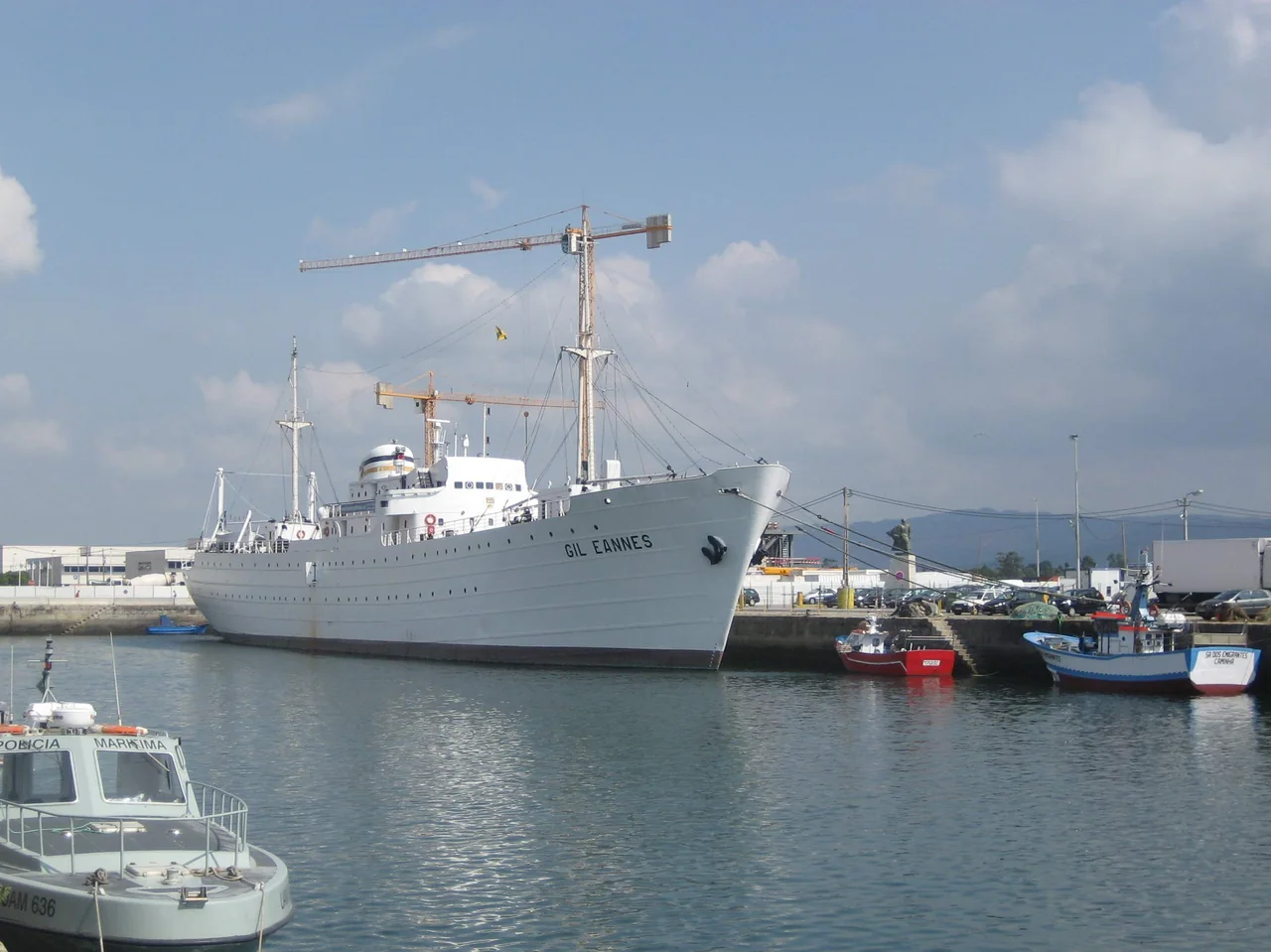
At the mouth of the Lima, Viana gathers river, town and hill into a compact landscape. The old centre is close to the waterfront; above it, Santa Luzia gives a wider view of the river’s final bend, the harbour and the ocean. Down at water level, the white hull of Gil Eannes introduces a much larger seafaring world.
Built here in 1955, the hospital ship supported Portuguese cod fishermen on the banks off Newfoundland and Greenland. Its museum brings the working voyage into focus: a fleet far from home needed medical care as well as fish holds, fuel and provisions. The distance between this small river city and those northern fishing grounds is part of what makes the visit memorable.
Viana’s maritime identity also lives ashore in the Nossa Senhora da Agonia tradition, fishing history and the city’s connections with shipbuilding. A walk between the old streets, the museum ship and the riverfront gives several ways into that story; Santa Luzia adds the geography behind it.
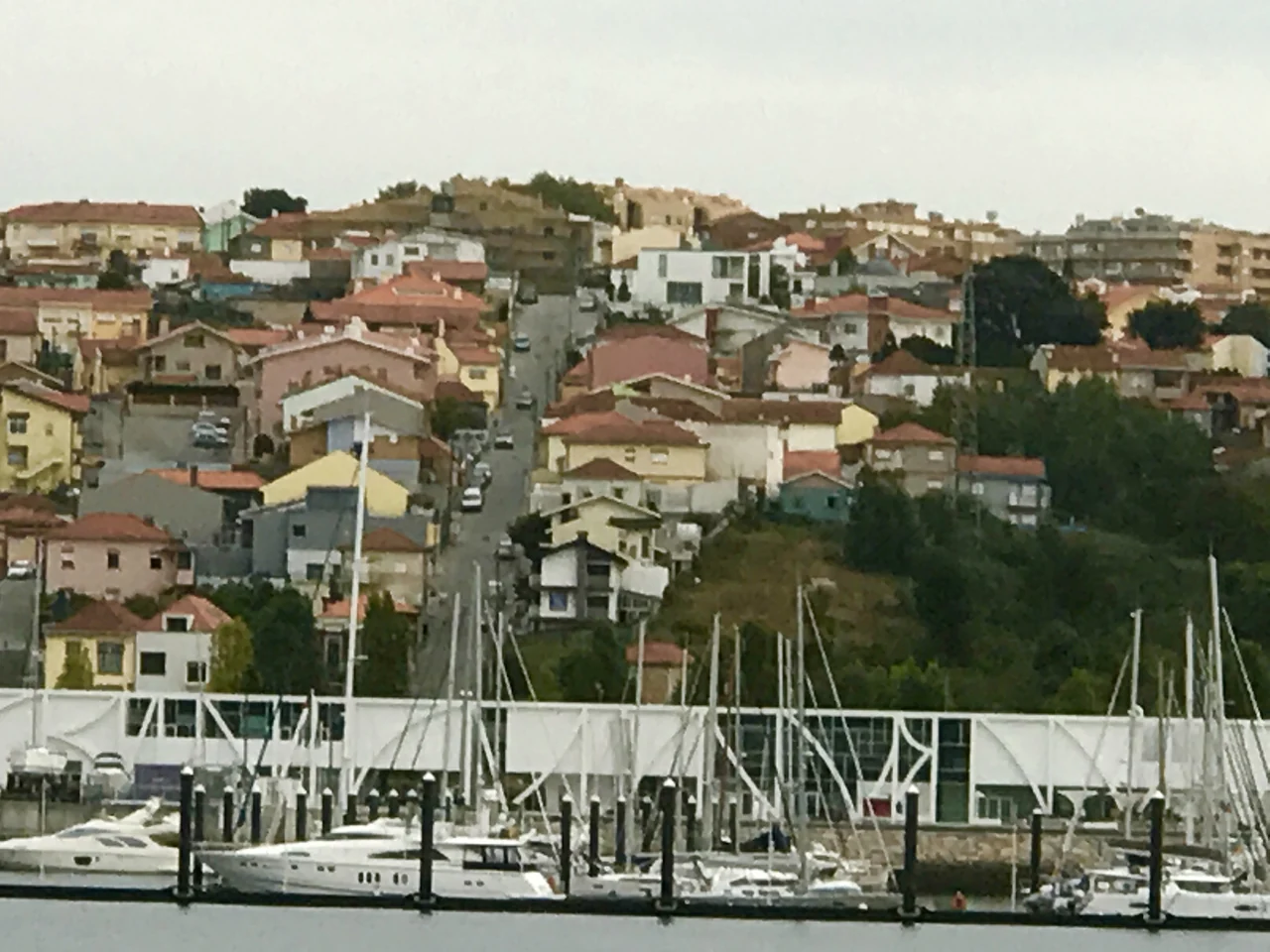
These are different kinds of arrival. Leixões puts the yacht inside a large commercial harbour, with Marina Porto Atlântico beside the northern breakwater at Leça da Palmeira. Fishing, cargo traffic and repair businesses form the setting. The Douro takes you into a river landscape, with Afurada beside the marina and Porto and Gaia climbing the banks farther inland.
Douro Marina has the closer relationship with Afurada and the river, but access depends on the conditions at the river mouth.
Afurada: the river at village scale
Douro Marina lies near the river mouth on the Gaia bank. Beside it, Afurada has its own fishing identity: small boats, a devotion to São Pedro and a heritage centre concerned with the people who worked this water. It offers a different arrival from the grander waterfronts upstream. Fish restaurants and the village streets are part of the immediate neighbourhood; Ribeira is a separate city outing.
The small river crossing links Afurada with Cais do Ouro on the Porto bank, near the Arrábida bridge. It carries you across the working river rather than directly into the historic centre. From there, Porto’s streets and riverside transport extend the visit. The crossing’s local timetable matters, particularly for the return; a road journey is the other straightforward connection.
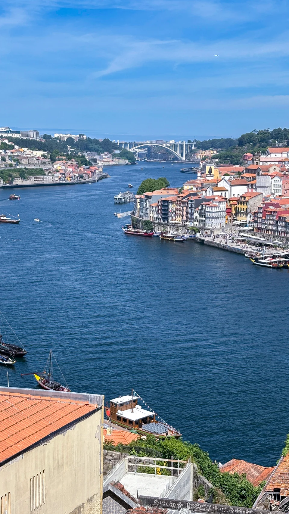
Farther upstream, Porto and Vila Nova de Gaia face each other across a landscape of bridges and steep streets. The wine lodges on the Gaia side belong to a chain that once ran from vineyards inland, down the Douro in barrel-carrying rabelos, into warehouses and out to the Atlantic. Seen that way, a cellar visit is also a visit to a maritime trading city.
Ribeira is the riverfront to wander; the streets above lead into another scale of city. A bridge crossing changes the view again, with Porto’s stacked façades opposite Gaia. The marina remains downriver, so the pleasure of exploring the city does not depend on taking the yacht beneath its bridges.
Afurada and the marina lie downriver from Porto’s old waterfront.
02 · Aveiro to Peniche
Long beaches. Unexpected openings.
Between Porto and the Tagus, the coast can look deceptively simple from offshore. Behind it are a shallow lagoon, a river port, a fishing town beside a submarine canyon and, off Peniche, one of the west coast’s rare island excursions.
Aveiro: a lagoon behind the dunes
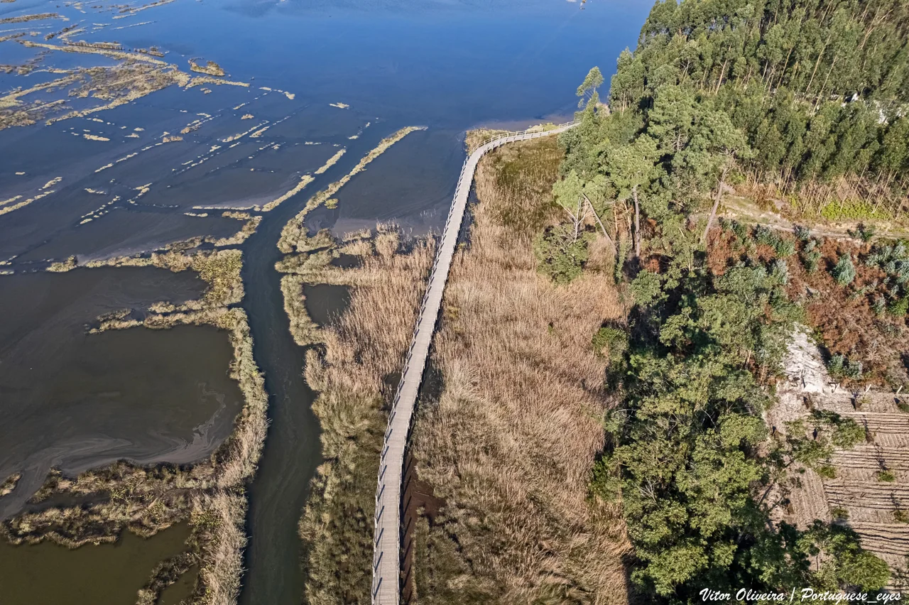
The entrance between Barra and São Jacinto opens through the sandy coast into a much broader landscape. The Ria de Aveiro runs roughly 45 kilometres along the land behind the sea, branching into channels, islands, shallows and salt country. Its name may recall Galicia, but the low horizons and flat shores belong to a different kind of water.
The high, painted bows of the moliceiros are now familiar from boat trips through Aveiro’s canals. Their original work was gathering moliço, aquatic vegetation from the lagoon, for use on the land. Their shallow form fits that working environment. Salt pans and lagoon-side walks add another way to understand the relationship between water, food and farming.
Aveiro’s city canals are one part of the visit. Barra’s lighthouse marks the ocean entrance; nearby Ílhavo brings the cod fishery back into the story through its maritime museum. The lagoon can be explored on foot, by bicycle or with a local boat operator, allowing a closer look at shallow water that is quite different from an ocean yacht’s harbour approach.
Yacht access and lagoon visits
The commercial entrance at Barra and the shallow inner channels are separate questions. Jardim Oudinot has a recreational dock, but a current transient berth and its access limits have not been established here. Arrange a specific reception with the local port before treating Aveiro as a yacht stop; the city and lagoon also make a worthwhile visit overland. A moliceiro excursion does not imply yacht access to the same canals.
Figueira has a useful place in the coast’s rhythm. Its marina is on the city side of the Mondego, with town streets behind and a broad ocean beach beyond the river mouth. Fishing and seaside-resort life share the waterfront landscape. This is a stop with an ordinary town around it, where a meal ashore and a walk along the beach can follow an open-coast passage.
The club places Aveiro about 31 nautical miles to the north, a useful sense of the spacing here.
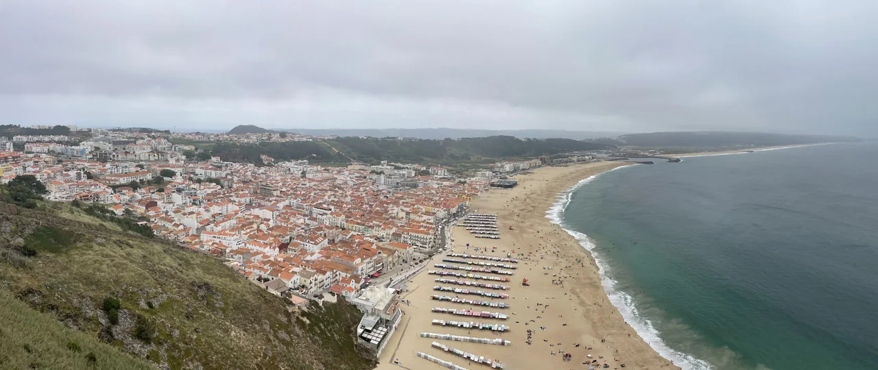
From Sítio, high above the town, Nazaré’s houses gather behind a sweeping beach. The harbour lies farther south; Praia do Norte is on the other side of the headland. That separation helps explain a place often reduced to a single photograph of an enormous wave.
Offshore, the Nazaré Canyon cuts deeply into the seabed and helps concentrate Atlantic swell towards Praia do Norte. The remarkable geography is mostly out of sight. Giant-wave surfing has made it famous, but the same sea supported a fishing community long before the surf records. The town, beach and headland bring those older and newer relationships with the ocean together.
Sítio gives the broad view; the lower town gives the closer one, among streets behind the sand and the surviving imagery and traditions of fishing. A visit to the headland can add the canyon’s story. The extraordinary waves depend on the swell and season, so a summer landfall can have a very different atmosphere from the winter photographs.
Peniche projects into the Atlantic, its fishing harbour on the southern side of the peninsula. Fishing boats and maritime businesses give it a working scale; Cabo Carvoeiro opens the view west to the Berlengas. After the long sandy coast, the relationship between peninsula, headland and islands is a welcome change of geography.
Peniche is also the mainland departure point for passenger boats to Berlenga Grande, which makes the islands accessible without moving the yacht.
Berlenga Grande, Estelas and Farilhões–Forcadas interrupt the west coast’s largely mainland story. Rocky slopes rise from clear water; seabirds use the islands, and the protected area extends well beyond the land. Berlenga lies about five to six nautical miles from the peninsula’s nearest coast.
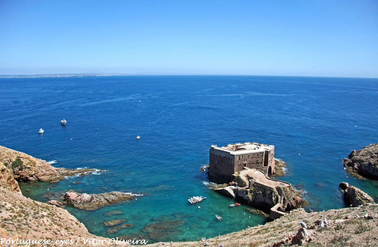
The Fort of São João Baptista stands below Berlenga Grande’s slopes, joined to the island by a narrow stone bridge. Its small, hard-edged shape against the water gives the scene an almost improbable scale. Above, paths reveal the island’s exposed sides and the mainland across the channel. The island visit adds rock, birdlife and open water to a passage otherwise marked by river mouths and town harbours.
The Fort of São João Baptista below Berlenga Grande, linked to the island by its narrow stone bridge.Photo: Vitor Oliveira
ICNF manages visitor registration, the shore-access fee and the island’s admission limit through BerlengasPass. Admission ashore does not settle where a yacht may anchor or use a mooring; those arrangements are separate from the visitor pass. Passenger boats from Peniche offer another way to make the crossing, with sailings dependent on sea conditions.
Cascais opens towards the Atlantic; Lisbon spreads along the broad Tagus. Between them, a railway follows the shore past beaches, river defences and Belém. The connection gives the coast and the capital a close relationship without making them the same place.
Cascais, beyond the arrival quay
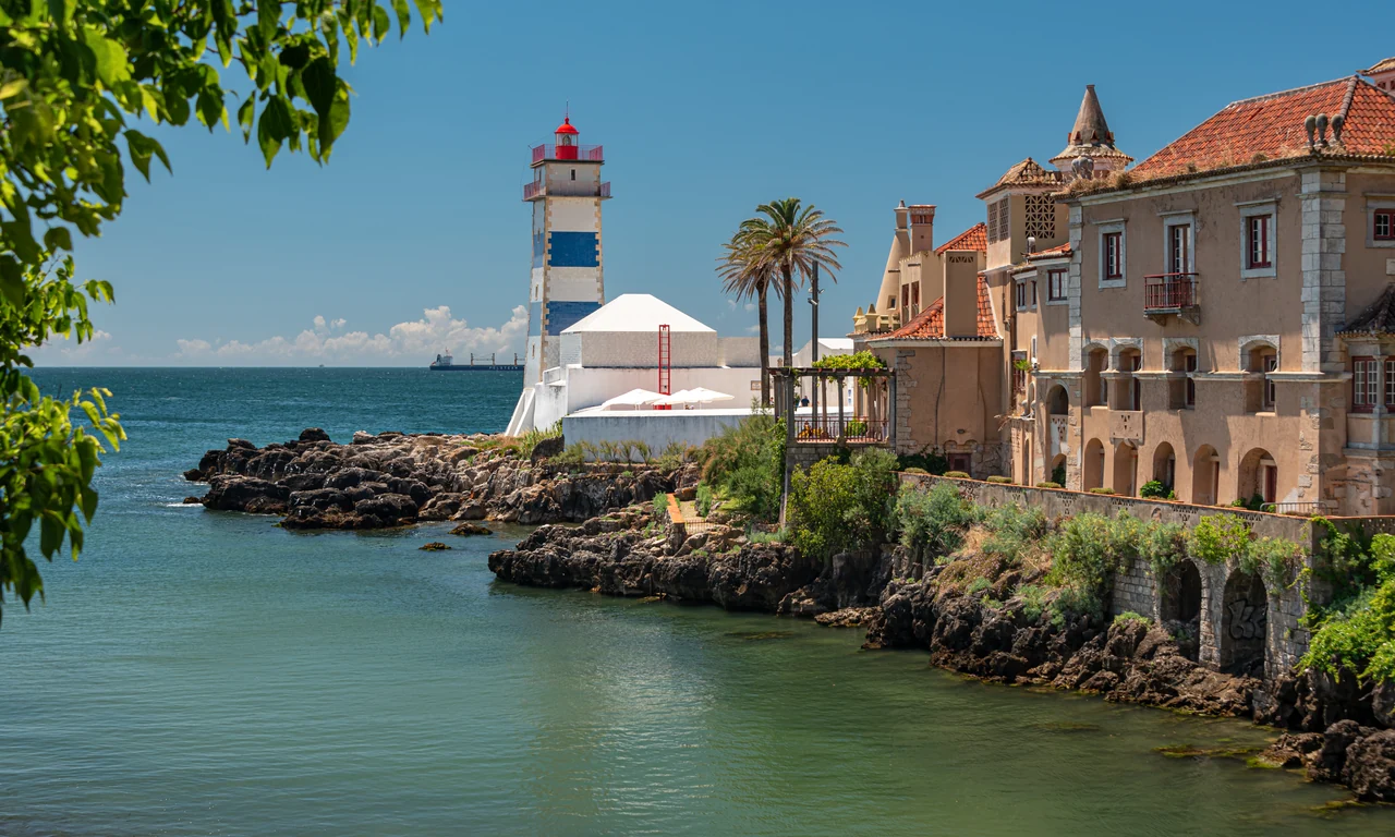
The marina sits below the citadel, close to the old town. Streets lead to small beaches and squares; west of the harbour, Santa Marta’s lighthouse and the rocky shore change the mood. Farther west, the coast opens towards Guincho and Cabo da Roca. The exposed ocean edge and the town’s more enclosed waterfront are close together, but feel quite different.
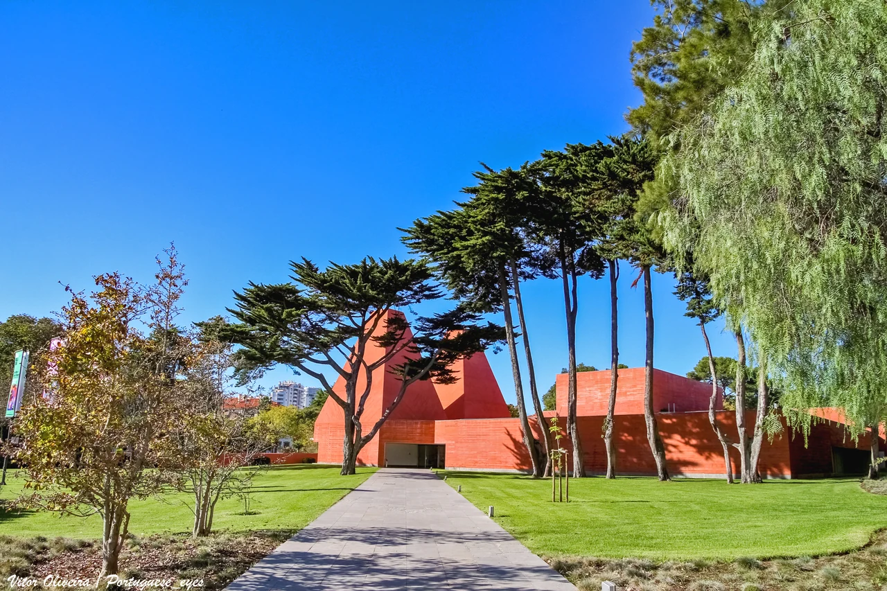
The Casa das Histórias Paula Rego is a particularly good reason to leave the waterfront. Eduardo Souto de Moura’s red building, with its two pyramid-like towers, houses work by an artist whose stories can be unsettling, intimate and darkly theatrical. It adds a different Portugal to the polished seaside streets, and makes an easy connection with the town’s gardens and museums.
The Tagus gives Lisbon its scale. Ferries cross a wide working estuary, ships pass the riverside districts, and the southern bank puts the whole city back into view. Cais do Sodré is a useful hinge between the Cascais railway, central Lisbon and river transport. Belém lies farther west, towards the sea, with its tower and monastery connected to the navigation, trade, royal wealth and empire that shaped Portugal’s oceanic history.
The Maritime Museum in Belém brings that history down to the scale of hulls, rigging, instruments and working boats. It also offers a connection with places already passed along the coast: the Douro’s wine boats and Aveiro’s shallow lagoon craft belong alongside the better-known story of ocean voyages. Outside, the river is still a transport corridor, giving the museum’s objects a living setting.
The Cascais railway runs to Cais do Sodré, making Lisbon accessible while the yacht stays by the sea. Engineering works can replace parts of the journey with buses, particularly during specified evening and weekend periods; CP’s current notice is useful when planning a late return. Belém, the centre and a ferry crossing each offer a different view of the river city.
Cascais, Oeiras and Alcântara offer different relationships with the coast and Lisbon.
Three ways to be beside the Tagus
Cascais has the strongest coastal-town setting. The choice changes the neighbourhood around the boat as well as the journey ashore.
Oeiras publishes limits of 25 metres in length, 6 metres beam and 3 metres draught, referenced to chart datum. Ask for the assigned berth and its arrival conditions; entrance, basin and berth depths are different figures. Alcântara’s visitor arrangements are handled by the Port of Lisbon. Ferries and commercial movements remain part of the Tagus setting at all three locations.
04 · Sesimbra, Arrábida and the Sado
Limestone hills. Sand and living water.
South of the Tagus, Cabo Espichel makes a forceful turn in the coast. Beyond it are Sesimbra’s fishing harbour, the wooded slopes of Arrábida and the Sado’s broad entrance. Setúbal and Tróia face each other across water that has sustained fishing, trade and industry for centuries.
Sesimbra and Cabo Espichel
Sesimbra sits in a bay beneath a castle ridge, with the fishing port at the western end and the town spread along the beach. Fish landed here and restaurants facing the water connect the working harbour with the seaside town. The castle above adds a different perspective, showing the enclosed shape of the bay and the hills behind it.
Cabo Espichel has a more austere presence: high cliffs, a lighthouse and a sanctuary standing close to the ocean edge. The headland belongs to the passage by sea, while its buildings and cliff-top landscape are a separate visit by land. East of Sesimbra, the coast becomes greener and more intricately folded as it meets Arrábida.
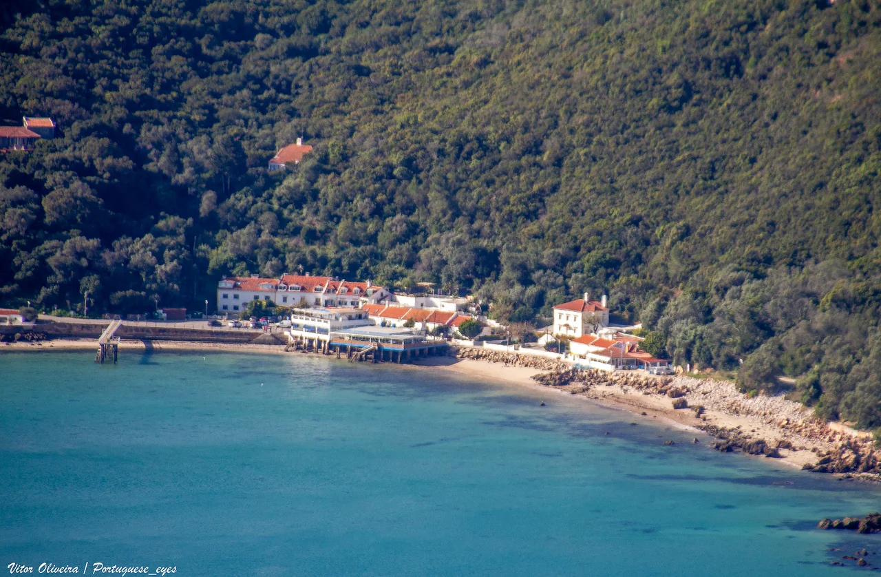
White limestone and dense green slopes descend towards small beaches and clear water. After the long, low Atlantic shore, Arrábida feels enclosed and richly textured. Portinho is the best-known meeting of hillside and sea, while the views towards Tróia reveal how close this rocky coast lies to a very different world of sand.
The coast lies within the Professor Luiz Saldanha Marine Park, whose protection zones affect anchoring and other uses. A beach that looks inviting from the water is not automatically an available anchorage. Portinho has its own anchoring restriction, and the park’s zone map and Setúbal captaincy notices are the relevant sources for a particular location. Shore visits and licensed local boat outings provide other ways into the landscape.
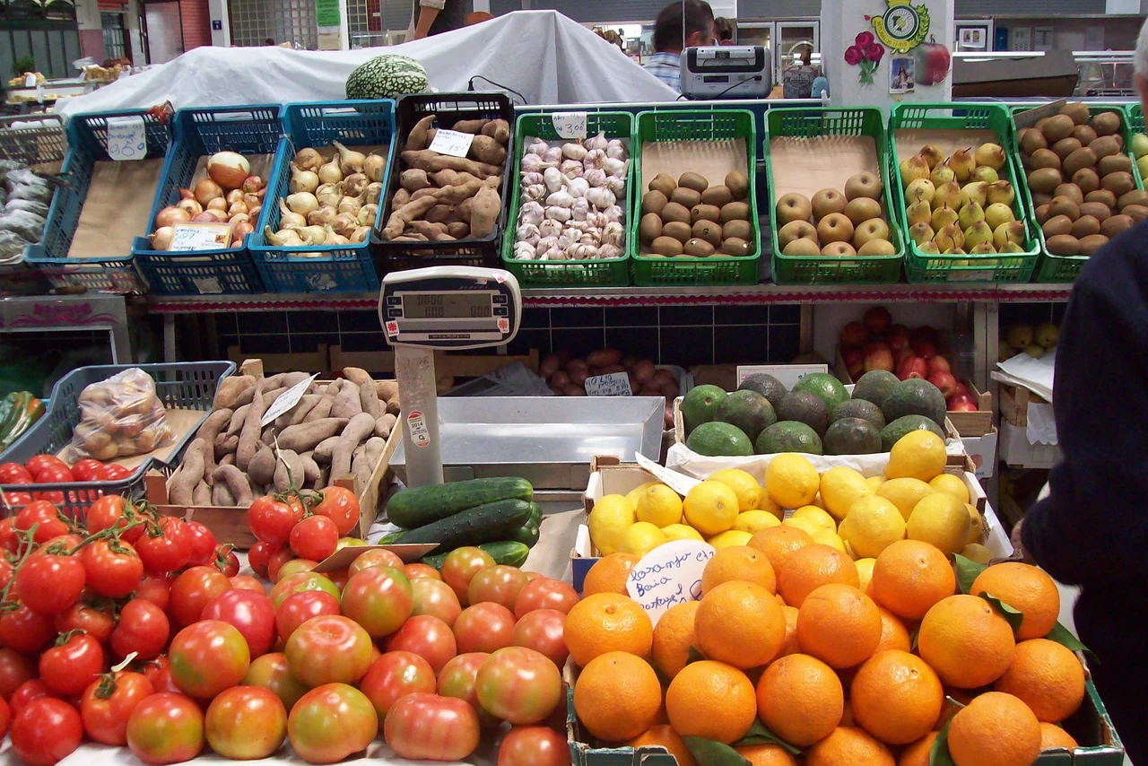
Setúbal is a city with a working waterfront. The Mercado do Livramento brings its relationship with the sea indoors: fish and shellfish share the tiled hall with fruit, vegetables, bread and cheese. It is a place to see what the surrounding water and country produce, as well as somewhere to buy lunch or provisions.
The city’s food gives that connection another form. Fried cuttlefish, choco frito, is a local signature; fish restaurants and the market make the port’s identity tangible. Beyond the market, the older streets and waterfront lead towards ferry terminals and the broader industrial estuary. Setúbal has its own life, rather than serving only as the mainland side of Tróia.
A ferry outing from Tróia is an established way to visit. For a yacht berth on the Setúbal side, arrange reception directly: the marina concession announced in 2026 should not be read as confirmation that every proposed visitor facility is already operating.
Tróia is a long sand peninsula separating the Atlantic from the Sado. Its marina faces the estuary near the northern end; the ocean beaches are across the sand. The contrast is immediate: river traffic and Setúbal on one side, dunes and a wide sea horizon on the other. Farther along the peninsula, the landscape opens towards Comporta and the low country behind it.
The Roman ruins add an unexpectedly industrial layer. Fish-salting tanks, houses and baths survive from a production centre active between the first and sixth centuries. Fish and sauces moved out from this shore through wider Roman trading networks. After Viana’s cod ship and the Douro’s wine stores, the site gives another period of the same story: coastal places connected to distant appetites.
The Sado also supports a resident bottlenose-dolphin community. A dedicated local wildlife trip can make the estuary’s channels and living water the focus of a visit; sightings remain an encounter with wild animals. Salt country, tidal shores and the meeting of river and ocean give the Sado a character that extends well beyond its beaches.
Marina and ferry connections
Atlantic Ferries runs separate passenger and vehicle services: the passenger catamaran serves the marina area, while the car ferry uses Cais Sul farther along the peninsula. Their Setúbal terminals also differ. Choose the service for the actual shore destination; the crossing is a connection between places, not a yacht-berthing arrangement.
Setúbal and Tróia face each other across the Sado; Arrábida rises to the west.
05 · The Alentejo coast
More ocean between the landfalls.
South of the Sado, the sand coast lengthens and the harbour choices thin out. Sines gathers fishing boats, yachts, an old town and a major commercial port into one coastal landscape. Farther south, beaches and cliffs lead towards Cape São Vicente.
Sines, below the castle
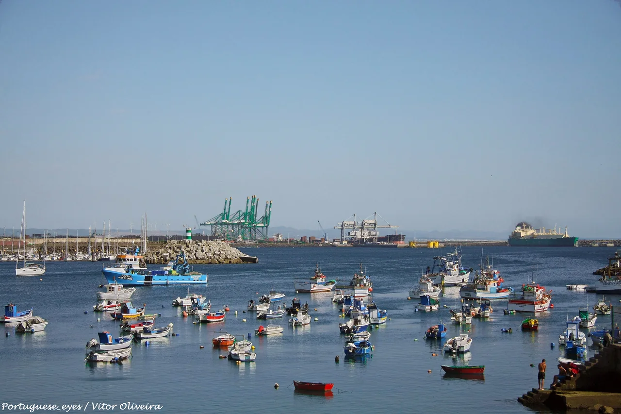
The recreational harbour sits beneath the older town, beside the curve of Vasco da Gama beach. Fishing boats bring the waterfront down to human scale; the commercial port gives it a much larger horizon. The climb into the old streets changes the view, with the castle above the bay and the sea returning between buildings.
Sines is closely associated with Vasco da Gama, whose family had links with the castle. The museum and the town’s places of memory connect this coast with the voyages to India. That history sits beside a contemporary port through which cargo still travels across oceans. The contrast is more interesting than treating Sines simply as a gap between marinas.
A meal near the fishing waterfront, a walk through the old centre and the beach below it all belong close to the harbour. South of town, São Torpes and Porto Covo introduce another shore: beaches, rocky edges and white village streets. Farther along the Alentejo, river mouths such as the Mira at Vila Nova de Milfontes are attractive places ashore, with bar and tidal conditions that make them a different proposition from a full-service yacht marina.
Fishing boats, yacht masts and the larger commercial port share the waterfront at Sines. Photographed in 2016.Photo: Vitor Oliveira
The coast south of Sines is a substantial open-water passage towards Cape São Vicente. At the cape the shoreline turns east, and the Algarve brings a new sequence of harbours, cliffs, beaches and lagoon entrances. Lagos belongs to that southern coast, with its own character and choices ashore.
Porto and Lisbon are the main airport gateways for this stretch. The onward journey depends on the harbour: Leixões and Afurada are different transfers from Porto; Cascais has its coastal railway to Lisbon; Sesimbra and Sines involve a longer road connection. Tróia adds a choice between a road approach along the peninsula and a ferry from Setúbal.
For crews chartering locally or joining a skipper, the actual embarkation marina matters more than the city name in the trip description. Porto, Cascais, Lisbon and the Sado offer different surroundings from the moment you step ashore. Confirm the handover point with the operator, then use the place chapters to see what lies around it.
The museum ships, river-boat collections, coastal towns and protected landscapes offer further ways into Portugal’s Atlantic life. Harbour and access links sit beside the places they describe, so the local detail stays connected to the visit.