Algarve, Gibraltar and Andalusia
Where the Atlantic
becomes Mediterranean.
At São Vicente, the coast turns east. Limestone cliffs give way to tidal islands, a river slips inland between Portugal and Spain, and Cádiz looks out towards the Atlantic. Beyond the Strait, Málaga’s beach boats and Almería’s desert mountains lead to the volcanic shore of Cabo de Gata.
Fishing villages, trading cities and very different waters—connected by the southern edge of Iberia.
← Spain and Portugal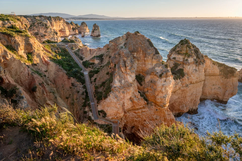
Photo: Keith Yahl
Cliffs, lagoons, a border river—and two seas.
The western Algarve and Ria Formosa belong to the Atlantic. So do the Guadiana and the broad Gulf of Cádiz. Gibraltar marks the entrance to the Mediterranean; east of the Rock, the Alboran Sea stretches between Andalusia and North Africa. The maps bring those changes into view. Portimão and Culatra are roughly 35 nautical miles apart; Gibraltar and Málaga about 60 nautical miles. Cádiz Bay, by contrast, brings several harbour towns around one shared body of water.
Coastline: Natural Earth · public domain. Maps: sol.blue · CC BY 4.0.
Western Algarve · São Vicente to the Arade
The corner where Portugal turns east.
São Vicente is an abrupt end to the west coast: a lighthouse above high cliffs, open Atlantic water and the turn towards Sagres. Around the corner, the southern shore opens into bays and beaches. The change in orientation matters aboard: the coast can offer shelter from the prevailing northerly wind, while Atlantic swell still wraps around the headlands. This is the Algarve’s ocean edge, before the lagoons begin.
The fortress at Sagres gives that geography a human scale. Its walls stand on a broad promontory with the sea on three sides; the old church, cistern and huge compass rose sit inside. The place is associated with Prince Henry and Portuguese maritime expansion. The physical setting tells its own story of lookout, defence and departure, without needing the legend of a formal navigation school.
Lagos: cliffs outside, history inside.
Ponta da Piedade is the Algarve in close detail: yellow limestone stacks, arches and narrow cuts where light and water change the rock’s colour. From the paths above, the shape of the coast is easier to read than from a beach. A local boat excursion offers another perspective, subject to sea conditions; the caves are busy excursion water, separate from a cruising yacht’s berth in Lagos.
Behind the waterfront, Lagos has lanes, tiled façades and small squares that reward walking away from the marina restaurants. Its seafaring past also includes enslavement. The municipal Rota da Escravatura museum confronts the arrival and sale of enslaved Africans in fifteenth-century Lagos. It belongs beside the monuments to exploration: both are part of how this port connected with the wider world.
Portimão and Ferragudo: the river’s working shore.
The Arade broadens the scene. Portimão’s marina lies by Praia da Rocha on the western bank; Ferragudo’s white houses climb the opposite side. Upriver, the Museu de Portimão occupies a former fish-canning factory. The restored working spaces connect the catch on the quay with the labour of cleaning, packing and selling it. Sardines here are a town’s industrial history as well as lunch.
Two useful harbours, with different surroundings
Eastern Algarve · lagoon and barrier islands
Olhão and Culatra: a coast made of channels.
Eastward, the cliffs fall away. The Ria Formosa is a long mosaic of tidal channels, salt marsh, shellfish beds and sandy islands, extending for roughly 60 km along the coast. There are two distinct shores: the towns and working quays facing the lagoon, and the islands’ ocean beaches beyond the dunes. The tide exposes mud and sand, changes the colour of the water and sets the working rhythm of the ria.
Olhão’s market faces the water.
Olhão makes sense from its waterfront. The paired red-brick market buildings divide fish from fruit and vegetables; behind them, lanes run into the old fishing quarter. Look upwards for the flat roof terraces called açoteias, a stepped roofscape quite different from Lagos. Fish processing and trade also left more elaborate houses, tiled fronts and wrought-iron balconies. The town has a working identity beyond its restaurants.
The market connects directly with what lies outside: clams and other bivalves from the lagoon, fish from the sea, and produce from inland. A plate of clams or razor-clam rice is another way into the geography. Farther east, Tavira’s riverfront and Cacela Velha’s elevated view over sand and water offer shore excursions; neither should be mistaken for an interchangeable deep-water yacht harbour.
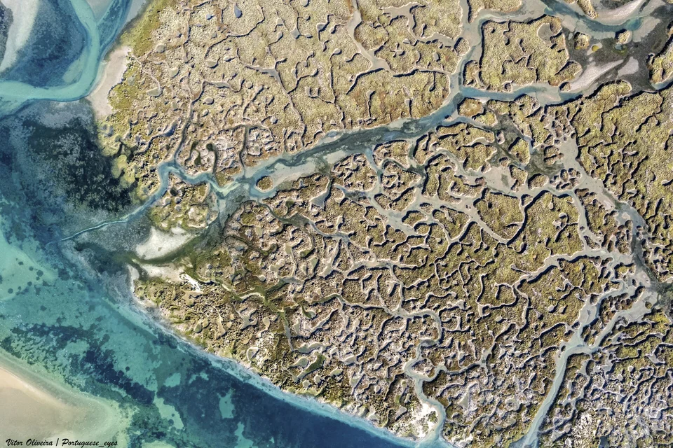
Photo: Vitor Oliveira
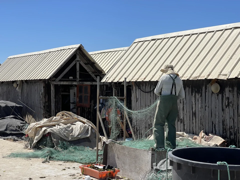
Photo: tjabeljan
Culatra, on the inhabited side of the island.
Culatra is more than a strip of sand between boat and beach. Fishing boats, gear, low houses and everyday village services occupy the lagoon side. Paths continue across the island towards the Atlantic beach, where the open horizon replaces the enclosed water of the ria. The contrast is the pleasure: a settlement with work to do, then dunes and a long ocean shore. Farol, around the lighthouse, is another settlement on the same island.
Reaching the town and islands
Regular passenger boats from Olhão serve Culatra and Armona, so the island visit can be independent of a yacht move. The ria is a protected wetland with specific navigation and anchoring zones; a quiet patch of lagoon is not automatically an available anchorage. Ria Formosa’s places and nature and ICNF’s protected-area information explain its setting.
Guadiana · the Portuguese–Spanish border
Turn inland between two countries.
At the eastern end of the Algarve, the Guadiana opens a different possibility. Vila Real de Santo António stands on the Portuguese bank near the mouth, its ordered streets and waterfront facing Spain. Ayamonte rises opposite, with a less regular pattern of streets around its harbour. The border runs down the water between them; it is visible in the languages, town plans and names on the banks.
Upstream, the broad estuary contracts into bends between low hills. Sea horizon gives way to riverbank, reeds, scattered houses and the next turn of the channel. This remains tidal water. The international road bridge above the lower towns is a real limit for a sailing boat: mast clearance, as well as draught and the state of the entrance, determines whether the inland river is accessible.
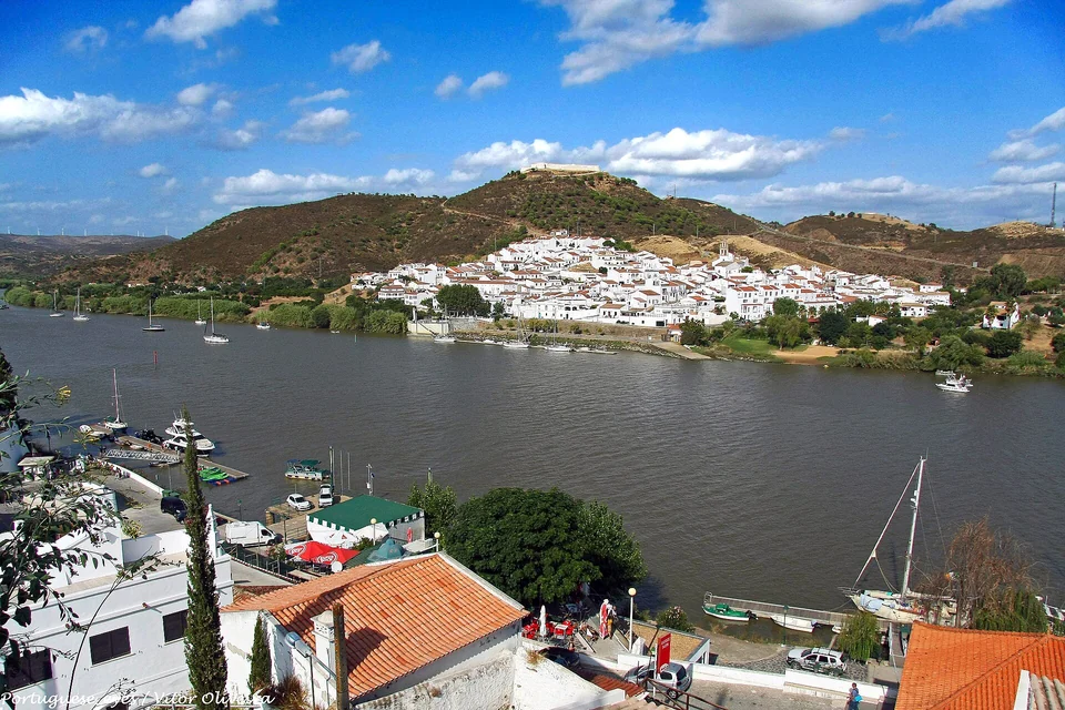
Photo: Vitor Oliveira
Alcoutim and Sanlúcar de Guadiana face each other farther inland, white villages on opposite slopes with the river as their shared square. Alcoutim’s castle looks over the waterfront; Sanlúcar’s houses climb towards its own hilltop fort. A short crossing changes country and local clock time. Portugal is one hour behind mainland Spain, a small detail that matters when arranging a boat crossing or a meal.
River trade and border life give the villages their substance. Boats once carried the interior’s products towards the coast, waiting on the tide; the border also created a trade in smuggled everyday goods. Alcoutim’s local history names coffee, sugar, flour and tobacco among them. Castle viewpoints, steep lanes and a table near the landing put that history in a setting small enough to walk through. The river is the destination here, not merely a passage to another port.
The lower ports and the upper river
The two harbour offices advise on visitor space and the relevant river conditions.
The Instituto Hidrográfico publishes river charts, including the international bridge–Alcoutim reach. Use their bridge information with the actual water level and the Vila Real captaincy’s current notices; a single quoted bridge height cannot establish mast clearance. Alcoutim and Sanlúcar are also reachable by road, keeping this inland visit open to crews whose yacht remains near the coast.
Gulf of Cádiz · bay towns and the tuna coast
A city almost surrounded by sea.
Cádiz occupies a narrow peninsula with Atlantic water on one side and the bay on the other. From the sea, its domes and pale buildings seem to rise directly from the water. Ashore, streets repeatedly lead back to a seawall, a beach or a view across the port. Its compact old centre is a place for walking between maritime history and ordinary city life.
The history is unusually deep: Phoenician Gadir, Roman trade, Atlantic commerce and the constitution of 1812 all left traces. Merchant watchtowers once looked for arriving ships; fortifications guarded the wealth they brought. Torre Tavira gives the roofscape a clear shape, while the Gadir archaeological site takes the story below street level. The sea-facing defences and La Caleta beach make an entirely different walk from the commercial harbour front.
The Mercado Central brings the city back to the present. Fish stalls, shellfish and the food counters around the market make the relationship with the water tangible. Nearby La Viña has a close connection with fishing, carnival and the beach. Fried fish, a small glass of sherry and the walk towards La Caleta belong to the same city as the cathedral and the merchant houses; the pleasure lies in their proximity.
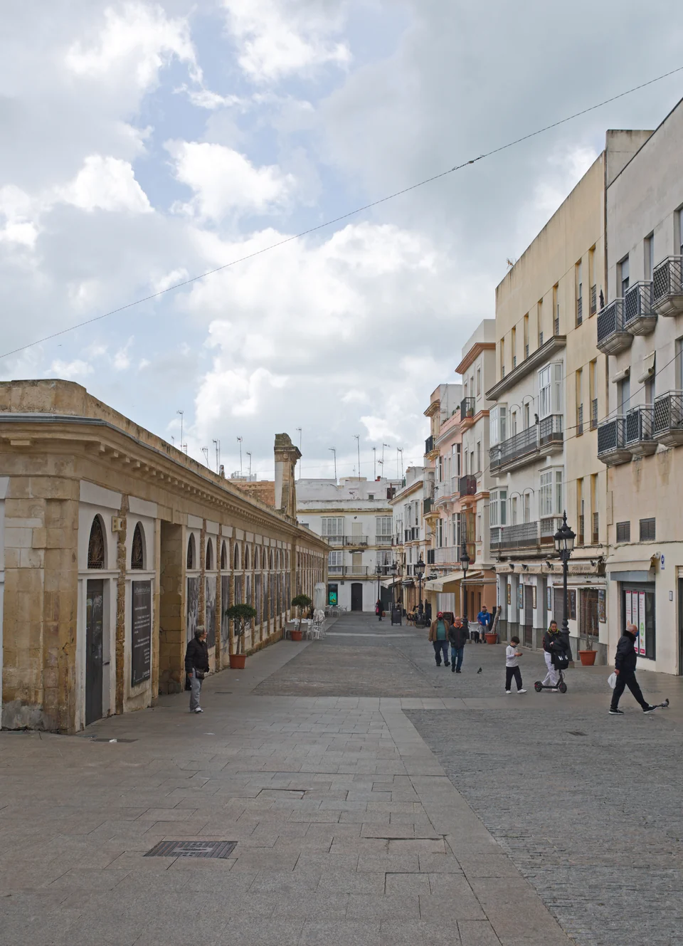
Photo: Ymblanter
Across the bay: Rota and El Puerto.
Cádiz Bay is larger than its headline city. Rota combines a harbour beside the old town with Atlantic beaches. El Puerto de Santa María brings the Guadalete river, sherry bodegas and a different trading history into the picture. Public catamarans connect both towns with Cádiz. They make it possible to change the view across the bay while leaving the yacht in its berth; wind can interrupt those services too.
Harbours around the bay
APPA operates both and publishes temporary-berth requests and bathymetry, including a March 2026 survey for Rota.
Barbate: following the tuna.
South towards Trafalgar and Barbate, the coast opens out again. Tuna links the fishing ports to the Strait: almadraba is the seasonal fixed-net fishery that intercepts bluefin tuna on their migration. Barbate’s port, preserved-fish traditions and restaurants give the subject more depth than a single tuna dish. The remains of the almadraba complex at Zahara de los Atunes add another shore stop to that story.
Seasonal tuna nets occupy water off this coast: their current marked positions affect a passage.
Tarifa, the Strait and Gibraltar
Africa comes into the picture.
At Tarifa the geography tightens. The Moroccan mountains stand across the Strait; ferries cross between continents while merchant ships stream along it. The water is a connection and a boundary at once. Gibraltar’s limestone Rock then rises at the eastern entrance, unmistakably different from the low Atlantic coast behind it. From its heights, the scale of the meeting between Europe and Africa becomes visible.
The Strait has its own weather language. Levante is the easterly wind; Poniente the westerly. The narrow gap and surrounding relief can accelerate the flow, so conditions near Tarifa and the Rock may differ sharply from the quieter coast beyond. Atlantic surface water generally enters the Mediterranean, but tidal streams and local countercurrents complicate a simple eastward-current picture. The AEMET Strait forecast is the useful local reference.
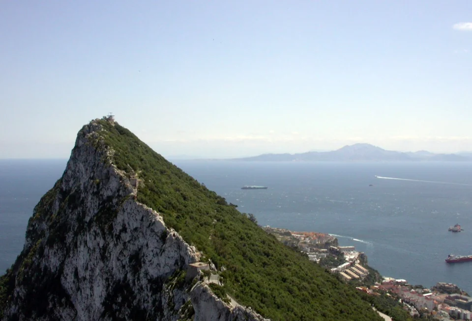
Photo: leonardo4it
Gibraltar deserves time ashore for more than the summit photograph. Main Street and the lower town hold a mixture of British institutions and Mediterranean street life; fortifications and tunnels reveal the Rock’s strategic role. On the eastern side, Gorham’s Cave Complex shifts the timescale again, to Neanderthal occupation. Its accessible viewing platform explains the site; visits to the caves themselves are restricted and arranged through the museum.
The Mediterranean Steps follow the Rock’s steep eastern flank, with views across towards North Africa. This is an exposed, strenuous walk, distinct from a gentle town circuit. The Nature Reserve’s access information matters because closures can follow rockfall. For a less demanding encounter with the prehistoric coast, use the Gorham’s Cave viewing platform on Europa Advance Road.
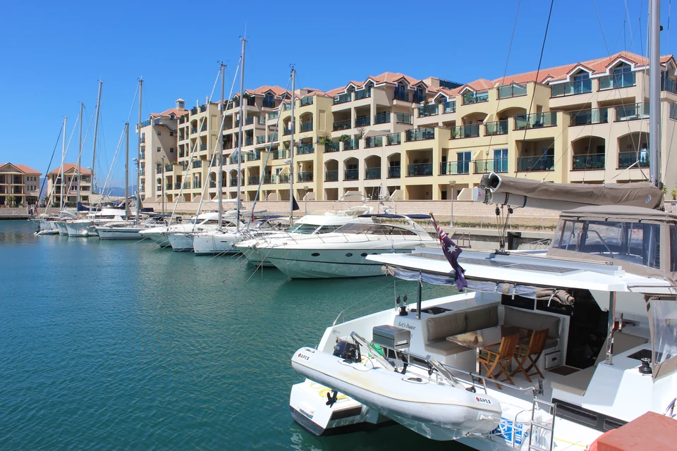
Photo: Uhooep
Choose the harbour side as well as the berth
Gibraltar Port Authority states that visiting yachts require port, customs and immigration clearance; marina staff can handle this for yachts without an agent. A Spanish marina booking does not cover a yacht arrival in Gibraltar. Current yacht-clearance procedure.
Orcas in the Gulf and Strait. Interactions with yachts remain a material local passage issue, especially for sailing vessels. MITECO publishes current advice and maps; the pattern changes, so use its Iberian orca guidance when deciding where and when to pass.
Costa del Sol · Málaga and its beach neighbourhoods
A trading city, with boats on the beach.
East of Gibraltar the shore becomes more densely built: apartment blocks, beaches, marina basins and towns backed by mountains. The Costa del Sol has many convenient places to berth, but its most absorbing city story is Málaga. The port, Roman theatre, Alcazaba and nineteenth-century commercial streets sit close enough together to show successive layers of a city formed by trade.
From the waterfront, the Alcazaba rises above the theatre, with courtyards and views back across the harbour. The old centre continues into shaded lanes, the cathedral quarter and the Mercado de Atarazanas, whose great entrance recalls an earlier shipyard. The Picasso museum adds an intimate cultural visit inside the city fabric. Málaga is much more rewarding when these places are connected on foot than when reduced to a museum transfer from a distant marina.
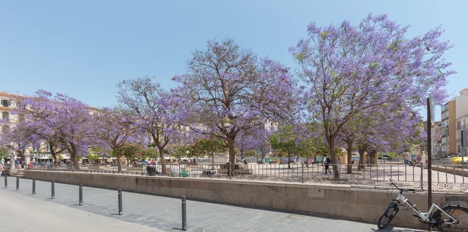
Photo: Diego Delso
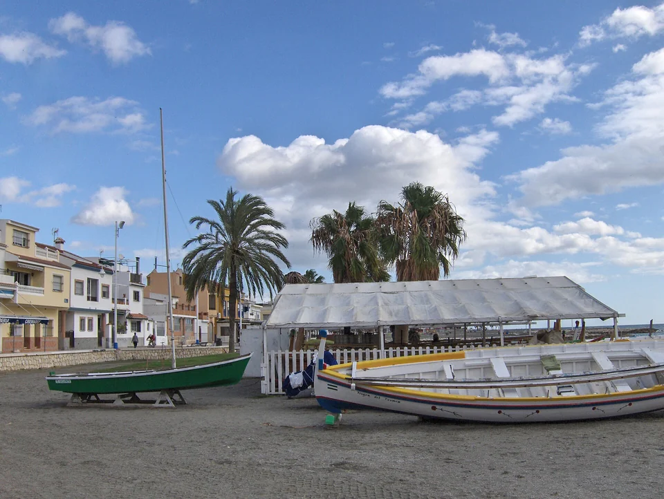
Photo: Tyk
East along the shore, Pedregalejo and El Palo keep a different maritime scale. Low waterfront houses and small beaches replace the monumental port front. The traditional jábega, with its high curved bow, survives through rowing and boatbuilding culture. Astilleros Nereo documents that living wooden-boat tradition beside Pedregalejo beach.
The food follows the boats. Espetos are sardines threaded onto skewers and cooked beside a wood fire, often in a sand-filled boat outside a beach restaurant. Watching the cook turn the fish towards the heat explains more than a menu translation. Along this shore, a simple fish lunch, the beach and the boats are parts of the same visit. Pedregalejo’s promenade has been undergoing redevelopment in 2026, so access and terraces may differ from older photographs.
A coastal berth and a city visit
The airport’s C1 train serves Málaga and Benalmádena–Arroyo de la Miel; the latter station is uphill from the marina.
Maro–Cerro Gordo · Costa Tropical · Almería
Mountains come down to the water.
Maro–Cerro Gordo: an interruption in the built coast.
Beyond Nerja, the cliffs of Maro–Cerro Gordo interrupt the long developed shore. Steep slopes, small coves and clearer views of the mountain backdrop change the scale again. The marine protected area is important to the character of the place: anchoring is subject to authorisation and designated zones. A cove’s appearance alone does not establish permission to stop there. The Junta’s protected-area guidance sets out the local process.
The Costa Tropical, between coast and mountains.
Around La Herradura and Almuñécar, headlands divide the coast into more intimate bays. Inland slopes carry subtropical orchards, while higher mountains remain close behind. Farther east, the working port of Motril opens a larger coastal plain. The landscape does not become uniformly wild: resort towns, cultivation, industry and steep ground alternate all the way towards Almería.
Almería: fortress, port and iron.
Almería brings the city back, beneath the long walls of the Alcazaba. Its tenth-century foundation as a port and subsequent trading importance make the fortress more than an isolated hilltop monument. From above, the connection between protected town, harbour and open sea is plain. Below, the old quarter, cathedral and tapas bars offer a compact change from beach towns and marina promenades.
At the waterfront, the Cable Inglés tells a later story. This great iron ore-loading structure joined railway to ship, allowing mineral cargo to descend into the holds below. Its elevated walkway now gives a view over the port and city. The fortress and the ironwork make a compelling pair: two eras in which Almería’s importance came from what moved across the water. Almería’s port history · Visiting the Cable Inglés.
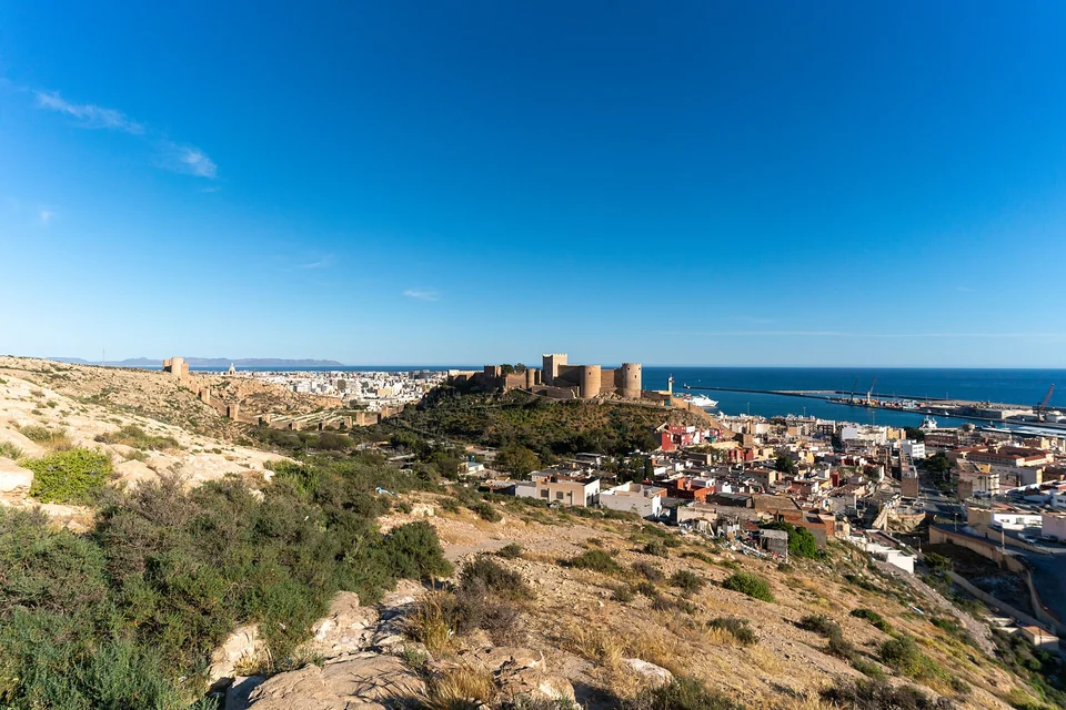
Photo: Paul Colin Hennig / firstdorsal.eu
The concentration of greenhouses behind this stretch of coast is also part of the view: an intensively cultivated landscape before Cabo de Gata’s protected headlands.
Cabo de Gata–Níjar Natural Park and UNESCO Global Geopark
Rock, salt and a different Mediterranean.
Cabo de Gata is a striking finish to this coast. Pale and dark volcanic rock breaks into headlands, stacks and small bays; dry hills rise behind the water, with little of the continuous building seen farther west. At the Arrecife de las Sirenas, sharp rocks stand below the lighthouse. The colour and texture of the shore make the geological change visible before any museum explains it.
This is an ancient volcanic landscape, part of a much larger complex extending beneath the Alboran Sea. Lava formations, domes and mineral deposits shaped both the coast and its working history. The UNESCO geopark connects that geology with fishing, salt production, water storage and the settlements of an unusually dry landscape.
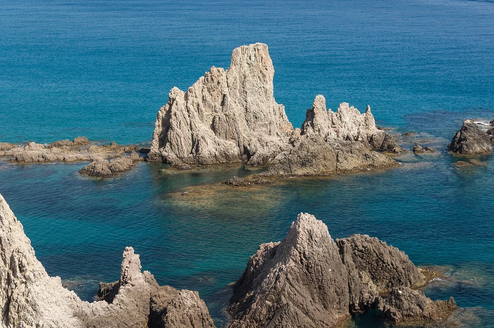
Photo: Jebulon
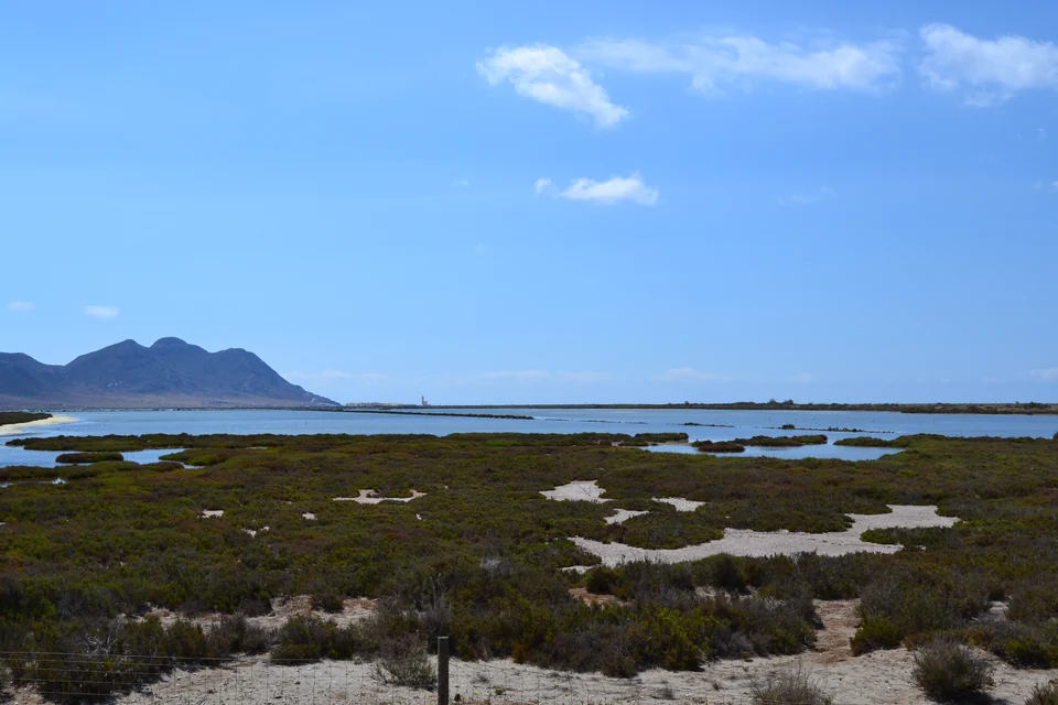
Photo: antonio almecija
On the western approach, the salt flats form a horizontal counterpoint to the hills: shallow basins, narrow embankments and the church beside the coastal road. Salt production and bird habitat share the same ground. The wetland invites a slow look from the public viewing places, while the long beach and the fishing settlement of San Miguel de Cabo de Gata keep the sea close at hand.
San José and the villages beyond the cape.
San José has the park’s best-known small leisure harbour, a beach and a village spread around its bay. Inland and along the coast, the choices become more varied: the broad sandy settings of Genoveses and Mónsul; Isleta del Moro’s fishing boats and compact headland; Las Negras beneath its dark coastal hill. These are places with different shore access, exposure and character, rather than a continuous line of interchangeable anchorages.
Rodalquilar takes the story inland. Former gold-processing buildings stand in a volcanic valley, and the Casa de los Volcanes explains the geology and mining. Nearby, the El Albardinal botanical garden introduces plants adapted to scarce water. Cisterns, wells and windmills elsewhere in the park show the same resourcefulness at a domestic scale. The apparently bare hills are a worked and inhabited landscape.
Harbour, beach and protected water are different choices
Shore visits from Almería or other coastal accommodation remain worthwhile independently of a yacht stop.
The park’s coastal zones and the national offshore marine reserve have separate rules. In the national reserve, anchoring is prohibited except for specified emergencies; elsewhere, park zoning and seasonal swimming areas still apply. Posidonia seagrass adds another reason to distinguish seabed habitats. National marine-reserve rules · Natural-park zoning · Seasonal coastal restrictions.
Arriving at the coast.
Faro serves the Algarve; its airport lists Aerobus links to Portimão and Lagos, while Olhão needs a different onward connection. Jerez has rail connections towards Cádiz. Gibraltar is convenient for the Rock and nearby Spanish coast, with the onward transfer depending on the chosen side of the border. Málaga has the C1 railway towards the city and western coastal towns. Almería gives road access to the eastern coast and Cabo de Gata.
Faro airport transport · Cádiz Bay transport · Gibraltar airport · Almería airport taxis.
Beyond this coast.
West of São Vicente, Portugal’s Atlantic coast continues towards Lisbon and Porto. East of Cabo de Gata, Cartagena belongs to a different stretch of coast in Murcia. For the practical business of moving a boat between regions, continue to Deliveries; for nearby cruising areas, return to Spain and Portugal.
Photographs, maps and local sources
Photo credits and licences are beside each image. The practical and cultural links throughout the guide lead to local operators, museums, tourism bodies and authorities. Harbour information and access sources were reviewed in September 2026; current local notices remain linked beside the places they affect.
An earlier glimpse of Culatra
Sailing SV Cordelia’s 2019 Culatra film records a personal visit, with island and dinghy scenes. It is a glimpse of life there at that time.