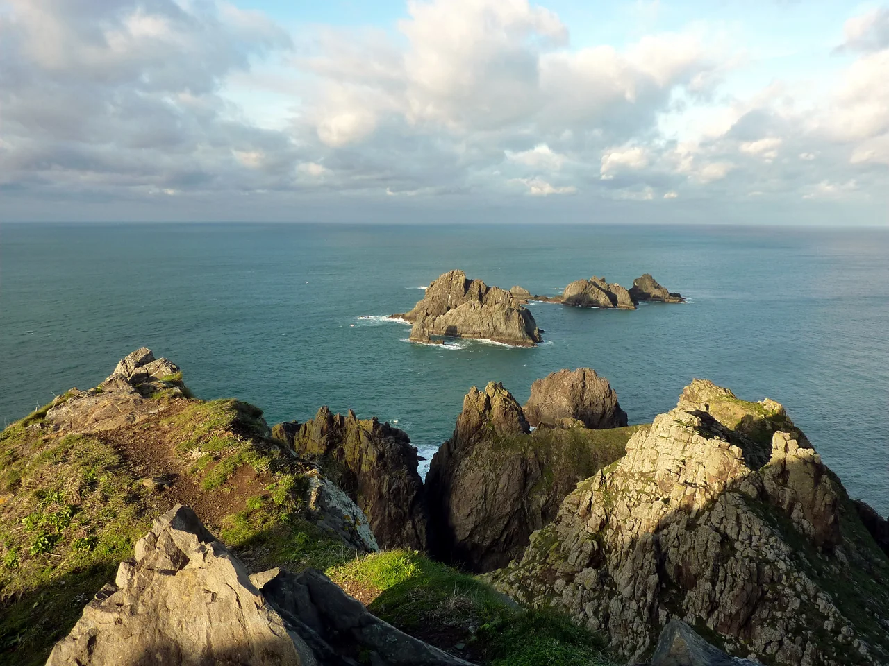
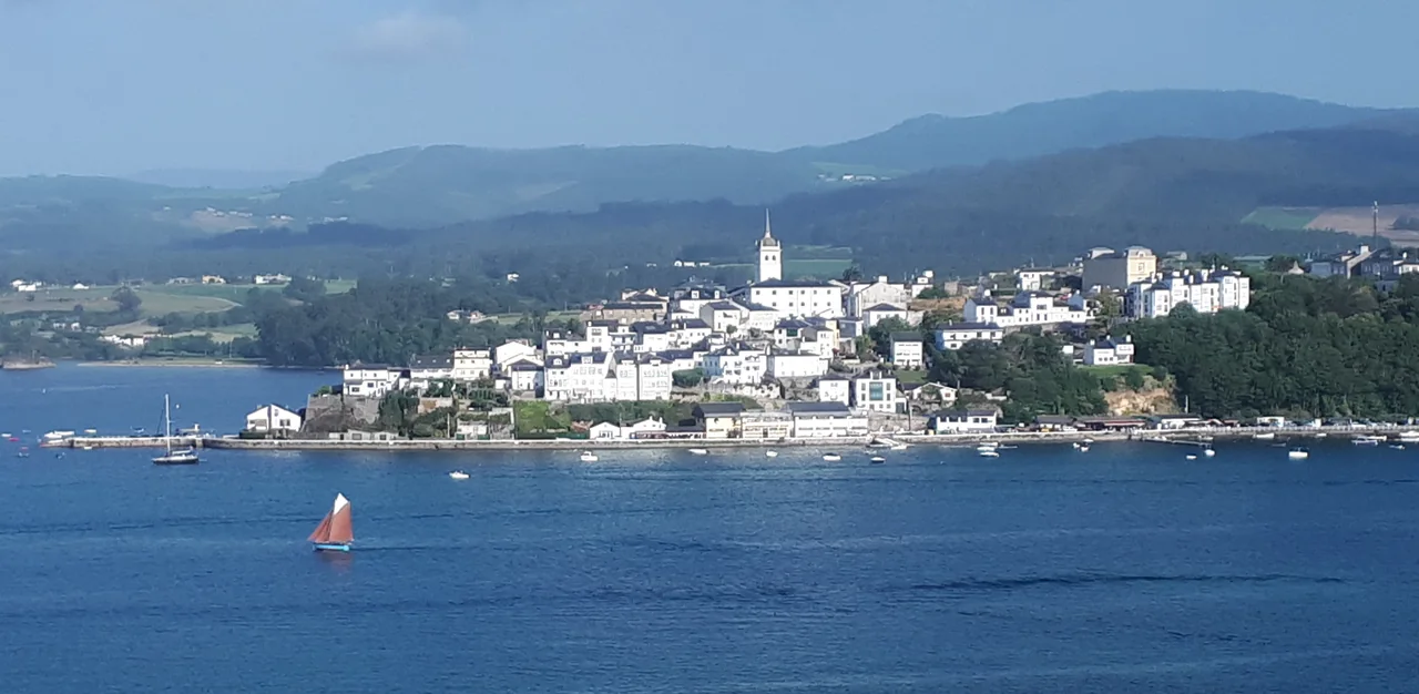
From the sea, northern Galicia rises in green hills, dark cliffs and lighthouse headlands. Turn into a ría and the coast opens inward: fishing boats, waterfront towns and beaches appear between the slopes. Sailing here brings those two worlds together.
A Coruña offers a landfall beneath a Roman lighthouse still in use. Beyond it, the sea branches into smaller cruising waters, enters the great naval harbour of Ferrol and reaches east towards the towns of the Cantabrian coast. There is far more here than a stop after Biscay.
A ría is a river valley flooded by the sea. In northern Galicia, these inlets turn an ocean-facing coast into a succession of places worth entering: a city harbour, a branching gulf, a fishing town beneath high hills. Their shores are as much the reason to come as the sailing between them.
Medieval streets, working fishing ports and a ría shared with Asturias.
This guide brings together the Costa da Morte around Camariñas and Muxía, the Golfo Ártabro and the Rías Altas continuing east to Ribadeo. At Estaca de Bares, the northernmost point of the Iberian Peninsula, the coastline turns towards the Cantabrian shore. Farther south, beyond Fisterra, the Rías Baixas offer a different, broader world of rías and islands.
01 · Camariñas and Muxía
Inside the Costa da Morte
Cabo Vilán rises above the outer coast; the sanctuary at Muxía stands among rocks on the other side of the entrance. Between them the sea reaches into a ría of fishing harbours, wooded slopes and quieter shores. The contrast gives this corner of Galicia much of its appeal.
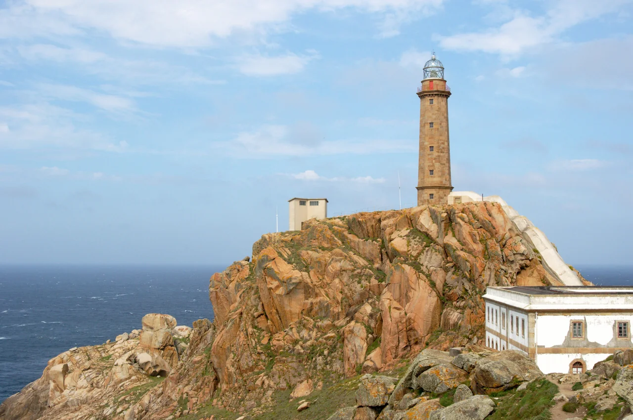
Cabo Vilán’s lighthouse rises above the outer coast; the ría and its fishing towns lie beyond the headland.Photo: Mussklprozz
The lighthouse at Cabo Vilán stands on a rocky height above the breaking water. It began operating in 1896, the first electrically powered lighthouse in Spain. The loss of HMS Serpent nearby in 1890 had strengthened the case for a better light; the English Cemetery on the coast preserves that connection. From a passing yacht, the setting explains why the beacon mattered long before its history is read ashore.
Camariñas is the natural town from which to explore this stretch of coast by land. The lighthouse has an exhibition space, and the coastal track towards the English Cemetery follows a landscape of bare rock, dunes and Atlantic-facing beaches. The full Camelle–Camariñas walking route is 26 km; visiting the lighthouse or a shorter section of coast is a separate, more compact outing. Cabo Vilán visitor information.
Camariñas: fishing boats and bobbin lace
Inside the ría, Camariñas brings the scale down to a working fishing town. Its other great tradition is encaixe, bobbin lace: threads crossed and twisted by the palilleiras, whose craft remains part of the town’s identity. The lace museum gives the work context, while the annual lace fair brings traditional techniques into contemporary design. It is a distinctive reason to step away from the harbour, with the fishing waterfront still close at hand.
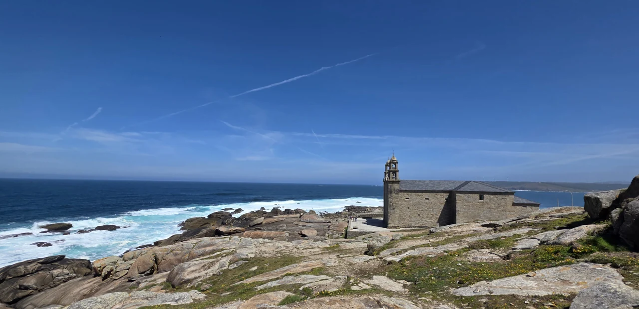
Across the water, Muxía has a different centre of gravity. The town’s peninsula ends at Virxe da Barca, a stone sanctuary set beside enormous rocks and the open Atlantic. The Fisterra–Muxía continuation of the Camino brings walkers here after Santiago. A yacht arrives from the water towards which those pilgrims have been walking: the meeting of the two journeys gives the place a particular resonance.
Local religious tradition tells of the Virgin arriving in a stone boat to encourage Saint James. Rocks around the sanctuary are associated with the vessel’s hull and sail. The legend belongs to a landscape where the sea is physically close: surf can sweep the rock platforms, and the exposed shore is a different environment from the marina inside the town’s shelter.
The food also belongs to this coast. Percebes, or goose barnacles, grow on wave-beaten rocks; harvesting them brings the percebeiros to the most exposed edge of land and sea. On a plate in town, they connect the fishing community to the headlands outside. Fish and shellfish here are part of the working landscape, alongside the small boats and harbour quays.
The sanctuary is a walk through town to the outer point; access to the rocks depends on the sea conditions.
For a boat arriving across Biscay, A Coruña can be the first close encounter with Spain. It is an unusually satisfying arrival: a lighthouse with Roman foundations, a proper maritime city and a harbour from which the streets, markets and waterfront are immediately part of the visit.
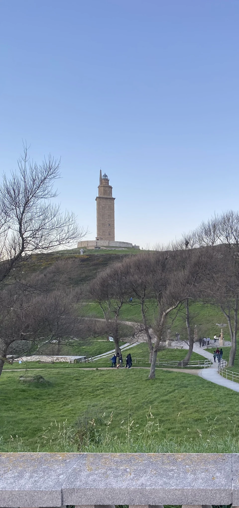
The Tower of Hercules on a January day · 14 January 2022.Photo: Rook48
The Romans built the Tower of Hercules in the late first century. Its ancient core survives inside the later exterior, and the tower still serves as a lighthouse. That continuity is what makes it remarkable from a yacht: an ancient maritime landmark still belongs to the present-day coast.
Ashore, the paths around its headland reveal the Atlantic side of the city, with grass, rocks and open water beyond the buildings. The sculpture park extends the visit outside the tower itself. Climbing the lighthouse offers another perspective, but admissions are limited and strong winds can close the tower or terrace. The surrounding headland and a tower visit are separate possibilities.
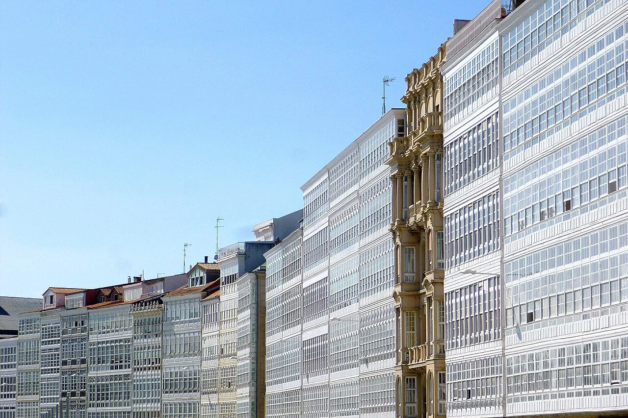
The long rows of glazed galerías along Avenida da Mariña give A Coruña its familiar waterfront face. Behind them, the broad space of María Pita square leads towards the older city’s narrower streets. The harbour is the front of the city, and the change from pontoon to urban life is one of the pleasures of staying here.
A Coruña occupies a peninsula, so the harbour side and the ocean-facing shore have distinct characters. The waterfront around the old town leads towards San Antón’s castle and archaeological museum; across the city, the beaches of Orzán and Riazor face the open bay. These are different parts of a living city, with museums, everyday shopping and places to eat connected by its streets and seafront.
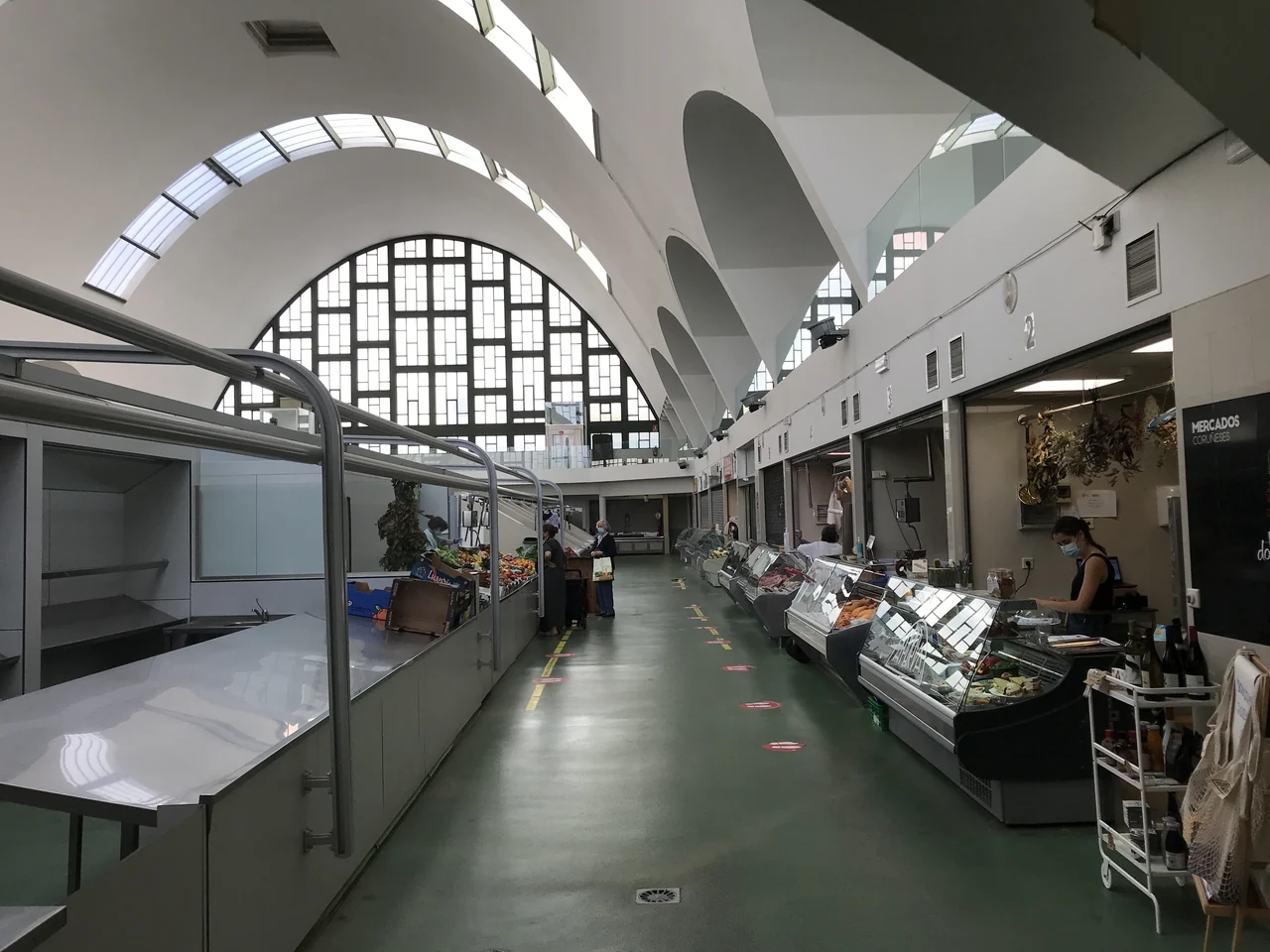
Inside San Agustín market hall · 23 August 2021.Photo: Waltie
A lonxa is a fish auction, where the catch begins its journey from vessel to wholesaler, fishmonger and kitchen. A Coruña’s fishing industry gives substance to the seafood on its menus: hake, monkfish, octopus and shellfish belong to a commercial harbour economy as well as to a meal ashore.
San Agustín and Plaza de Lugo are public food markets where that connection becomes accessible to a visitor. Fish stalls make provisioning part of discovering the place, alongside vegetables, bread and other ingredients for the boat. The working auction is a different operation; a visit to a market hall does not depend on obtaining access to the industrial port.
Long before leisure yachts crossed Biscay, pilgrims arrived by ship from Britain, Ireland, Flanders and Scandinavia. A Coruña and Ferrol were important landing places before the walk to Santiago, in the tradition now represented by the Camino Inglés. The tower was a landfall mark for those sea travellers too. Arriving here by boat joins a much older relationship between Galicia and northern Europe.
MC Varadero at Faro de Oza is the technical yard farther inside the bay, not another name for either city marina.
A Coruña is one doorway into a much larger arrangement of water. The rías of A Coruña, Betanzos, Ares and Ferrol branch into the land around the Golfo Ártabro. This is where a coastal passage can become local exploration, with smaller towns and beaches across the water from the two cities.
The appeal is the density of different shores. A city marina, the fishing streets above Sada, Ares’s beach and the compact waterfront at Redes belong to neighbouring waters. Moving between them changes the experience ashore without requiring another passage around the great northern capes. The gulf’s inner branches are more enclosed than its mouth, although exposure still depends on the particular shore and wind.
Sada offers a smaller-town stay than A Coruña. In the fishing quarters of Fontán and A Tenencia, narrow streets and houses with glazed galleries keep the waterfront close, even as the ground rises above it. Fontán’s relationship with the harbour is especially clear: boats below, older streets above, and the wider ría beyond.
The Terraza building adds a different note along Sada’s promenade, with its light structure and coloured glazing. The interest here lies in the town’s mix of fishing history, seaside architecture and ordinary life around the harbour. It makes an appealing shore visit without needing the scale or monument list of a city.
Both the town waterfront and Fontán are part of the local shore visit.
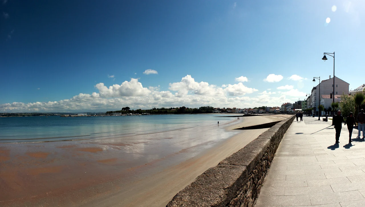
Ares spreads along a curving beach, with the promenade joining the town to the harbour. It is a place where a stay aboard and time ashore remain closely connected: the beach, streets and places to eat all belong to the same waterfront. The marina provides a practical point of contact with the ría’s smaller communities.
Redes is more compact. Houses crowd the water around a little fishing harbour; wooden frames beside the shore recall the nets hung out to dry, the craft that gave the village its name. Home, quay and boat sit close together here. It rewards a shore outing from elsewhere in the gulf, although visitor yacht berthing is not established.
Where the salt water gives way to rivers
Pontedeume and Betanzos add another layer to the gulf. Pontedeume stands at the Eume’s mouth, with an old town and a connection inland towards the wooded valley of the Fragas do Eume. Betanzos lies farther up its own river system, a town of medieval streets and churches beyond the broad tidal water. These are worthwhile land excursions from a coastal berth. Their position at the head of a ría does not make them straightforward destinations for a deep-keel yacht.
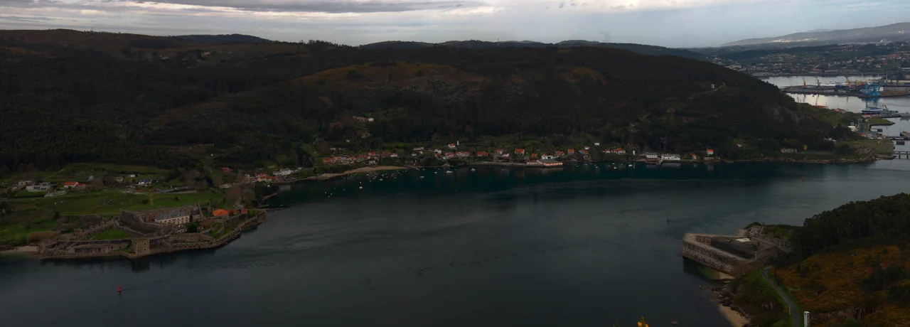
Ferrol’s geography tells its history before the yacht reaches the town. The entrance narrows between fortified shores, then opens into a large inner harbour. A defended gateway and ample water behind it made this a place to build, repair and protect a fleet.
San Felipe and A Palma face one another across Ferrol’s entrance, with the wider harbour opening behind them.Photo: Xosema
The castles face one another across the entrance: San Felipe on the northern shore, A Palma opposite. Seen together, they explain the strategic value of the channel more directly than a museum plan could. Visiting San Felipe ashore adds the scale of its walls and gun positions to the view from the water. The military and commercial installations farther inside remain working parts of the port.
The eighteenth-century naval arsenal reshaped Ferrol. Workshops, docks and shipbuilding needed a city around them, and A Magdalena was laid out in a regular grid that contrasts with the older waterfront. Its streets, squares and glazed façades belong to the same history as the naval structures below. Ferrol’s interest is the relationship between those parts: harbour, industry and planned urban life.
Exponav, the shipbuilding museum, gives that industrial story a tangible focus. The Naval Museum adds the history of the fleet. Arsenal visits have their own organised access arrangements; the public museums and a walk through A Magdalena are more straightforward ways to understand the city without assuming access to an active naval site.
Curuxeiras: where the sea journey became a walk
At the older docks of Curuxeiras, Ferrol’s naval story meets another history. This waterfront is the starting place of the Camino Inglés from Ferrol, recalling pilgrims who arrived by ship before continuing inland towards Santiago. Fishing boats, pleasure craft, pilgrimage markers and the nearby naval landscape share a small stretch of shore. The city’s maritime life is still visible, rather than confined to its museums.
Beyond the Ártabro waters, high ground presses towards the sea. The inlets are separated by substantial headlands, and the contrast between sailing outside and exploring inside becomes stronger. Cedeira, Ortigueira and O Barqueiro each reveal a different landscape behind the outer coast.
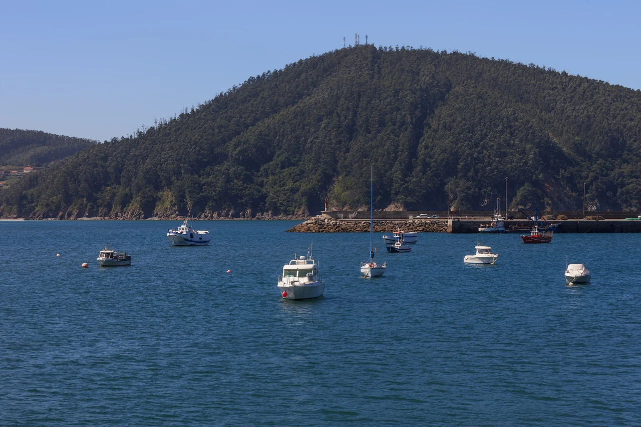
Boats in Ría de Cedeira · 31 August 2014.Photo: Luis Miguel Bugallo Sánchez (Lmbuga)
Cedeira sits beside the mouth of the small Condomiñas river, with an old quarter, fishing harbour and a promenade towards Magdalena beach. The town is on the inside of the ría, where the scale becomes domestic again after the outer coast. Across the water are wooded slopes; beyond the town rise the hills that end at the Capelada cliffs.
Fishing is central to the town’s life. The fleet and its quays are part of a working port, while the beach and old streets offer a different shore experience close by. Staying at anchor here gives a particularly clear view of the ría as an inhabited place, with the town gathered around its sheltered water.
Above the sea: Vixía Herbeira and Santo André
The Serra da Capelada gives this stretch of coast its extraordinary height. Around Vixía Herbeira, the ground rises more than 600 metres above the sea. From offshore the cliffs form an immense edge to the land; from the viewpoints above, the view reaches back over the water a yacht has crossed. Cedeira is a useful starting place for a land excursion into these hills, where distances and climbing make transport worthwhile.
Santo André de Teixido adds a very Galician human story to the landscape. The small pilgrimage village stands high above the coast. Local tradition says that those who fail to visit in life must come after death; other customs gather around springs, stones and the herba de namorar, the “love herb”. These are living traditions attached to a specific place, encountered among steep green slopes and the open Atlantic.
At Cabo Ortegal the lighthouse looks towards the sharp rocks of Os Aguillóns. This headland is part of a UNESCO Global Geopark whose rocks record the collision of ancient continents. Some were once more than 70 km below the surface, in the Earth’s upper mantle. The dark rocks visible above the water carry evidence of a landscape formed long before the present Atlantic coastline.
Cariño provides the shore connection to the cape. Its fishing port and houses sit inside the ría, while the road to the lighthouse climbs towards the exposed point. A land visit gives a close view of the rocks and lighthouse without turning the headland itself into a suggested yacht stop. The Cabo Ortegal Geopark.
Ortigueira: cliffs give way to wetlands
Inside Cabo Ortegal, the Ría de Ortigueira spreads into a broad inlet before narrowing towards tidal flats, marshes and river mouths. Cariño belongs to the fishing-port side of this landscape; Ortigueira lies farther inland, beside the softer, tidal end of the ría. The difference is visible on the map and pronounced ashore: exposed rock gives way to birdwatching places, promenades and water that changes shape with the tide.
Ortigueira’s waterfront and Alameda offer an easy way into the town. Its International Festival of the Celtic World brings another expression of Atlantic culture, but the ría’s interest extends beyond a festival date. The changing shore, local fishing communities and views back towards the high coast give it a character quite different from Cedeira or Ferrol.
Cariño and the inner ría
Cariño and Ortigueira have harbour facilities, but published harbour capacity does not establish a visiting-yacht berth. The inner ría becomes shallow and tidal. For a stay afloat, establish visitor acceptance and the current depth with the harbour authority; the towns, wetlands and Cape Ortegal can also be explored by land. The municipal coast guide identifies shore viewpoints around the ría and the fishing settlements along it.
O Barqueiro makes a quiet counterpoint to the cities and great capes. Houses step up the slope above a small harbour, beside the estuary of the Sor and its bridges. The wooded, river-like inner landscape sits close to the exposed peninsula of Bares. It is worth including as a shore visit in its own right; the small harbour should not be assumed to offer space and depth for a visiting cruising yacht.
Estaca de Bares: the coast turns east
Estaca de Bares is the northernmost point of the Iberian Peninsula, traditionally marking the meeting of the Atlantic and Cantabrian seas. On a coast of memorable headlands, it has a particular geographical role: beyond it, northern Spain extends eastwards. The lighthouse and seabird passage make it compelling from land too. Birds moving along the ocean margin give the point a life quite separate from the boats rounding it.
The passages outside these rías cross open water around exposed capes. Conditions inside an inlet do not describe the swell outside it, and shelter depends on the direction of the weather. That distinction matters especially around Ortegal and Bares, where a quiet stay ashore and the next coastal passage can feel like very different activities.
06 · Viveiro to Ribadeo
Fishing towns on the Cantabrian shore
East of Bares, the coast opens towards A Mariña. The great northern headlands give way to another pattern of inlets, beaches and working towns. Viveiro brings the boat back towards medieval streets; Ribadeo reaches across the water to Asturias.
Viveiro and Celeiro: old town, living fishing port
Viveiro’s ría runs inland between hills towards the old town and the Landro river. The Carlos V gate stands as a reminder of the former walls, with streets and squares behind it that invite exploration away from the waterfront. Covas beach occupies a different shore of the ría, giving a stay here both a town and a beach setting.
Nearby Celeiro has another identity: a major fishing port with a working fleet and fish auction. The harbour is part of the source of the region’s seafood, not a museum version of fishing. Its presence changes the picture of Viveiro from a picturesque old town into a ría that still earns its living from the sea. A walk through the public waterfront areas and a meal ashore can make that connection without assuming entry to the auction floor.
Continuing towards Ribadeo, the coast remains a place of fishing towns and open beaches, but its outline changes from the high Capelada wall. Praia das Catedrais gives this stretch its best-known shore spectacle: rock arches and cavities cut into the cliffs, revealed as the sea falls away from the sand.
As Catedrais is a land excursion, with a tidal window. At high water the sea covers the beach; the arches are approached around low water. The Xunta requires a free reservation during Easter and in July, August and September, with bookings opening up to 30 days ahead. The reservation site supplies tide times for the chosen day. The upper paths and viewpoints offer a different visit; access down to the sand is by steps.
The Ría de Ribadeo, also known as the Eo, joins Galicia and Asturias across the same water. Ribadeo rises on the Galician side, with Castropol and Figueras on the Asturian shore. For a visiting boat, the shared inlet is more immediate than the administrative boundary: towns face one another, the river reaches inland, and the sea opens north beneath the entrance bridge.
The yacht harbour at Porcillán sits below Ribadeo’s town, connecting an arrival afloat with streets climbing above the waterfront. Looking across to Castropol makes the next region tangible without leaving the ría. It is a natural eastern conclusion to northern Galicia, and a beginning for exploration farther along the Cantabrian coast.
Practical connections
Arriving and sailing here
A Coruña is a useful city arrival point, whether the journey begins across Biscay or at the airport. The rías then offer very different ways to spend time along the coast, from marina stays in town to anchorages and shore excursions.
Outside and inside
The outer passages are exposed to Atlantic or Cantabrian swell, while the rías offer varying degrees of shelter behind headlands. A settled day inside does not establish conditions around the next cape. On the north-facing coast, northerly weather reaches shores that may be sheltered from westerlies; fog can also obscure the high land. The useful distinction is local: the water outside, the entrance and the chosen shore inside.
Joining in A Coruña
A Coruña airport has bus and taxi connections into the city. The city marinas, Sada and the Oza yard are different meeting points, so the final transfer depends on where the boat lies. The airport’s transport pages give the current services and stops.
For the approach across Biscay, see Bay of Biscay. South of this guide, the Rías Baixas develop into wider, island-rich cruising waters. To the east, Ribadeo’s shared ría opens the way towards Asturias and the rest of Spain’s northern coast.