Scotland · Cruising grounds

Firth of Clyde,
Bute and Loch Fyne

Coming north from the Irish Sea, it is easy to look past the Firth of Clyde towards the Hebrides. Yet the turn inland opens a large, comparatively sheltered cruising world on the sea road to Glasgow.

Islands and peninsulas enclose broad sailing waters, wooded narrows and long sea lochs. There is room to sail, with town harbours, village moorings and major sailing centres close enough to explore together. And for boats that fit the Crinan Canal, a western exit leads onwards to the Sound of Jura.

Explore the Clyde on the map ↓
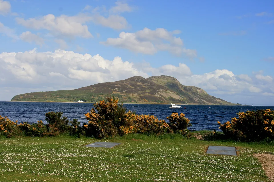
A grassy shore and yellow gorse at Lamlash, with Holy Isle across the blue bay.
Lamlash Bay on Arran, looking towards Holy Isle · May 2011.
Photo: Mike Peel (www.mikepeel.net)

The water and the land

How the Clyde opens up

Kintyre forms the western wall of the firth, with Arran dividing its broad southern waters. Farther in, Bute sits between the mainland sailing centres and the narrow Kyles. Around its northern end, the waterways lead towards Loch Fyne and the canal connection west.

Firth of Clyde, Bute and Loch Fyne Arran lies in the southern firth, with Kintyre to the west. Bute and the Kyles lead towards Loch Fyne. Ardrishaig and Crinan mark the canal connection to the Sound of Jura. Linked place names open their sections below. Firth of Clyde Jura Loch Fyne Crinan Ardrishaig Tarbert Portavadie Kyles Bute Largs Kintyre West Kintyre Lochranza Lamlash Arran Carradale Campbeltown Firth of Clyde ≈ 5.4 nautical miles N ↑ © OpenStreetMap contributors · ODbL Firth of Clyde, Bute and Loch Fyne Arran lies in the southern firth, with Kintyre to the west. Bute and the Kyles lead towards Loch Fyne. Ardrishaig and Crinan mark the canal connection to the Sound of Jura. Linked place names open their sections below. Firth of Clyde Jura Loch Fyne Cowal Crinan Canal Ardrishaig Tarbert · Loch Fyne Portavadie Port Bannatyne Rothesay Kyles of Bute Bute Largs · town Yacht Haven Kintyre West Kintyre Lochranza Brodick Lamlash Arran Carradale Campbeltown Firth of Clyde Mull of Kintyre ≈ 5.4 nautical miles N ↑ © OpenStreetMap contributors · ODbL
© OpenStreetMap contributors · Map data · ODbL · Sophie map design · CC BY 4.0

Explore these waters

Arran and east Kintyre
Open water, mountain-backed bays and the southern approach from the Irish Sea.
Largs and Cumbrae
Mainland sailing facilities beside the islands, with Fairlie’s yacht-building history just along the shore.
Bute
Rothesay’s harbour town and steamer heritage; Port Bannatyne’s smaller village setting.
The Kyles of Bute
Wooded narrows, small islands and waterside villages around northern Bute.
Loch Fyne
A long sea loch opening inland, with Tarbert’s village harbour and Portavadie’s modern marina on opposite shores.
Crinan Canal
The connection from Ardrishaig to the Sound of Jura, for boats within the canal’s operating limits.

The scale makes much of this coast accessible in short passages. Largs Yacht Haven publishes approximate cruising distances of 6 nautical miles to Rothesay, 14 to Colintraive in the Kyles, 16 to Brodick and 22 to Tarbert. Arran and the lower firth still involve open-water crossings.

Largs cruising distances ↗

The southern approach

Arran and Kintyre:
entering the Clyde

From the Irish Sea and North Channel, Campbeltown and southern Arran stand at the entrance to this cruising ground. Beyond them, Kilbrannan Sound runs between Kintyre and Arran, while the wider firth opens along the island’s eastern shore.

An island with several ways ashore

Arran gives the lower Clyde much of its scale: a mountainous island with bays and villages on different shores, rather than one harbour serving the whole coast. A stay here is often on a mooring, with the dinghy making the final connection to the village. Lamlash, Brodick and Lochranza each offer a different view of the island.

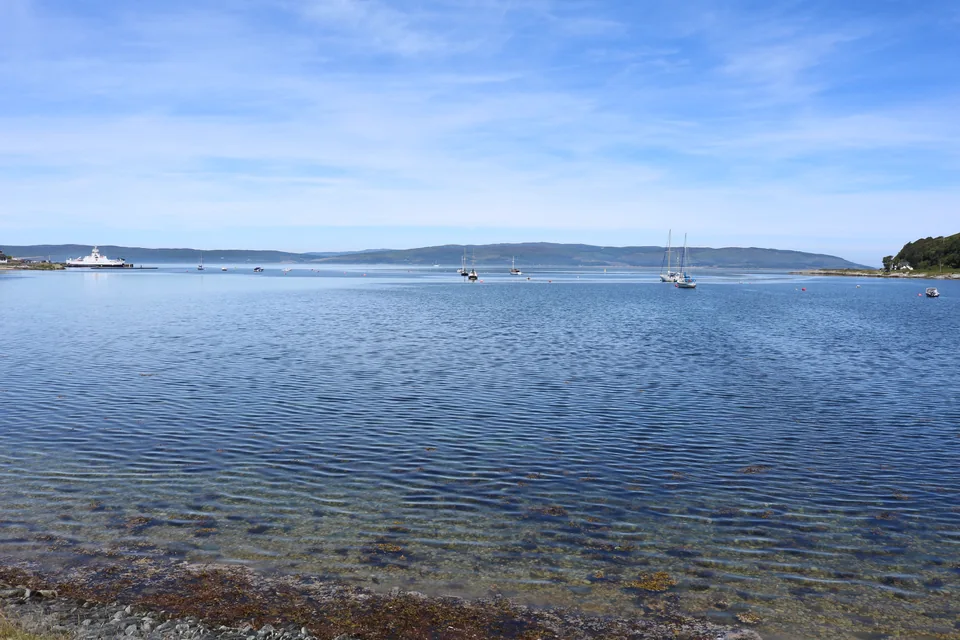
Clear, shallow water beside Loch Ranza, with several sailing boats farther out in the bay.
Loch Ranza · June 2018.
Photo: Billy McCrorie

Northern Arran

Lochranza: a castle beside the water

At Arran’s northern end, the village gathers around a small sea loch, with the ruined castle on a low spit beside the moorings. Hills rise behind the houses. The waterfront and castle give a visit its focus, while the position brings northern Arran into the same stretch of water as the approaches to Bute and Loch Fyne.

The castle normally opens from April to September.

Lochranza Castle
Lamlash: the bay and Holy Isle

Holy Isle stands across the mouth of Lamlash Bay, enclosing a sweep of water between its steep slopes and Arran’s village shore. The view from a mooring gives the island as much presence as the waterfront behind. Ashore, shops and places to eat follow the village, while COAST’s discovery centre introduces the marine life beneath the bay.

COAST marine discovery centre

Visits to Holy Isle have their own landing arrangements; a mooring in Lamlash does not include access to the island.

Brodick: the island’s busy front door

Brodick’s ferry harbour and village face the eastern firth beneath Arran’s mountains. It is another arrival point by yacht, with shops near the waterfront and Brodick Castle, gardens and country park farther north along the bay. The castle is a separate outing from the harbour, about 3.2 km from the ferry terminal.

Brodick Castle and gardens ↗

Southern Kintyre

Campbeltown: a harbour at the crossroads

Campbeltown lies deep inside its loch near the southern end of Kintyre. Its town-centre marina sits within a working harbour, with shops, cafés and provisions a walk from the pontoons. For a boat arriving from Ireland, this is a useful place to meet the Scottish coast: the Clyde opens to the northeast, while rounding the Mull leads towards the islands to the west.

The Picture House adds an evening ashore to the harbour’s practical appeal.

Campbeltown Picture House ↗

East Kintyre · Kilbrannan Sound

Carradale: the smaller harbour shore

Farther up Kintyre’s east coast, Carradale’s fishing harbour faces Arran across Kilbrannan Sound. The village, woods and hills give this shore a smaller, more rural character than Campbeltown. Deer Hill’s 5.9 km trail is a strenuous walk, with rough and steep ground.

Deer Hill trail ↗

The mainland sailing shore

Largs and the Clyde’s
sailing tradition

The Clyde’s connection to Glasgow is present far beyond the river’s shipyards. Yacht building, racing and excursions down the firth have shaped these shores. At Largs, that tradition has a modern expression in a large sailing centre beside the Cumbrae islands.

A well-connected sailing base

Largs Yacht Haven lies south of the town, sheltered by Great Cumbrae. Visitor berths, fuel, chandlery, repairs and storage make it a practical place to arrive, prepare a boat or arrange work between cruises. Bute is close across the water; Arran and Loch Fyne lie farther out. The town’s promenade and the marina are connected by a coastal walk.

Fairlie and the Fife yachts

Just south of Largs, generations of the Fife family designed and built sailing yachts on Fairlie’s foreshore. Their surviving boats still return to Clyde waters for the Fife Regatta. A memorial on Bay Street marks the boatbuilders and local craftsmen whose work carried the village’s name far beyond Scotland.

The old yard has gone, but the shoreline places that history beside today’s sailing grounds. It gives a visit to this small village a particular meaning for anyone arriving under sail.

Fairlie’s yacht-building heritage ↗

The island at the centre

Bute and the journey
“doon the water”

For generations, Glasgow holidaymakers boarded steamers and travelled down the Clyde to Rothesay. Those journeys made Bute a seaside destination long before the modern marina. Arriving by yacht brings the harbour, promenade and town into view from the same water.

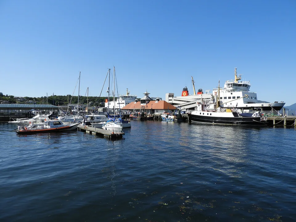
Small sailing boats moored in Rothesay harbour, with a ferry and the town's waterfront behind.
Rothesay harbour · July 2017.
Photo: Reading Tom
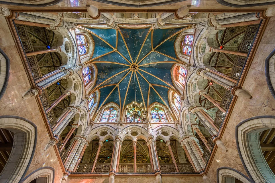
Looking up through Mount Stuart's colourful marble hall towards a blue ceiling decorated with stars.
Mount Stuart's marble hall · August 2018.
Photo: © User:Colin
The photographer's HDR image, combined from three exposures.

Rothesay: the harbour in the town

Rothesay’s waterfront puts ferry traffic, small boats and the streets ashore together. The promenade and Victorian resort buildings give the town a character quite different from a marina on an isolated shore. Bute Museum’s steamer models, photographs and shipboard objects tell the story of the journeys that made this a holiday island.

Bute Museum: the Clyde steamers ↗

Port Bannatyne and a visit to Mount Stuart

Port Bannatyne offers a smaller village stay on Bute’s eastern shore, with a marina, local shops and places to eat.

Farther south on Bute, Mount Stuart adds an extraordinary interior to the island’s coastal scenery: a marble hall beneath a star-painted ceiling, followed by gardens and grounds. From Rothesay, buses 90/490 leave opposite the ferry terminal. The house has seasonal and private-event closures; its visiting page gives the dates and travel details.

Visiting Mount Stuart ↗

Around northern Bute

The Kyles:
sailing into the landscape

North of Rothesay, the scale changes. The Kyles wind between Bute and Cowal, with wooded slopes, small islands and hills close above the water. The boat follows the folds of the shore, and each turn reveals another stretch of the sound.

Wooded shores and small islands in the Kyles of Bute, seen from a green hillside beneath a partly cloudy sky.
The Kyles seen from Balnakailly on Bute · August 2018.
Photo: Dave souza

Narrow sounds and a loch beyond

The eastern and western Kyles meet around the northern end of Bute, where Loch Riddon reaches farther into Cowal. Colintraive sits by the short ferry crossing to Bute. On the western arm, Tighnabruaich and Kames stretch along the mainland shore, looking across the sound towards the island.

Moorings, anchorages and dinghy journeys ashore are part of the character here. A meal in a waterside village can be the reason for a stop; the wooded passages between villages are an attraction in themselves. South through the West Kyle, the water opens again towards the mouth of Loch Fyne.

Kames and Tighnabruaich

Kames Hotel stands beside the water, with a bar and restaurant overlooking the Kyles. Its moorings put a meal ashore within reach of a stop in the western Kyles.

Colintraive

Beside the ferry narrows, the Colintraive Hotel links a mooring visit with its pub and restaurant. Its moorings give priority to dining guests. The hotel asks sailors to call ahead about availability.

Beyond the Kyles

Loch Fyne:
a sea loch opening inland

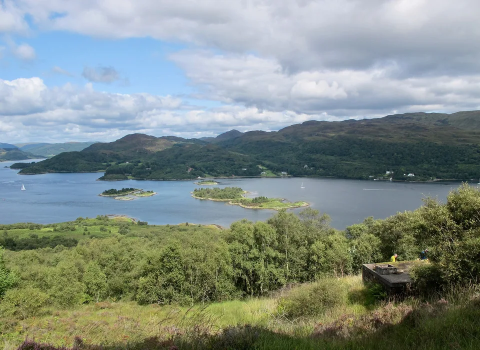
Beyond western Bute, Loch Fyne opens north between Kintyre and Cowal. The close wooded sounds give way to a longer reach of water, leading inland past harbour villages towards Ardrishaig and the Crinan Canal. Tarbert and Portavadie face each other across its lower waters.

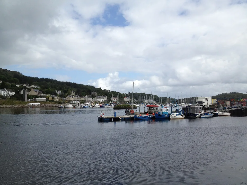
Fishing boats in Tarbert harbour, with white houses along the water and wooded hills beneath a cloudy sky.
Tarbert on Loch Fyne · August 2012.
Photo: ChrisSampson87

Kintyre shore

Tarbert: village life around a working harbour

Tarbert’s harbour sits within the village, with fishing boats, yacht pontoons and waterfront buildings gathered around the same sheltered inlet. Shops, galleries and places to eat are part of the arrival. Above them, the castle ruins give a view back over the boats and the entrance to Loch Fyne.

The castle walk is the immediate outing; the harbour’s local guide also describes paths towards Shell Beach and White Shore.

Tarbert walks and activities ↗

Cowal shore

Portavadie: a modern marina on the loch

Across Loch Fyne, Portavadie brings a modern marina and leisure facilities to the Cowal shore. Its marina occupies a man-made lagoon, with purpose-built facilities, restaurants and leisure pools beside the pontoons. Tarbert brings the boat into an old village; Portavadie gathers the services around the marina, with the loch and hills beyond.

From Loch Fyne to the western islands

A western exit through
the Crinan Canal

At Ardrishaig on Loch Fyne, the Crinan Canal crosses the peninsula to the Sound of Jura. For a yacht within its operating limits, this changes the shape of a Clyde cruise: the inland turn can become a way through to Scotland’s western islands.

The canal was built to connect the Clyde with the west coast while avoiding the sea passage around the Mull of Kintyre. Its roughly 7.8 nautical miles contain 15 locks and seven bridges. Passing between the two coasts means working through the locks and moving through the landscape, with a minimum of six to eight hours advised even without delays.

Beyond Crinan, the Sound of Jura opens towards a different set of islands and passages. The Clyde’s harbours and sea lochs can therefore form part of a wider west-coast journey as well as a cruising destination in their own right.

Explore Islay, Jura and Colonsay →
Sources and further reading

Harbour operators and local organisations are linked beside the places they describe. Additional sources below explore the islands and the Clyde’s maritime history. Photo credits and licences accompany each image.