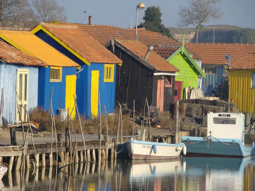
Vendée · La Rochelle · Atlantic islands

Vendée, La Rochelle
and the Atlantic islands

Ocean landfalls, fortified harbours
and the tide-shaped islands.

Off Vendée, the Atlantic lies between island landfalls and working ports. Around La Rochelle, Ré and Oléron reshape the water: ocean-facing shores outside, tidal channels and oyster grounds within.

← Channel and Atlantic France
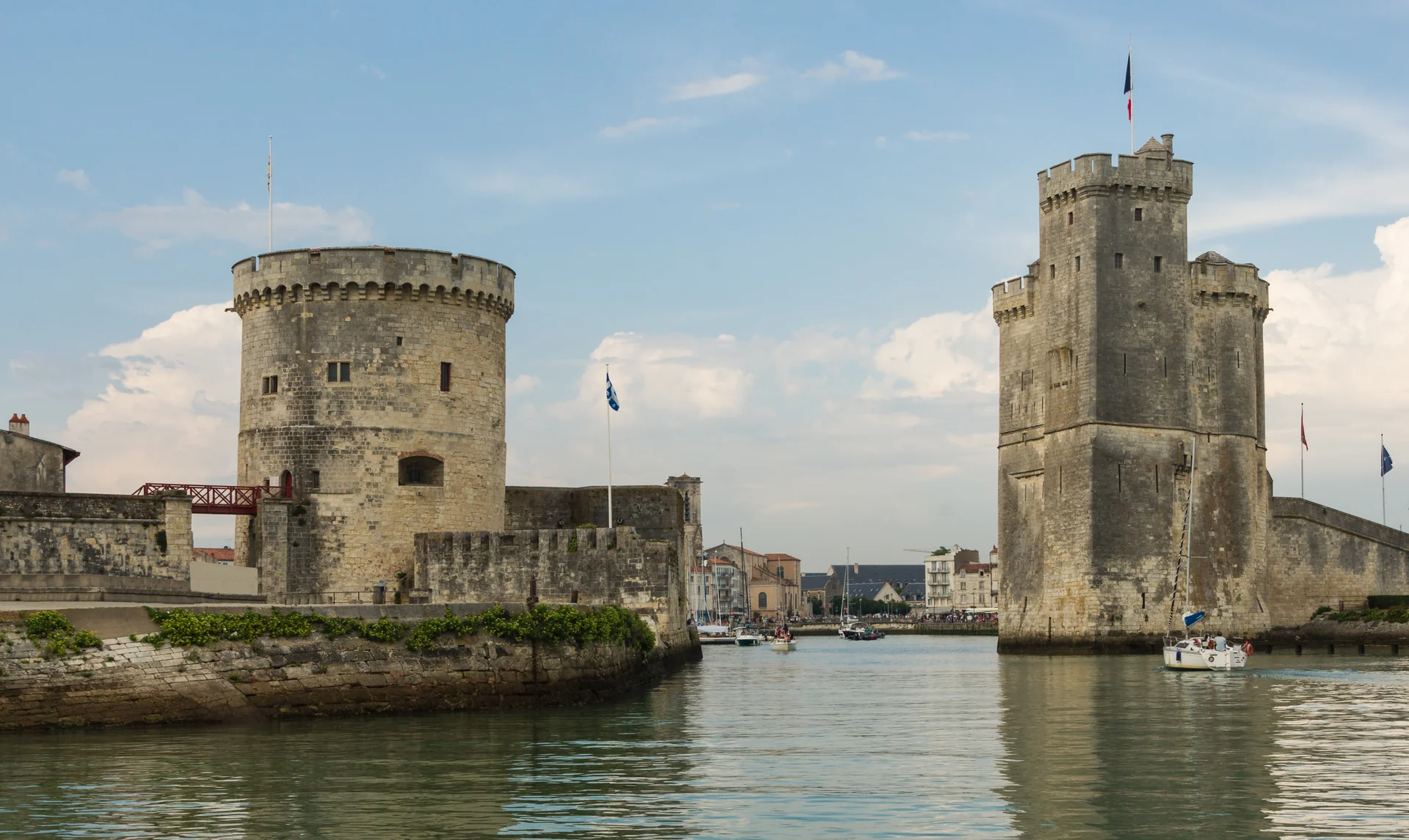
Stone towers on either side of the entrance to La Rochelle's old harbour
The entrance towers of La Rochelle's Vieux Port. 2015.
Photo: Jebulon

The setting

From open Atlantic
to the mer des Pertuis

Noirmoutier and Yeu sit off the Vendée coast; Les Sables-d’Olonne opens directly onto the Atlantic. Farther south, Ré, Aix and Oléron enclose shallower waters around La Rochelle, interrupted by channels, banks and broad tidal flats.

Vendée and the Atlantic islandsNoirmoutier and Yeu lie off the Vendée coast, north of Les Sables. Ré, La Rochelle, Aix and Oléron form the southern group. Place links open their sections in this guide.Vendée and the islandsNoirmoutierÎle d’YeuLes Sables-d’OlonneRéLa RochelleOléronAixAtlantic OceanVENDÉE≈ 10.8 nautical milesNNatural Earth · IGN / data.gouv.fr Vendée and the Atlantic islandsNoirmoutier and Yeu lie off the Vendée coast, north of Les Sables. Ré, La Rochelle, Aix and Oléron form the southern group. Place links open their sections in this guide.Vendée and the islandsNoirmoutierÎle d’YeuLes Sables-d’OlonneRéLa RochelleOléronAixAtlantic OceanVENDÉE≈ 10.8 nautical milesNNatural Earth · IGN / data.gouv.fr

The harbours are separated by real stretches of sea. L’Herbaudière publishes approximate distances of 23 nautical miles to Yeu, 47 to Les Sables and 80 to La Rochelle; these are broad harbour estimates, not measured tracks between berths.

L’Herbaudière · published distances ↗
Map sources and scale

Mainland: Natural Earth, public domain. Island outlines: IGN / data.gouv.fr, ODbL, acquired 18 September 2026. sol.blue maps adapt the original Sophie cartography under CC BY 4.0.

Island source data · GeoJSON

The Vendée coast

Fishing islands
and an ocean-racing town

The northern landfalls each have a different relationship with the mainland: Noirmoutier joined by bridge and tidal causeway, Yeu beyond a stretch of open sea, and Les Sables gathered around its long entrance channel.

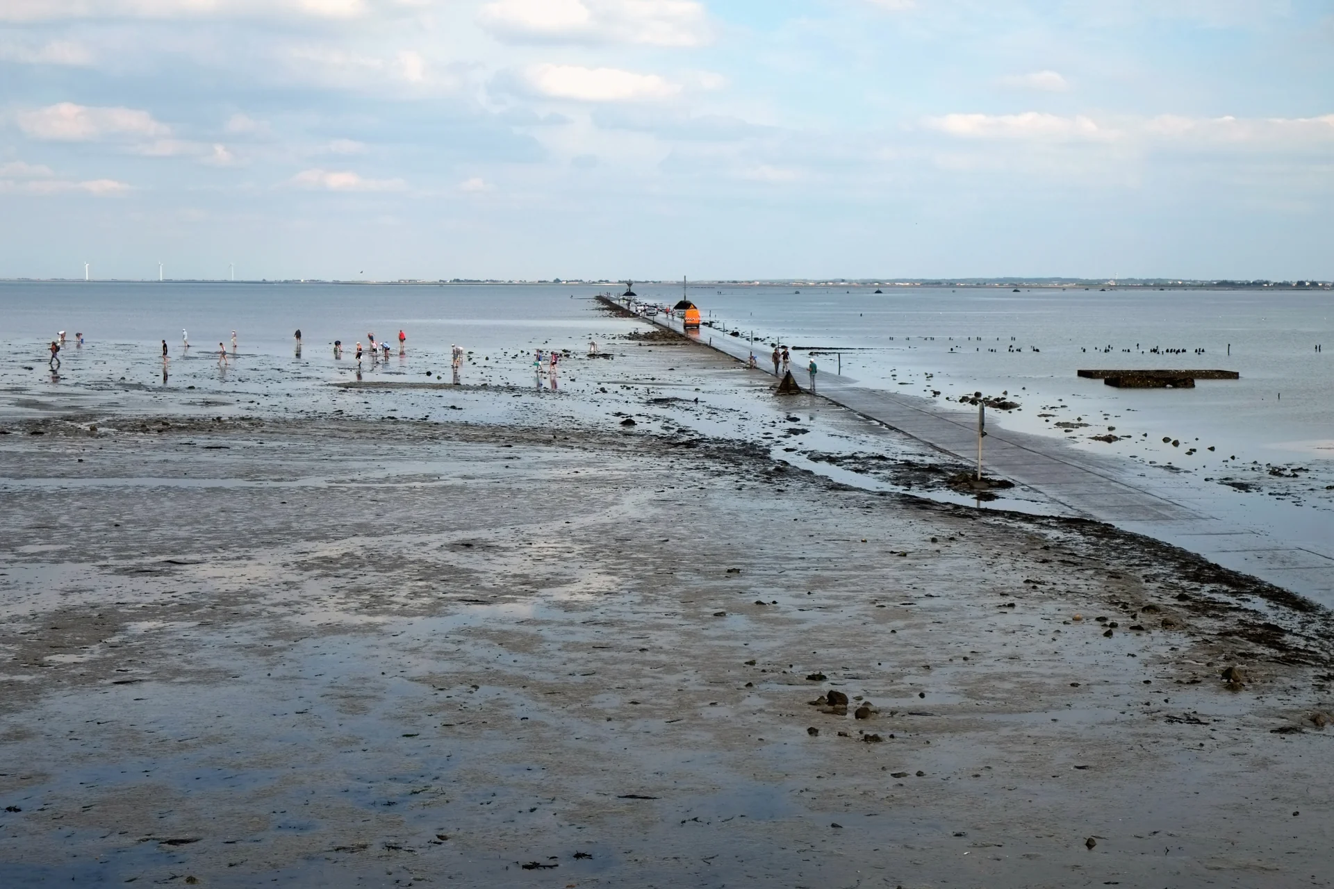
The exposed Passage du Gois crossing tidal flats, with people gathering shellfish beside the causeway
The Passage du Gois at low tide, 2014.
Photo: Patrick Despoix

Noirmoutier

An island drawn by the tide

At the Passage du Gois, a road runs for 4.2 km across tidal flats before disappearing beneath the sea. It is the clearest introduction to Noirmoutier’s low-lying landscape: polders, oyster grounds and salt pans where seawater is guided from basin to basin and salt is still harvested by hand.

L’Herbaudière, at the island’s northwestern tip, combines fishing and leisure boating. Inland, the salt workers’ huts offer a closer look at the harvest; at Port du Bonhomme, tractors head out to the oyster beds as the tide falls. Le Vieil’s lanes and the wooded shore at Bois de la Chaise give the island another texture.

The signed 19.2 km “Entre plages et ports” cycle circuit links L’Herbaudière, Le Vieil, Bois de la Chaise, Plage des Dames and Noirmoutier town. The Gois is a separate outing at the island’s southeastern end: crossing depends on the day’s tide and conditions; the bridge provides the permanent road connection.

Gois · crossing information ↗The salt marshes and their producers ↗ ↑ Map
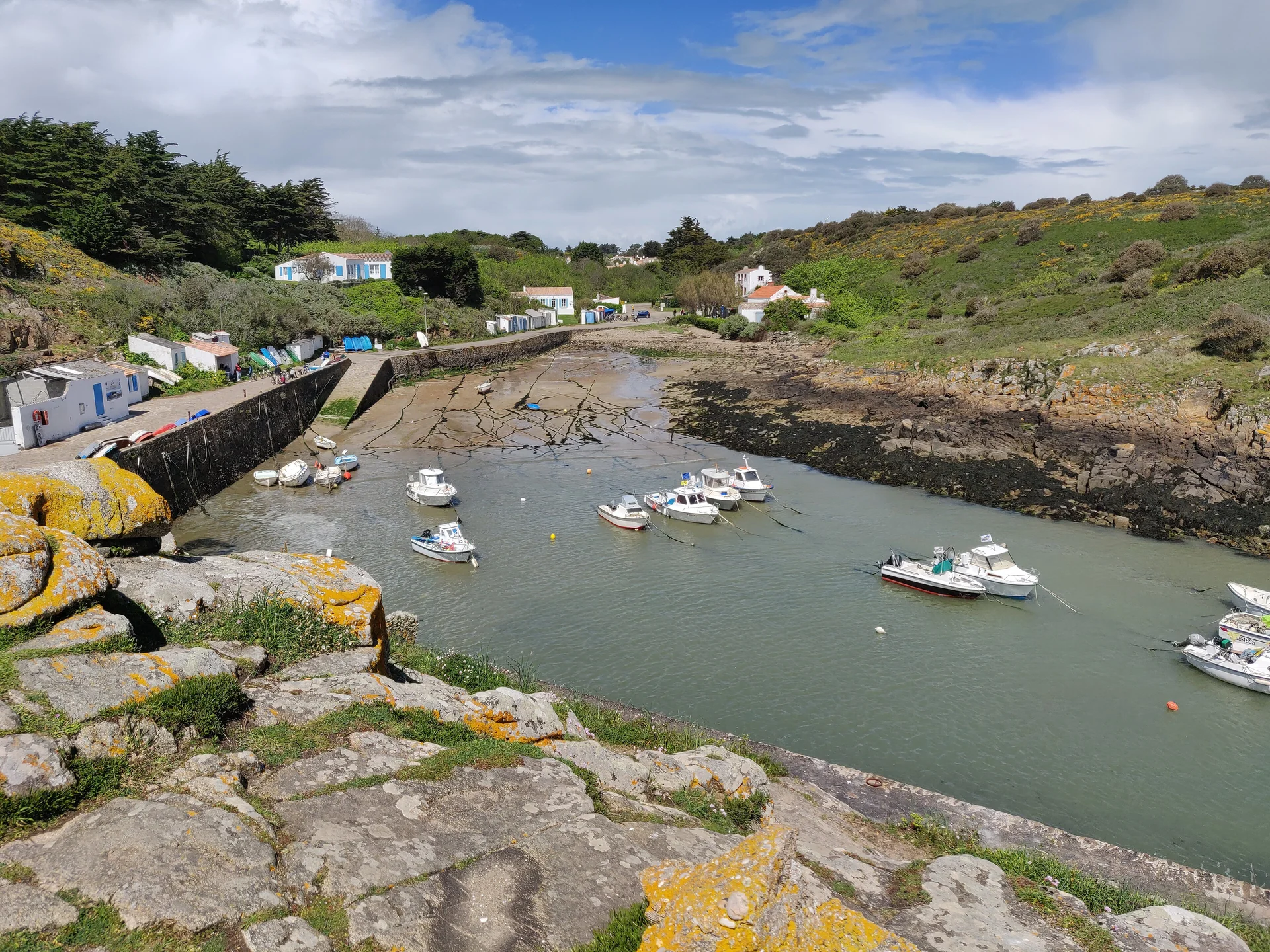
Small boats between the rocky sides of La Meule fishing harbour
La Meule on Île d’Yeu: a small fishing harbour to visit from land. 2019.
Photo: Pinpin

Île d’Yeu

Beyond the mainland

Yeu is an offshore landfall with two strikingly different coasts. Port-Joinville faces the mainland: ferries, fishing boats and visiting yachts share the harbour’s life. The island’s fishing history reaches well beyond these waters—its sailing tuna boats, the dundees, once ranged into the Atlantic for albacore.

Across the island, low dunes and beaches give way to the southern wild coast’s rocky headlands and small coves. La Meule is a cleft in that coast, with a chapel above its fishing harbour. Farther west, the Vieux Château stands on a rock surrounded by the sea. Saint-Sauveur’s village lanes lie inland between these shores.

La Meule and the Vieux Château are shore excursions from Port-Joinville. Cycling links the villages; the coastal paths are also rewarding on foot. The castle’s opening programme distinguishes guided and independent visits.

Vieux Château · visits ↗ ↑ Map
The entrance channel of Les Sables-d’Olonne, with La Chaume on the left and port buildings beyond
The harbour channel at Les Sables-d’Olonne, 2014.
Photo: Yves LC

Les Sables-d’Olonne

The channel to the world

The channel at Les Sables-d’Olonne is the threshold of the Vendée Globe: ocean-racing boats leave between its quays and return here after circling the world. Port Olona is part of that sailing culture, but the waterfront also belongs to fishing boats, marine trades and the people crossing between town and La Chaume.

On the western bank, La Chaume’s small fishermen’s houses and the Saint-Nicolas headland face the harbour entrance. Across the channel are the fishing quays and the town, with Halles Centrales for market shopping and the long Grande Plage along the seafront. The racing story sits within a working seaside town.

Les Sables and the Vendée Globe ↗Fishing, boatbuilding and maritime heritage ↗ ↑ Map

La Rochelle and the mer des Pertuis

Islands, channels
and fortified shores

Ré and Oléron break the Atlantic swell, creating a partly sheltered sea with wide tidal foreshores. The Pertuis Breton lies north of Ré; the Pertuis d’Antioche opens between Ré and Oléron. South of Oléron, the narrow Pertuis de Maumusson leads towards the Seudre and lies beyond the area described here.

Shelter changes with the wind and with exposure to the openings. Banks, oyster grounds and dredged channels shape the passages; the tide also determines entry to several of the small harbours. Inside the islands, distant towers, low shorelines and the freestanding walls of Fort Boyard give the water its particular character.

La Rochelle and the mer des PertuisThe Pertuis Breton lies north of Ré, and the Pertuis d’Antioche between Ré and Oléron. Linked places include the harbours of Ré and Oléron, La Rochelle, Aix, Fort Boyard and Rochefort on the mainland.Ars-en-RéSaint-MartinLa FlotteLa RochelleSaint-DenisAixFort BoyardBoyardvilleLe ChâteauRochefortPertuisBretonPertuis d’AntiocheRéOléronN5 nautical miles
Natural Earth · IGN / data.gouv.fr · sol.blue
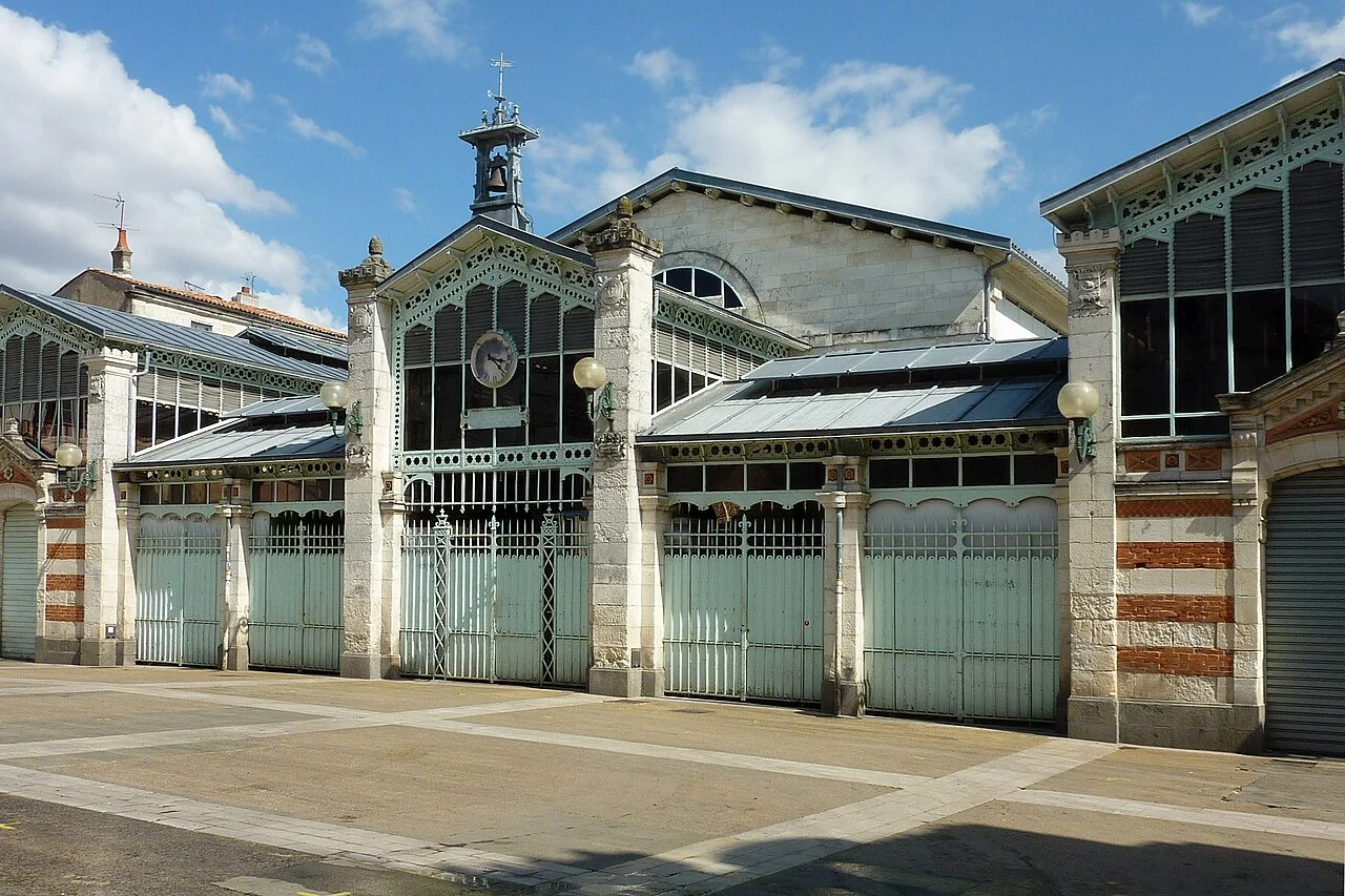
Stone and green-painted ironwork on La Rochelle's closed covered market
La Rochelle's covered market, with its shutters closed. 2013.
Photo: Patrick Despoix

La Rochelle

A trading city at the water’s edge

La Rochelle’s old harbour still opens between the Saint-Nicolas and Chaîne towers, once joined by a chain that closed the port. These are medieval town defences, from a city whose prosperity grew through maritime trade in wine and salt. Behind the quays, arcaded streets lead to the covered market; the aquarium lies beside the former docks.

Les Minimes is the modern marina, spread around several basins south of the old town. The Bus de Mer makes the connection part of the visit: about 20 minutes from pontoon 7 to the foot of the Tour de la Chaîne, with departures varying by season.

The Tour de la Chaîne and Tour de la Lanterne offer monument visits. The Tour Saint-Nicolas is currently closed to visitors; the monument operator publishes reopening information.

Bus de Mer · stops and service ↗The towers · visits and opening information ↗ ↑ Map
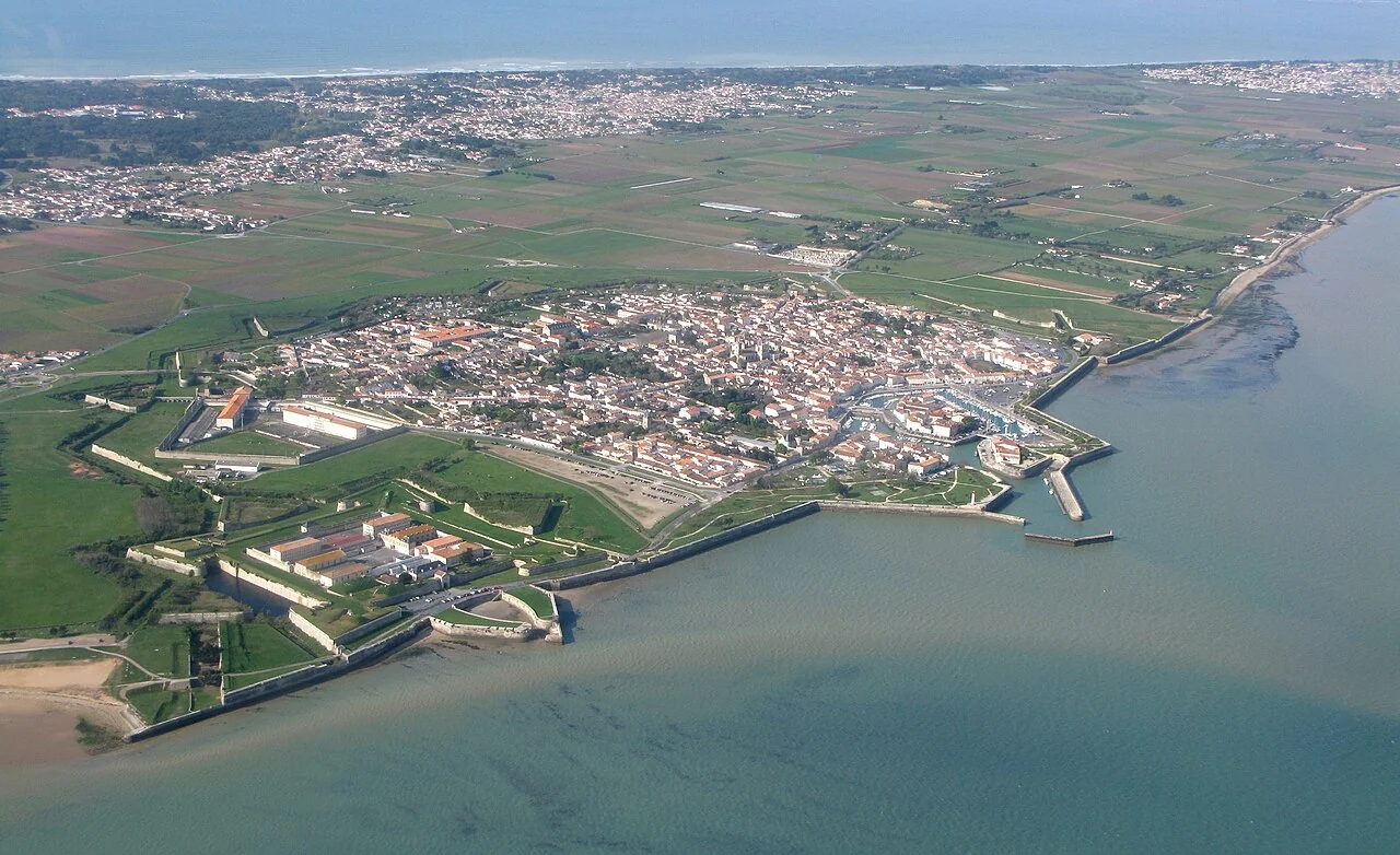
Aerial view of Saint-Martin-de-Ré showing the harbour, town walls and projecting bastions
Saint-Martin-de-Ré: town, harbour and Vauban fortifications, 2009.
Photo: Villefluctuante

Île de Ré

Three harbours, three settings

Ré’s harbour towns face the inner waters, while its longer southern shore looks into the Atlantic. At Saint-Martin, the harbour curls into the town beneath the angular earthworks of Vauban’s fortifications. Walking the waterfront towards the Barbette and the citadel reveals their scale; the citadel itself remains a working prison and is viewed from outside.

Bicycles connect the harbour towns, vineyards, beaches and salt marshes. Saint-Martin, La Flotte and Ars offer different settings, so a visit ashore can range beyond the harbour where the boat is berthed.

Saint-Martin · the fortifications ↗↑ Map

Saint-Martin · within the walls

The lively harbour is the centre of the visit: quayside cafés, a morning food market and streets enclosed by the fortifications.

La Flotte · a village around its harbour

A curved quay and the little market square bring village life close to the water. The market’s stone arcades have a medieval appearance; they frame stalls selling fish, bread and island produce.

Ars · beyond the salt marshes

Around the Fier d’Ars, channels feed working salt pans and expose broad mudflats at low water. The harbour and village sit within that landscape; farther north, Maison du Fier in Les Portes introduces the birds and habitats around Lilleau des Niges.

Maison du Fier · LPO ↗
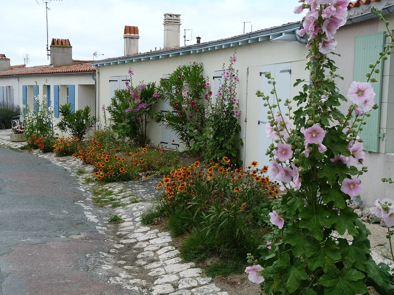
Hollyhocks beside white village houses with green shutters on Île d’Aix
Hollyhocks and white houses on Île d’Aix. 2011.
Photo: michael clarke stuff

Île d’Aix

A landing by launch, an island on foot

Aix is small enough to explore on foot: white houses, green shutters and hollyhocks give way to paths beside its sea defences. Arriving on a visitor mooring adds a short launch journey between boat and island, rather than a walk along a marina pontoon.

Its forts look towards the approaches to the Charente and Rochefort’s former royal dockyard. That history is part of the island’s shape, from fortified shoreline to village streets; a coastal walk keeps bringing the water back into view.

The Fouras–Aix ferry from Pointe de la Fumée also makes an island visit possible from the mainland. Its sailing times depend on the tide.

Fouras–Aix ferry ↗ ↑ Map
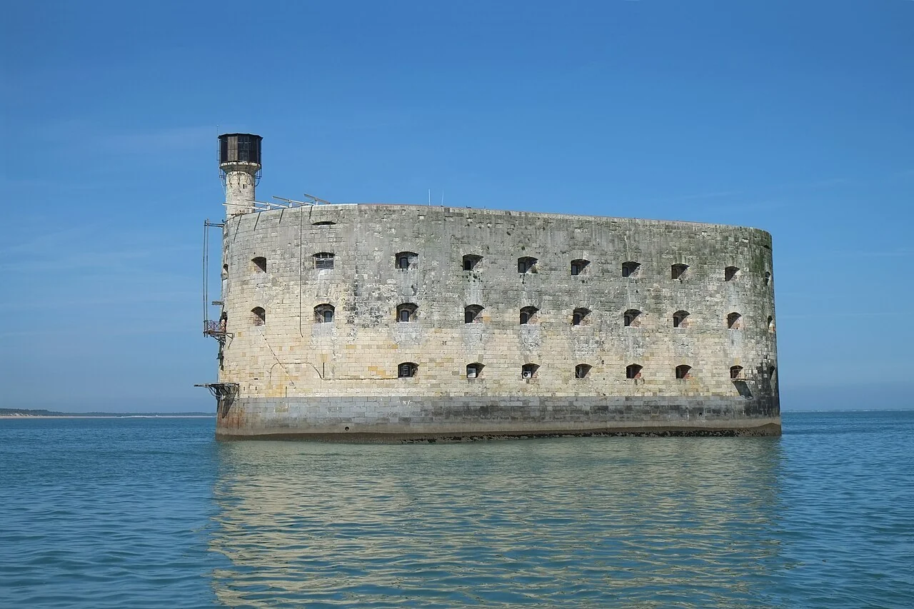
Fort Boyard rising directly from the sea, photographed in 2015 before the current restoration works
Fort Boyard before the current restoration works, 2015.
Photo: Patrick Despoix

Fort Boyard

A fort built in the sea

Fort Boyard stands alone between Aix and Oléron. It was intended to close the gap between shore batteries guarding Rochefort’s naval approaches, but its long construction outlasted its military purpose: improved artillery had overtaken it by completion in 1857. Its later life as a television setting made that unmistakable outline familiar far beyond this coast.

Restoration works run from March 2026 towards spring 2028. Navigation is prohibited within 480 m of the fort during the works; it is presently a landmark to see from outside that perimeter, not a landing place.

Fort Boyard · current works and exclusion zone ↗↑ Map
Colourful oyster huts and small workboats along a channel at Le Château-d’Oléron
Oyster huts beside the water at Le Château-d’Oléron, 2007.
Photo: Philippe Rio

Île d’Oléron

From the lighthouse to the oyster channels

Oléron changes from the Atlantic-facing point of Chassiron to the oyster channels on its eastern side. Saint-Denis gives access to the northern villages and beaches; Boyardville faces the inner sea and Fort Boyard. Farther south, Le Château combines a citadel, a working oyster harbour and former oyster huts now occupied by artists and craftspeople.

Oyster farming explains much of the eastern shore. Channels reach the tidal beds; former salt ponds have become claires, shallow basins used to finish oysters. At Le Château, the boats and painted huts belong to a living waterfront, with production continuing alongside the studios.

↑ Map

Saint-Denis and Chassiron

Boirie beach and the village lie close to the harbour; cycle paths lead towards Chassiron’s black-and-white lighthouse. Its 224 steps reach a view over the island’s northern point.

Boyardville and La Perrotine

Boyardville opens towards the inner waters, with a sandy shore and views of Fort Boyard. The harbour sits on the channel of La Perrotine, with restaurants, a bakery and cycle hire nearby.

Le Château’s citadel and huts

Walk from the citadel to the oyster harbour and the Couleurs Cabanes workshops. Ceramics, paintings and other craft work occupy former production huts along the channels. Le Château makes an outing ashore from another Oléron harbour.

Le Château · oyster harbour ↗Couleurs Cabanes · studios ↗

Seasons and tides

The shore changes
with the water

Low water reveals oyster grounds and mudflats; high water returns the small harbours to the sea. Salt harvesting brings another seasonal rhythm on Noirmoutier and Ré. Summer also brings fuller harbours and longer transport schedules, while Aix’s visitor buoys and launch have defined May–September seasons.

The open Vendée crossings and the Atlantic sides of the islands remain exposed to ocean swell. Inside the Pertuis, shelter is more varied, but shallow banks, harbour gates and wind against the tidal stream still shape when and where a visit works.

Travel and preparation

Getting here.
Preparing the boat.

La Rochelle and Les Sables have rail connections and substantial marine services. The island harbours then offer distinct places to stay or visit ashore.

Time aboard

La Rochelle as a starting point

Les Minimes offers a large marina and marine services beside the southern islands. The Vieux Port places a stay closer to the historic centre; the Bus de Mer connects the two waterfronts.

Les Minimes facilities ↗

Reaching the boat

Arriving by train

Paris–La Rochelle trains reach the southern part of the area; Nantes–Les Sables services give access to the northern mainland port. The final transfer depends on the marina and pontoon.

Local connections

Yélo’s Illico 4 connects La Rochelle station with the Port des Minimes area. Regional route 150 to Ré also serves the station. The Bus de Mer connects Les Minimes with the old harbour.

Paris–La Rochelle trains ↗
Nantes–Les Sables trains ↗
Yélo routes and timetables ↗

Boat preparation

A place for work

La Rochelle has lifting, repair and hardstanding facilities alongside its sailing harbour.

A little more to explore

A few minutes along the coast.

Two different glimpses: a bicycle outing on Yeu and a longer tour around La Rochelle and Ré.

Local sources and further reading

History and the new local detail were checked against harbour operators, municipalities, monument managers and local tourism sources on 22 September 2026. Harbour and transport links appear beside the places they describe.

Yeu · the history of tuna fishing ↗La Rochelle · history of the towers ↗Fort Boyard · history ↗Marine nature park · visiting by boat ↗
Photographs and credits

Photographs show the places at their stated dates. Photographer, source and licence details accompany each image.

Photo credits and provenance · JSON