Italy and Sicily

Southeast Sicily

The market in Ortigia, evenings in Marzamemi and a few days ashore.

Seven to ten days from one of these places can be the whole holiday. Around two weeks leave room for both, with time for the sea, town life and a few excursions. Noto and Vendicari lie between them; Marina di Ragusa is a possible addition westwards.

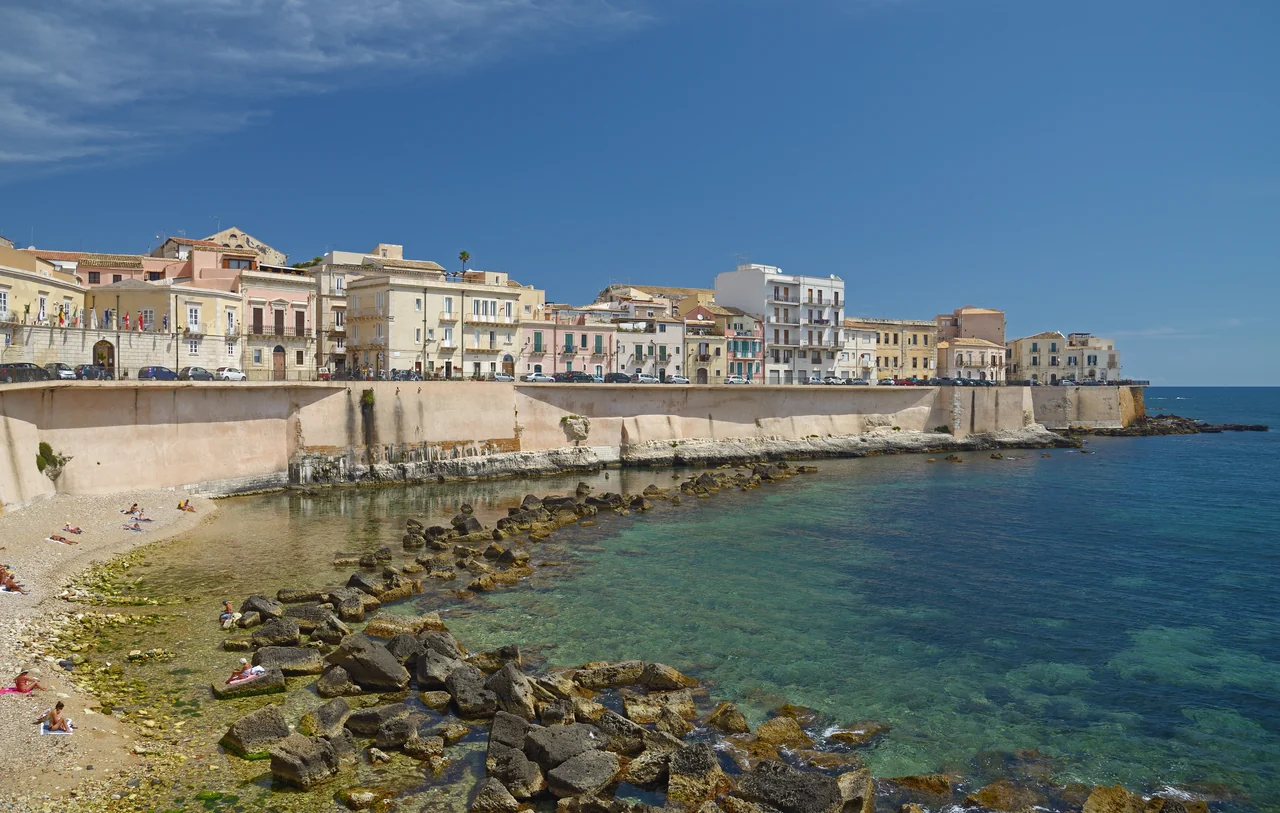
Stone houses and high seawalls above a small beach and clear water on Ortigia’s eastern side.
The waterfront on Ortigia’s eastern side · 16 May 2018.
Photo: Volodymyr Vlasenko (Ввласенко)

Two places to linger

From Ortigia to Marzamemi

Ortigia is in Siracusa. Marzamemi lies farther south, with the visitor berths at Porto Fossa separate from the old village. Noto and Vendicari are shore excursions.

Southeast Sicily Ortigia and Marzamemi are the holiday bases. Noto and Ragusa Ibla are inland. Plemmirio is a possible visit by sea; Marina di Ragusa is an optional addition with a boatyard. Place map, not for navigation. Point database: /documents/cruising-grounds/southeast-sicily/map-points.json. © OpenStreetMap-bidragsytere, ODbL; Wikimedia structured coordinates, CC0; harbour operator. Coast: Natural Earth 1:10m v5.1.1, public domain. Composition: Sophie, CC BY 4.0. Southeast Sicily Place map · not for navigation Ortigia arrival Plemmirio Noto Marzamemi Ragusa Ibla Marina di Ragusa 10 nm N Holiday base / harbour area Shore trip / geographical landmark Sea visit: access to be confirmed Optional base and boatyard Sophie · Natural Earth · Wikimedia © OpenStreetMap contributors
The two main bases and the optional western extension.Map sources
Marzamemi and the southern tip Marzamemi and Porto Fossa are separate from the shore excursions to Vendicari, Portopalo and the views towards two distinct small islands. Place map, not for navigation. Point database: /documents/cruising-grounds/southeast-sicily/map-points.json. © OpenStreetMap-bidragsytere, ODbL; Wikimedia structured coordinates, CC0; harbour operator. Coast: Natural Earth 1:10m v5.1.1, public domain. Composition: Sophie, CC BY 4.0. Marzamemi and the southern tip Place map · not for navigation Vendicari Marzamemi the village Porto Fossa the harbours Portopalo Isola di Capo Passero Isola delle Correnti 3 nm N Holiday base / harbour area Shore trip / geographical landmark The small islands are shown as place points. Views from land at the southern tip. Sophie · Natural Earth · Wikimedia © OpenStreetMap contributors
A closer look at Marzamemi, Vendicari and the southern tip.Map sources

A day without moving the boat

Market and narrow streets in Ortigia

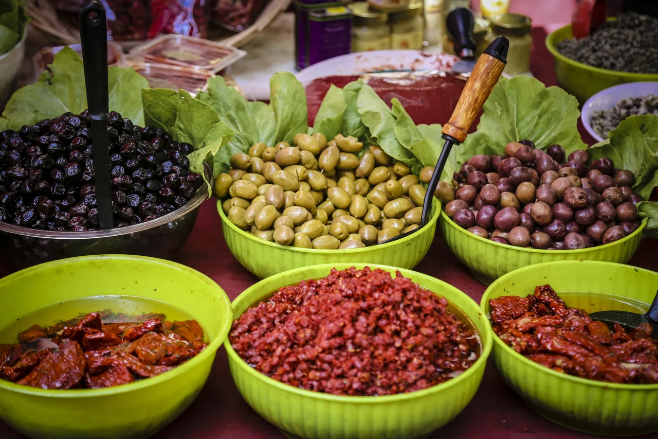
Bowls of green and dark olives, dried tomatoes and chopped tomato on a market stall.
Olives and tomatoes at Ortigia’s market · 8 September 2016.
Photo: kaempfe.ch

Shopping for lunch aboard

The market at the entrance to Ortigia has fish, olives, spices and tomato products for lunch aboard. The narrow streets and Piazza Duomo offer more destinations for walks around town.

The evening can be spent walking along the sea or having a meal in one of the squares. Ortigia provides plenty for several days while the boat stays put.

Ortigia and Siracusa ↗
The smaller village

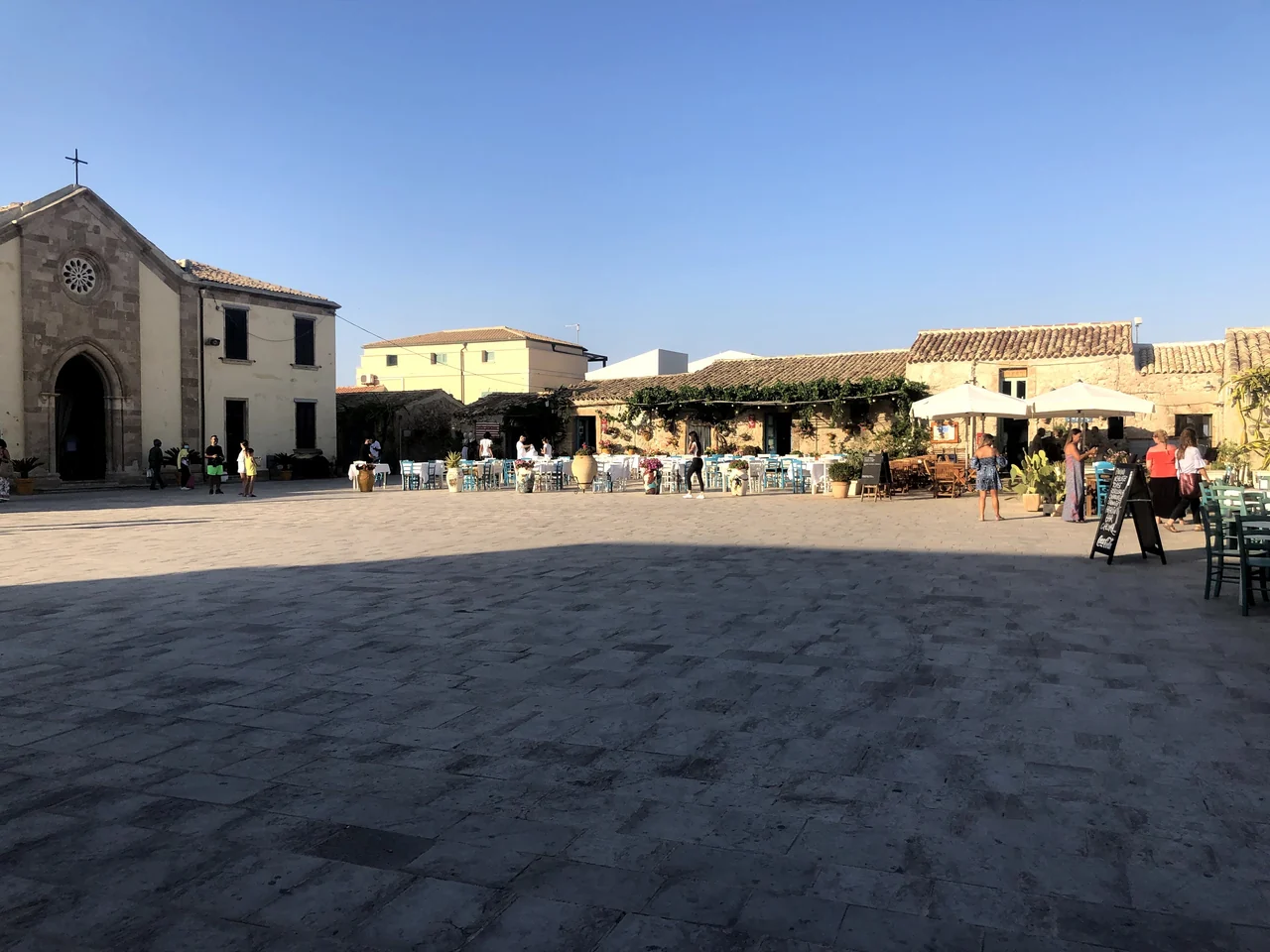
Several evenings in Marzamemi

The stone church and low houses with café tables around a sunlit square in Marzamemi.
Piazza Regina Margherita, Marzamemi · 10 July 2021.
Photo: Davide Mauro

The square, food and beach

Low stone houses and places to eat surround Piazza Regina Margherita. The old tuna fishery has left its mark on both the buildings and the food: tuna products, bottarga and tomatoes from Pachino are things to try.

A morning at Spinazza beach can be followed by a quiet afternoon aboard and an evening in the square. The village has many visitors in season.

Marzamemi and the surrounding area ↗
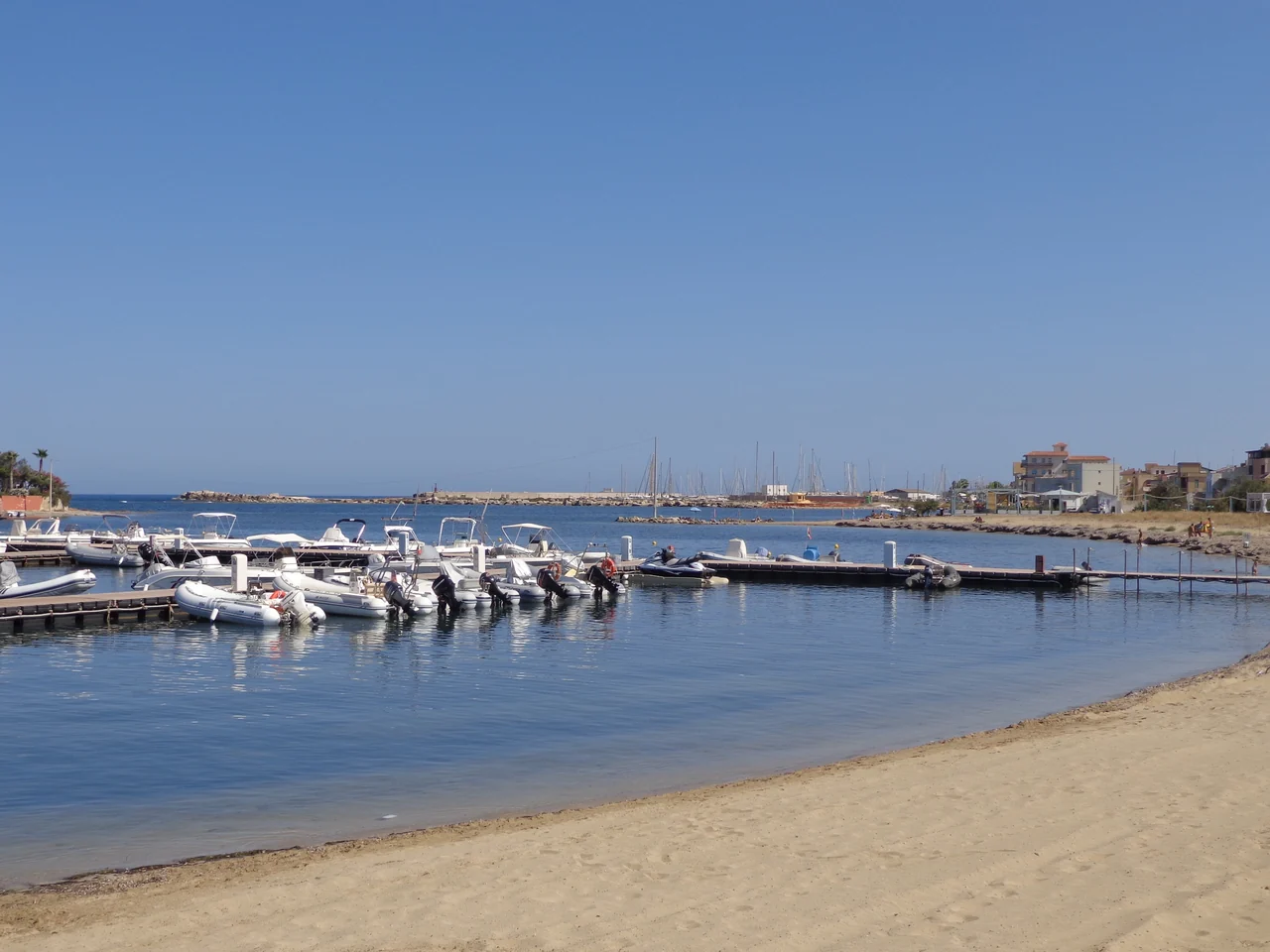
Small motorboats at a pontoon in front of a sandy beach, with buildings and more boats in the background.
Small boats along Marzamemi’s waterfront · 11 July 2021.
Photo: Effems

The boat at Porto Fossa

The small boats along the village waterfront are part of the place. Possible visitor berths are at Porto Fossa farther south. There are two different facilities there: Yacht Club Marzamemi and Marina di Marzamemi. The journey to the village and the possibility of collecting a hire car are part of the choice.

Yacht Club: winter care and external lifting

The Yacht Club offers winter supervision. The advertised 50-tonne travel lift is a service outside the harbour. The lifting location, operator, keel support and storage must be clarified separately.

Services and external lifting ↗

Excursions from the harbour

Noto and Vendicari

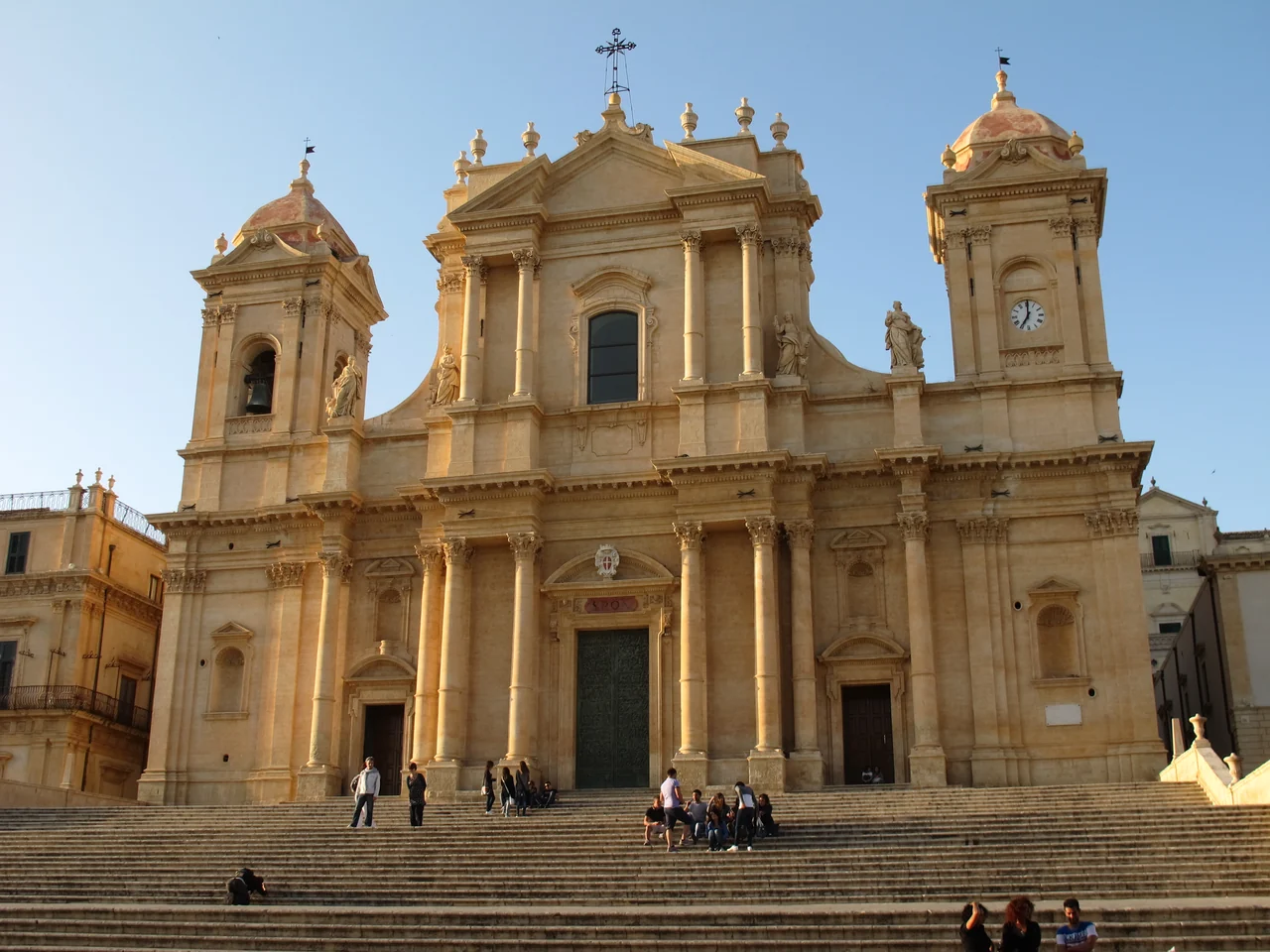
The cathedral’s pale stone façade with two bell towers and a broad staircase with visitors.
Noto cathedral · 16 May 2012.
Photo: Mikenorton

An afternoon in Noto

A stroll through Noto can follow Corso Vittorio Emanuele, past pale stone façades and the steps up to the cathedral. The streets and a café break with granita can fill the afternoon.

A hire car or prearranged car transfer is the starting point for the trip, returning to the harbour the same day.

Noto ↗
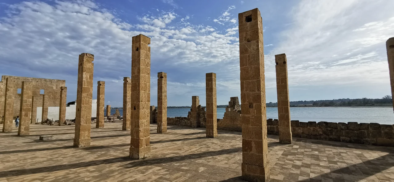
Rows of stone columns in the ruins of the tuna fishery, with the sea behind.
The old tonnara at Vendicari · 25 May 2019.
Photo: Lisabauable

Trails and wetlands in Vendicari

Vendicari suits a separate day trip. Marked paths follow the wetlands and coast, with the chance to see the remains of the tonnara — the old tuna-fishing facility. The beach and birdlife offer other reasons to stop along the way.

The visit is made from land. The reserve rules prohibit ordinary arrival by boat from the sea. The boat stays in harbour.

Vendicari: entrances and trails

The reserve may close in response to weather and fire alerts. Stay on the marked paths through the dunes; parasols, beach chairs and inflatable beach equipment are not permitted.

The reserve manager ↗ Visitor rules (PDF) ↗

Possible extra excursions

Plemmirio or the views in the south

Rocky coast by Siracusa

Plemmirio can offer a day at sea alongside the city days. The 2026 rules prohibit anchoring in zone C, both north and south. A visit depends on an authorised buoy that is in service and suits the boat and weather.

Plemmirio: permits and buoys

The additional rules of 18 February 2026 require a permit and impose specific boat and weather conditions. Boats of 10–24 m use one buoy each. Which fields are open, a suitable buoy and any overnight use have not been clarified. The undated installation notice still refers to testing; the diving buoys in zone A are not ordinary visitor berths.

Permits and current information ↗ The 2026 rules (PDF) ↗

Portopalo and Isola delle Correnti

The coast at Portopalo and the view towards Isola delle Correnti are possible destinations for a drive from Marzamemi. The small island lies southwest of Isola di Capo Passero; the map shows both.

The coast at Isola delle Correnti ↗

Holiday length

One base, or two

Seven to ten days

Choose Ortigia or Marzamemi, and a few days ashore.

About two weeks

Use both bases. A published estimate puts the distance between Siracusa and Marzamemi at about 24 nautical miles.

Two to three weeks in total

Stay longer, or add Ragusa. Sailing back to the same harbour also takes time.

June or September are possible times. Wind and sea conditions govern moves and a visit to Plemmirio; towns and shore excursions fill the days when the boat stays put.

Optionally westwards

Marina di Ragusa, with Ibla inland

The extension from Marzamemi rounds the southern tip, with a published estimate of about 35 nautical miles. Marina di Ragusa is a beach town and a possible base for a longer stay. From the harbour, a day trip can lead to Ragusa Ibla, with the streets around San Giorgio, Piazza Duomo and Giardino Ibleo.

There is also a boatyard for work ashore and afloat. Ragusa is therefore an option both for a longer stay to the west and for preparing the boat.

Ragusa: boatyard and storage

The yard has a shed and outdoor work areas. Current lifting capacity, travel-lift clearance, keel support and storage terms have not been established; the shed does not necessarily mean indoor boat storage.

Boatyard and services ↗ Ragusa Ibla ↗

Getting here

Via Catania to Siracusa

Interbus has a direct bus from Catania airport to Siracusa. The final transfer to the marina follows from there.

Onward transport to Marzamemi or Ragusa by car or bus must be clarified for the travel dates.

Interbus: airport and timetables ↗ Etna Trasporti: connections towards Ragusa ↗

An impression from ashore

Marzamemi on film

The village and a café stop

Gone Again shows the square, café tables and the village from above in the Marzamemi chapter from 2025. Start at 0:30. The chapter runs to 5:00; the full film about southeastern Sicily lasts 35 minutes and 26 seconds.

Watch the Marzamemi chapter on YouTube ↗
Sources and photo credits

Sources and photo credits

Source material reviewed on 19 September 2026. Harbours, transport and access rules are linked beside the places they concern.

Distances and time

The 24 and 35 nautical miles are Luise Sicily’s approximate harbour distances, with berth points and method unspecified. Holiday lengths are suggestions allowing time for stays and shore excursions.

Luise Sicily: distance table

Photo credits

The photographer, date, original page and licence are listed beside each photograph. “Full photograph” opens the largest local version. The waterfront in the opening photograph is on Ortigia’s eastern side.

Maps

Design: Sophie, CC BY 4.0. Coast: Natural Earth 1:10m, public domain. Place points: Wikimedia, © OpenStreetMap contributors and the harbour operator in Ragusa. The combined point list is shared under ODbL 1.0, with the sources’ own terms stated.

Places and coordinate sources (JSON)

The maps show places without sailing tracks or protected-area boundaries. The Porto Fossa point lies at the harbour area’s northern land edge. The smallest islands are shown as place points; the coastline data has limited detail.