← Explore Scotland
Scotland · Applecross to Cape Wrath
Northwest Scotland
Sea lochs and the mountain coast.
Here the mainland becomes the cruising ground. From Applecross to Cape Wrath, exposed headlands alternate with sea lochs reaching deep into the mountains. Small settlements sit beneath the great slopes of Torridon; beyond Ullapool, the Summer Isles scatter across the water before the isolated peaks of Assynt take over the skyline.
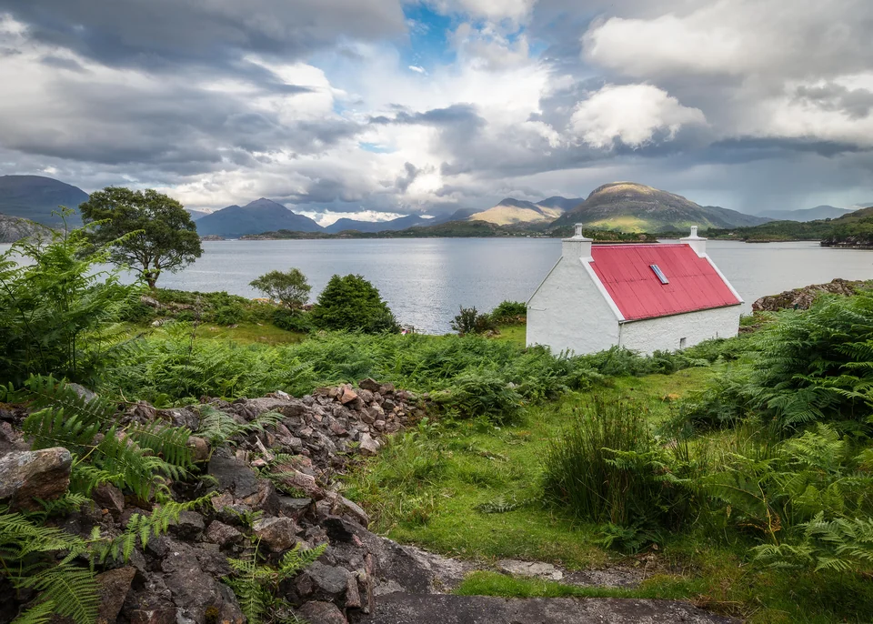
Photo: Chris Combe from York, UK
Reading the coast
A coast that opens inland
The Inner Sound lies between the mainland and Skye, Raasay and Rona. Farther north, the Minch separates this coast from the Outer Hebrides. Torridon, Loch Ewe and Loch Broom reach inland; Coigach and the Summer Isles create a compact island world before the coast continues through Assynt towards Cape Wrath.
Along the coast, or into the next loch?
Turning inland changes both the view and the water. A loch may take a boat out of Atlantic swell and bring the mountains close, but shelter depends on its opening and the wind: an enclosed skyline is no promise of calm. Anchorages and small community landings matter as much here as harbour pontoons.
Applecross & the Inner Sound Torridon & Shieldaig Gairloch, Badachro & Loch Ewe Ullapool & Loch Broom Coigach & the Summer Isles Assynt & Lochinver Loch Laxford & Kinlochbervie Cape WrathThe Inner Sound
Applecross — the sea was the road
The Applecross peninsula faces the Inner Sound, with Raasay and Skye across the water. Its crofting townships follow the shore beneath a mountainous interior. The difficult road approach has helped define its reputation for remoteness; from a boat, the relationship between settlement and sea is much easier to understand.
Its Gaelic name, A’ Chomraich, means “the sanctuary”, a reminder of its early Christian heritage. More than twenty crofting townships still form a living community here. Around Shore Street, the inn looks across the bay towards the islands; walks and the heritage centre give reasons to spend time beyond the waterfront.
Applecross opens onto the Inner Sound; the village is a shore visit whose landing depends on conditions in the bay. For a community pontoon within the Torridon loch system, Shieldaig offers a defined short-stay option farther north.
Applecross Trust · heritage and walks Applecross InnThe mountain lochs
Torridon & Shieldaig — into the mountains
Loch Torridon draws the boat east from the Inner Sound into a landscape of enormous mountain walls. Upper Loch Torridon reaches beneath Liathach and Beinn Alligin; Loch Shieldaig branches south. The settlements and wooded shores are small elements in a much larger scene of water and rock.
Shieldaig’s waterfront faces a wooded island. The village was established in the early nineteenth century to foster seafaring skills for the Royal Navy; fishing remains part of its working life. Creel fishing, local seafood and the village shore make the maritime history tangible without leaving the loch.
Torridon · National Trust for ScotlandWester Ross
Gairloch, Badachro & Loch Ewe
Loch Gairloch combines a working harbour at Flowerdale with the smaller settlement of Badachro across its southern waters. Fishing gives both their character. Gairloch Museum records how herring fishermen once listened for shoals at night and watched for the glow of phosphorescence: local knowledge gathered for a livelihood at sea.
The museum occupies a former nuclear bunker and includes a lighthouse lens among its coastal collections. It stands away from Flowerdale harbour, so the visit involves a separate walk or transfer. Gairloch’s beach offers a simpler stretch of shore, with the houses following the bay.
Gairloch Museum · visiting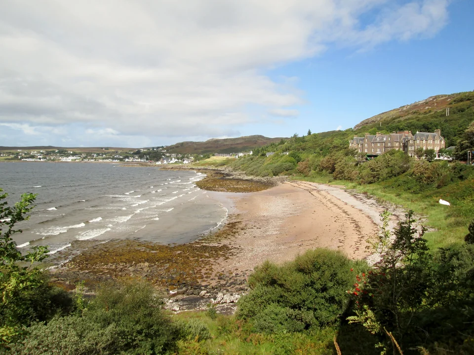
Photo: Martin Dawes / Geograph
Badachro: a mooring and the inn
Loch Ewe: an anchorage with a global history
Loch Ewe opens another world beyond Gairloch. During the Second World War, Allied merchant ships and their escorts assembled here before Arctic convoy passages to the Soviet Union. The scale of the loch helps explain why it was chosen: water now associated with small boats once held ships bound for a hazardous ocean supply route.
The Arctic Convoy Museum at Aultbea tells the story through the ships and people involved. Its wartime trail connects remains around the loch. Aultbea and Inverewe are different places on its shores; a museum visit and a garden landing need their own shore arrangements.
Arctic Convoy Museum · Aultbea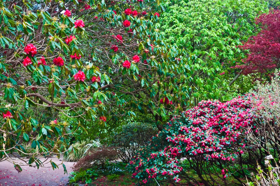
Photo: Phillip Capper
Inverewe: a garden beside the loch
Dense planting, paths and sheltered garden spaces offer a different view of Loch Ewe. The garden, house and café have separate seasonal opening hours. Visitors arriving by sea must contact the National Trust for Scotland office to arrange a space; the jetty is locked outside opening hours. Overnight use is not established by the published visitor information.
Inverewe · visits and sea accessInside Loch Broom
Ullapool & Loch Broom — a town made by the sea
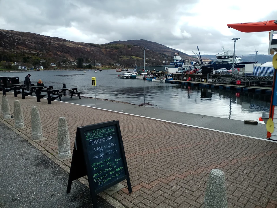
Photo: Victuallers
Ullapool sits inside Loch Broom, where an open coastal passage gives way to a town waterfront. Ferries, fishing vessels and visiting yachts share a working port. Shops, food, the museum and transport connections make it the principal town stop on this stretch of coast.
The British Fisheries Society founded the town in 1788 around the herring trade. Its planned streets and surviving curing buildings connect the waterfront to that history. Ullapool Museum adds the stories of surrounding communities, crofting and emigration; a seafood lunch keeps the connection with the working coast immediate.
Ullapool Museum Seafood Shack · seasonal food ashoreThe Inverness–Ullapool Citylink 961 bus provides a useful crew connection; Inverness Airport is reached via a separate city transfer.
Citylink · UllapoolIsle Martin: a community island
Near the mouth of Loch Broom, Isle Martin offers a small museum, heritage trail and walks that can be steep and boggy. The Trust welcomes visitors using their own transport, but its published information does not establish yacht dimensions or overnight pontoon terms. Its seasonal ferry leaves from Ardmair, a separate transfer from Ullapool.
Isle Martin Trust · visitingOff Coigach
Coigach & the Summer Isles — an island world
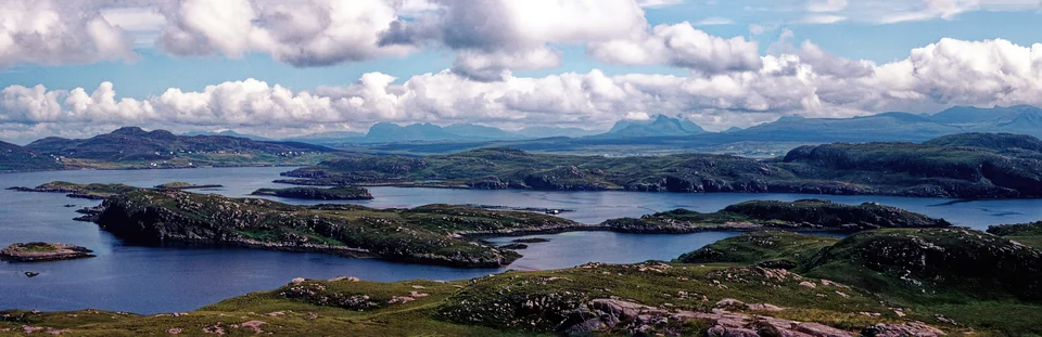
Photo: Julian Paren
Off Coigach, the coast breaks into islands, skerries and channels. The Summer Isles form a cruising ground of their own: nearby shores change the scale of the water while the mainland mountains remain in view. Tanera Mòr is the largest island; Tanera Beag, Isle Ristol and the smaller rocks give the archipelago its intricate shape.
Tanera Mòr’s herring station dates from 1784. Fish were processed and packed here for export; the island’s custodians explain that soil behind the station arrived from Ireland as ballast, emptied ashore before the ships loaded barrels of herring. Even a small patch of cultivated ground carries the history of a much larger trading world.
The Tanera Project now welcomes seafarers to the herring-station anchorage, bothy, museum and artists’ studio. The former post office and café elsewhere on the island have become a mess hall for the project; they are no longer the old visitor stop. Use the project’s current visitor information for the shore visit.
Tanera Mòr · the island and herring station Coigach and the Summer IslesLochs, islands and the open Minch
The islands lie west of the mouth of Loch Broom, with Coigach to the north and Lochinver beyond. An island anchorage belongs to a wider coast still exposed to wind and swell. Seals and seabirds are part of these waters; dolphins, porpoises and whales may appear farther out, without turning a passage into a promised wildlife encounter.
From Ullapool, a commercial Summer Isles cruise offers another way to see this geography. An excursion does not necessarily include an island landing.
Summer Isles excursions from UllapoolNorth of the Summer Isles
Assynt & Lochinver — a coast of silhouettes
North of Coigach, the mountain skyline changes. Suilven, Canisp and Quinag rise as individual shapes above lower ground threaded with rock, peat and freshwater lochs. From Loch Inver, the steep end of Suilven stands out behind the village. These silhouettes give Assynt a different character from the broad mountain walls of Torridon.
The North West Highlands Geopark helps explain the landscape. In the nineteenth century, rocks of apparently impossible ages and order led geologists to recognise enormous movements of the Earth’s crust. Along the Moine Thrust, older rocks had been pushed over younger ones. Inland exposures such as Knockan Crag tell that story particularly clearly; the isolated coastal peaks add their own long history of erosion.
North West Highlands Geopark · the moving landscape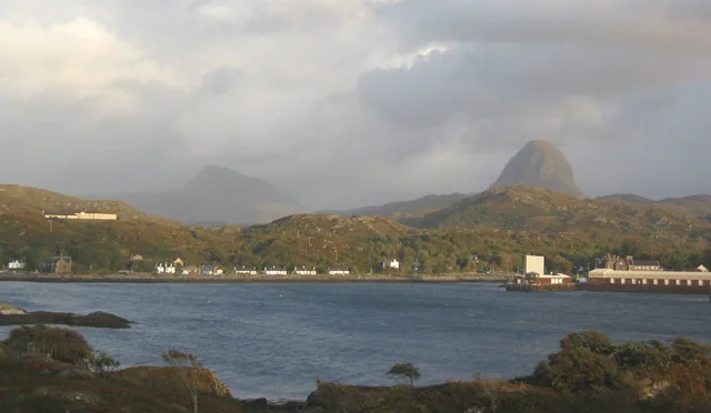
Photo: Espresso Addict
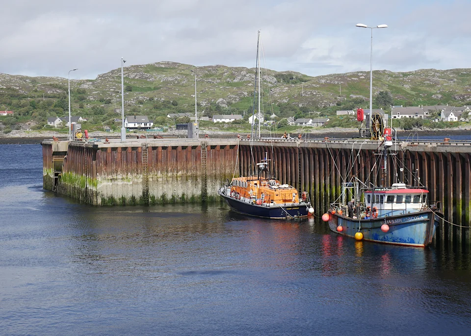
Photo: Craig Wallace
Lochinver: the Atlantic fishing port
Lochinver’s harbour serves fishing grounds off western Scotland, Rockall and the North Atlantic. That working role gives the village a scale and purpose beyond its size. Visiting yachts have pontoons with water and electricity, while fishing vessels continue to land their catches nearby.
Culag Woods brings paths, woodland and small coves into a shore visit; its roughly 3.2 km circuit includes steep, rocky and sometimes muddy sections. Lochinver Larder offers food by the River Inver. Farther along the coast, Achmelvich’s pale sand supplies another contrast to the rock and peat; reaching a beach ashore is a separate choice from finding a yacht anchorage.
Culag Woods · the woodland walk Lochinver LarderThe coast beyond Assynt
Loch Laxford & Kinlochbervie — the northern lochs
Loch Laxford: the inlets beyond the headlands
Beyond Lochinver and the Stoer peninsula, substantial services become more widely spaced. Loch Laxford breaks into islands and inlets, giving a different kind of stop from a town harbour. Its attraction is the water enclosed by low, rocky shores and the possibility of staying within that landscape while the outer coast changes with the weather.
Laxford is an anchorage landscape with little shore infrastructure. Different arms offer different shelter; a quiet berth here depends on the wind direction and the particular inlet. Kinlochbervie, farther north in Loch Inchard, provides the nearby working-harbour alternative.
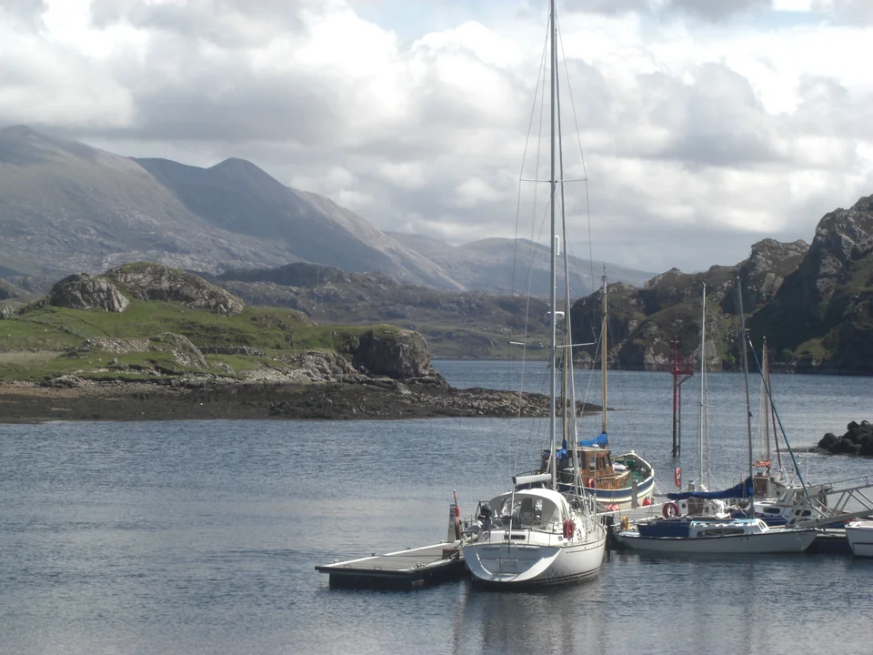
Photo: Stuart Logan
Kinlochbervie: a harbour built around work
Kinlochbervie’s importance comes from its position close to the north and west coast fishing grounds. Fish auctions, ice, stores and commercial quays explain the harbour’s scale. For visiting yachts it is a substantial harbour stop before Cape Wrath, with showers and a laundrette as well as pontoon access.
Scotland’s northwest corner
Cape Wrath — the turn from west to north
At Cape Wrath, the Atlantic-facing west coast turns towards Scotland’s north coast. The name is usually linked to the Norse idea of a turning point. Robert Stevenson’s lighthouse, built in 1828, stands above the headland: a visible marker of a very real change in the shape of the country.
The cape is directly exposed to Atlantic swell, and wind against tidal streams can produce difficult seas. Its character changes markedly with the weather window. Kinlochbervie and the lochs to the south give the approach its practical context; rounding the cape opens a different coast beyond this guide.
The Cape Wrath military range includes a sea danger area. Live firing can restrict access: the Ministry of Defence publishes the current Cape Wrath firing notices. The lighthouse tower itself is not open to the public.
Cape Wrath · Northern Lighthouse Board Cape Wrath firing notices · Ministry of Defence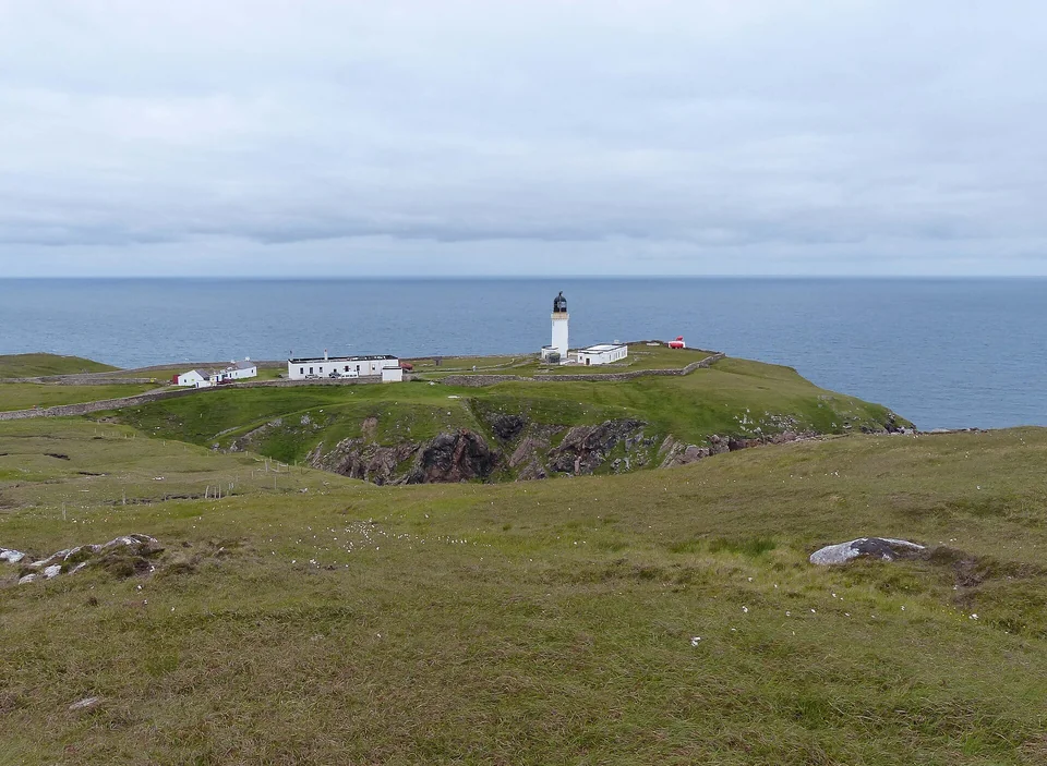
Photo: Kognos
Neighbouring cruising grounds
Across the Minch, or back towards Skye
The Outer Hebrides lie across the Minch; Skye and the Small Isles connect with the mainland waters to the south. Each brings another geography of harbours, islands and passages.
Explore the Outer Hebrides → Explore Skye and the Small Isles →Sources and local information
Local history and landscape
Applecross Trust Shieldaig · maritime origins Gairloch Museum · herring history Arctic Convoy Museum Ullapool · town history UNESCO · Wester Ross Loch Laxford · a visiting sailor’s accountHarbour and visitor information checked in September 2026. Operator links beside each place provide current arrangements.
Photographs and map sources
Photo credits and licences accompany each photograph. The coastal overview uses Natural Earth; the central detail uses OpenStreetMap coastline data.
Photographs, maps and provenance