Scotland

Scotland · Inner Hebrides

Southern Skye
and the Small Isles

A sheltered sound, mountains rising straight from the sea, and four very different islands offshore. Here the west-coast passage opens into a choice of Hebridean worlds.

East of Skye, the Sound of Sleat runs between a living Gaelic landscape and the mainland mountains. To the west, Loch Scavaig reaches beneath the Black Cuillin. Beyond lie Eigg, Rùm, Muck and Canna: close neighbours across open water, each with its own way of being an island.

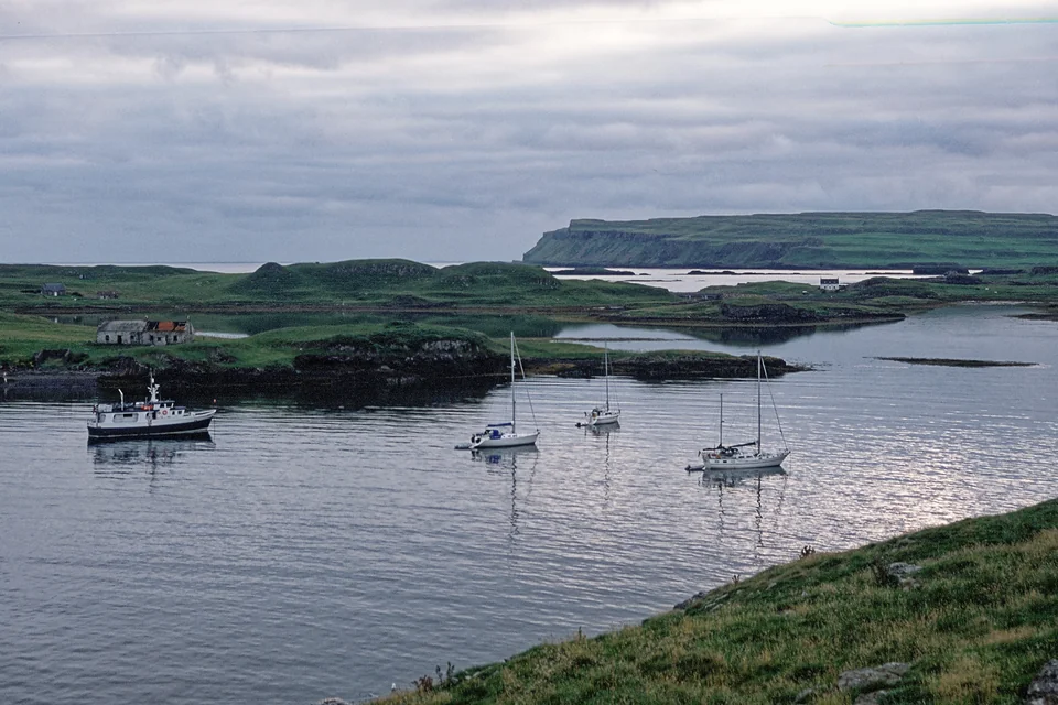
Sailing boats and a small motorboat on calm water in Canna harbour, with green islands and houses behind.
Canna harbour, August 2006: boats gather between Canna and Sanday.
Photo: Julian Paren

Geography first

Three waters, one cruising ground.

Mallaig faces southern Skye at the entrance to the Sound of Sleat. West of the mainland, the Small Isles form a loose cluster below Skye’s mountain coast. The distances are modest; the changes in exposure and character are substantial.

Southern Skye and the Small IslesSkye lies north of the Small Isles. Armadale faces Mallaig across the Sound of Sleat. Loch Coruisk is inland from Loch Scavaig beneath the Cuillin. Eigg and Muck lie south of Rùm; Canna and Sanday lie to its northwest. Linked places open their guide sections.Skye and the Small IslesCarbostSkyeCoruiskElgolArmadaleCannaSandayRùmKinlochMallaigArisaigEiggMuck≈ 5.4 nautical milesN ↑● Places□ Boatyard© OpenStreetMap contributors · ODbLSound of SleatSouthern Skye and the Small IslesSkye lies north of the Small Isles. Armadale faces Mallaig across the Sound of Sleat. Loch Coruisk is inland from Loch Scavaig beneath the Cuillin. Eigg and Muck lie south of Rùm; Canna and Sanday lie to its northwest. Linked places open their guide sections.Skye and the Small IslesCarbostSkyeLoch CoruiskElgolArmadaleCannaSandayRùmKinlochMallaigArisaigEiggGalmisdaleMuckPort Mòr≈ 5.4 nautical milesN ↑● Places□ BoatyardNatural Earth · © OpenStreetMap contributors · ODbLSound of Sleat
A locator showing island harbours and places ashore.Coastline: Natural Earth and © OpenStreetMap contributors, ODbL. Map data

The inside coast

The Sound of Sleat offers more shelter from Atlantic swell, with wooded shores, villages and views into Knoydart. It continues north to the tidal narrows at Kylerhea.

The mountain coast

Round Point of Sleat, Skye faces the more exposed western waters. Loch Scavaig draws the boat into the landscape beneath the Black Cuillin.

The Small Isles

Eigg, Rùm, Muck and Canna are linked by open-water passages. There is no chain of marinas here: visits revolve around anchorages, a few community moorings and landings shared with island traffic.

The mainland connections

Mallaig brings railway, ferries and marina facilities together. Arisaig, farther south, has visitor moorings and a boatyard.

For a sense of scale, recorded passages from Eigg to Loch Scresort on Rùm, and from there to Canna, were about 11 nautical miles each. These crossings still bring wind, swell and the choice of a suitable landing into the day’s sailing.

The inside coast

Sound of Sleat — a living Gaelic shore.

Sleat is Skye’s southern peninsula: a greener, more inhabited coast facing the mainland across a long sound. Armadale and Isle Ornsay look towards Knoydart; Loch Nevis and Loch Hourn reach into the mountains opposite. Sailing here places villages, wooded slopes and mainland glens in the same view.

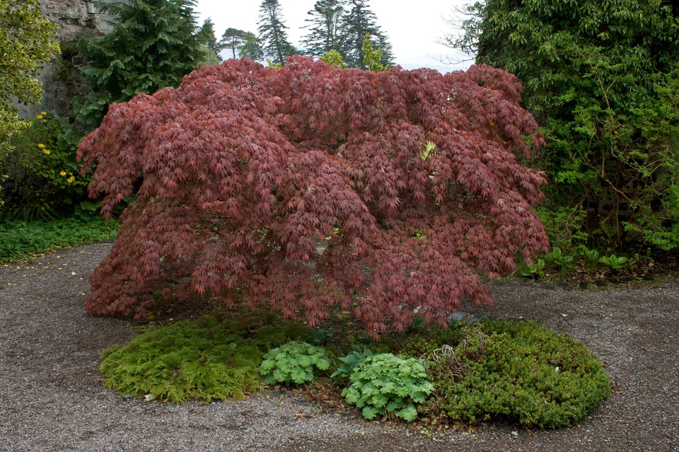
Gravel paths wind among green plants and a red-leaved tree in Armadale Castle’s gardens.
Armadale’s gardens, 21 May 2010.
Photo: Mike Peel (www.mikepeel.net)

Armadale · Clan Donald

The old seat of power, beside the sound.

The ruined castle at Armadale was the last principal home of the MacDonald chiefs of Sleat. Its gardens surround the remains of an estate built on an older maritime world: the power of Clan Donald extended across islands joined by sea. The Museum of the Isles carries that story through clan politics, the Jacobite period and crofting life.

The garden paths and museum are about ten minutes’ walk from the ferry terminal. The operator lists daily opening from 27 March for the 2026 season; its opening page carries current hours.

Castle, gardens and museum opening
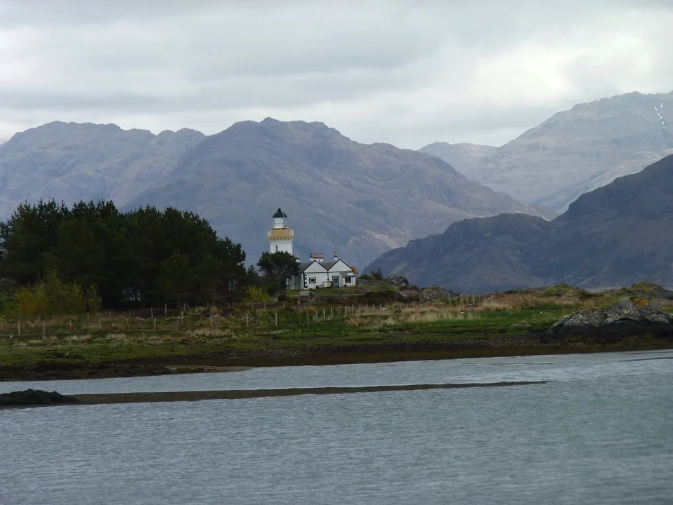
A white lighthouse and keeper’s cottage on a low wooded island, with steep mainland mountains across the water.
Ornsay lighthouse against the mainland mountains, 21 May 2013.
Photo: James Allan

Isle Ornsay · Eilean Iarmain

A pier, a pub and Knoydart across the water.

Isle Ornsay has the scale of the inside coast: a small settlement, an old stone pier, the Eilean Iarmain hotel and its pub facing the sound. Offshore, the white Ornsay lighthouse, first lit in 1857, stands against the mountains of Knoydart. The shore and the distant ridges are the attraction here; a meal by the water belongs naturally to the stop.

Eilean Iarmain: the place and its Gaelic heritage

The mountain coast

Loch Scavaig — arrive beneath the Cuillin.

Round southern Skye and the scale changes. The green shores of Sleat give way to the western sea; beyond Elgol, the Black Cuillin rise in dark ridges above Loch Scavaig. Approaching by yacht, the mountains fill more and more of the view until the boat lies beneath their walls.

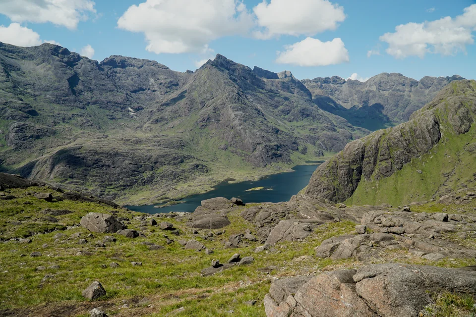
Loch Coruisk and the Cuillin mountains seen from above, from the high viewpoint of Sgùrr na Stri.
Loch Coruisk within the Black Cuillin, seen from Sgùrr na Stri on 15 July 2025.
Photo: Phil1401

From salt water to Loch Coruisk.

The attraction is the connection between sea and mountain. From the head of Loch Scavaig, a landing gives access to freshwater Loch Coruisk, enclosed by the Cuillin. The low ground beside the loch brings rock, water and the mountain amphitheatre close; the high viewpoint in the photograph is a separate mountain walk.

The steep terrain also funnels powerful gusts and squalls down into the anchorage. Scavaig can be a poor place in strong winds, even when its enclosing hills suggest shelter. Its particular reward is an arrival in settled conditions, with time to take in the shore.

Elgol’s view across the water.

Elgol faces the Cuillin from the opposite side of Loch Scavaig. For visitors arriving by road, its local boat trips offer the sea approach and time ashore at Coruisk; they are weather dependent.

Misty Isle: boat trips from ElgolLocal sailing guide: the two sides of Skye

Eigg · Rùm · Muck · Canna

Four islands. Four ways of island life.

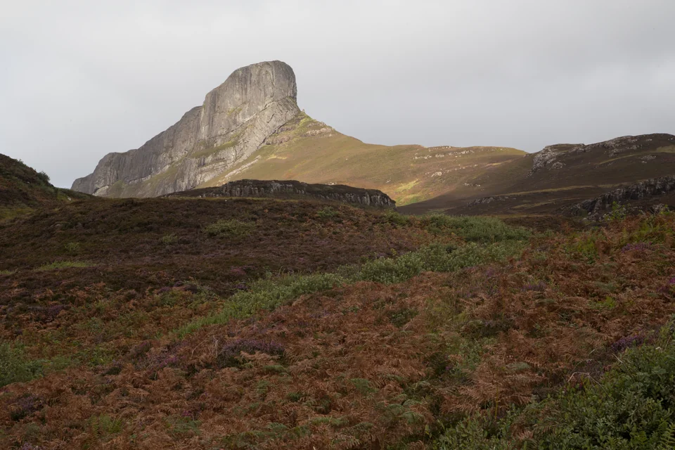
An Sgùrr gives Eigg a profile of its own. Rùm rises into a much larger mountain mass; Muck lies low and green; Canna gathers boats in its harbour. Their modern histories are just as distinct: community ownership, a nature reserve and village, a family farm, and an island held by the National Trust for Scotland.

An Sgùrr’s steep rock profile rises above heather and bracken beneath a cloudy sky on Eigg.
An Sgùrr’s unmistakable profile above Eigg, 30 August 2017.
Photo: Tom Parnell / itmpa

Eigg · community ownership

An island shaping its own future.

An Sgùrr’s steep prow makes Eigg recognisable well before arrival. Below it, the landing at Galmisdale leads to An Laimhrig: café, shop and local businesses clustered where people and goods come ashore. Farther inland, paths lead towards the ridge, the crofting landscape and beaches looking across to Rùm.

In 1997, a community buyout put Eigg into the care of the Isle of Eigg Heritage Trust. Homes, businesses and island infrastructure have since become part of a shared project. The community electricity grid combines hydro, wind and solar power, with diesel backup when needed. That continuing work is as much part of Eigg’s identity as its skyline.

An Laimhrig has food, shops and wash-house facilities, with individual businesses opening seasonally.

An Laimhrig and island facilitiesThe island’s community buyout
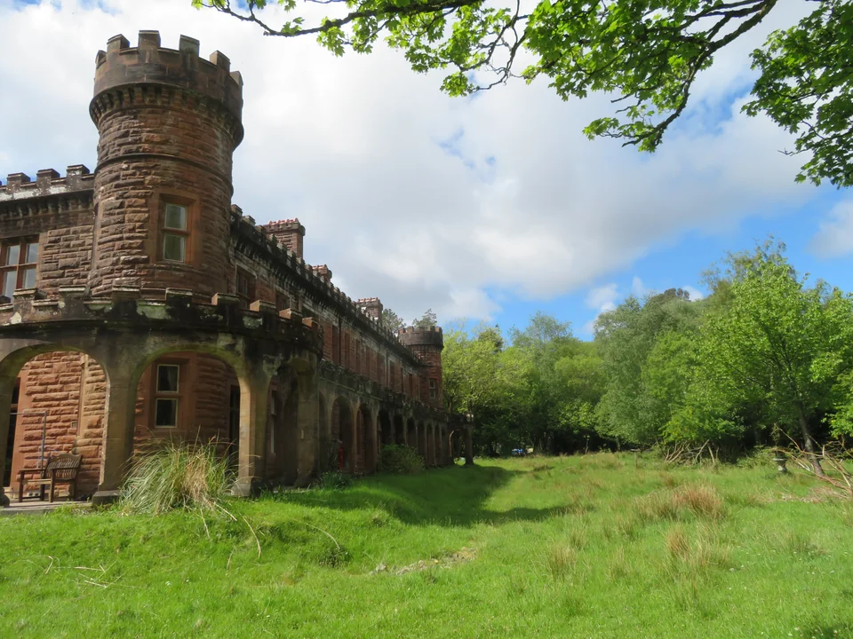
Kinloch Castle’s red stone façade, lawn and woodland edge on Rùm, seen from outside.
Kinloch Castle at the edge of Rùm’s mountain country, 24 May 2022.
Photo: M J Richardson

Rùm · mountains and Kinloch

A great mountain island, with a village at its edge.

Rùm is the largest and most mountainous of the Small Isles. Loch Scresort opens on its eastern side, bringing the yacht to Kinloch beneath the bulk of the hills. The community owns land and property around the village; most of the island is managed by NatureScot as a National Nature Reserve.

Beyond Kinloch, the landscape opens into moorland, glens and steep ridges. Red deer are part of the island’s long research history, while Manx shearwaters nest in burrows high in the hills and return from the sea after dark. Woodland paths around the village offer a closer, gentler encounter with the reserve than the mountain routes.

The red sandstone of Kinloch Castle introduces a startling change of scale. George Bullough, an industrialist’s wealthy son, built it as an extravagant sporting home; luxuries and even its building stone arrived by sea. The exterior can be seen from the passing track. The castle interior is closed, with no tours.

Kinloch’s woodland trail leads towards a wildlife hide, about 1.5 kilometres from the main pier.

NatureScot: the reserve and visits
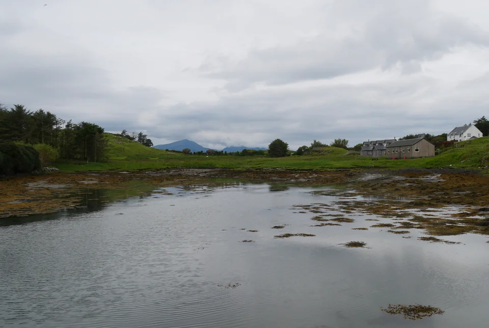
A tidal inlet with seaweed, low green fields and village buildings; distant mountains rise beneath cloud.
Port Mòr from the old pier, 20 July 2025: Muck’s low green shore, with Rùm beyond.
Photo: habiloid

Muck · farm and community

Fields, freight and a small island’s daily life.

South of Eigg, Muck changes the proportions: lower hills, green fields and a working sheep-and-cattle farm. Most of the island belongs to the MacEwen family, whose connection goes back to the nineteenth century. A primary school, community hall and a small group of households sustain a place where farming remains central.

The islanders describe unloading ferry freight together — a practical glimpse of how this community works. In summer, the tearoom at Port Mòr becomes a meeting place for residents and visitors. Across the island, Gallanach opens to the north; the walk between the two bays places Rùm’s mountains beyond Muck’s pasture.

The community hall provides toilets, a shower and laundry facilities; the tearoom opens seasonally.

Life in Muck’s community

Canna · harbour, history and memory

A harbour full of voices.

Northwest of Rùm, the bay between Canna and Sanday brings yachts, ferries and working boats into the same small harbour. Its buildings and green slopes feel gentler than Rùm’s mountain front. Community moorings, the shop and people arriving from other islands give it a natural gathering-place character.

Canna House holds the collection assembled by John Lorne Campbell and Margaret Fay Shaw: Gaelic songs, stories, photographs and recordings gathered across the Hebrides and as far away as Nova Scotia. The island passed to the National Trust for Scotland in 1981. The archive connects ordinary lives — work, music, remembered journeys — across a much wider seaborne world.

The house reopened in 2025 after conservation work and is visited by prebooked guided tour. Around 2,000 recordings are also available through Tobar an Dualchais. Listening to a song or story before going ashore gives the collections a human voice, whether or not you speak Gaelic.

Beyond the harbour lie traces of prehistoric farming and early Christian life, abandoned settlements and seabird cliffs. The carved Celtic cross at Keill gives this older landscape a particular focus for a walk ashore. Canna’s past is present in the ground as well as in the house. Alongside it, farming, fishing and creative work continue: the island is both an archive and a home.

Canna’s Gaelic collections and recordings
Canna House: tours and opening

The mainland connection

Mallaig — railway, fishing boats and island ferries.

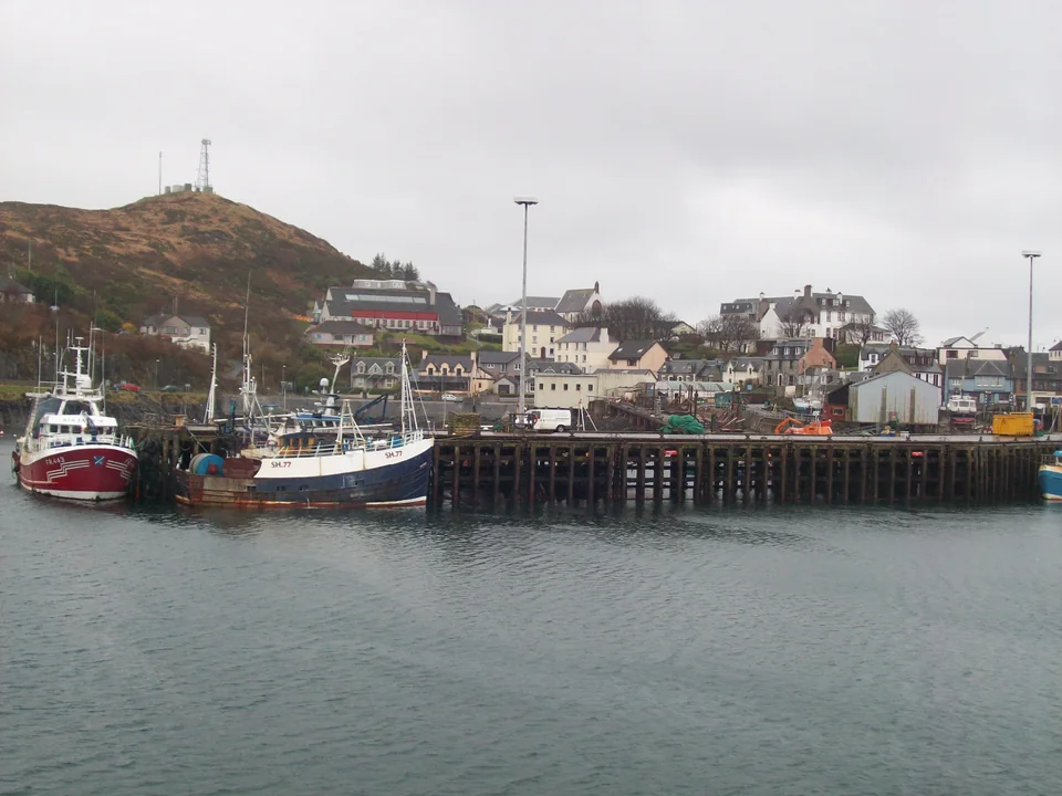
The railway ends at Mallaig, close to the working waterfront. Fishing boats, island ferries and visiting yachts share the harbour, while shops, places to eat and the Heritage Centre make it a useful place to join a boat or replenish stores.

Fishing boats along Mallaig’s quay, with shopfronts and white houses climbing the slope behind.
Mallaig’s working harbour, 24 March 2009.
Photo: Dbx54

A practical meeting point.

The West Highland Line connects Glasgow Queen Street with Mallaig. CalMac ferries link the port with Armadale and the Small Isles; their service patterns and weather disruptions matter for crew changes involving an island. Glasgow Airport’s city bus connects with the rail journey through central Glasgow.

ScotRail: Glasgow–MallaigCalMac: Small Isles services

Arisaig: moorings and boat work.

The business called Mallaig Boatyard is based at Corpach, farther inland near the Caledonian Canal, rather than at Mallaig Marina.

Farther along western Skye.

North of the Cuillin coast, Loch Harport reaches inland to Carbost and the Talisker distillery. This is another stretch of western Skye, reached around an exposed coast.

Beyond the Small Isles

The next horizon opens out.

From Canna and Rùm, the mainland lies east, Skye rises to the north and the Outer Hebrides draw the eye west and northwest. The more sheltered route north continues through the Sound of Sleat and Kylerhea; western passages lead towards a different island chain. This is one of the places where the geography of a Scottish cruise becomes wonderfully open.

Sources and photo credits

Sources

Local information reviewed 22 September 2026, using island communities, harbour operators, NatureScot, the National Trust for Scotland and Gaelic cultural institutions. Links beside each place lead to current visitor and access information.

Canna House: Gaelic collections

Photo sources

Photographer, date and licence appear beside each image. The maps have separate source credits.

Photographs and licences The map’s geographic data