Balearic Islands · Menorca
Menorca.
One more dip.
A bay with clear water, a garden on a small island and dinner by the harbour. Menorca leaves room for both beach days and town life, with time to return to somewhere that appeals.
Seven to ten days around Maó, or more time along selected coasts. The holiday need not go all the way around the island.
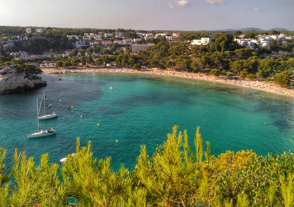
Photo: Travelinho
The easternmost island
Choose a few places.
Get to know them a little.
Maó is in the east, Ciutadella in the west. The north coast’s villages and the south coast’s coves offer different kinds of days.
- 1 · MaóA possible base, town life and provisioning.
- 2 · Es Castell / Cales FontsAn evening by the water, as a land excursion.
- 3 · Illa del ReiArt and garden by passenger boat.
- 4 · Es Grau / ColomVillage beach, park trails and a possible visit by sea.
- 5 · AddaiaA quieter harbour, if the depth suits.
- 6 · FornellsWhite houses and seafood by the bay.
- 7 · CiutadellaThe old town and a long evening ashore.
- 8 · Galdana / MacarellaA swim and a path through the pine woods.
How long are the legs?
Yates Mallorca estimates about 10 nautical miles from Macarella to Ciutadella, 25 from Ciutadella to Fornells and 25 from Fornells to Maó. These are rough operator estimates with no specified sailing track. The connection around the northwest coast, in particular, is more than a short hop between swimming coves. No sailing time or continuous sequence of available stops has been established.
The operator’s approximate distances ↗Time to stay
A week with one base.
Or several weeks with fewer plans.
Seven to ten days: A suitable harbour in Maó can be a base for outings in the east, with several days without moving the boat.
About two weeks: Choose a few coasts and town stays. Two to three weeks can leave room for longer stays, more outings and further swims at a favourite spot.
June or September may be options. Wind, swell and heat can change the plan; neither calm coves nor few visitors are guaranteed. The durations are holiday ideas, and a longer stay requires a suitable harbour agreement.
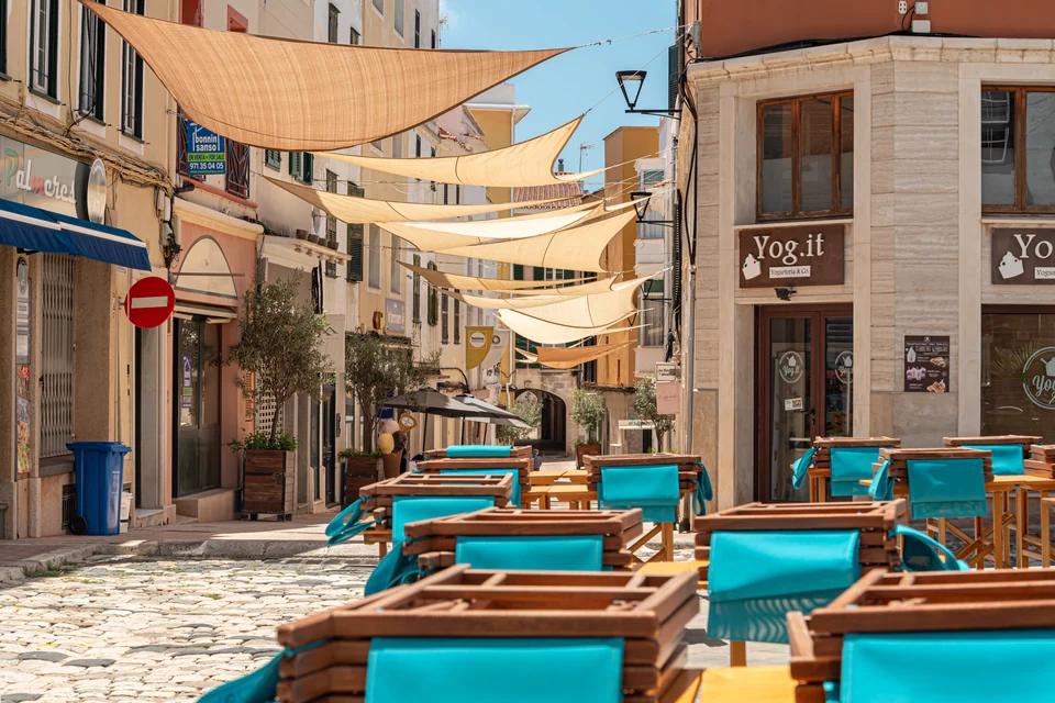
Photo: Jorge Franganillo
1 / Maó
Café tables
and town life.
Maó leaves room for shopping, café visits and dinner ashore, with provisions for the boat along the way.
A stay here requires a suitable berth with shore access for the entire period.
Which marina in Maó?
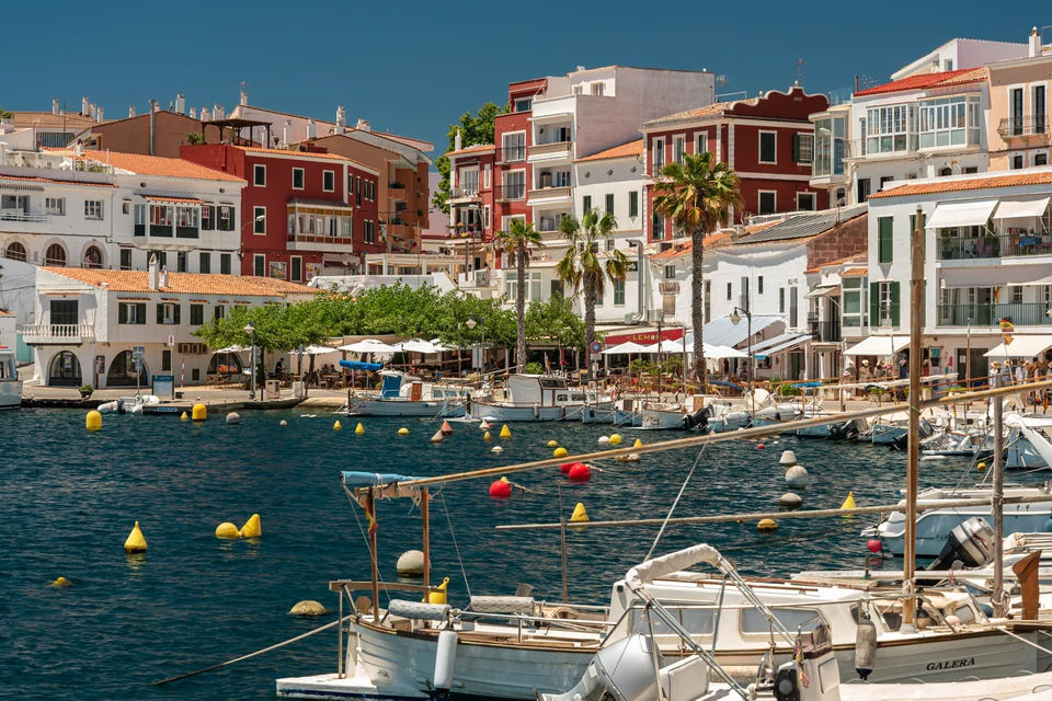
Photo: Jorge Franganillo
2 / Es Castell · an evening ashore
A table at Cales Fonts.
The colourful houses and small boats give the evening a different setting from Maó. A stroll along the water can end with a leisurely dinner.
As a land excursion from Maó, the visit requires transport both ways; neither a berth, a dinghy landing nor a short walk around the entire harbour has been established.
More about Cales Fonts and the harbour towns ↗3 / Illa del Rei · a day without sailing
Art and garden
on Illa del Rei.
Hauser & Wirth on Illa del Rei combines galleries with Piet Oudolf’s garden. A visit can also include lunch at Cantina.
The gallery boat leaves from Moll de Llevant 61. Getting from the marina to the departure point is a separate leg. The opening day and return boat need confirmation for the date of the visit.
The visit and the harbour’s different places
The dedicated visitor portal lists different spring, summer and autumn periods. When checked on 18 September 2026, the period from 9 September to 25 October was listed as Wednesday–Sunday, 10:00–16:00; these are not fixed opening hours for future years.
The visit is by passenger boat. Independent landing by boat or dinghy has not been confirmed.
- A: Sa Colàrsega – a possible holiday berth with shore access.
- B: Varadero Menorca – technical work, separate from the marina.
- C: Moll de Llevant 61 – departure point for the gallery boat.
- 2 and 3: Es Castell and Illa del Rei – excursion destinations.
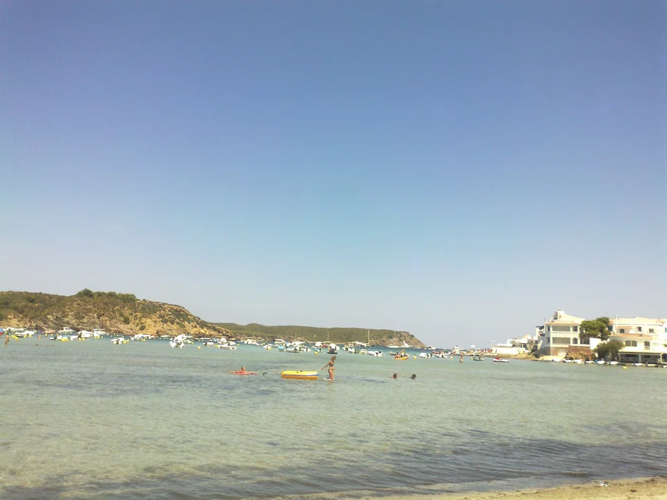
Photo: Songbird8
4 / Es Grau
Beach, village
and a short walk.
A day in Es Grau can begin at the village beach and continue on the park’s trails. A short walk by the lagoon is one option. Es Grau can also be visited by road from Maó while the boat stays put.
A visit by sea to Illa d’en Colom requires separate clarification of buoy arrangements, weather and landing. The village, visitor centre and island are different destinations.
The park, seagrass and Colom
The park authority prohibits anchoring over both Posidonia and Cymodocea. Marine protected zones must be checked on current maps; this locator map does not show legal anchorages.
The park’s website describes two public beaches on Colom, while the rest of the island is private and strictly protected. This does not confirm a specific dinghy landing in the prevailing conditions. The buoy berth at Colom–Tamarells is a separate service with its own terms.
The Rodríguez Femenías visitor centre is reached by a separate turn-off from the road to Es Grau. Swimming belongs at the sea beach; the lagoon itself is protected against swimming and recreational activities.
Park authority: visits and protection ↗PortsIB: Menorca’s mooring fields ↗5 / Addaia · access and berths
A quieter harbour?
Addaia can offer a less urban stay, with rural surroundings and a small marina. Depth at the entrance and alongside the pontoon remains crucial and unresolved.
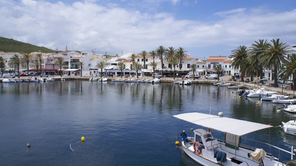
Photo: Ian Kirk
6 / Fornells
A walk along the bay.
Then dinner.
White houses, small boats and an evening with seafood. Fornells is known for its lobster stew, caldereta de langosta.
A visit where everyone goes ashore requires a suitable pontoon berth or arrival by road. On a public buoy, PortsIB requires someone to remain on board.
Pontoons, buoys and water are separate questions
PortsIB’s August 2026 drought instruction applies to Fornells and Addaia, among other places. It restricts the supply and use of drinking water for nautical purposes while the municipal measures remain in force. The current status and the possibility of filling the drinking-water tank need clarification. This is not evidence of a general ban on seawater-based watermakers on board.
Drought instruction, August 2026 ↗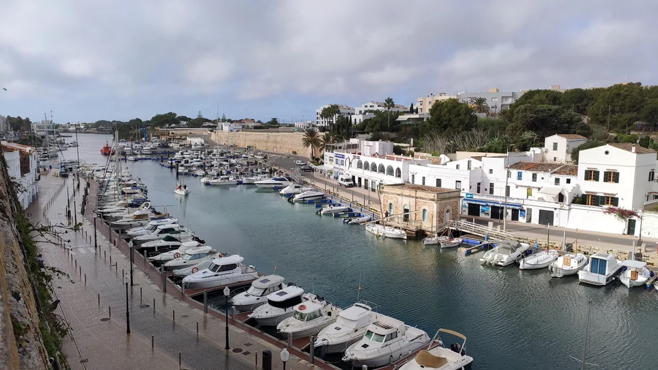
Photo: Américo Toledano
7 / Ciutadella
The old town first.
The harbour later.
The day can begin in the streets above the harbour and continue down by the water for dinner. There is reason to stay more than one evening here, or visit by road from another base.
A suitable visitor berth must be arranged with the harbour. The harbour is also exposed to rissaga – rapid, weather-induced changes in water level.
A private berth or a visit by land
Son Blanc is the outer ferry terminal. It is not the berth in the inner harbour. On arrival by ferry, the transfer from the terminal to the boat still remains.
AEMET: current weather warnings ↗More about Ciutadella ↗8 / Cala Galdana and Macarella
A swim
and a little of the coastal path.
Galdana has buildings and amenities around the beach. Macarella is less developed, and Camí de Cavalls connects them through the pine woods. A swim and a stretch of the path can be enough for the day.
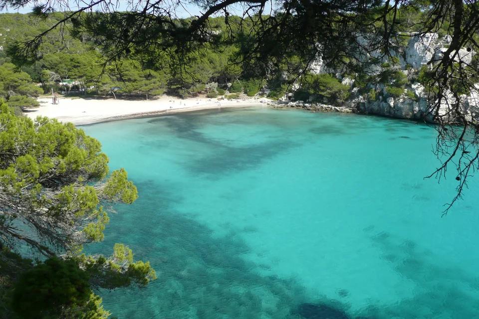
Photo: Paul Stephenson
The coves can be visited overland from Ciutadella. A stay by boat depends on swell, bathing areas, protection rules and depth; no dinghy landing or overnight stay has been confirmed.
A beach day suited to the conditions
Road access needs checking for the relevant season. Macarella is not a confirmed provisioning stop.
Menorca’s tourism brochure: the landscape and path ↗An option for a longer holiday
A crossing
from Mallorca?
If the crossing itself appeals, Mallorca can be the start of a longer stay or a one-way holiday. For a short Menorca holiday, arriving directly at the airport and Maó is a simpler starting point.
The crossing can be part of the holiday or a separate relocation leg. Distance alone does not decide the choice; weather, time and the desire to make the crossing also matter.
Crossing in your own boat or by passenger ferry
Yates Mallorca estimates Cala Ratjada–Macarella at about 25 nautical miles. Macarella is a weather-dependent cove, not a confirmed arrival harbour. An agreed alternative harbour and suitable weather are needed before departure.
Baleària operates a passenger ferry between Alcúdia and Ciutadella. This is a different journey, with separate terminals and onward transport from Son Blanc. The ferry time is not an estimate for sailing in your own boat.
The operator’s crossing estimate ↗Baleària: the passenger ferry ↗Back to the Balearic Islands ↗Getting here
From the airport
to the harbour.
Menorca Airport, MAH, is a natural arrival point for Maó. A taxi can take you to the correct harbour gate. Airport bus 10 runs to Maó bus station; the journey to the boat remains from there. Preparation and any relocation legs are planned separately from the holiday days.
From the airport to the chosen harbour
For Ciutadella, TMSA describes a change in Maó to line 01, followed by onward transport to the agreed berth. A prearranged taxi is another option.
Aena: airport bus 10 ↗Aena: taxi ↗TMSA: onward to Ciutadella ↗A base for the whole stay
Standard public visitor berths allow a maximum stay of five days. Public buoys normally allow three consecutive days with overnight stays; further extension requires specific approval. Successive new bookings cannot be used to bypass the limits.
The buoys cannot be used to leave a boat without crew, and they are neither storm shelters nor storage places. The weather and liability terms must be read for the booking concerned. These rules apply to the public products, not automatically to every private berth. A seven-to-ten-day holiday therefore needs a suitable agreement.
PortsIB: berth conditions ↗PortsIB: buoy conditions ↗Boatyards, storage and supervision
Varadero Menorca at Moll del Cos Nou lists existing lifting equipment of 30, 50 and 150 tonnes. The mentioned expansion and new 80-tonne equipment are project information. Pedro’s Boat offers maintenance and storage, but the same yard page gives conflicting lifting figures. The largest figure cannot be used as confirmed capacity.
A quotation must cover the boat’s actual loaded dimensions, weight, keel, shoreside supports and any mast work. Berthing, workshop work, storage and supervision during periods without crew are separate matters to settle. No price or availability has been established; any quotations are compared with their dates and excluding VAT.
Varadero Menorca: current services ↗Pedro’s Boat: haul-out and conflicting figures ↗Pedro’s Boat: maintenance ↗Two earlier visits
A garden.
A walk through the village.
Glimpses of Illa del Rei and Es Grau. The films show earlier visits; current exhibitions, transport and access need checking separately.
Photo and planning sources Reviewed 18 September 2026
The photographer, date, source and licence are listed beside each image. They show earlier visits, not present-day harbour facilities or access. The holiday lengths are suggestions.
Map sources
North-up Mercator maps with approximate place points. The Maó inset uses more detailed coastline geometry. The maps show no depths, sailing tracks or permitted landing and anchoring zones.
Natural Earth 1:10m, version 5.1.1 ↗Natural Earth: public domain ↗© OpenStreetMap contributors · ODbL ↗Download Maó coastline data · GeoJSONMap design: Sophie · CC BY 4.0 ↗Weather and further planning
Practical sources are gathered beside each place. June and September are possible travel periods, not promises about the weather. The film selection is based on visual spot checks without sound, not a full review; automatic captions were not used as a factual source.
AEMET: historical climate normals ↗AEMET: Balearic marine forecast ↗AEMET: explanation of rissaga ↗