Balearic Islands · two islands to get to know

Ibiza and Formentera.
Time for the sea and small-town life.

A swim, lunch in the shade and an evening in the old town. Several days in one place leave time for town life on Ibiza or cycle rides on Formentera.

Seven to ten days between the islands can make a whole holiday.
The mainland is a separate option to add.

Towns and beaches
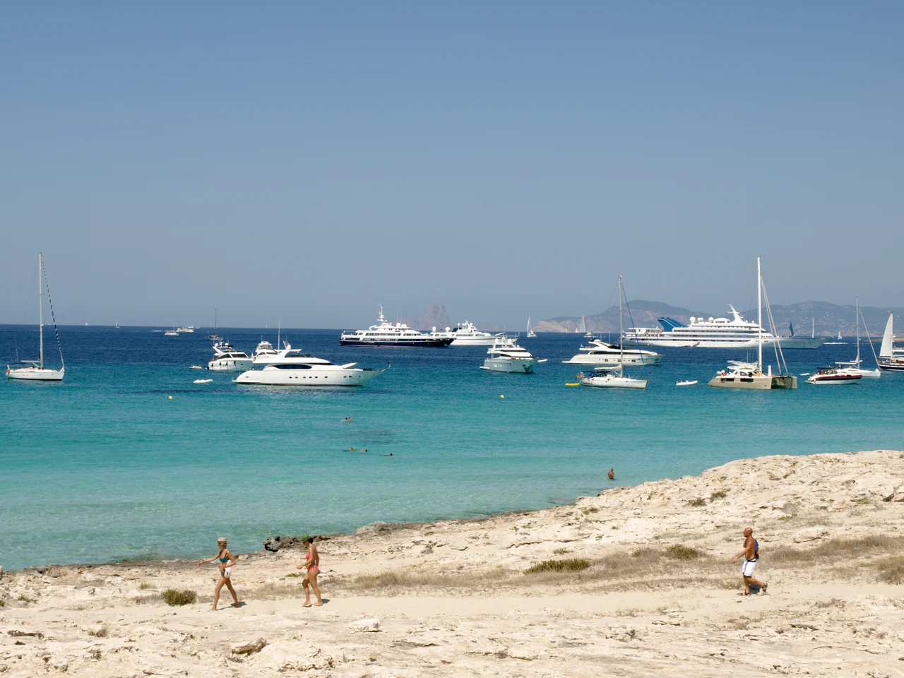
People walking along the pale beach, with turquoise water and many boats offshore.
The beach at Ses Illetes on Formentera · 19 August 2013.
Photo: MrPepanos

The islands and the mainland

Two islands. Several ways to spend your time.

Ibiza and Formentera lie east of Dénia and the mainland coastal towns. A stay can focus on the islands or combine them with the coastal towns and the long crossing.

The mainland and two islands Dénia, Xàbia, Altea, Sant Antoni, Eivissa, La Savina. The mainland and two islands Places to choose from Dénia Xàbia Altea Sant Antoni Eivissa La Savina Mainland Ibiza Formentera Mediterranean Sea 50 km N Natural Earth / © OSM contributors
Mainland and islands with the coastal towns described.Natural Earth · © OpenStreetMap contributors · Map data · ODbL

Choosing the scope of a trip

  • Seven to ten days · the islandsEivissa and Formentera, with time for beaches and town life without sailing all the way around Ibiza.
  • Ten to fourteen days · a little more of IbizaRoom for a stay at Sant Antoni in the west or Santa Eulària in the east.
  • Two to three weeks · mainland and islandsA possible combination with one or two coastal towns, allowing time for the crossing and any wait for suitable weather.
Harbours and berths ↓What does the crossing involve? ↓
A closer look at the island map and places
Ibiza and Formentera Sant Antoni, Santa Eulària, Platges de Comte, Eivissa, s’Espalmador, Trucadors, La Savina, Sant Francesc, Cala Saona. Ibiza and Formentera Places to choose from Sant Antoni Santa Eulària Platges de Comte Eivissa s’Espalmador Trucadors La Savina Sant Francesc Cala Saona Ibiza Formentera 10 km N © OpenStreetMap contributors
Towns, beaches and islands around Ibiza and Formentera.Natural Earth · © OpenStreetMap contributors · Map data · ODbL

Places on the islands

  • IbizaSant Antoni and Platges de Comte in the west, Santa Eulària in the east, Eivissa with Dalt Vila in the southeast.
  • FormenteraLa Savina in the north, Sant Francesc inland and Cala Saona on the west coast.
  • Ses Illetes and s’EspalmadorSes Illetes lies on Formentera’s northern spit. s’Espalmador is a separate island to its north.
See the island marinas ↓

From a place to a berth

Harbours and berths.

Marinas by the towns and islands on the map, with berth details, locations and links to the harbour offices.

Formentera · La Savina

Ibiza

Mainland

Ibiza · town life and coast

An afternoon among white houses.

In Eivissa, Dalt Vila’s streets and walls climb the hill from the harbour. A slightly cooler part of the day suits the walk well.

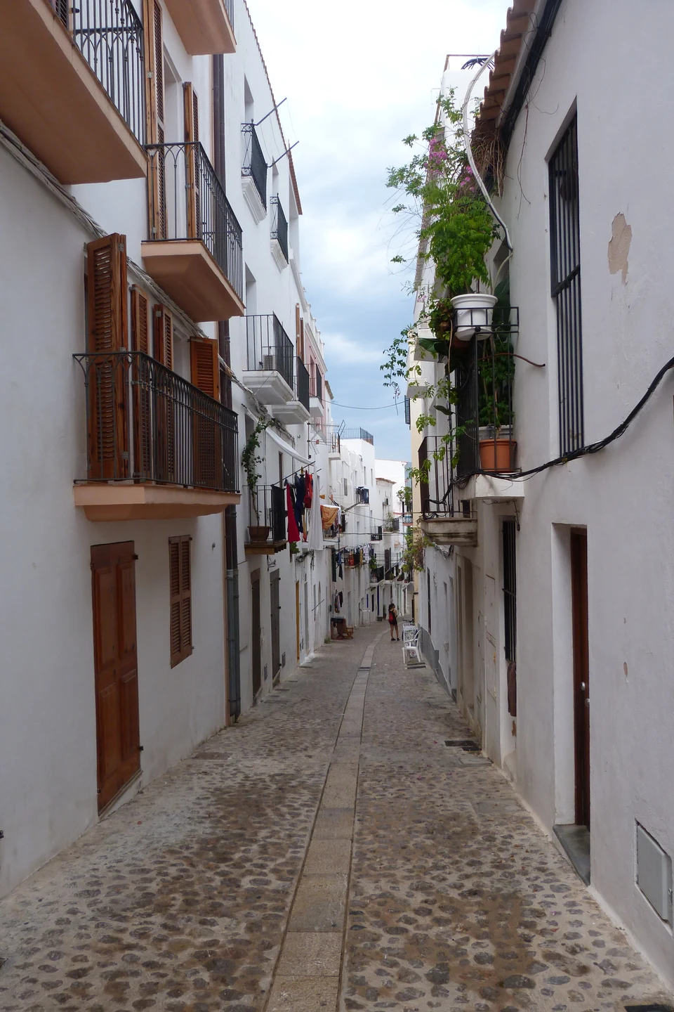
A narrow cobbled street between white houses and balconies in Dalt Vila.
A street in Dalt Vila · 29 August 2017.
Photo: steve p2008

The old town first. Dinner afterwards.

The streets within the city walls overlook the harbour. Below them are restaurants and small shops in the La Marina quarter. Marina Ibiza lies on the north side of the harbour basin, with Dalt Vila opposite.

Marinas on Ibiza ↓
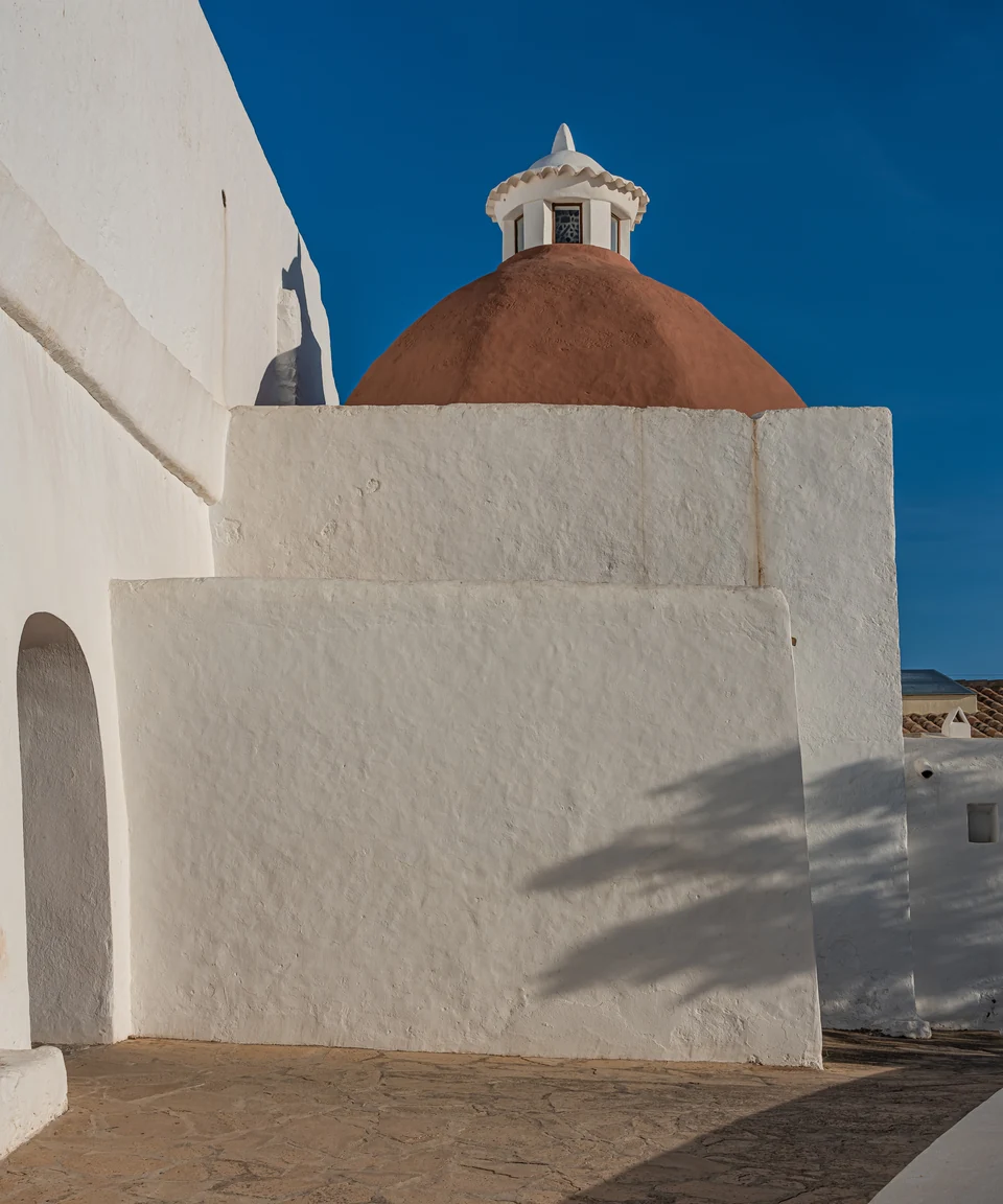
Whitewashed walls and a red dome at the church on Puig de Missa.
Puig de Missa in Santa Eulària · 21 April 2023.
Photo: A.Savin, Wikipedia

Another day in Santa Eulària.

Santa Eulària has a seafront promenade and a walking path along the river, past the old mill. Puig de Missa stands on the hill, with white church walls and views over the town.

Sant Antoni is an alternative on the west coast, also as an arrival point from the mainland. Platges de Comte, with sandy beaches and views towards the small islands, can be visited on an outing from there.

Santa Eulària: places along the walks (PDF, 2025) ↗

Formentera · stay a few days

Cycling, salt landscapes and a swim.

La Savina is the starting point for a stay on Formentera. From here, outings lead to Sant Francesc, through the salt landscapes and out to the beaches at Ses Illetes. The island can also be visited by passenger ferry from Ibiza.

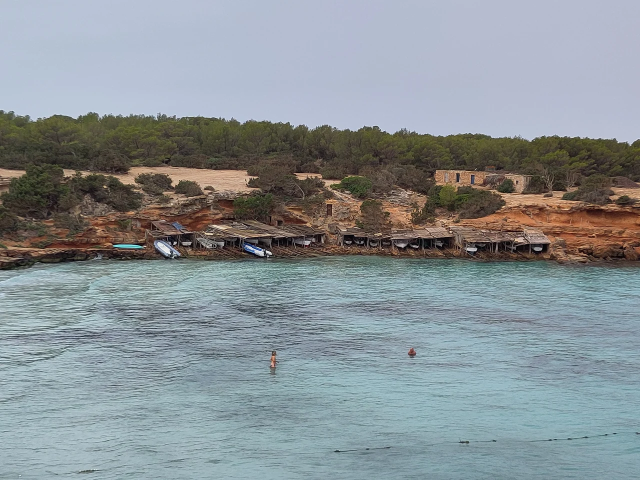
Low boathouses and boat slipways beneath the reddish cliffs on the far side of Cala Saona.
The boathouses at Cala Saona, seen from the beach · 8 September 2024.
Photo: Joan Gené

Cala Saona from the land.

Low boathouses and reddish cliffs frame Cala Saona. The beach on the west side of the island is a pleasant destination for a cycle ride and a swim.

The two marinas in La Savina ↓
Anchoring and mooring buoys off Formentera

Badia de s’Alga by s’Espalmador and Caló de s’Oli by La Savina have regulated mooring fields. In PortsIB’s fields, someone must remain on board; advance bookings are limited to three consecutive nights. The fields are intended for short stays in favourable sea conditions.

Posidonia is protected seagrass, and Ses Salines Natural Park has its own anchoring rules. The channel between Trucadors and s’Espalmador has strong currents, and crossing it on foot is prohibited.

PortsIB · mooring fields and reservations ↗PortsIB · conditions of use ↗Ses Salines and Posidonia · rules and areas ↗Trucadors and s’Espalmador ↗

The mainland · an additional option

Coastal towns worth a few days of their own.

Dénia, Xàbia and Altea can be combined with one or two harbour stays. The other towns can be visited overland from the same base.

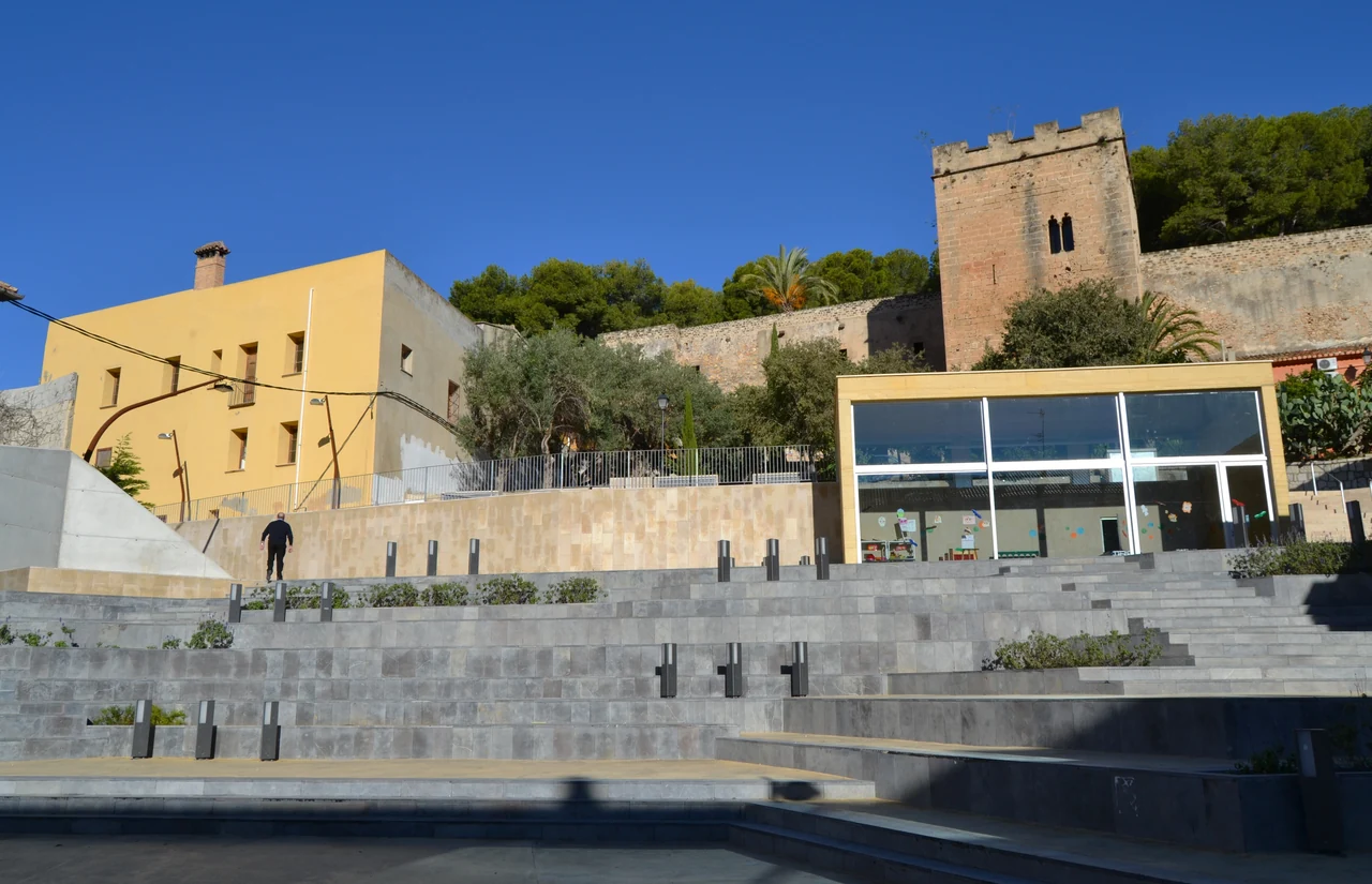
Broad steps in Plaça del Consell, with castle walls and a square tower above.
Plaça del Consell in Dénia · 2 November 2012.
Photo: Joanbanjo

Dénia, from the castle to the dinner table.

A day can begin in the streets around the castle and Les Roques, then continue down to the fishing quarter of Baix la Mar. Around Els Magazinos are places to eat and terraces.

Marina de Dénia is beside the southern breakwater, with restaurants along the quay. The harbour list has berth information and a reservation link.

Dénia: the harbour and Baix la Mar ↗
Mainland marinas ↓
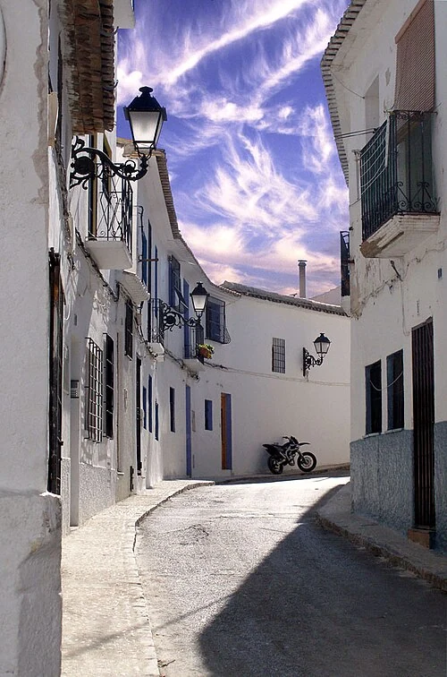
A sunlit bend in a narrow street with white houses, wrought-iron lamps and balconies in Altea.
A street in Altea’s old town · 11 March 2007.
Photo: Rod Jones / Astronautilus

A seafront promenade, or the streets on the hill?

In Xàbia/Jávea, Duanes de la Mar is by the sea, with Casa del Cable and the Loreto church. It is a separate area from the old town inland and Arenal beach.

In Altea, the walk heads uphill through streets with workshops and on towards the church’s blue dome. That means slopes and steps from the sea. Club Náutico de Altea is in the town harbour south of the centre.

Xàbia: Duanes de la Mar ↗
Altea: the old town and coast ↗
Cabo de San Antonio · marine reserve

Anchoring is prohibited within the fisheries reserve at Cabo de San Antonio, between Dénia and Xàbia. The reserve’s boundaries and rules are available from the authorities of the Valencia region.

Cabo de San Antonio · the reserve ↗

Dénia–Sant Antoni

From the mainland to Ibiza.

55–60 nmAbout 8–9 hours at sea at 7 knots

The direct crossing from Dénia to Sant Antoni is a long day’s passage. An islands-only stay can begin with a flight to Ibiza; a ferry from the mainland is another option.

A trip combining the mainland and the islands needs to allow for the crossing in both directions, with a weather window for each leg.

Flights, ferries and servicing

Getting here.

Ibiza has its own airport. Formentera is reached by ferry from Ibiza or Dénia. Alicante is a possible airport for a mainland stay.

A small glimpse

See the days from another boat.

Two travel films with different focuses: beaches and the sea on the islands, and everyday life during a stay in Altea.

Sources and planning background Sources reviewed 18–19 September 2026

The suggestions draw on local tourism authorities, operators’ own websites, harbour authorities and published rules. Links to practical information are provided beside the relevant place. The durations are suggestions for holidays with time to stay and wait for suitable weather.

Photo sources Photographs and maps

The images are real photographs, with the date taken beside each one.

The beach at Ses Illetes on Formentera

MrPepanos · original photograph

19 August 2013.

CC BY 3.0 ↗

A street in Dalt Vila

steve p2008 · original photograph

29 August 2017.

CC BY 2.0 ↗

Puig de Missa in Santa Eulària

A.Savin, Wikipedia · original photograph

21 April 2023.

Free Art License ↗

The boathouses at Cala Saona, seen from the beach

Joan Gené · original photograph

8 September 2024.

CC0 1.0 ↗

Plaça del Consell in Dénia

Joanbanjo · original photograph

2 November 2012.

CC BY-SA 3.0 ↗

A street in Altea’s old town

Rod Jones / Astronautilus · original photograph

11 March 2007.

Photographer’s website · required attribution ↗CC BY 2.0 ↗

The overview map uses Natural Earth 5.1.1. The island map’s coastlines and the maps’ place markers come from OpenStreetMap. North is up; the scales show straight-line distances.