A road to a castle disappears beneath the sea. A ferry changes its landing place. Around Chausey, sand and granite emerge between the islands. From Cotentin to the Channel Islands and Saint-Malo, the tide shapes the places you sail between—and the life you find ashore.
Cotentin forms the eastern side of this cruising ground. Alderney lies off its northern tip; Guernsey, Herm and Sark gather farther southwest, with Jersey to the south. Granville faces Chausey, and Saint-Malo stands at the mouth of the Rance. The crossings also link different cultures: the islands form the self-governing Crown Dependencies of Jersey and Guernsey, outside the United Kingdom, with Norman roots and their own institutions.
Made with Natural Earth · 1:10m land data, v5.1.1 · Map design: Sophie.
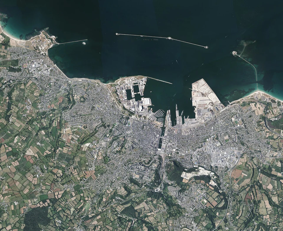
The long breakwaters make the scale of Cherbourg clear before you reach the town. The central sea wall alone stretches about 3.7 km. Forts, naval docks and commercial basins grew around an ambition to shelter a fleet on this exposed coast; a visiting yacht occupies a small corner of that immense maritime landscape.
The Art Deco transatlantic terminal tells another chapter. Passengers once arrived by train to embark for America; today the building houses the Cité de la Mer. Visiting it connects the harbour outside with the journeys that began here.
Paris trains reach Cherbourg, so it serves as both a place to explore and a point for joining a boat.
From Cherbourg, the port gives approximate sailing distances of 25 nautical miles to Saint-Vaast and 42 to St Peter Port on Guernsey.
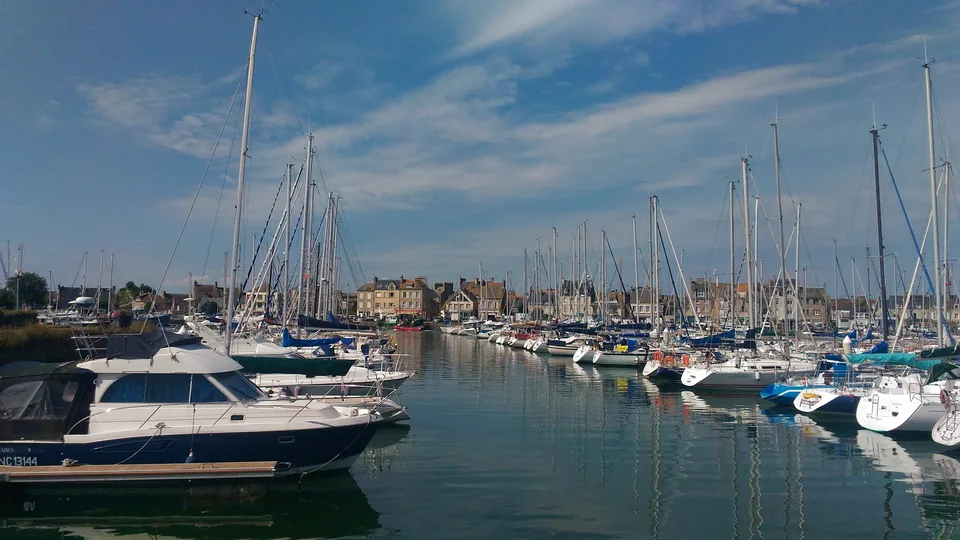
On Cotentin’s eastern coast, St-Vaast brings fishing boats and visiting yachts into a harbour bordered by town streets. The marina gate opens around high water. Maison Gosselin has cheese, fruit and good things to take back aboard; the harbourfront has places for lunch and a walk along the quay.
Across the oyster-growing shore lies Tatihou. Its tower and the one on La Hougue were built to protect the anchorage after French ships were destroyed here in 1692. The amphibious passenger boat makes the crossing part of the visit: it sails or rolls according to the water level. Ashore are the tower, gardens and maritime museum.
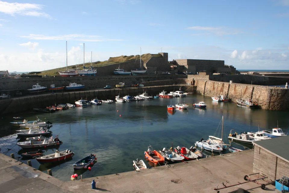
Off Cotentin’s northwestern corner, Alderney is a compact island beside fast-moving water. The Race between it and La Hague makes the tidal stream part of the geography: the time of departure can matter as much as the distance on the chart. Braye offers a different pace, with visiting yachts on moorings and St Anne a walk inland.
Guernsey, Herm and Sark: three scales of island life
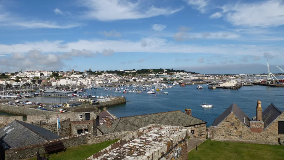
St Peter Port seen from Castle Cornet (2012).Photo: Rumburak3
Castle Cornet stands at the harbour entrance, with St Peter Port climbing the hillside behind the quays. Streets lead uphill from shops and cafés towards Hauteville House; down by Havelet Bay, La Vallette’s seawater pools offer swimming, a café and changing facilities. The town’s pleasures are close together, with the sea present at every level.
Victor Hugo lived in exile at Hauteville House and wrote Toilers of the Sea here. His glass writing room looks over the town and water; the novel draws on Guernsey’s coast and maritime life. A house visit is by guided tour, booked in advance.
Victoria Marina and the outer Swan pontoons are separate visitor options. High-season berthing may involve rafting, with the way to the quay crossing another boat.
Herm: an island with two front doors
The passenger boat from St Peter Port uses Herm Harbour at high water and Rosaire Steps at low water. The tide changes where you step ashore. Beyond the landing are village lanes, beaches and a walk around the cliffs. Herm and Sark can both be visited by passenger boat while the yacht remains in Guernsey.
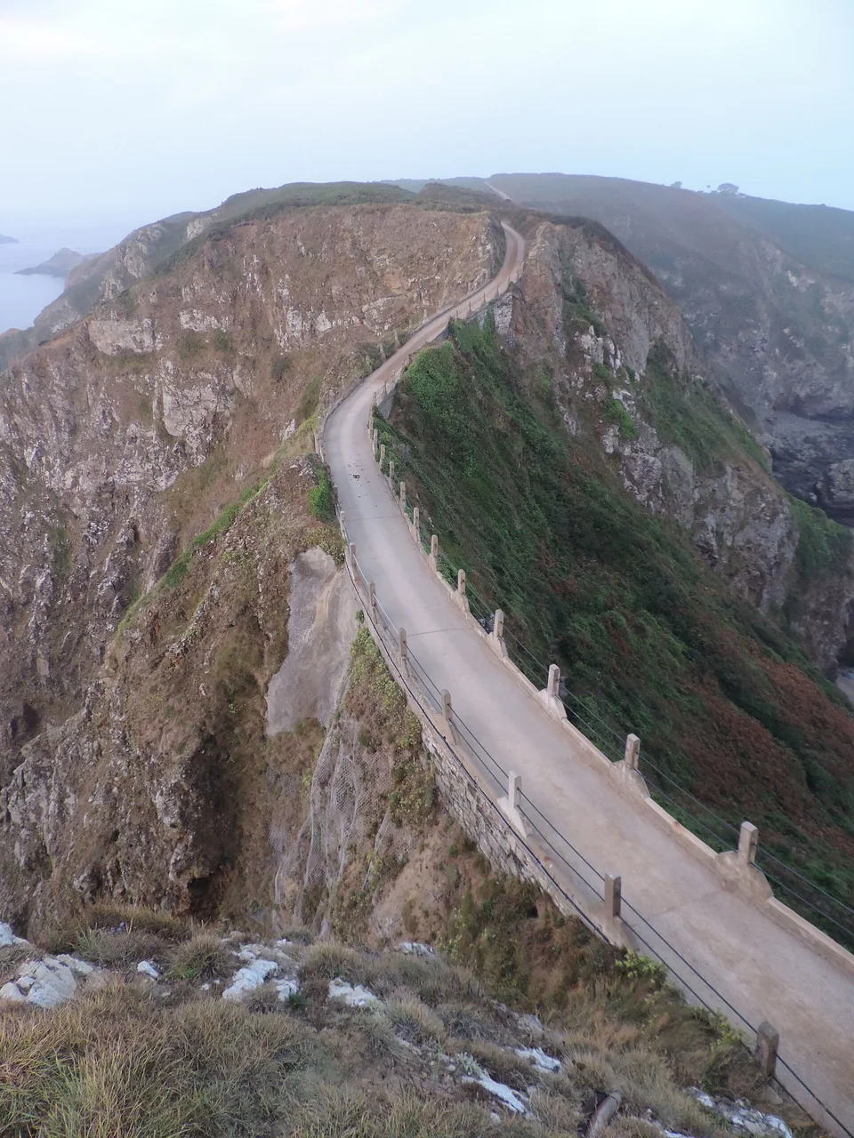
Arriving by ferry at Maseline Harbour is a small journey in itself. Low water exposes extra steps at the quay; beyond the tunnel, a tractor bus climbs Harbour Hill. Above are car-free lanes for walking and cycling. The southeast walk follows Dixcart Valley towards La Coupée, the narrow ridge leading to Little Sark.
St Helier combines a substantial harbour town with the Central and Beresford markets and buses out across the island. Around its modern yacht basins, the gates still follow the water level. Along St Aubin’s Bay, the same change is visible to anyone walking the shore.
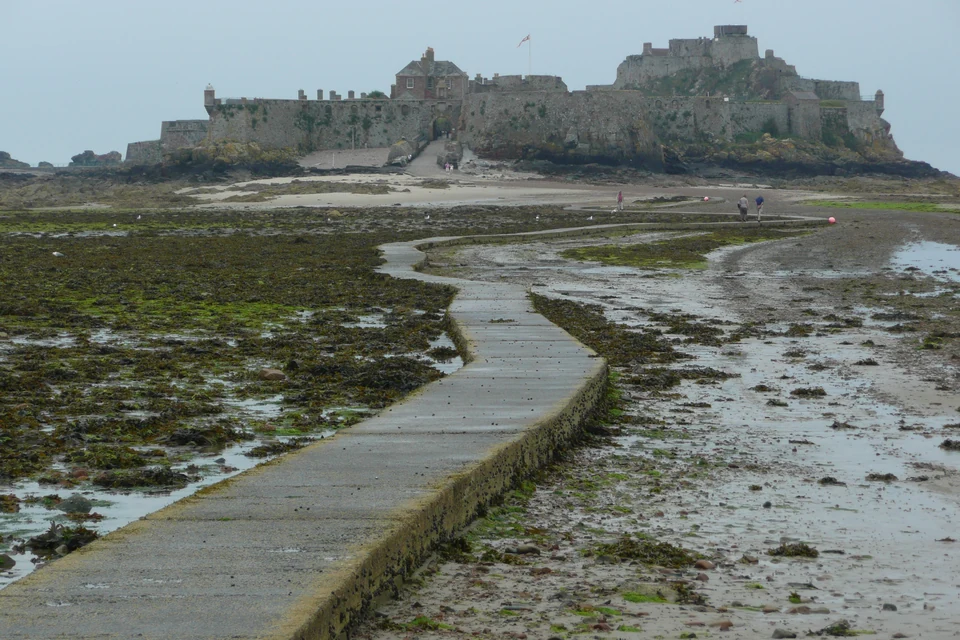
Elizabeth Castle stands on an islet offshore. At low water its causeway becomes a walking route; when the sea covers it, an amphibious ferry carries visitors across during opening hours, subject to conditions. The castle’s visitor information gives the walking windows and ferry arrangements.
On the east coast, Mont Orgueil rises above Gorey Harbour, facing Normandy. Work on the present castle began in 1204, the year King John lost mainland Normandy. Jersey retained its allegiance to the English Crown, and its Norman inheritance is still present in Jèrriais, local names and traditions. The view from this side of the island gives that history a setting.
Granville and Chausey: a port and its scattered islands
Granville, between the fishing quay and the upper town
Granville is a working port before it is a departure point for the islands. Fishing boats and shellfish landings share the waterfront with passenger services and the marina. Above them, the old upper town occupies its granite headland. From a berth at Le Hérel, the climb to the ramparts changes the view from quays and boats to the open bay.
A passenger crossing from Granville reaches Chausey in about an hour, making Grande Île accessible while the yacht stays in town.
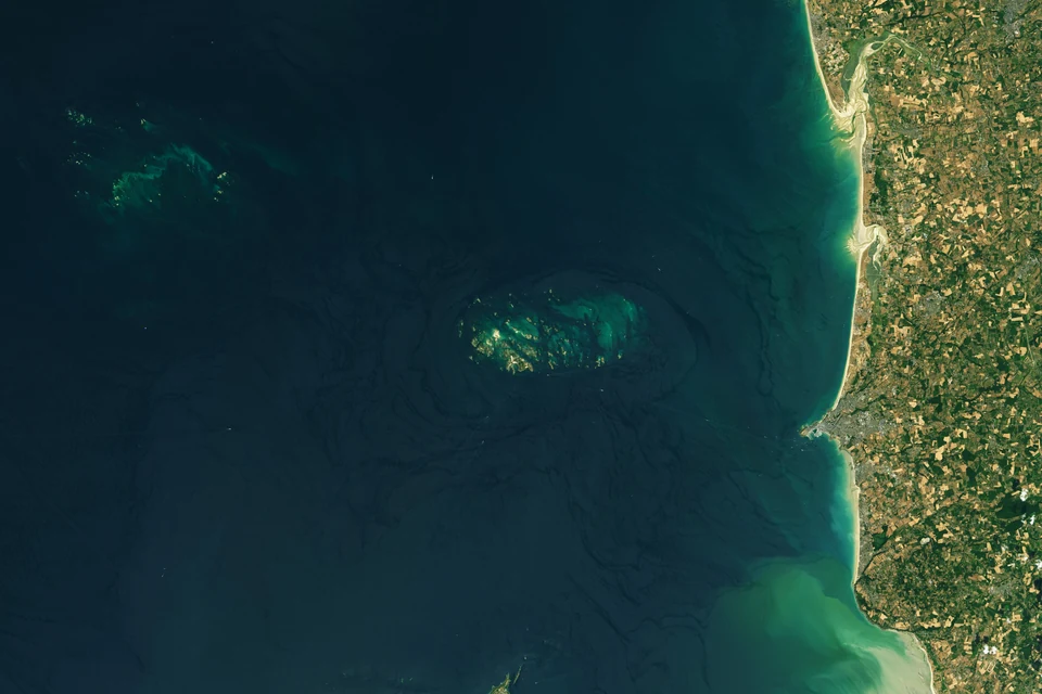
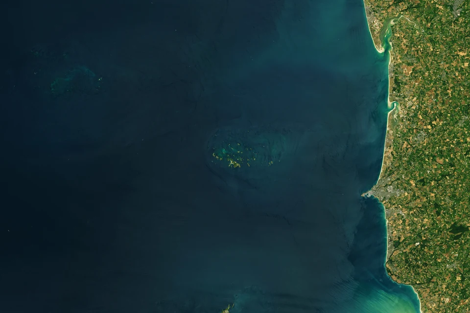
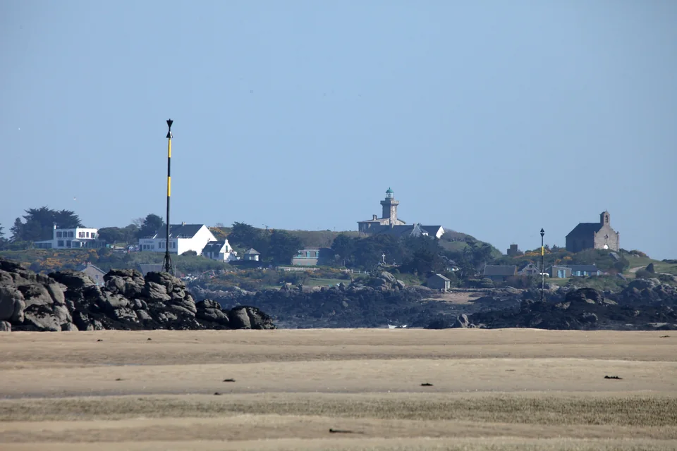
At high water, Chausey is a scattering of granite islands. As the sea retreats, beaches, sandbanks and channels emerge across almost 3,000 hectares of shore. A view that seemed open water becomes a landscape of pale sand and dark rock. The two satellite views below show the extent of that change.
Low water — Landsat 8, 22 July 2018.Image: Allison Nussbaum / NASA Earth Observatory
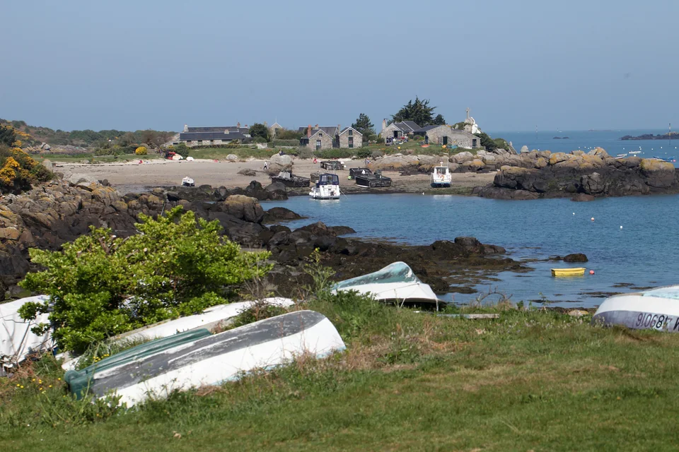
This has long been a worked landscape. Chausey granite travelled to Mont-Saint-Michel and Saint-Malo; the Blainvillais settlement recalls workers who burned seaweed for soda used in soap-making. Fishing and shellfish farming continue around the islands. The small stone houses belong to that history as much as to the view.
On Grande Île, a 5.5 km circuit follows permitted paths past houses and beaches, with wide views across the archipelago. Walking it brings the changing shore close: a beach grows below the path, rocks join up and boats settle against a different background.
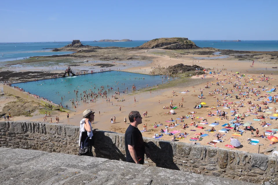
The ramparts frame a city whose fortunes were made at sea. Privateers sailed with state commissions to capture enemy shipping; Atlantic fishing and overseas trade also brought wealth to the port. Fort National and the offshore islets belong to the city’s seaward defences. At low water, walking routes open across the sand to places that were islands a few hours before.
Below the walls, Bon Secours has a beach and seawater pool; inside them are streets, shops and places for supper. The Fort National walk depends on the tide and the fort’s opening hours. Saint-Malo’s outward-looking life continues in the Route du Rhum: since its first edition in 1978, the solo transatlantic race has linked this port with Pointe-à-Pitre in Guadeloupe.
Their positions give different walks into town; the operator publishes lock schedules and marina access information.
The Rance: another way inland
Behind Saint-Malo, the Rance opens into a broad estuary. Its tidal power station, in service since 1966, turns the movement of the sea into electricity. A lock carries boats through the barrage into a quieter landscape of villages and wooded banks. The power station changes the water levels and creates strong currents near its works; EDF publishes the lock arrangements and levels for navigation.
Farther inland, Dinan offers a separate outing by land. Rue du Jerzual descends between old houses to the river port. The Rance power station also has a visitor centre, so its engineering can be explored without taking the yacht through the lock.
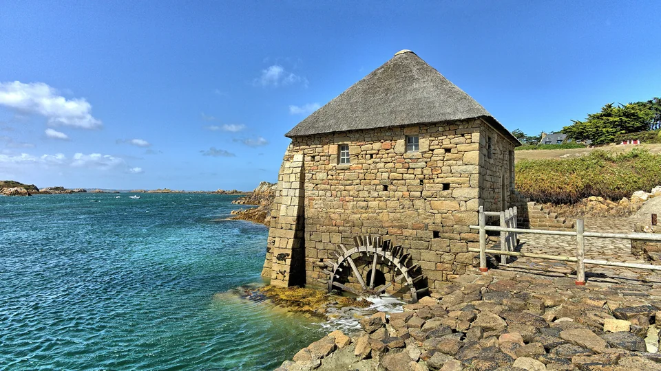
West of Saint-Malo, Bréhat introduces another granite island world: paths, gardens and the Birlot tidal mill. Lézardrieux lies upriver on the Trieux, with a marina in a wooded valley. The island and the river port make distinct visits along the onward coast.
From June to early September, days by the water come with rain and windier pauses. High summer can also mean rafted berths in the busier harbours.
Rail and ferry connections
Joining the boat
Arrival by sea
Guernsey
Passenger ferries connect St-Malo and St Peter Port. The operator’s sailing calendar gives the available crossings.
Arrival by rail
St-Malo
Trains connect St-Malo with Paris. Vauban and Les Sablons lead to different parts of town, so the final station-to-berth transfer follows the marina choice.
Arrival by rail
Cherbourg
Trains link Paris with Cherbourg. Port Chantereyne combines a berth near town with technical facilities for preparing the boat.