Italy and Sicily · north of Sicily

The Aeolian Islands

Evenings in Lipari town, lunch in Lingua and several quiet days on Salina.

Seven to ten days around these two islands can be the whole holiday, with sailing, swimming, trips ashore and several nights in one place. With more time, some of the islands farther out are possible additions.

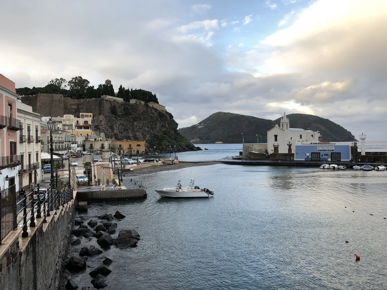
The small harbour of Marina Corta, with houses along the quay, a white church and the castle above.
Marina Corta on Lipari · 9 December 2017.
Photo: Davide Mauro

Two islands as a starting point

Lipari and Salina, at the heart of the islands

Vulcano lies just south of Lipari. Panarea and Stromboli lie to the northeast; Filicudi and Alicudi to the west. The transport and preparation hubs are on Sicily.

The Aeolian Islands Place map with Lipari and Salina at its core and the other islands as options. Sicily has separate symbols for a technical base and passenger travel. Not for navigation. The Aeolian Islands Place map · not for navigation Stromboli Panarea Alicudi Filicudi Salina Lipari Vulcano Capo d’Orlando technical base Milazzo passenger port 10 nm at 38.5° N N Core Addition Sicily Sophie · Natural Earth 1:10m · Wikimedia / harbours
The islands and Sicily.Map sources
Lipari and Salina Place map of Salina, Lipari and Vulcano. Santa Marina, Lingua, Malfa and Pollara are shown on Salina. Pignataro is marked north of Lipari town and Marina Corta. Not for navigation. Lipari and Salina Place map · not for navigation SALINA LIPARI Pollara viewpoint Malfa Santa Marina marina Lingua Pignataro Lipari town Marina Corta Vulcano 3 nm at 38.5° N N Core Addition Sophie · Natural Earth 1:10m · Wikimedia / harbours
A closer look at Lipari and Salina.Map sources

Town life and archaeology

A day in Lipari town

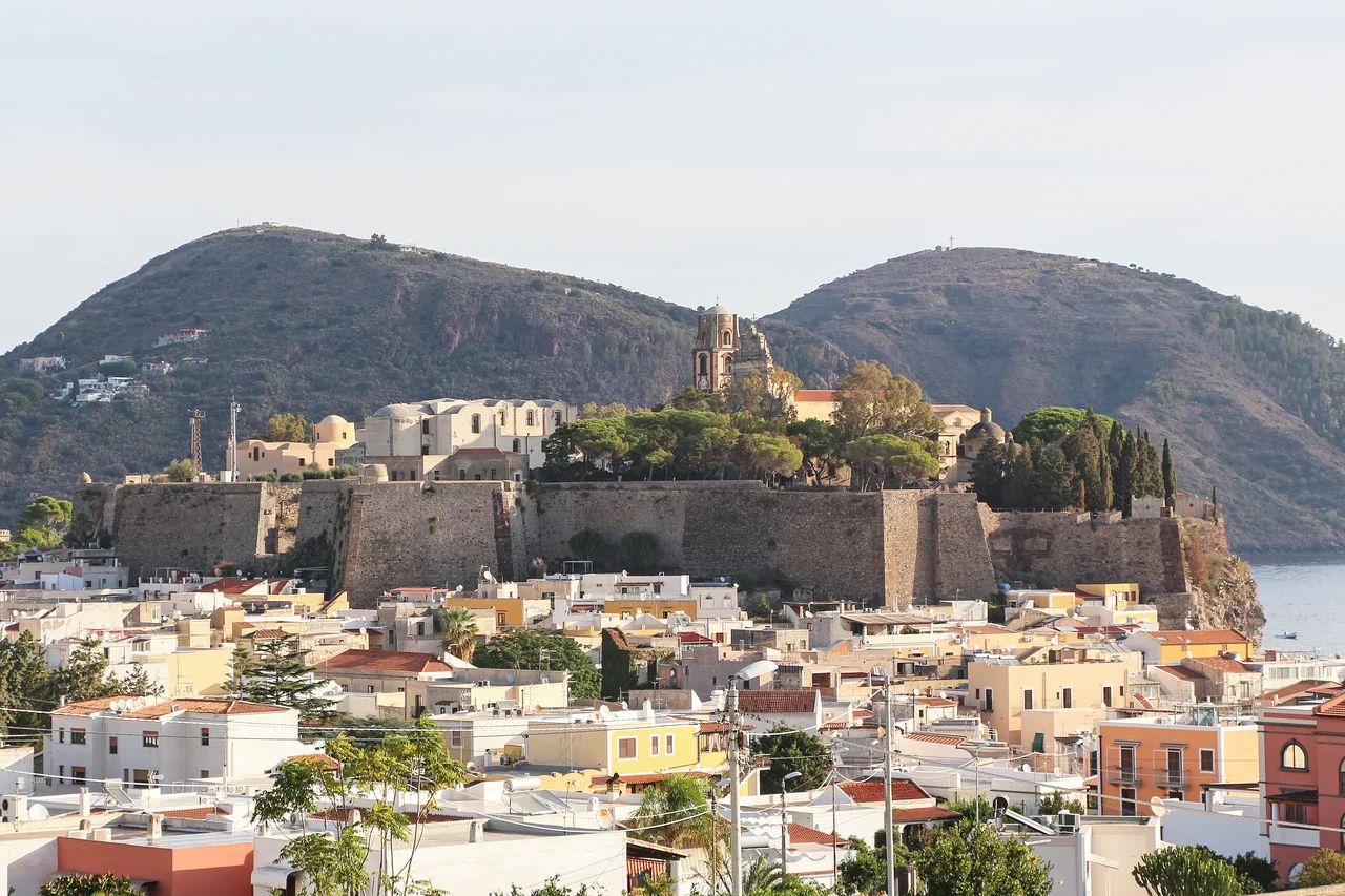
Castle walls and the cathedral above Lipari’s rooftops, with hills behind.
The castle above Lipari town · 9 October 2024.
Photo: Bernard Gagnon

The castle, museum and Marina Corta

A walk around town can begin on the castle plateau. The Bernabò Brea Museum includes theatre masks and finds from Greek and Roman shipwrecks. Some museum departments are undergoing work.

Afterwards there are narrow streets, shops and dinner down by Marina Corta. The small harbour in the opening photograph is part of town life; the boat can stay at Pignataro outside the centre.

Pignataro: haul-out and winter storage

The operator also lists haul-out and winter storage ashore. Lifting capacity, keel support, depth at the berth in question and available supervision have not been clarified.
Lipari museum ↗

Time in one place

Several days on Salina

With the boat in Santa Marina, there is time to explore the island overland: a day in the village, one by the sea and one on an excursion.

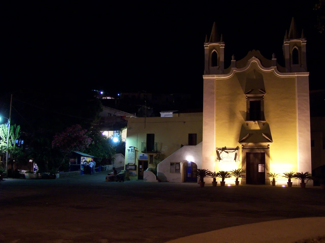
An illuminated church and a few tables in the square at Santa Marina Salina in the evening.
Evening light in Santa Marina’s square · July 2006.
Photo: Sebastian Fischer

Santa Marina as a base

Shops, places to eat and evening walks ashore bring variety to days in harbour. Santa Marina is also an option for joining the boat, if the berth and transport work out.

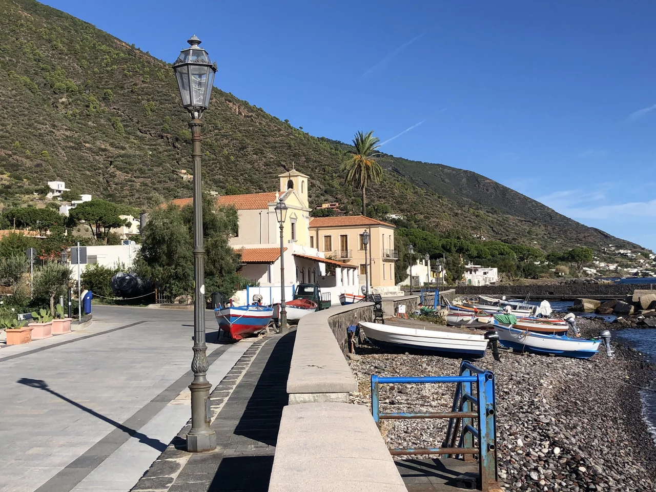
Small boats on the pebble beach and a church along Lingua’s promenade.
Lingua’s waterfront promenade · 9 October 2020.
Photo: Davide Mauro

Lingua

Lunch by the sea

Lingua is the destination for a short excursion south. It is a place for pani cunzatu — bread with generous toppings, often capers and tomato — and granita afterwards. A stroll along the water passes the small boats on the beach.

Lunch, swimming and a quiet afternoon can fill a day in Lingua.

Salina and Lingua ↗
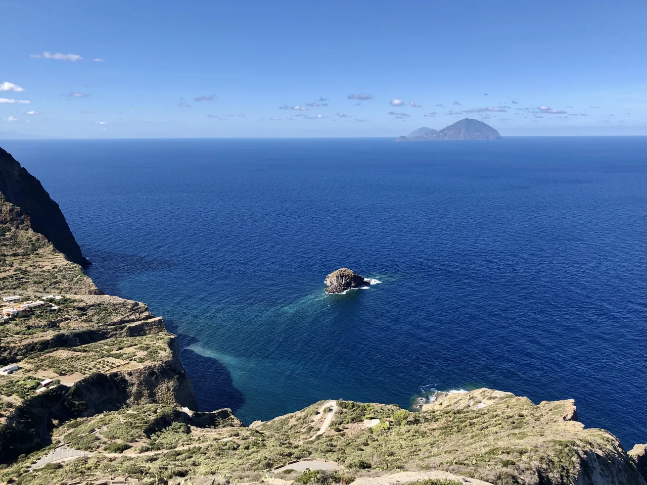
Steep cliffs below the viewpoint at Pollara and blue sea towards the islands to the west.
The view at Pollara, Salina · 9 October 2020.
Photo: Davide Mauro

Malfa and Pollara

Across the island to the western views

Local transport, taxis or a hire car allow a day trip to Malfa and the viewpoint at Pollara. Here the mountainside drops steeply to the sea, with the western islands on the horizon.

Pollara is a trip to enjoy the view from land. The steps down to the beach and landing from the sea have not been clarified. The boat can remain in Santa Marina during the excursion to this side of Salina.

A possible addition

Vulcano ashore

Vulcano’s landscape can provide an extra island day. A trip to the view at Capo Grillo is an option if transport and access work out. The crater and hot bathing areas have their own changing access rules; the guide does not suggest visits there.

Vulcano: civil protection information ↗

With more time

One direction farther

Around two weeks leaves room for one extension. Wind, swell and the possibility of getting ashore determine which stops suit.

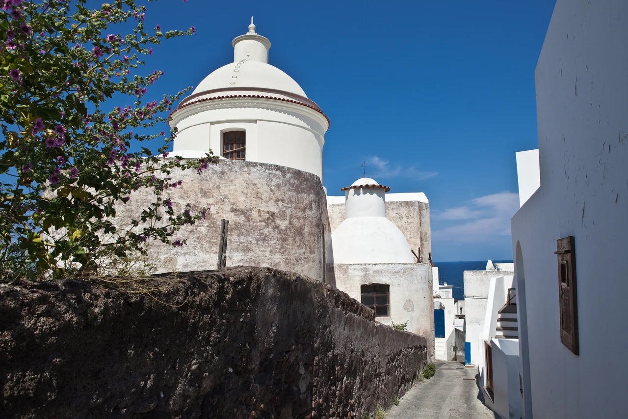
White houses, a narrow passage and the church dome in Stromboli’s village.
In Stromboli’s village · 4 May 2009.
Photo: François CHABRERIE

Panarea and perhaps Stromboli

The villages to the northeast

On Panarea, the white houses of San Pietro and the Bronze Age settlement at Capo Milazzese are inviting. A stop requires confirmed mooring and landing arrangements.

Stromboli’s village can be an addition. Staying with the boat and walking on the volcano are two different choices: current marine restrictions and rules for excursions ashore must be checked separately.

Access at the outer islands

Information on organised moorings at Panarea is preliminary; the operator, season and types of boat they can accept remain unclear. The guide suggests neither anchoring in Cala Junco nor swimming near gas emissions.

The Stromboli order reviewed dates from 5 May 2025 and distinguishes between trails, guides and sides of the island. It does not establish future access. The guide suggests no specific volcano excursion or close passage by Sciara del Fuoco.

Lipari municipality: current notices ↗Stromboli: civil protection information ↗
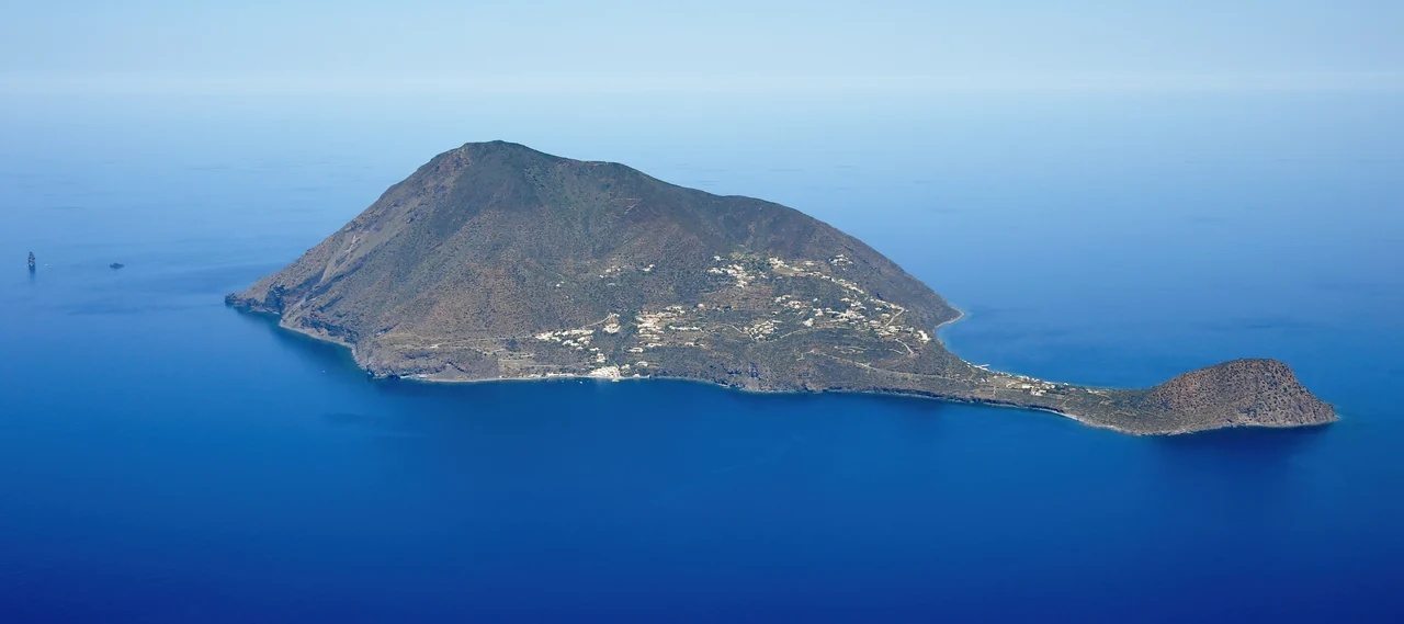
The whole of Filicudi seen from the air, with buildings on the slope and Capo Graziano to the right.
Filicudi seen from the south · aerial photograph · 22 May 2022.
Photo: Carsten Steger

Filicudi, with Alicudi as an option

Westwards to small settlements and ancient sites

Filicudi has Pecorini a Mare, hillside villages and the archaeological site at Capo Graziano. Porto and Pecorini have different landing conditions; the ferry quay is not a visitor berth.

Alicudi has steps climbing between the houses and no tourist marina. A visit is therefore a possible addition once landing arrangements or a workable return passenger journey have been confirmed.

The museum on Filicudi

Filicudi Porto received summer opening hours on three days a week from 15 July 2026, with no end date stated. The excavations at Capo Graziano in September do not in themselves mean that the site is closed.

The museum’s summer notice ↗

Holiday length

Seven to ten days, or a little longer

Seven to ten days

Lipari and Salina, with town life, swimming and shore excursions. Vulcano can be added if it fits.

About two weeks

Choose northeast towards Panarea, or westwards to Filicudi, while keeping time ashore.

Two to three weeks in total

More time to linger and a few selected additions.

June or September are possible choices. Individual legs depend on weather and harbour berths.

Getting here

Via Catania and Milazzo

From Catania airport, Giuntabus runs to Milazzo. Liberty Lines sails from there to the islands. Lipari/Pignataro and Santa Marina are possible arrival points.

Connections on the way to the boat

The final trip from the passenger port to the boat is an additional leg. Timetables change with the season; a departure to an outer island does not necessarily mean that a day trip with a return journey works out.

Giuntabus: airport–Milazzo ↗Liberty Lines: current timetables ↗

Preparation on Sicily

Milazzo is primarily the passenger hub; Lussino is another possible boatyard there.

Milazzo storage and mainland transfers

Lussino’s lifting capacity is not documented. The airport bus goes to Milazzo; Capo d’Orlando’s own bus to the town centre runs in the summer season.

Lussino: storage in Milazzo ↗

An impression from ashore

A stroll around Lipari

Lipari Town & Port

Travels with Matteo & Micha shows a place to eat, the church interior and views from the town’s heights in this chapter from 2021. Start at 11:44; the full film about Lipari and Vulcano lasts 23 minutes and 25 seconds.

Watch the Lipari chapter on YouTube ↗
Sources and photo credits

Sources and photo credits

Practical sources checked on 19 September 2026. Harbour and transport sources are linked beside the relevant paragraphs.

Access and stays

We do not have a complete account of anchoring, buoys and landing arrangements around the islands. Up-to-date local rules apply to each individual stop.

Stromboli’s older order and volcano monitoring information are used as background; they do not establish future access to trails or marine areas.

Lipari municipalityStromboli: official advice

Photo credits

The photographer, date, original page and licence are listed beside each photograph. “Full photograph” opens the largest local version. The Filicudi image is an aerial photograph; Marina Corta was photographed in winter.

Maps

Design: Sophie, CC BY 4.0. Coast: Natural Earth 1:10m, public domain. Place coordinates: Wikimedia and harbour operators. Places and coordinate sources (JSON). The maps show places, without sailing routes or protected-area boundaries. The smallest islands have limited detail in the coastline data.