Islands, city harbours and the sea below the Alps
Cannes, Lérins &
the eastern Riviera.
An island monastery within sight of the Croisette. Fortified Antibes, Nice’s colourful port, the deep blue bowl of Villefranche. Then Monaco rising above its quays and Menton facing Italy: a remarkably varied coast, with a railway following much of the shore.
Explore the coast ↓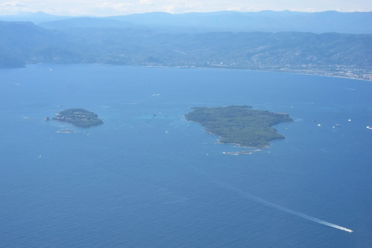
Photo: Olivier Cleynen
A coast of close neighbours and different worlds
The shore changes direction as much as character. Cannes looks south to its islands. Cap d’Antibes makes a substantial turn between the Golfe-Juan side and the long sweep towards Nice. East of Nice, steep hills crowd the water; headlands separate Villefranche, Beaulieu and Monaco. The Lérins islands offer the clearest break from the mainland’s continuous urban life.
- CannesThe old port, Le Suquet and a town older than cinema.
- The Lérins islandsForest, a royal prison and a living monastery.
- Antibes & Cap d’AntibesRamparts, Picasso and the working world of yachts.
- NiceA Sardinian port beside a cosmopolitan winter city.
- Villefranche-sur-MerA grand natural bay and the Darse’s naval heritage.
- Cap Ferrat & BeaulieuGreen headlands, gardens and two imagined worlds.
- MonacoHarbour engineering, a vertical city and ocean science.
- Menton & the borderFishing boats, citrus gardens and the train to Italy.
These are short geographical intervals, though the capes shape the sailing. The centres of Cannes and Antibes are about 5 nautical miles apart in a straight line; Antibes and Nice about 10; Nice and Menton about 11. Those map distances describe the scale of the coast, not passages around its headlands. Lérins lies only a few nautical miles offshore, close enough for the city and islands to remain visible to one another.
Coast data: © OpenStreetMap contributors · ODbL · Geographic data
Cartography: sol.blue.
The boat and the coastal railway
A berth here can open more than its own town. The coastal railway connects Cannes, Antibes, Nice, Villefranche, Beaulieu, Monaco and Menton, then crosses into Italy at Ventimiglia. It makes a museum, market or garden accessible without moving the boat for every visit. The relationship is strongest east of Nice, where the stations often sit close to the coast and roads squeeze between the hills and sea.
The stations are not interchangeable with the harbours. Nice-Ville serves the city centre; Nice-Riquier is on the eastern side, while the tram reaches Port Lympia itself. Beaulieu is the useful rail stop for its own waterfront and the eastern side of Cap Ferrat. Èze-sur-Mer is below the hill village, which requires a separate uphill journey. Monaco’s station has several exits in a steep city. Menton-Garavan serves the eastern harbour and gardens more conveniently than the main Menton station.
Cannes → Antibes → Nice → Villefranche → Beaulieu → Èze-sur-Mer → Cap-d’Ail → Monaco → Menton → Ventimiglia
Services do not all call at every station. The current timetable is more useful than a fixed frequency, particularly for an evening return or crossing the border. From Nice airport, Nice Saint-Augustin station is reached through the Grand Arénas side of the airport district; tram travel between terminals 1 and 2 and Grand Arénas is free. Tram line 2 also links the airport and Port Lympia, with a fare beyond the airport’s free section.
01
Cannes: the harbour below the image
Fishing boats beneath Le Suquet, regattas in the bay and the Croisette facing its islands.
Cannes is best understood from the corner of the Vieux Port below Le Suquet. The hill, the church tower and the houses rising behind the quay give the waterfront a scale quite different from the hotels along the Croisette. Small fishing boats share the town’s maritime identity with classic yachts and the very large vessels that dominate its publicity. From the harbour, the old streets lead uphill; the long promenade turns away east towards the other end of the bay.
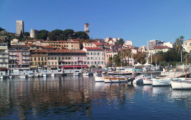
Photo: Guy Lebègue
The port is part of the making of the town. Before its first nineteenth-century mole, cargo had to be transferred through an exposed roadstead and landed in small boats. Construction between 1838 and 1843 changed that relationship with the sea. The railway arrived in 1863, tying Cannes to a much larger world of visitors. Its sailing culture was already taking organised form: the Société des Régates de Cannes was founded in 1860, long before the film festival gave the town its modern international shorthand.
That older Cannes remains easy to find. Le Suquet offers steep lanes and a view back over the harbour; the Marché Forville is a more useful expression of local life than another row of luxury shopfronts. Food shopping, a café beside the market and the climb through the old quarter belong naturally together. The market continues to trade during renovation, but since April 2025 its stalls have been divided between two sites. The planned rooftop garden is a future part of the scheme, not an existing visit.
The Croisette brings another history into view: winter visitors, hotels, palms, beaches and the public theatre of cinema. Its curve is worth walking for the changing view across to Lérins, even if shops and festival celebrity hold little interest. The city’s September 2026 works notice announces preparation followed by surface works from mid-October, with a programme extending towards 2028. Access and the feel of individual stretches will change as the works move along the promenade.
Two harbour settings
02
Lérins: forest, prison and a living monastery
Two low islands in the bay, each with a distinct history and a different reason to go ashore.
From Cannes, the islands first appear as a low, wooded interruption of the sea. Once alongside them, the towers and fortifications become more apparent. Sainte-Marguerite is the larger island, with long forest paths and the Fort Royal above its northern shore. Saint-Honorat is smaller and more openly cultivated: vineyards, chapels and monastery buildings occupy a compact island around which the sea is never far away. The narrow water between them explains their visual unity, but it does not make them the same destination.
The contrast with Cannes is physical as well as historical. A mainland promenade becomes a path under trees; the hotels fall back into a distant line. On Sainte-Marguerite, walking inland through pines and eucalyptus is as much part of the visit as following the rocky shoreline. The south coast faces open water, while the northern side keeps the town and mountains in view. A boat visit can be centred on that landscape, or on the fort, without treating either as a brief stop on the way to the other island.
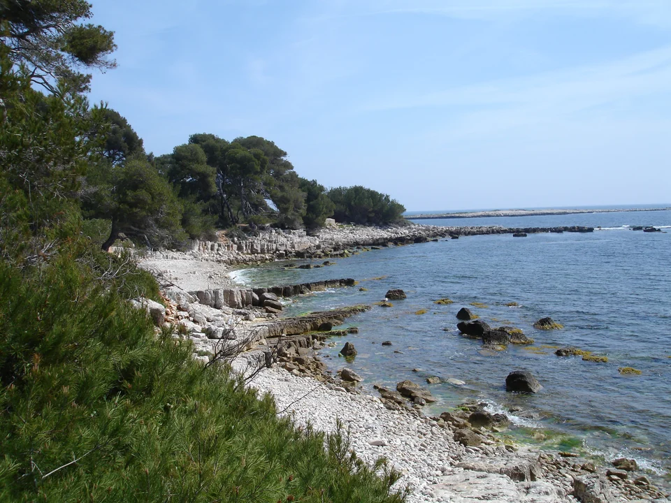
Photo: Guillaume Paumier (Guillom)
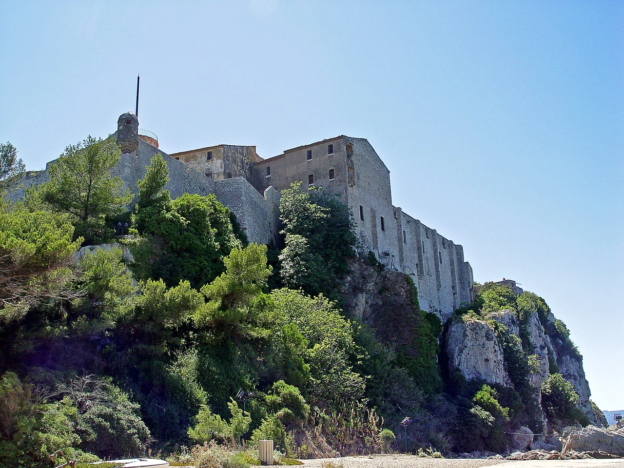
Photo: Yesuitus2001
Behind the Iron Mask story
Fort Royal gives the island its most concentrated historical encounter. The famous prisoner known as the Man in the Iron Mask was held here from 1687 to 1698. His unknown identity has attracted theories far more colourful than the evidence allows. The cell is compelling, but the fort’s history extends beyond that single mystery: Protestant pastors imprisoned after the revocation of the Edict of Nantes, and Algerian captives during the nineteenth-century conquest, also belong to its story. The museum connects these histories with archaeology from the island and surrounding sea.
Seen from the water, the fort is an assertion of control over a vulnerable coast. Seen from its rooms and walls, it becomes a place of confinement as well as defence. That double reading gives substance to a visit which might otherwise be reduced to a famous name. The museum’s current opening arrangements are published by Cannes; the forest and shoreline have a different rhythm from an indoor visit, and access to wooded areas can be affected by fire restrictions.
Saint-Honorat: cultivated land and continuing worship
Saint-Honorat’s monastery reaches back to the early fifth century, when Honoratus established a religious community on the island. The present life is not an unbroken survival of every institution since then. There were closures and changes of ownership around the Revolution, followed by the return of Cistercian monks in 1869. Today the vineyards, church and community belong to a working religious place. The island’s agricultural pattern is visible from the sea: cultivated clearings interrupt the woodland, with the fortified monastery standing close to the southern waterline.
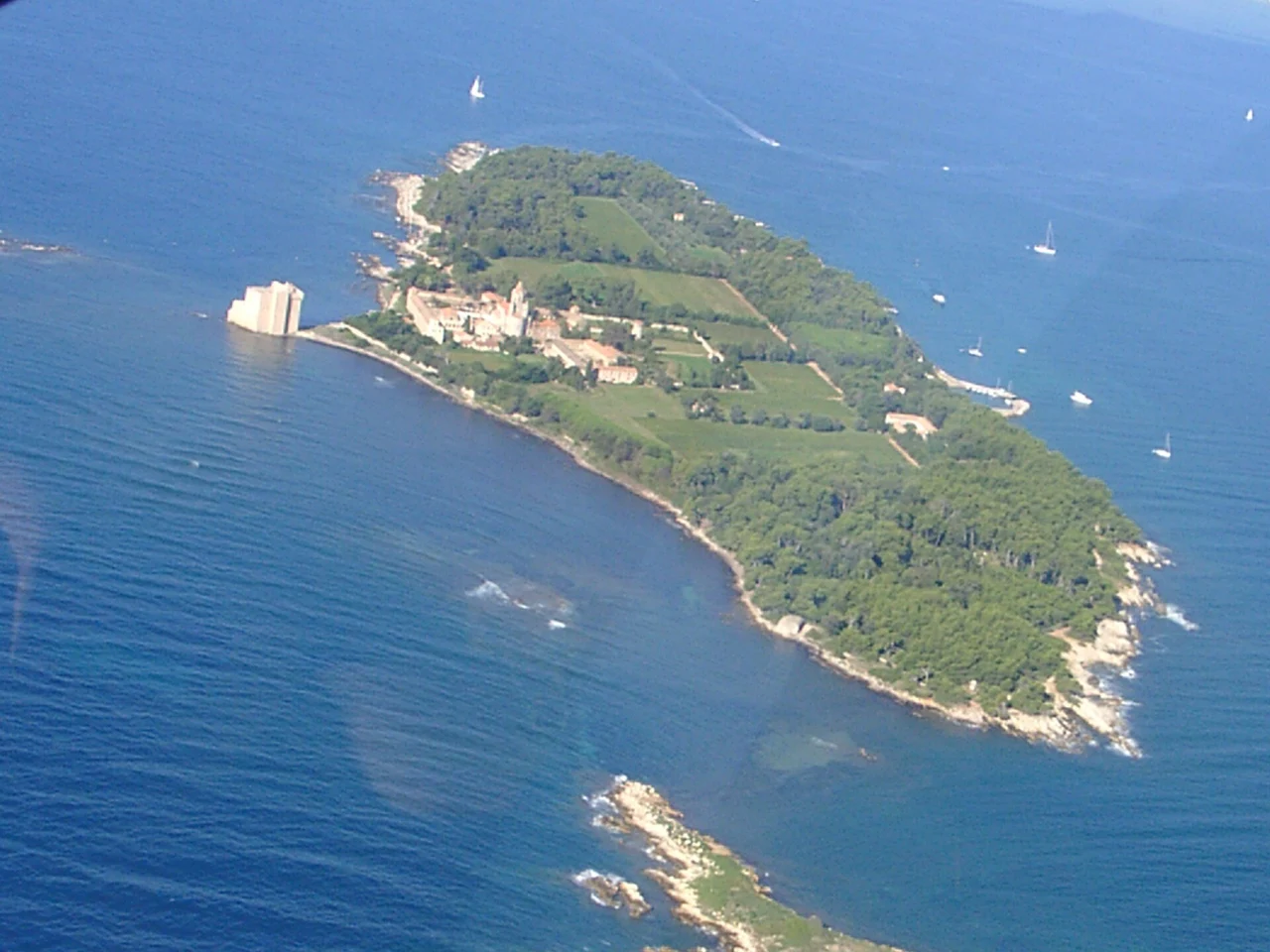
Photo: Jeje42
The fortified monastery makes particular sense on an island exposed to attack: it joined spiritual life to the practical need for refuge. Following restoration, it is again part of the island’s visitor offer. The church, chapels and paths give other ways into the place, while the monks’ wine production connects the present community to the land. These are not ruins set apart from daily life. Public visiting areas and worship spaces have their own access arrangements; the abbey’s information distinguishes them from the private parts of the monastery.
Mooring, going ashore and swimming are separate choices
Cannes’s passenger boats offer a straightforward shore visit when a suitable yacht or tender landing is unavailable; services to the two islands are separate.
The island channel is limited to 5 knots, with 3 knots in the authorised mooring area. A swimming stop therefore needs its own appropriate location, away from prohibited zones and ferry traffic, rather than being assumed to come with a buoy booking. Moure Rouge and the municipal maritime service are the useful contacts for current mooring and landing arrangements; the abbey and Fort Royal provide the separate information for visits ashore.
03
Antibes: a fortified town in a working yacht port
Picasso above the sea, a market inside the old streets and marine trades around Port Vauban.
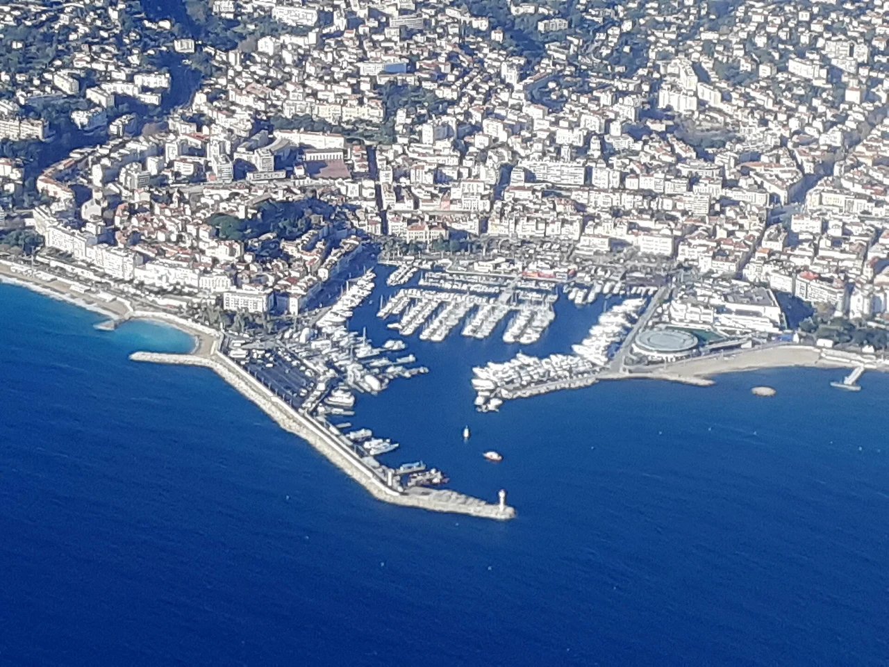
Photo: Abxbay
Antibes gives the Riviera’s yachting world a town to walk into. The old streets and market are close to Port Vauban, while ramparts hold the edge between buildings and sea. The harbour’s scale can be striking, but the surrounding life includes boatyards, suppliers, crew work and the everyday movement of a major yacht port. It is a place where provisioning and shore exploration overlap: market food can return to the boat by the same streets that lead towards the museums and sea walls.
Fort Carré explains an older maritime role. Built in the sixteenth century, it stood at a frontier facing the County of Nice, when Antibes was the last French port before another state. Its high position and angular form are readable from both the harbour and the sea. The walk around its base brings the port into view through Mediterranean vegetation. The later development of the harbour did not erase that strategic geography; modern yacht basins now fill the foreground of an older fortified coast.
Art made beside the water
The Musée Picasso occupies Château Grimaldi, where Picasso worked in 1946. That connection makes the visit more specific than a collection assembled in an unrelated building. Sea creatures, Mediterranean light and the exuberant figures of that period belong to work made here; he left paintings and drawings to the town. The building itself holds the sea close, so the transition from rooms to ramparts keeps the setting present. The museum and Fort Carré tell different stories, and both are accessible from the same old-town and port area.
The covered Provençal market supplies another texture: food stalls beneath a roof, narrow streets outside and the everyday business of buying something to cook. Beyond the old town, Cap d’Antibes spreads south into villas, gardens and a rocky coastline. Juan-les-Pins faces the other side, towards Golfe-Juan and Cannes, with a beach-resort and musical identity of its own. These are different faces of the headland; a coastal walk and a visit to Juan-les-Pins need not be folded into the same old-town outing.
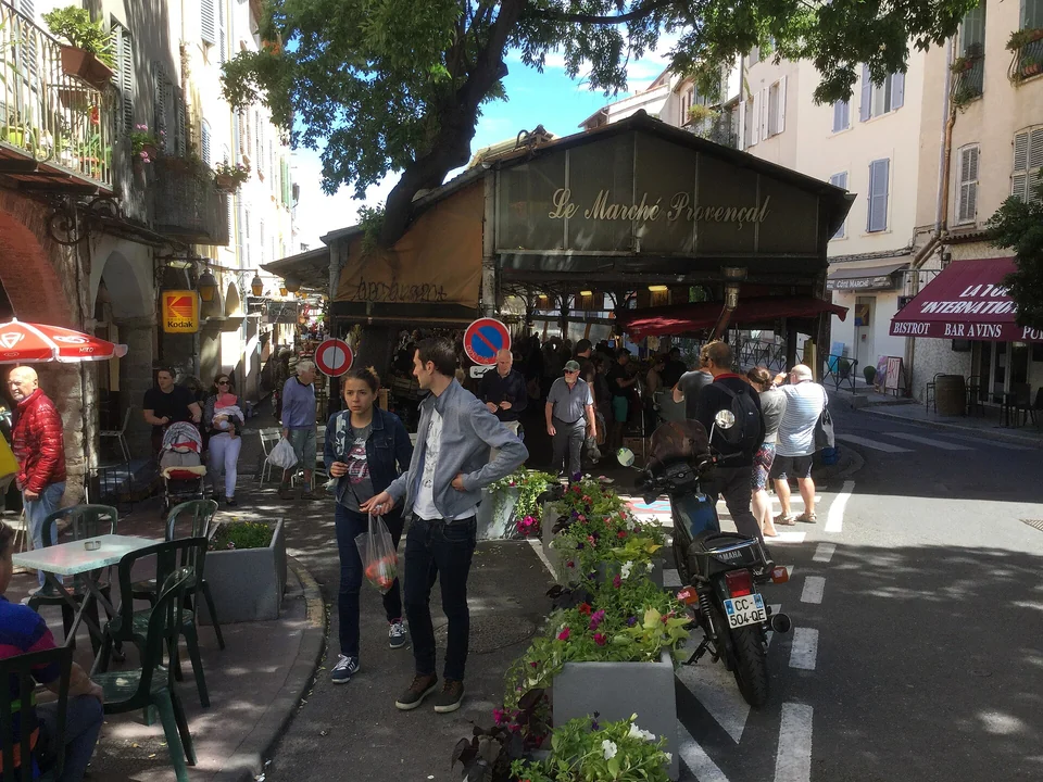
Photo: Sinikka Halme
Port Vauban and the changing harbour
04
Nice: a city with two seafronts
Port Lympia faces one way; the Promenade des Anglais opens another world around Castle Hill.
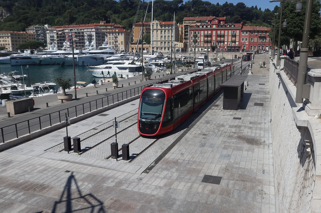
Photo: MB-one
Nice is much more than the long beach seen from an arriving aircraft. Port Lympia sits east of Castle Hill, enclosed by coloured façades and steep slopes, with small traditional boats sharing a working port with yachts and commercial traffic. Walk around Rauba Capeu, beneath the hill, and the outlook changes abruptly: the broad curve of the Baie des Anges, the old town and the Promenade des Anglais open to the west. The city’s two waterfronts are close on foot but distinct in geography and mood.
The harbour began as a Sardinian project in 1749, under Charles Emmanuel III. Nice’s relationship with France is comparatively recent; the city became French in 1860. That history helps explain why the port’s architecture, the old streets and the city’s place names feel connected to both sides of today’s border. Port Lympia is not a marina constructed outside the urban story. It belongs to the city’s trade, political history and present transport system.
The winter-resort city developed around a different kind of arrival. From the eighteenth century, foreign visitors came for the climate, first prominently British and then increasingly international. The promenade and later avenues, gardens, villas and hotels gave that seasonal life a lasting urban form. UNESCO’s recognition concerns this larger winter-resort landscape, not just one famous walkway. A walk from the old town towards the Promenade moves between a dense older city and the spacious architecture made for visitors.
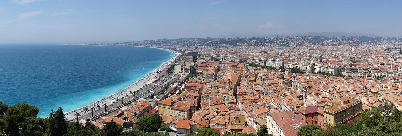
Photo: Spike
For a shore visit, the port, Rauba Capeu, Castle Hill and the old town form a coherent geographical group. The hill gives the clearest view of how they fit together; the old streets bring the scale back down to food, shops and squares. The Promenade can then be a long waterfront walk rather than the only image of Nice. Art collections farther inland open another side of the city, but they involve a separate urban journey rather than simply stepping off a yacht.
Port Lympia: pleasure boats in a commercial port
Tram line 2 terminates at the port, making Nice unusually convenient for an airport connection directly from the waterfront. For coastal trains, Nice-Riquier and Nice-Ville serve different parts of the city. A crew change at Lympia, a museum visit from another harbour and a stay in Nice itself are therefore different uses of the same transport network. The city has enough substance to justify any of them without treating it merely as an airport stop.
05
Villefranche: the bay and the working Darse
A natural roadstead with a naval harbour, an old fishing waterfront and science beside the sea.
Port Lympia · Villefranche · La Darse · Saint-Jean · Beaulieu
Villefranche’s most powerful feature is the shape of the water. The hills rise around a deep natural bay, with the old town on its northwestern edge and Cap Ferrat forming the eastern arm. From a boat, the scale of this amphitheatre is easier to grasp than from the road. It has attracted naval ships, commercial activity, visitors and marine scientists for different reasons. Today cruise ships and their tenders can be part of the same scene as yachts and the railway along the shore.
The town’s pretty waterfront is only one part of that story. The Darse lies separately to the southwest, below the citadel side of the bay. It is a port to visit for the fabric of maritime work: stone vaults, a drydock, workshop buildings and the remains of a naval establishment. The relationship between the two waterfronts is worth understanding before arriving. The old town gathers cafés, narrow streets and the little Port de la Santé; the Darse retains the deeper connection with repair, construction and naval infrastructure.
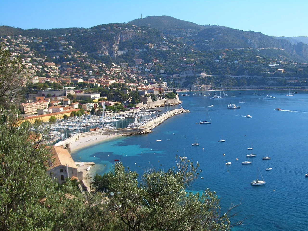
Photo: Vmenkov
A royal port still connected to work
The Darse developed as a royal port of the House of Savoy, later serving the Kingdom of Sardinia. Its eighteenth-century structures explain the needs of a fleet: a drydock for working below the waterline, a forge, a ropewalk and facilities associated with quarantine. The drydock, dating from 1730, is about 62 metres long. It remains connected to yacht restoration rather than surviving only as an empty monument. The old forge’s arcades and the long ropewalk make the industrial scale of the place legible on foot.
Classic-yacht craftsmen and repair businesses keep that continuity visible. Elsewhere in the same complex, the former ropewalk has become part of the Institut de la Mer de Villefranche, associated with Sorbonne University and the CNRS. Naval logistics and marine science now occupy successive chapters of the same waterfront. A public walk along the port gives the setting; workshops, the drydock and research premises remain workplaces with their own access, rather than a museum circuit open throughout.
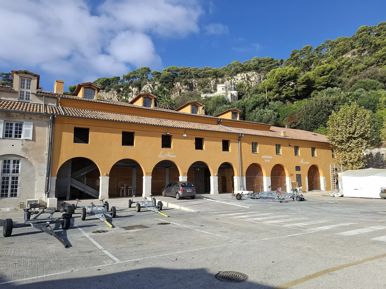
Photo: Broenberr
Back in the old town, the Chapelle Saint-Pierre offers a smaller maritime encounter. Jean Cocteau decorated the fishermen’s chapel in 1956–57, bringing Saint Peter and local Mediterranean life into the same interior. Its position near the waterfront makes it part of the harbour’s social history, not simply another art stop. The surrounding lanes and steps climb away from the quay, giving repeated glimpses back towards the bay and the opposite headland.
Darse, Santé and the open bay
Neither the number of boats visible in the bay nor its naval history establishes a visiting berth or a permitted anchoring position.
For a boat stay, ask the departmental harbour team about the appropriate port, the berth available and its accepted dimensions. For a visit by train, Villefranche station opens the town and waterfront without needing a separate harbour move. The rade itself remains a real sea space: Cap Ferrat changes exposure across it, and swell or weather from the open southern sector can alter an apparently calm setting. Current anchoring restrictions and tender arrangements belong with the port authority’s notices, especially when large passenger ships are present.
Port rules and current guidance · Cocteau and the fishermen’s chapel
06
Cap Ferrat and Beaulieu: gardens between two bays
A green peninsula, a village port and houses that turned the Mediterranean into a work of imagination.
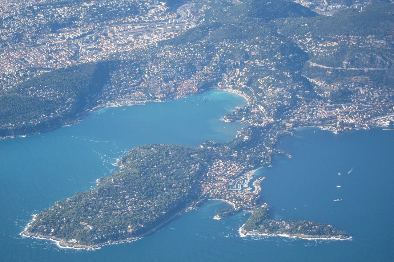
Photo: Olivier Cleynen
Cap Ferrat brings a change of texture after the cities. The peninsula projects between Villefranche’s rade and the Beaulieu side of the coast, with villas and gardens behind trees and rocky edges below. Saint-Jean’s village and harbour face east, rather than into the great bay on the western side. That small geographical distinction matters both afloat and ashore: the village port, the exposed outer headland and the Villefranche waterfront are separate settings.
Walking brings the shape of the peninsula into focus. The local tourism office describes a 4.8-kilometre circuit of the outer cap, with steps and uneven stretches near the sea. It is more demanding than the waterfront connection towards Beaulieu, the Promenade Maurice Rouvier. Coastal paths can close in rough weather or after damage, so their current status affects which walk is available. The reward is specific: views back into Villefranche, out to the open Mediterranean, then towards the rising coast beyond Beaulieu.
Two villas, two invented worlds
Villa Ephrussi de Rothschild combines a collector’s house with gardens set high on the peninsula. The value of the visit is in that relationship between interiors, planted terraces and the surrounding water. Béatrice Ephrussi de Rothschild’s collections and the estate she left to the Institut de France belong to the extraordinary culture of villas built here around the Belle Époque. The sea remains present in the garden views, even when the subject has shifted from boats to porcelain, furniture and cultivated landscapes.
At Beaulieu, Villa Kérylos offers a different act of imagination. Built in the early twentieth century for Théodore Reinach with architect Emmanuel Pontremoli, it reinterprets an ancient Greek house through modern scholarship, craft and comfort. It is not an ancient ruin. Courtyards, mosaics, painted decoration and rooms facing the water make it an unusually complete statement of how the past could be recreated on this coast. The current official site lists opening and exceptional closures; tickets are sold on site, apart from certain specially ticketed events.
Saint-Jean, Beaulieu and the railway
Èze is a further shore possibility east of Beaulieu. The railway follows the sea, while the celebrated old village sits high above it. Reaching the village involves an uphill walk or road connection, not a short level stroll from the station. Its appeal is the sudden elevation over the coast; it is best understood as an inland excursion from the rail corridor, rather than another yacht harbour.
Peninsula paths · Villa Ephrussi · Villa Kérylos: current visits
07
Monaco: the sea and the vertical city
A harbour enlarged by engineering, a principality climbing the hillside and a museum rooted in ocean exploration.
Monaco is most interesting when its geography comes before its reputation. From Port Hercule, buildings rise almost immediately above the quays, while the old town occupies the Rock on the western side. Roads, stairs, lifts and terraces connect levels which a flat map compresses. The sea has been both the principality’s opening and its constraint: harbour works and reclaimed ground have repeatedly altered the limited strip between cliffs and water.
Hercule began with a natural deep-water bay that remained vulnerable to easterly conditions. Successive harbour works changed its usefulness, culminating in the great semi-floating breakwater installed in the early 2000s. Built near Gibraltar and brought to Monaco, the structure is 352 metres long. It helps explain the modern harbour more clearly than the size of the yachts alone: this is a place where major engineering has extended what a difficult coastal site can support.
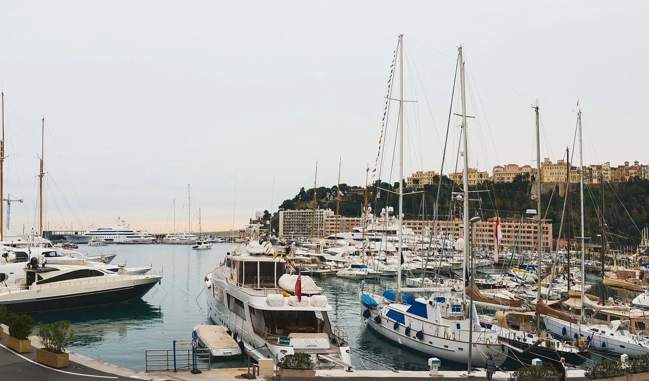
Photo: Jorge Láscar
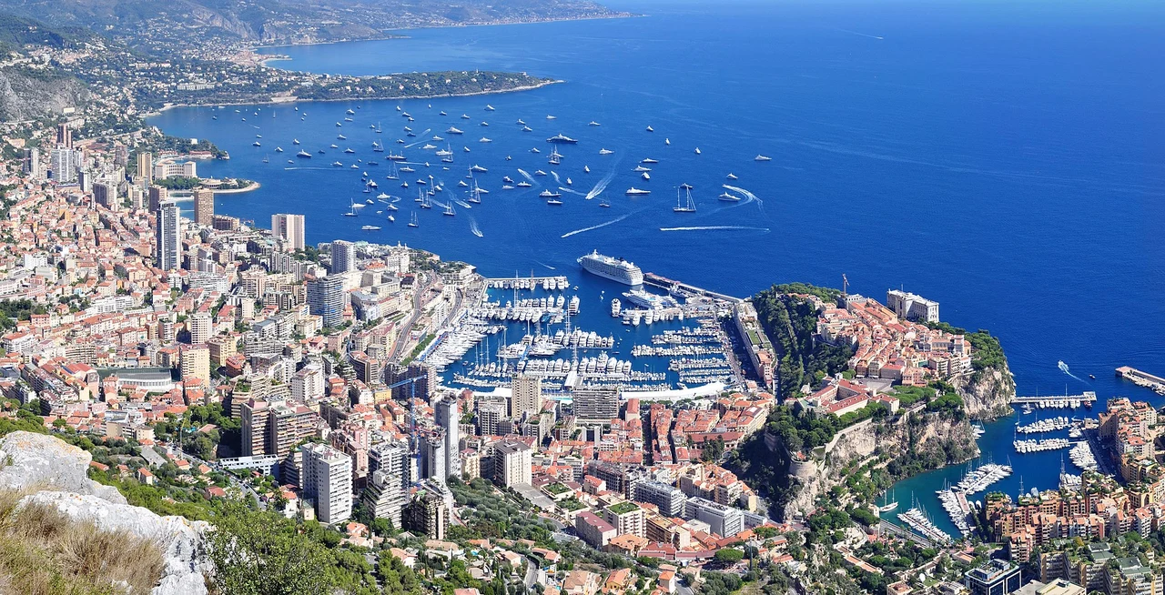
Photo: Tobi 87
At water level, the scale is more varied than aerial photographs suggest. Ordinary sailing boats sit within a port known internationally for large yachts and events. Above it, the old town, palace district and gardens offer another pace, though the climb and the network of public lifts shape how a walk fits together. Cap-d’Ail, just west of the principality, belongs to the same close coastal setting but is a separate French harbour and town; a nearby name does not mean a berth within Monaco itself.
Albert I and the ocean
The Oceanographic Museum makes the sea more than scenery. Prince Albert I’s expeditions and scientific work lie behind the institution, whose monumental building opened in 1910 above the cliff. Instruments, collections and the history of exploration connect the principality to a much wider ocean. The building’s position is part of the experience: from the Saint-Martin gardens its seaward face appears rooted in the rock, while inside the subject ranges far beyond the marina below.
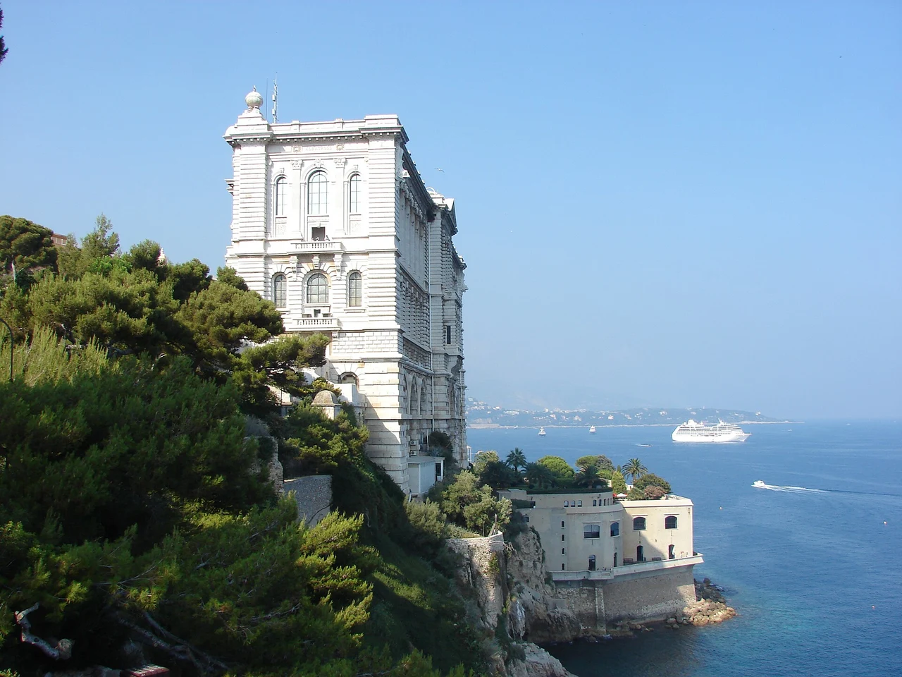
Photo: M.Strīķis
The museum and its aquariums do not currently offer every section in their usual form. The Mediterranean Aquarium is closed for renewal; the operator continues to list other spaces, including the tropical aquarium, shark lagoon, turtle area and roof terrace. That distinction matters if a particular collection is the reason for going. The museum’s current visitor page gives the available experience and any changes, rather than a promised reopening date.
Hercule and Fontvieille
Albert I and oceanography · Museum: current visitor information
08
Menton: fishing boats, gardens and the border
The old town above its harbour, citrus on the slopes and Italy just beyond Garavan.
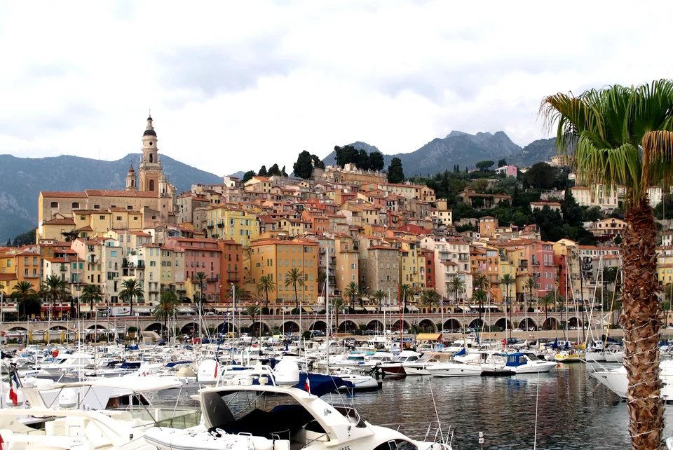
Photo: Gilbert Bochenek
Menton gives this coast a different ending. The old town rises in a tight group above the Vieux Port, its colours and church towers forming a recognisable whole from the water. Fishing boats remain part of the harbour, and the port operator identifies a fish-sales point near the entrance. The Sablettes waterfront runs towards the east, while lanes and stairs turn inland into the older town. Beyond the modern Garavan marina, the border is close enough to become part of ordinary shore travel.
The town’s political history makes that border less simple than a line on a map. Menton passed from the Genoese Vento family to the Grimaldis in the fourteenth century. In 1848, Menton and Roquebrune declared themselves free towns under Sardinian protection; they became French in 1861. The railway and harbour development then connected the town more firmly to the nineteenth-century Riviera. These changes are a useful background to streets that look towards both France and Italy without belonging neatly to a single coastal stereotype.
Cocteau at the water’s edge
The Bastion, a small seventeenth-century defensive building by the sea, houses a Jean Cocteau museum. Its compact scale and position suit a visit from the old harbour: the building itself remains part of the waterfront story. It is distinct from the larger Séverin Wunderman museum building, whose existence should not be taken as confirmation that its galleries are open. The current Bastion listing is the relevant starting point for this particular visit.
Citrus provides another thread with substance beyond festival imagery. Menton’s sheltered slopes supported a commercial lemon-growing economy, with trade flourishing in the nineteenth century. The difficult relationship between produce, transport and the developing harbour belongs to that history. Looking uphill from the waterfront, gardens and terraces are therefore more than a decorative backdrop: they recall a landscape cultivated for export as well as pleasure.
A garden with a scientific life
Val Rahmeh is a botanical garden of the Muséum national d’Histoire naturelle, not simply the grounds of another grand villa. Its acclimatised plants and citrus collection give the local climate a visible expression, with a scientific purpose behind the planting. The garden lies on the eastern side of Menton, making Garavan the useful geographical reference. Like the old town, it rises away from the waterfront; a garden visit and a level seafront walk make different demands.
Roquebrune continues the theme of a coast with a steep second layer. The medieval village stands above the water between Monaco and Menton, while the railway follows the lower coast. From the train or boat, the hillside is a backdrop; a visit to the village needs a separate ascent. Across the border, Ventimiglia is directly connected by coastal trains. That makes Italy a practical shore excursion as well as the next geographical chapter, without requiring a yacht move for a first visit.
Old port or Garavan
The choice is chiefly geographical: the old port for the immediate old-town waterfront, Garavan for the eastern side, gardens and Menton-Garavan station. Both belong to a living town rather than an isolated marina development. The railway gives the final connection of the guide: west to Monaco and the other Riviera towns, east to Ventimiglia, with the boat still in the same berth.
Bastion museum · Val Rahmeh botanical garden · Trains across the border
Westwards, and back to the wider coast
West of Cannes, the red Estérel coast and the Gulf of Saint-Tropez introduce different landscapes and more space between the urban centres. East of Menton, the Ligurian shore continues into Italy. Cannes–Lérins–Menton holds together through its close relationship between islands, capes, city harbours and rail: the sea remains the connecting view even when a visit continues ashore.
Estérel and Saint-Tropez · Explore Mediterranean France · Back to the coast map