Scotland · The Great Glen
The Caledonian Canal
Sail across Scotland.
Leave the sea at Inverness or Corpach and take a yacht into the Highlands, its mast still standing. Locks lift the boat towards wooded banks and mountain lochs; open water gives room to sail before the next village or cutting draws the shores close again. The Caledonian Canal joins two coasts through the Great Glen—and makes the country between them part of the cruise.
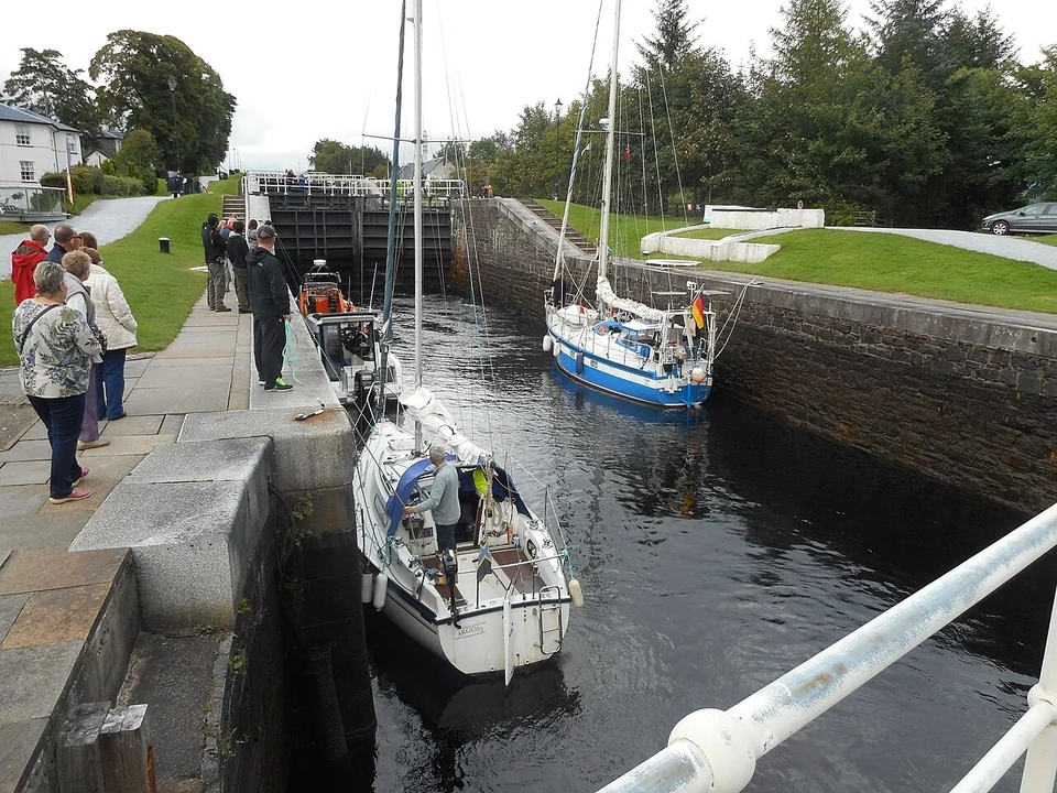
Photo: Bill Henderson
Reading the Great Glen
Two coasts, three great lochs
The waterway runs southwest from Clachnaharry, beside Inverness, to Corpach near Fort William. Loch Ness, Loch Oich and Loch Lochy account for much of its roughly 50-nautical-mile length. Artificial cuttings connect them, and 29 locks raise and lower boats between the sea and the summit at Loch Oich, about 32 metres above sea level. Either end can be the beginning.
A different way between coasts
The eastern entrance connects with the Moray Firth; the western entrance opens towards Loch Linnhe, the Sound of Mull and the Hebrides. The canal offers a crossing through Scotland that avoids the long passage around its northern coast. Along the way, broad sailing water alternates with locks, towpaths and villages where the boat comes into the middle of everyday life.
Inverness & Clachnaharry Loch Ness & Urquhart Fort Augustus Loch Oich & Laggan Loch Lochy & Gairlochy Neptune’s Staircase & CorpachThe eastern sea gate
Inverness & Clachnaharry — leave the tide behind
Clachnaharry’s sea lock lies on the Beauly Firth, west of Inverness. From the Moray Firth, the approach passes beneath Kessock Bridge before turning into this quieter corner of the firth. Inside, Seaport Marina occupies Muirtown Basin; the Muirtown locks then lift the canal above the city. Farther along, Dochgarroch and the smaller Loch Dochfour lead into Loch Ness.
Inverness offers shops, railway connections and a walk beside the River Ness before the landscape becomes more rural.
The first gate still belongs to the tide. Clachnaharry needs sufficient water to operate its gates, so entry depends on both the tide and staffed opening hours. The sea-lock team uses VHF 74. Scottish Canals publishes the current access details and approach map.
Sea-lock access and facilitiesThe largest stretch of open water
Loch Ness — sailing water between the hills
Beyond Loch Dochfour, the banks fall away and Loch Ness stretches southwest between steep slopes. The change is immediate: room for sails, a long horizon and a sense of distance that the canal cuttings conceal. Wind can build a substantial wave pattern along this long, narrow loch. Its freshwater setting does not make it sheltered canal water.
Urquhart Castle projects into the loch from the western shore. From the water, its position makes sense: a stronghold overlooking movement through the Great Glen. Scottish and English forces contested it, and the Lords of the Isles repeatedly raided it. In 1692, the departing garrison destroyed its gatehouse to prevent the castle being used again as a stronghold.
The waterside view is part of the sailing passage. A castle visit ashore is a separate outing with admission arrangements; its tour-boat jetty should not be treated as an available yacht berth.
Urquhart Castle · visits and history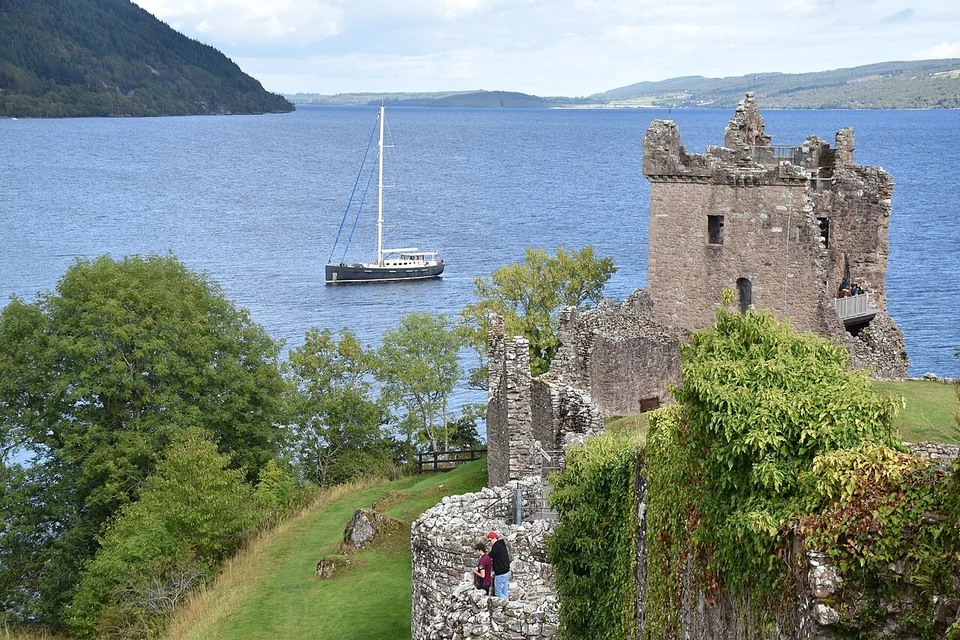
Photo: Kognos
Nessie has a place in the story, too. The monster tradition reaches back to the medieval account of St Columba and a creature in the River Ness. Today it adds a layer of folklore to a landscape whose scale is striking enough without it.
The village around the locks
Fort Augustus — the boat enters village life
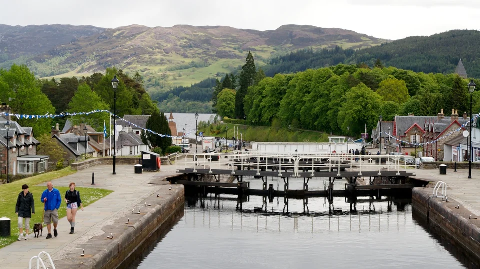
Photo: Christoph Strässler
At the southwestern end of Loch Ness, five locks climb through Fort Augustus. The towpath is also a village pavement: cafés, shops and people watching the chambers fill are close beside the boat. A stop here gives the crossing a human scale after the long loch. Walk down to the water’s edge to look back along Loch Ness, or follow the canal away from the busiest streets.
Locks also change who you meet. Boats share chambers and encounter one another again at the next pontoon. Scottish Canals staff operate the gates; crews handle their lines. Waiting and moving together gives this inland stretch a more sociable rhythm than an offshore passage.
The summit waters
Loch Oich & Laggan — above the sea
Above Fort Augustus, the canal becomes quieter through Kytra and Cullochy before opening into Loch Oich. This smaller loch is the summit of the crossing, roughly 32 metres above sea level. A boat that entered on an ocean tide has been lifted into the Highlands; from these waters the locks descend towards either coast.
Low islands, wooded banks and the narrow passage at Laggan give this part of the canal an enclosed, intimate character. Along Laggan Avenue, trees replace the distant horizon with a close corridor of reflections. The towpath offers a different view on foot, with the canal beside you rather than ahead of the bow.
Keep the marked channel through Loch Oich distinct from the open sailing water of the larger lochs.
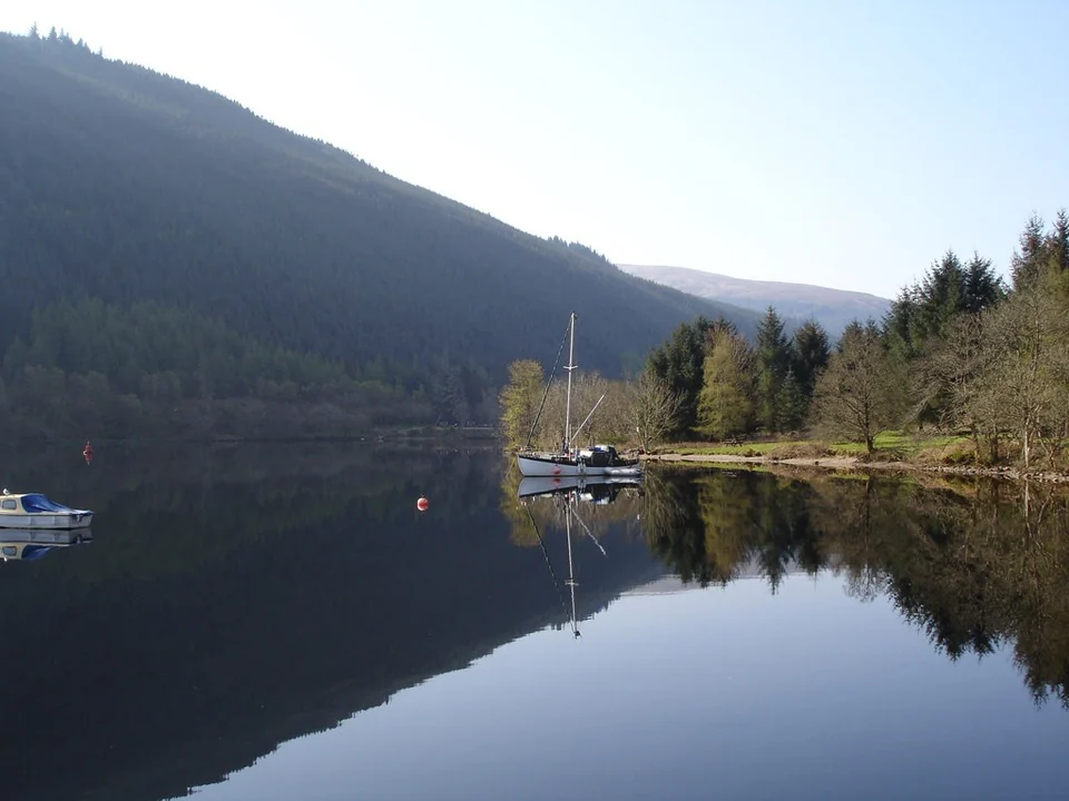
Photo: Annette Lee
The western mountain loch
Loch Lochy — the mountains close in
Below Laggan Locks, the water opens out again. Loch Lochy brings back the scale of a sailing passage, with long mountain slopes rising directly from the shore. The alternation is the canal’s particular pleasure: trees and masonry close to the hull, then enough water and sky to set sail. Wind funnels along the glen, and conditions on the loch can decide when that change of pace is appealing.
At the southwestern end, Gairlochy brings the boat back into the canal. It is a quieter place to step ashore for a towpath walk before the approach to Banavie. From here, the final cutting runs towards the locks above Corpach, with the mountains around Fort William gathering beyond it.
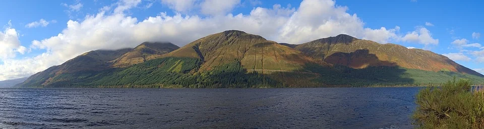
Photo: Daniel Kraft
The western sea gate
Neptune’s Staircase & Corpach — back to salt water
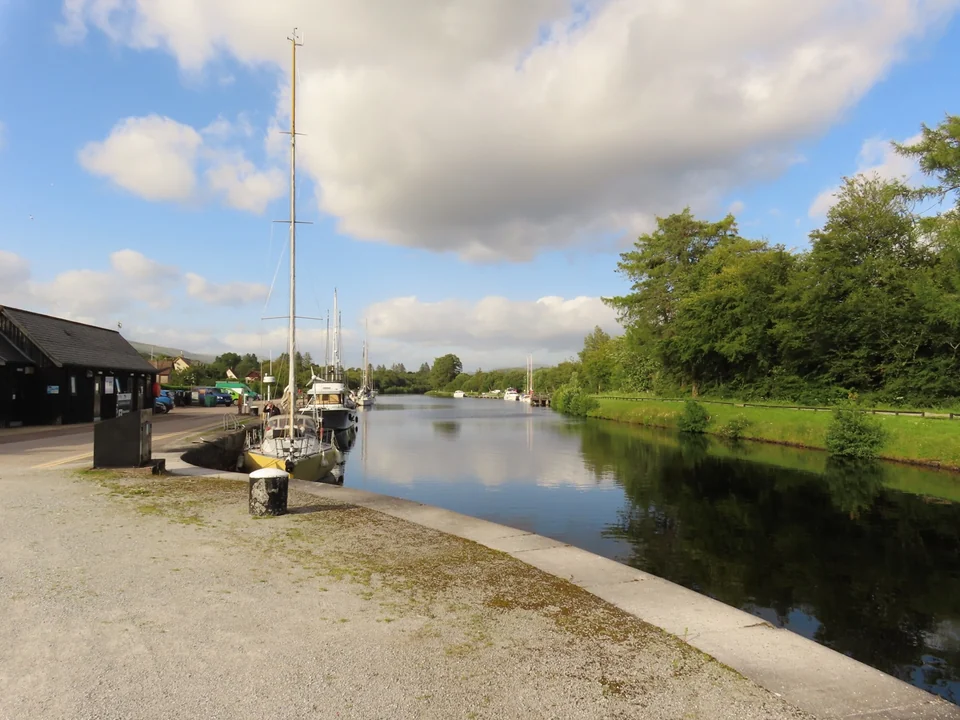
Photo: Colin Park
At Banavie, eight linked locks form Neptune’s Staircase. Together they change the water level by about 19 metres, with Ben Nevis rising beyond the canal. For a westbound yacht, this is the long descent towards the sea; eastbound, it is a striking introduction to the inland crossing. Boats move through chamber after chamber while walkers and cyclists follow along the banks.
The towpath makes the engineering easy to explore ashore, and Banavie provides access to Fort William and the wider Lochaber landscape. Ben Nevis is a separate mountain outing, well beyond a casual lockside stroll. Even from the canal, the contrast between the stone chambers and the high ground explains much of this end of the Great Glen.
Neptune’s Staircase · Scottish CanalsA waterway with a different future
Built for shipping, discovered for pleasure
The canal was intended to give merchant and naval ships an alternative to the exposed route around northern Scotland, while bringing employment and development to the Highlands. James Watt surveyed a route in 1773; Parliament authorised construction in 1803, with Thomas Telford and William Jessop responsible for the work. It opened in 1822, after Napoleon’s defeat had already reduced its strategic urgency.
The great commercial transformation its supporters imagined did not follow. Another use grew instead: Queen Victoria travelled along the canal in 1873, passenger steamers brought visitors into the glen, and leisure boats became part of its everyday traffic. The large locks built for seagoing ships now make this Highland crossing possible for cruising yachts.
The canal’s history · Scottish CanalsTaking a yacht through
What shapes the crossing
Mast up, within the limits
Most cruising yachts can transit with the mast standing. Kessock Bridge, on the eastern sea approach, has a lower clearance than the canal itself; tall rigs need a clearance confirmed for that approach. Scottish Canals’ published draught figures differ between some pages, so deep-draught boats should obtain confirmation from the canal office using their freshwater draught. Its current Skippers’ Guide gives vessel dimensions and contact details.
Dimensions and canal contactsThe waterway has opening hours
Scottish Canals gives 2½–3 days as the minimum sea-to-sea transit, subject to weather, traffic and operational delays. Staffed locks and bridges, tidal sea gates and seasonal maintenance shape progress. That minimum describes passage through the system; it does not include the visits, walks and pauses that make the canal a destination.
Current operation and closuresA visitor licence covers canal use and visitor moorings and must be bought at least 24 hours before the intended transit. The booking information sets out insurance and boat requirements, and the sea-lock team provides access to canal facilities. Locks are worked with the crew’s own lines and fenders; the official guide explains the arrangements. For longer boats, Scottish Canals asks vessels of 15 metres or more to contact the office ahead in summer so overnight berthing can be planned.
Visitor licences · Scottish CanalsWhere the water leads
Continue into Scotland
At Corpach, Loch Linnhe leads towards Mull and the western islands. At Clachnaharry, the Moray Firth opens the eastern coast. The crossing belongs to both: a connection between sea areas with its own lochs, settlements and stories in the middle.
Explore Mull and the Sound of Mull → Back to Scotland’s cruising grounds →