Italy · Corsica and Sardinia

Southeast Sardinia

Beach days and town evenings around Villasimius, with Porto Giunco and Notteri close by.

Seven–ten days allow time for swimming, the walk up to the tower, the museum and meals in town. The boat can spend several nights in the same harbour, with short sailing trips when conditions suit.

With more time, the trip can continue north to Arbatax and Santa Maria Navarrese, with longer legs and other places to linger.

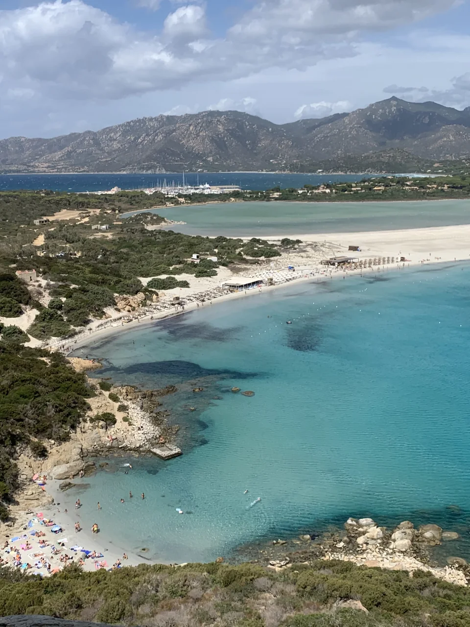
Porto Giunco’s pale beach between the blue sea and the Notteri lagoon, seen from the tower.
Porto Giunco and Notteri · 28 August 2023.
Photo: Muzzudan

Places along the coast

Villasimius and a possible continuation

The local map shows days around the harbour. The overview puts the longer coast towards Ogliastra in context.

Around VillasimiusNorth-up place map. Blue circle: place with a harbour. Brown circle: visit ashore. Purple square: possible technical base. Around Villasimius N Cala Sinzias Cala Pira Villasimius town centre Marina di Villasimius Notteri Porto Giunco Capo Carbonara 1 nm at 39.15° N Natural Earth 1:10m · public domain Design: Sophie · CC BY 4.0 · 2026
Villasimius and the surrounding beaches.
From the south to OgliastraNorth-up place map. Blue circle: place with a harbour. Brown circle: visit ashore. Purple square: possible technical base. From the south to Ogliastra Northern limit of the guide: Navarrese N Santa Maria Navarrese Tortolì Arbatax Villaputzu Muravera Porto Corallo Costa Rei Cagliari Capitana Villasimius 10 nm at 39.59° N Natural Earth 1:10m · public domain Design: Sophie · CC BY 4.0 · 2026
Santa Maria Navarrese is the northern limit of this guide.

Place with a harbour Visit ashore Possible technical base

Days from the same harbour

Between beach and town

Porto Giunco forms a pale strip between the sea and the Notteri lagoon. A walk up to the tower gives views over both.

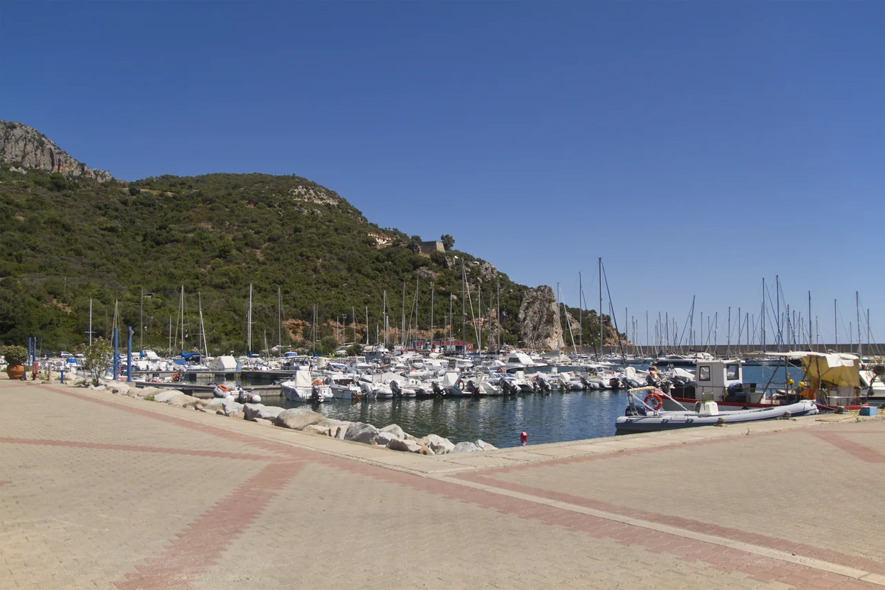
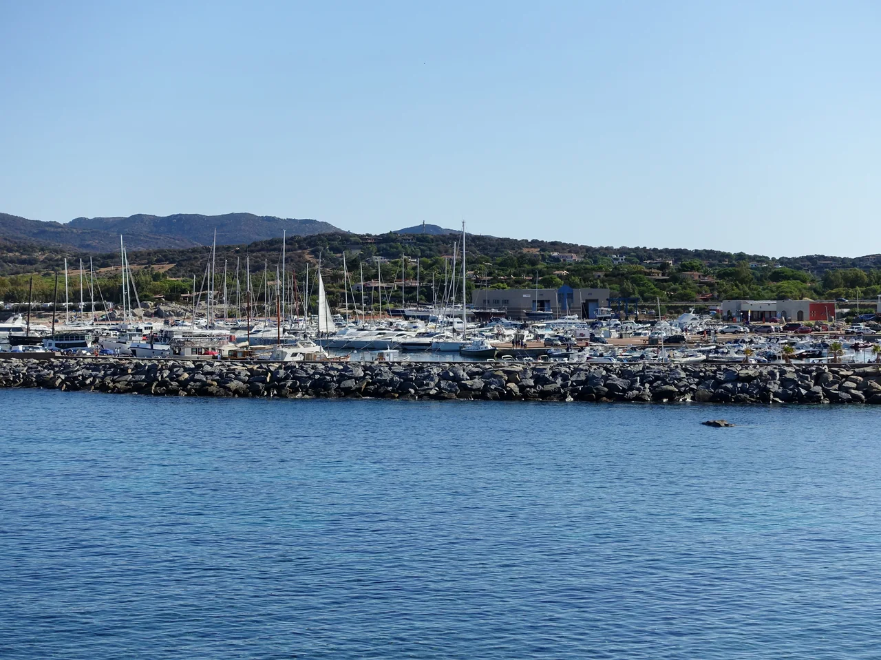
The breakwater and sailing boats in Marina di Villasimius, with green hills behind.
Marina di Villasimius · 15 September 2017.
Photo: Olaf Tausch

Marina di Villasimius

A harbour to return to

Around Capo Carbonara, lawful anchoring depends on the protected zone, seabed and current rules. The park’s 2026 buoys are for specific approved commercial activities; they are not ordinary visitor buoys.

Anchoring at Capo Carbonara

The 2017 rules must be read together with the current year’s provisions and zone map. Boat type, zones and delimited areas determine where anchoring is permitted. Anchoring in Posidonia meadows is prohibited.

The separately closed strip at Spiaggia del Riso is a different area from Punta Molentis. Tender access through swimming areas and landing on Cavoli or Serpentara remain unconfirmed.

The park’s 2026 regulations ↗Park zone map ↗
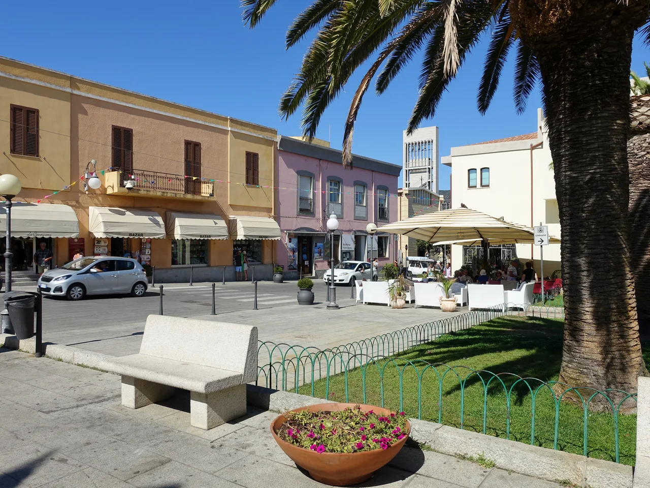
Palm trees, benches and café tables on Villasimius’s town-hall square.
Villasimius town-hall square · 13 September 2017.
Photo: Olaf Tausch

Villasimius town centre

Museum, small streets and dinner

The MAVI archaeological museum displays amphorae and finds from shipwrecks among other exhibits. It is a destination for the afternoon before dinner in town. Fortezza Vecchia by the harbour can be an extra outing when open.

MAVI: collections and opening hours ↗

North of Villasimius

Cala Pira, Cala Sinzias and Costa Rei

Cala Pira is a smaller bay, while Cala Sinzias and Costa Rei offer long stretches of beach. The beaches can be visited by car while the boat stays in harbour.

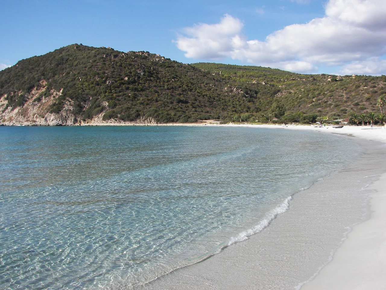
Cala Pira’s sandy beach, with blue water and green hills around the bay.
Cala Pira · 18 September 2008.
Photo: gian luca bucci

A beach day without moving the boat

The beaches leave room for swimming and walks by the water. July and August are busy months. Easterly swell and shifting winds affect which beaches appeal that day.

The beaches are not confirmed as overnight anchorages or tender landing places. At Costa Rei, current local notices to mariners must also be checked before stopping from the sea.

Cala Pira at Sardegna Turismo ↗

A day ashore

Muravera and the Sarrabus lagoons

A day by car can take you to Muravera, through a landscape known for citrus growing. A town visit and lunch can be combined with a walk by Colostrai or Feraxi if a suitable open path is available. This is an excursion ashore while the boat stays put.

Muravera and its surroundings ↗

A possible addition

Onwards to Ogliastra

Porto Corallo can be a stop on the way to Arbatax during a holiday of two–three weeks in total, with separate days for stays along the way.

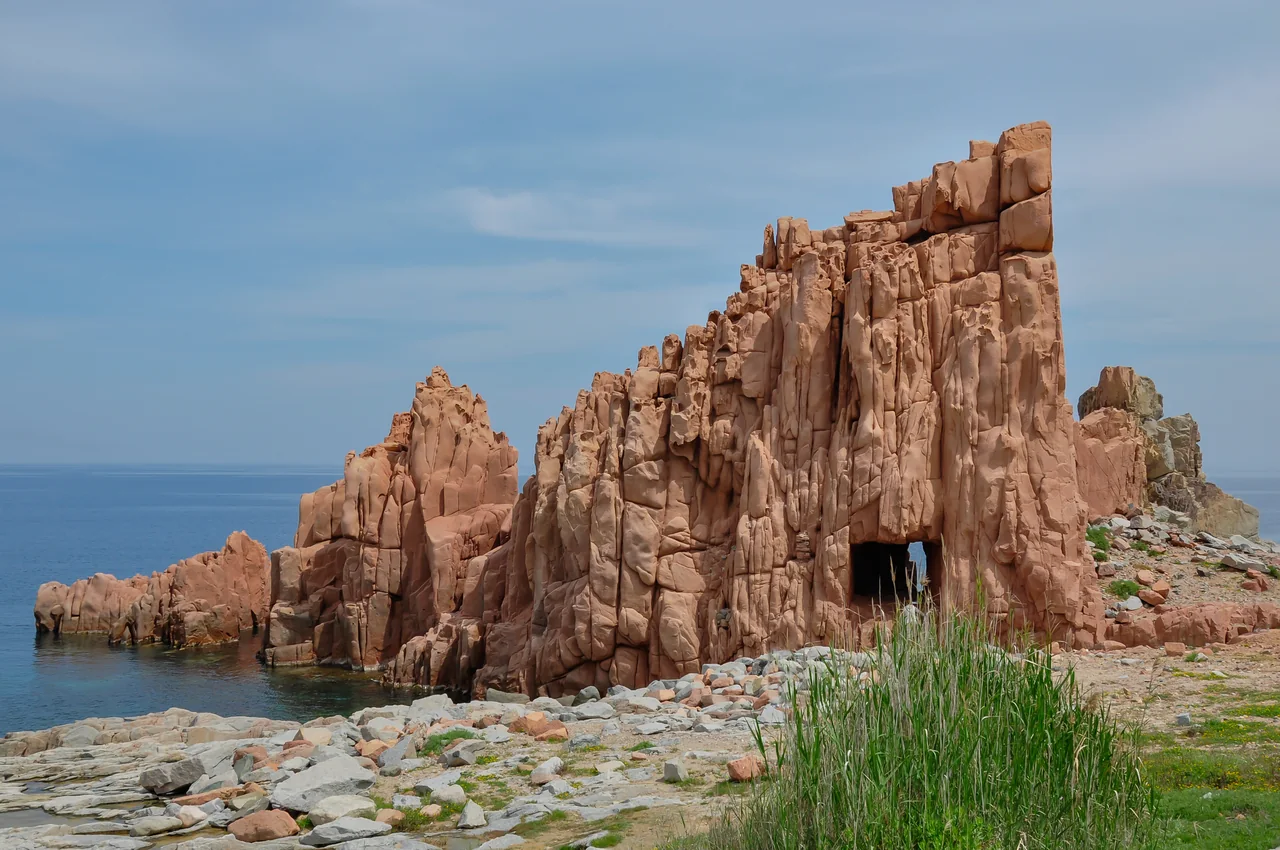
Pointed red rocks beside the sea in Arbatax.
Rocce Rosse in Arbatax · 27 April 2010.
Photo: Isiwal

Arbatax and Tortolì

Red rocks and dinner in Tortolì

Rocce Rosse offers a short outing to the sea from Arbatax. Tortolì suits a town visit and a dinner of culurgiones, the filled pasta native to Ogliastra.

The connection north passes areas with local notices and military activity at Quirra and Capo San Lorenzo. Current boundaries and any repeals are unconfirmed; Murtas and Quirra are therefore not suggested as landing places here.

Longer legs northwards

Published rough comparisons give about 26 nm for Villasimius–Cala Sinzias–Porto Corallo and about 32 nm for Porto Corallo–Foxi Manna–Arbatax. The municipality gives about 31 nm between the latter two harbours. Methods are not stated, and actual endpoints and restrictions may change the length.

Secondary sources from September 2026 refer to Cagliari 175/2026 and Arbatax 54/2026 and 58/2026. The official texts and later amendments could not be confirmed. This must be clarified before a specific northbound trip.

Sailing boats and pontoons in Santa Maria Navarrese, with green hills behind.
Santa Maria Navarrese harbour · 18 July 2012.
Photo: trolvag

Santa Maria Navarrese

A few days by the harbour and village

Here you can walk from the harbour to the village and beach while the boat stays put. Arbatax and Santa Maria Navarrese can also make a holiday of their own, but have been researched less thoroughly than Villasimius.

The coast onwards through Baunei and the Gulf of Orosei, Cala Gonone and La Caletta to San Teodoro has not been researched in this guide.

Time to linger

A shorter or longer holiday

Seven–ten days around Villasimius can be filled with beach life, town visits and outings. About two weeks give more time for Cagliari, Costa Rei and longer stays. Two–three weeks in total allow the northern extension.

The holiday harbour

Villasimius is a natural starting point for a beach holiday.

Depth and berth choice

The actual approach must suit the boat, including one with a lifting keel.

Preparation and storage

Capitana can be a technical base before the holiday. Cantieri Mulas is a separate workshop in Arbatax.

Lifting and looking after the boat

Capitana lists a 60-tonne travel lift; an older image caption still says 40 tonnes. The transport trolley and crane are separate machines. Mulas lists a 200-tonne travel lift.

Capitana: workshop ↗Cantieri Mulas ↗

Getting here

Via Cagliari Elmas

Flying to Elmas and arranging road transport to the boat is the simplest starting point. Harbours further north mean a longer drive.

Train, bus and the final stretch to the marina

The airport train goes to Cagliari. From there, ARST 101 serves the Villasimius area; a separate final leg from town to marina is needed. This is not a confirmed through connection.

The tourist office mentions Summer Bus, but the year, operating dates, marina stop and last return must be checked for the journey. The same applies to Villasimius Express and where it drops passengers.

Airport: transport ↗ARST line 101 ↗Local summer bus ↗

An impression from land

The walk up at Porto Giunco

Villasimius Dream Beaches

Reigne Or Shine walks the path up from the beach and shows the views over Porto Giunco and the lagoon. The chapter starts at 08:44 in a film from a May 2023 trip. The full film runs for 13 minutes and 49 seconds.

Watch the Porto Giunco chapter on YouTube ↗
Sources and photo credits

Sources and photo credits

Practical information and sources checked 19 September 2026.

Photo sources

The photographer, date taken, original page and licence appear beside each image. The “Full photograph” link opens the largest local version. Isiwal’s image is credited to Isiwal/Wikimedia Commons/CC BY-SA 4.0.

Map

Design: Sophie, CC BY 4.0. Coastline: Natural Earth 1:10m, public domain. Places from Wikimedia, the harbour operator and FAO’s coordinate register. The maps show neither sailing routes nor protected-area boundaries.