Corsica and Sardinia

Northwest Sardinia

To the west lie Alghero’s old town and the limestone cliffs at Porto Conte. Further north are Asinara and the harbour towns around the gulf, with Castelsardo’s houses climbing towards the castle.

Two areas, each able to fill a holiday of its own, with time for both the sea and days ashore.

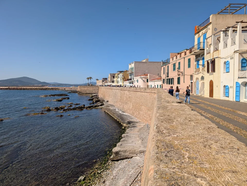
The stone seawall in Alghero, with pedestrians and pale pastel-coloured houses.
Alghero’s bastions · 1 May 2025.
Photo: Basilicofresco

The area on the map

The west coast or the gulf in the north

Alghero and Porto Conte are on the west coast. Stintino, Asinara and Castelsardo lie around the Golfo dell’Asinara to the north.

Two holiday areas North up. Overview map, not a nautical chart. No sailing routes are drawn. Map: Sophie. Land: Natural Earth v5.1.1 and © OpenStreetMap contributors, ODbL. Two holiday areas N Asinara Stintino Porto Torres Castelsardo Isola Rossa Porto Conte Fertilia Alghero Golfo dell’Asinara SARDINIA Northeast Sardinia → Bosa lies further south ↓ 10 nm · straight-line distance at 40.8° N
Natural Earth© OpenStreetMap contributors · ODbLMap: Sophie · CC BY 4.0

A guide estimates Alghero–Stintino at about 39 nm via Fornelli, or 62 nm around Asinara. Fornelli requires a separate assessment of current depths, rules and conditions, and the boat’s draught. A lifting keel alone does not determine whether the passage is suitable.

Holiday length and the connection between the areas ↓

The western holiday

Alghero and Porto Conte

Alghero leaves room for a few days of shopping for the boat and walks along the bastions before dinner. Catalan influences are found in both the town and the food; Catalan-style spiny lobster is a local speciality.

A beach day at Maria Pia, with sand and pine trees, can be an outing from land while the boat stays put. Alghero has several marina operators; the chosen berth determines the way back from town.

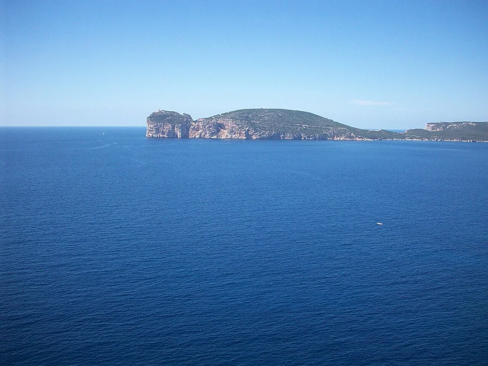
The long limestone headland of Capo Caccia above dark blue sea, with vegetation on top.
Capo Caccia seen from Porto Conte park · 29 April 2017.
Photo: Giada94jeje

Porto Conte / Punta Giglio

Woodland paths and cliff views

At Punta Giglio, paths run through woodland and towards the sea. The old coastal battery has become the MAPS open-air museum. It suits a day ashore, with transport to the walking area and a walk that can be short or longer.

Grotta di Nettuno is a separate excursion: by passenger boat from Alghero or about 660 steps down from Capo Caccia. Sea conditions can close the cave, including to those coming by the stairs.

Walks, cave and boat stays in Porto Conte

A visit by the stairs must be booked; the boat fare and cave entrance are separate tickets. Private tender landing at the cave is unconfirmed.

Punta Giglio and MAPS ↗Grotta di Nettuno: visits and reservations ↗The park’s buoys and updated rules ↓
The northern holiday

Stintino and the harbour towns

A few places around the gulf can fill a holiday with several nights in each harbour. Asinara can be part of the stay, with your own boat or a passenger boat.

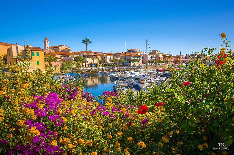
Flowers in front of boats and yellow and pink houses around Stintino harbour.
Flowers and marina in Stintino · 29 September 2014.
Photo: Tommie Hansen

Stintino

An evening by the harbour

Stintino has small boats, places to eat and the MUT tuna museum, which tells the story of the fishing that shaped the place. A museum day can be followed by an evening in town while the boat stays put.

MUT: tuna museum ↗
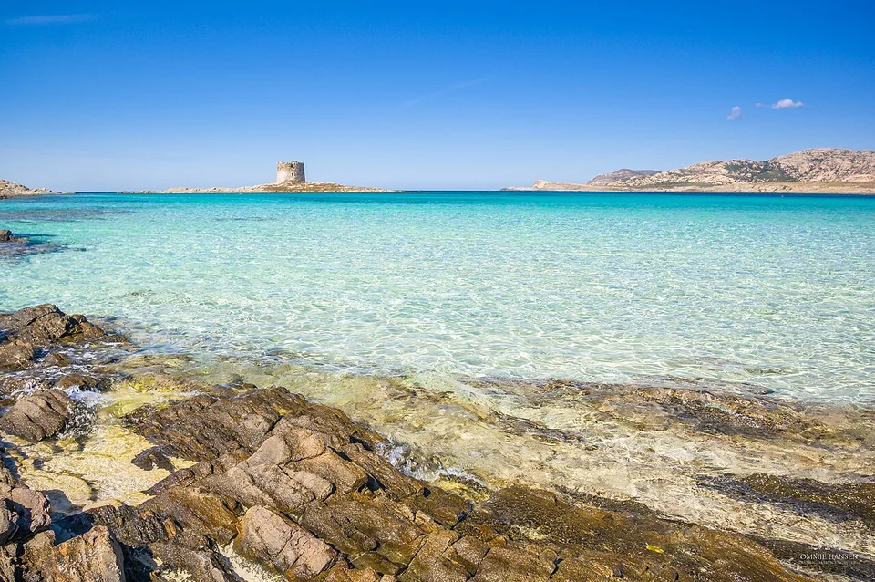
Clear turquoise water over sand, with rocks in the foreground and La Pelosa’s tower in the background.
La Pelosa with the tower offshore · 29 September 2014.
Photo: Tommie Hansen

La Pelosa

A beach day from Stintino

La Pelosa can be a separate outing from land, with transport back to the boat. In 2026, beach reservations are required from 15 May to 15 October. A beach ticket does not permit anchoring or taking a tender onto the beach.

La Pelosa: official booking page ↗
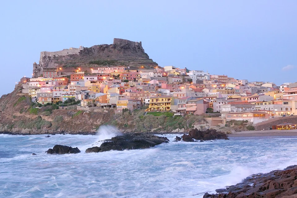
Colourful houses below Castelsardo’s castle, with waves breaking against rocks in the foreground.
Castelsardo in evening light · July 2007.
Photo: David Piras

Castelsardo

Small streets up to Doria Castle

Inside the castle is the museum of Mediterranean woven crafts, with baskets and other everyday objects. Around it are small streets, shops and places to eat.

Doria Castle and the craft museum ↗

Porto Torres

The area around San Gavino basilica is a destination for a walk in town. Molo Segni is the departure point for the passenger boat to Asinara, separate from the berth. Access to the Antiquarium and archaeological site remains unconfirmed after the 2026 closure.

Isola Rossa

The harbour and Spiaggia Longa can offer a few extra beach days east of Castelsardo. The settlement itself is on the mainland. Isola Rossa is a possible holiday extension.

Asinara

The island with a quarantine station and prison

The old settlements tell of daily lives very different from those of the harbour towns. Around Cala Reale, the buildings and landscape offer an insight into the island, with a chance of meeting some of the white donkeys.

Older buildings in stone colours with red roofs beside Cala Reale’s rocky coast.
The buildings at Cala Reale · 6 October 2024.
Photo: Alexey Komarov / Alexkom000

A short outing ashore

The park advises against walking and cycling in summer because of heat, little shade and scarce water. A short visit at Cala Reale or organised transport on the island may suit better.

Delcomar’s passenger boat runs between Molo Segni in Porto Torres and Cala Reale. It offers an alternative while the boat stays in harbour, depending on sea conditions and that day’s departures and returns.

To Asinara in your own boat

Buoys, tender and landingPark walk descriptions and seasonal advice ↗Delcomar: passenger boat ↗
Map of Asinara and Fornelli
Asinara and Fornelli North up. Overview map, not a nautical chart. No sailing routes are drawn. Map: Sophie. Land: Natural Earth v5.1.1 and © OpenStreetMap contributors, ODbL. Asinara and Fornelli N Cala Oliva Cala Reale Fornelli Isola Piana Asinara Fornelli strait Stintino lies south of the map ↓ 2 nm · straight-line distance at 41.0° N
Natural Earth© OpenStreetMap contributors · ODbLMap: Sophie · CC BY 4.0

The map shows places on the island, not individual buoys, pontoons or a route through the strait.

Time and distances

Seven–ten days or a longer holiday

June and September are possible months for a holiday here. Heat, maestrale and swell affect both boat days and which outings ashore appeal.

7–10 days

Choose Alghero–Porto Conte, or a few places around Stintino–Asinara–Castelsardo. Each area can also fill two weeks with more time in the same place.

2–3 weeks

Two–three weeks allow the areas to be combined, with time for the connection between them. The estimated 39 or 62 nm between Alghero and Stintino form a separate sailing leg.

Four weeks

More time to stay put and return to favourite places. Isola Rossa can be an addition.

How far apart are the places?

The Alghero–Stintino figures come from Segelrevier Sardinien and are guide estimates, not a verified route. Fornelli requires an assessment for the individual boat; the alternative around Asinara is not ruled out merely because it is longer.

Castelsardo marina lists about 21 nm to Stintino, 14 nm to Porto Torres and 10 nm to Isola Rossa. These are the operator’s estimates, without a specified route.

Guide estimates for the west–north connection ↗Castelsardo’s distance table ↗

Getting here and the boat

Getting to Alghero and boat care nearby

Preparation and any relocation can be done before the holiday days. Fertilia, Alghero and Porto Conte have different roles.

Getting to Alghero

The ARST bus runs from the airport to Via Catalogna all year. The final stretch with luggage depends on the marina. The airport bus to Stintino is seasonal.

Airport: bus connections ↗

Boat care in Fertilia

Base Nautica Usai is a possible yard by Calik. CAM is another operator. Fertilia can be a starting point for preparation before moving the boat to where the holiday begins.

Yards, draught and storage between trips

Alghero’s municipal directory lists 3 m draught and lifting up to 100 tonnes at Usai. The operator’s website was unavailable when checked. The June 2026 permit for a new lifting basin does not say whether the facility has entered service.

Porto Torres has service providers, but a complete storage and boat-care arrangement is unconfirmed.

Alghero directory: Base Nautica Usai ↗

A look from land

Through Castelsardo’s streets

Cem Berksoy’s walk shows slopes, paved streets and closely packed houses. Published 6 October 2023, 11 minutes.

Watch the Castelsardo walk on YouTube ↗
Sources and practical updatesChecked 19 September 2026

Places and access

SardegnaTurismo: Alghero ↗Municipal link to La Pelosa booking ↗Antiquarium: closure extension, June 2026 ↗

Reopening after 11 July is unconfirmed. Other sources accompany the individual places.

Map sources

Natural Earth v5.1.1 provides the overview. OpenStreetMap provides more detailed island geometry at Asinara and Isola Piana. Place markers are approximate.

Natural Earth · free use ↗© OpenStreetMap contributors · ODbL ↗Derived map data · GeoJSON ↗
Photo sourcesPhotographer and date appear beside each image

The six photographs were taken between 2007 and 2025. Each image is accompanied by the photographer’s credit, original page and licence.